My Store
Antique 1718 Anglia, Scotia & Hibernia by Christoph Weigel – United Kingdom, Ireland, Scotland, England, Wales, London, Dublin, Belgium, UK
Antique 1718 Anglia, Scotia & Hibernia by Christoph Weigel – United Kingdom, Ireland, Scotland, England, Wales, London, Dublin, Belgium, UK
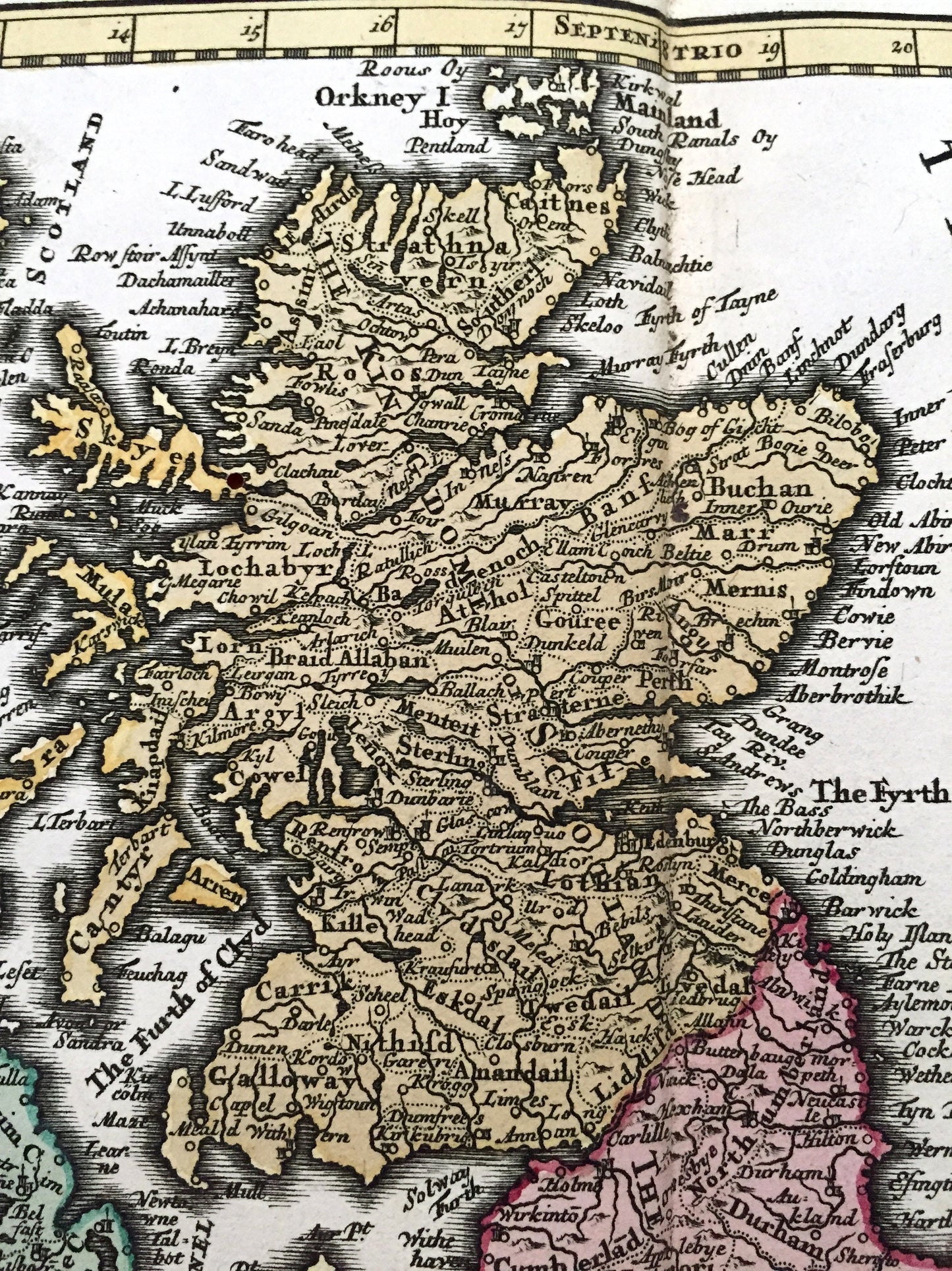
Beautiful, antique map "Anglia Scotia & Hibernia, cum Infulus Vicinis" by Christoph Weigel published in "Atlas scholasticus et itinerarius" in collaboration with scholar Johann David Köhler. This is an authentic 1718 print and is NOT a computer reproduction.
See what the British Isles looked like over 300 years ago, including England, Wales, Scotland, Ireland as well as the Netherlands, Belgium and France. Lots of charming, intricate details and contours, including major cities islands, counties, rivers and lakes. Hand-colored. Verso is blank.
Perfect for the historian, map-lover, the curious or just as a conversation starter. Wonderful and rare. Vintage maps such as these make great gifts.
Edition of 1718, printed 1718
Dimensions: 17 1/2" width x 13 3/4" height
----
Condition: Good Vintage condition, commensurate with age. This map is in great shape for being over 300 years old. Has some wear, mostly around edges, but this will all read as vintage character. Has about a two inch tear at the bottom, just to the left of the atlas fold, but this will disappear with framing. Colors are very bright for a print over 300 years old.
----
We will happily adjust shipping price for multiple purchases. Maps are rolled up and shipped in sturdy mailing tubes, never folded.
Couldn't load pickup availability
Share