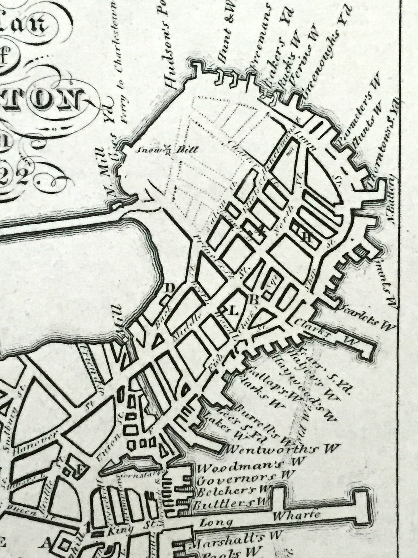
Beautiful, antique "Plan of Boston, Massachusetts in 1722." This is an authentic print by Abel Bowen, published in 1825, and is NOT a computer reproduction.
See what Boston looked like 300 years ago, before parts of the city were filled in like the Fens and South Bay—when Boston was connected to the land by Boston Neck. Lots of charming, intricate details and contours, including, rivers, streets, wharfs and important places such as the Governors house and various churches. Verso is blank.
Perfect for the historian, map-lover, the curious or just as a conversation starter. Wonderful and rare. Vintage maps such as these make great gifts.
Edition of 1825, printed 1825
Dimensions: 7" width x 10" height
----
Condition: Very Good Vintage condition, commensurate with age. This map is in great shape for being 200 years old. Some edge-wear, light scuffing and toning, all of which will add to vintage character when framed.
----
We will happily adjust shipping price for multiple purchases. Maps are rolled up and shipped in sturdy mailing tubes, never folded.