My Store
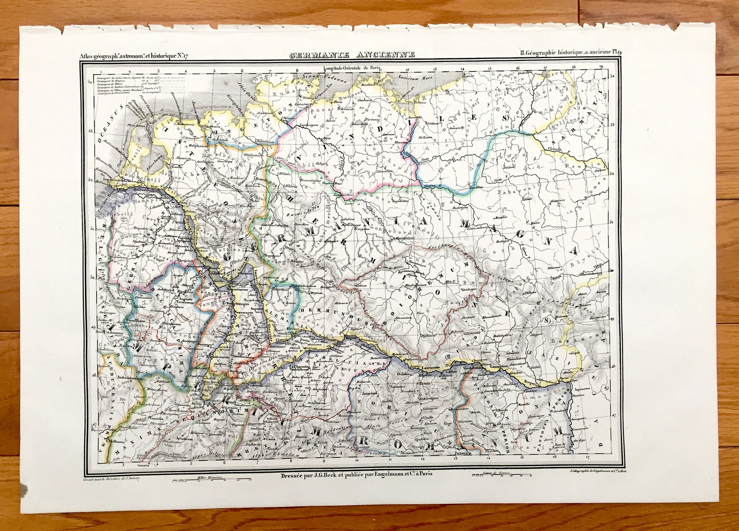
Antique 1835 Ancient Germany Map from JG Heck's Atlas Géographique, Astronomique et Historique – Hamburg, Bremen, Hanover, Frisian, Denmark
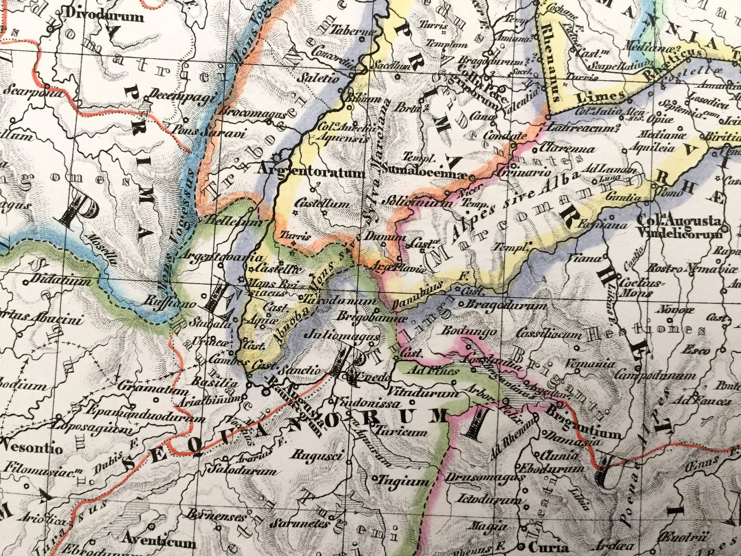
Antique 1835 Ancient Germany Map from JG Heck's Atlas Géographique, Astronomique et Historique – Hamburg, Bremen, Hanover, Frisian, Denmark
Beautiful, antique map of Ancient Germany. This is an authentic 1835 stone lithograph from J.G. Heck's "Atlas Géographique, Astronomique et Historique" and NOT a computer reproduction. Plate No. 9. Very Fine Condition.
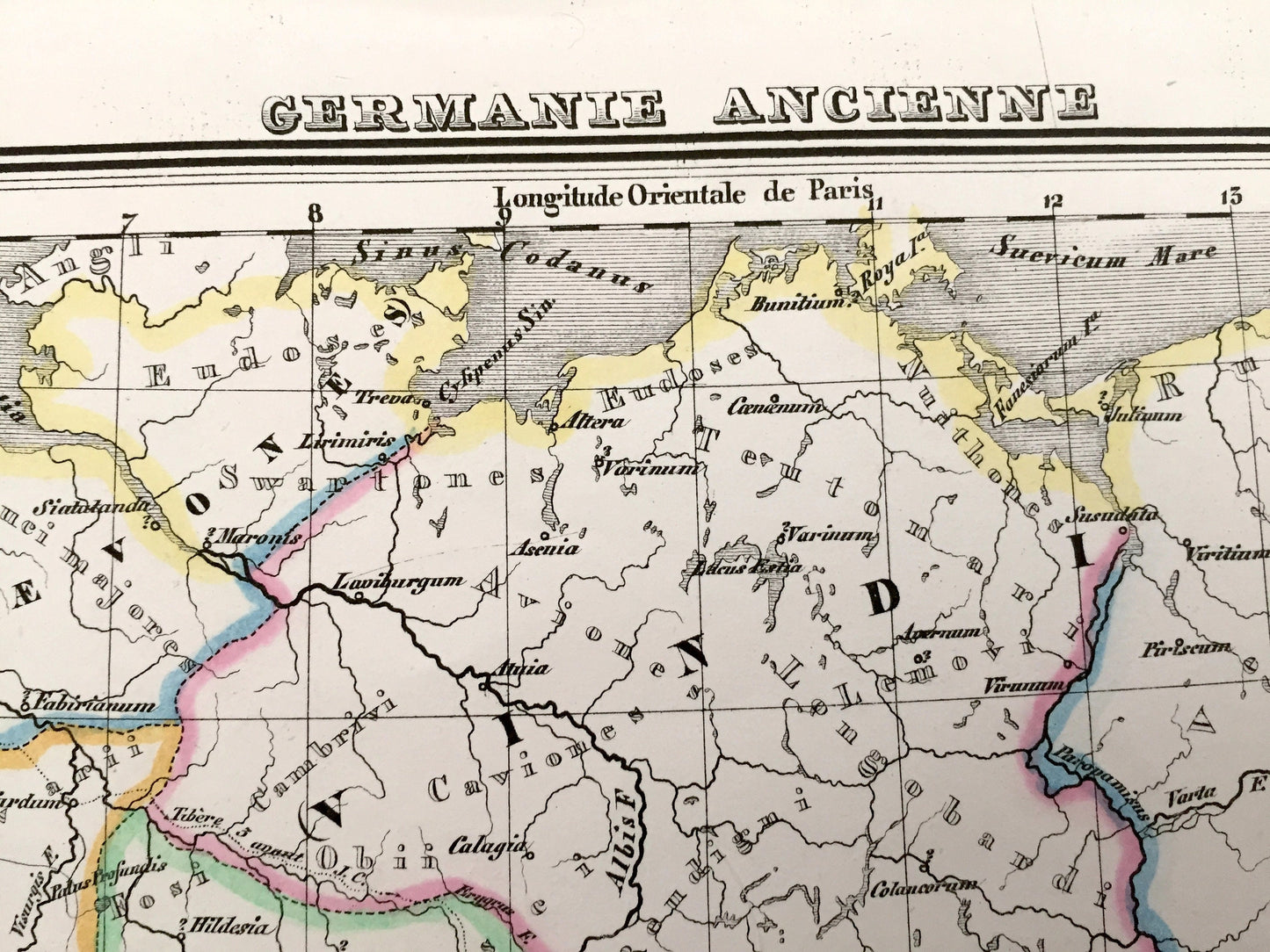
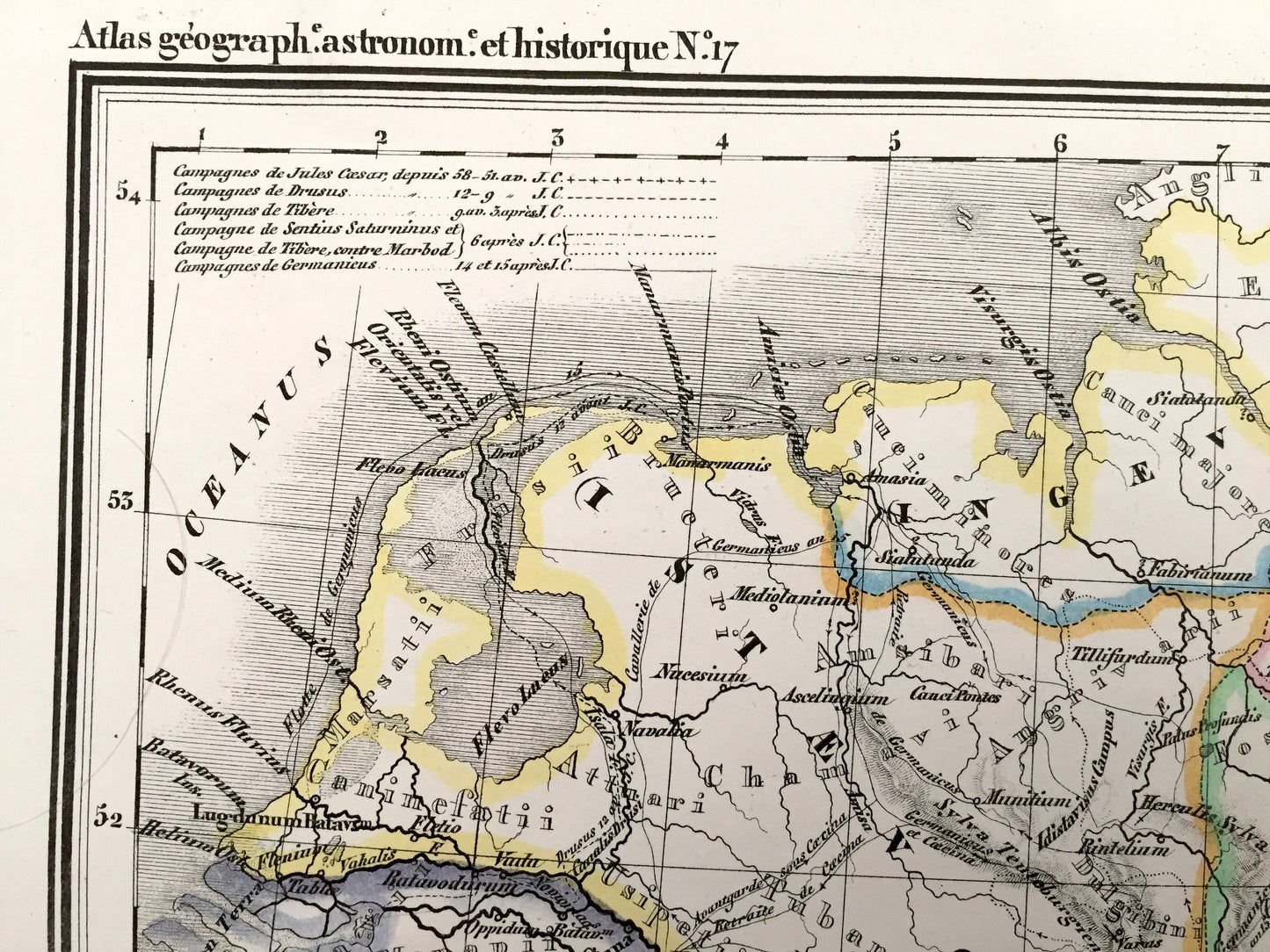
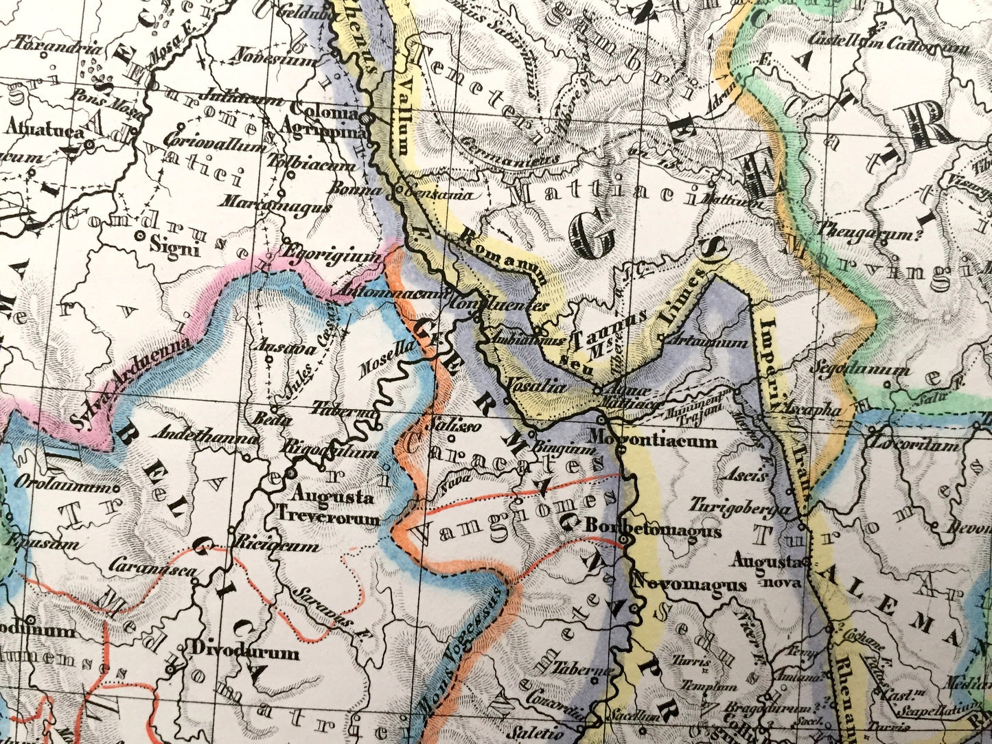
See what northern Germany—or Germania Magna—looked like during the time of the Roman Empire. Lots of charming, intricate details and contours, including mountains, islands, counties, rivers and tribal areas. Hand colored. Verso is blank.
Perfect for the historian, map-lover, the curious or just as a conversation starter. Wonderful and rare. Vintage maps such as these make great gifts.
Edition of 1835, printed 1835
Dimensions: 16 3/4" width x 11 1/2" height
----
Features
Points of Interest: Ancient Germany, Germanie Anciene, Germania Magna, Lands of the Goths, Hermiones, Vindiles, Imperium Romanium, Frisii, Saxones, Langobardi, Cherusci, Chatti, modern-day German city locations such as Hamburg, Bremen and Hanover, and many more.
----
Condition: Very Fine condition, commensurate with age. This map is in exceptionally fine shape for being over 180 years old. The paper quality is strong and bright. Very light foxing and small marks, but this will all read as vintage character when framed. Maps of this age and quality are very rare.
----
We will happily adjust shipping price for multiple purchases. Maps are rolled up and shipped in sturdy mailing tubes, never folded.
Couldn't load pickup availability
Share