My Store
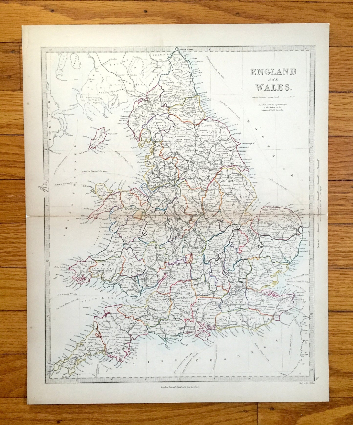
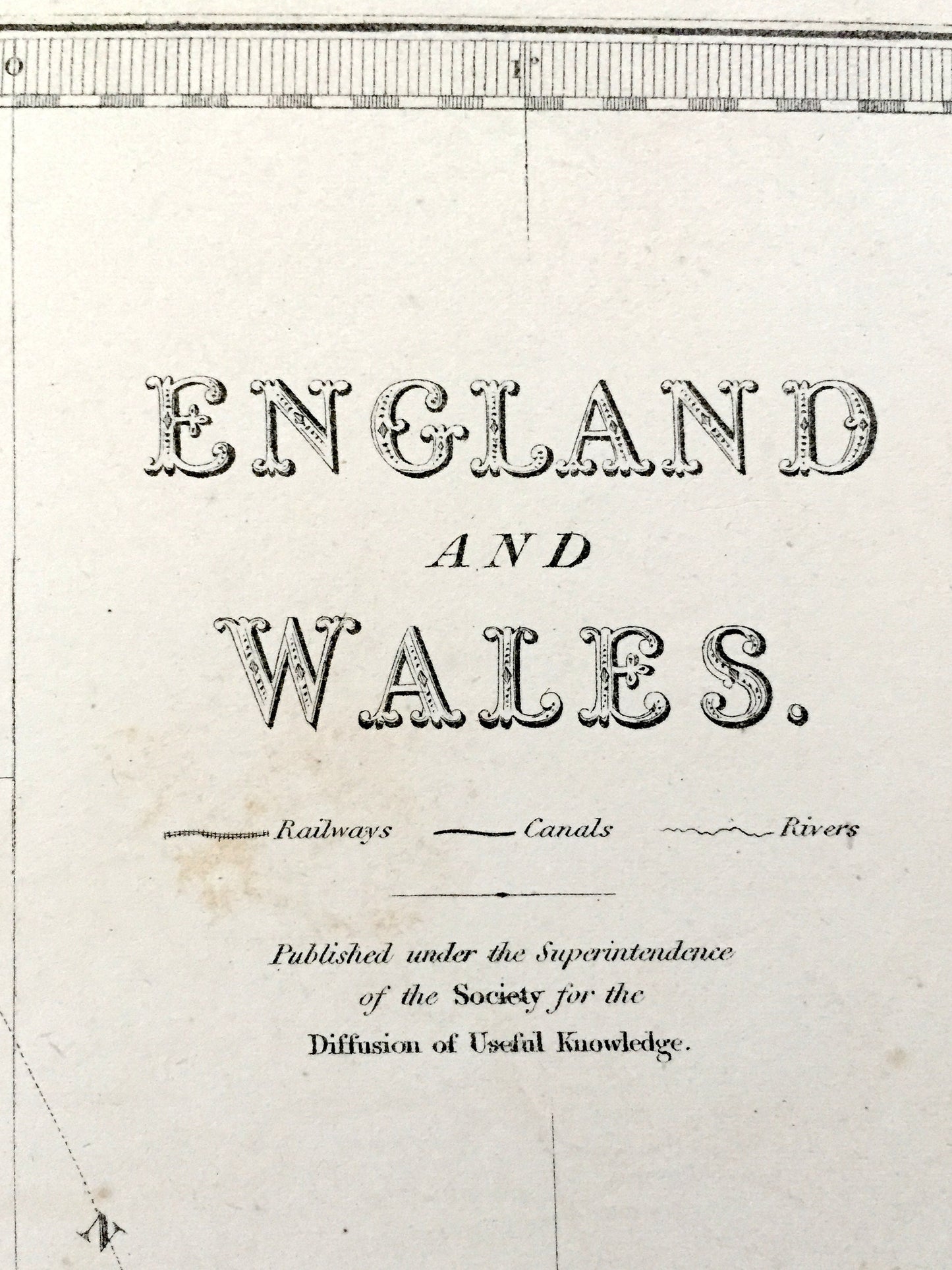
Antique 1844 England & Wales Map from SDUK Atlas – United Kingdom, Great Britain, British Isles, Scotland, London, Manchester, Liverpool, UK
Antique 1844 England & Wales Map from SDUK Atlas – United Kingdom, Great Britain, British Isles, Scotland, London, Manchester, Liverpool, UK
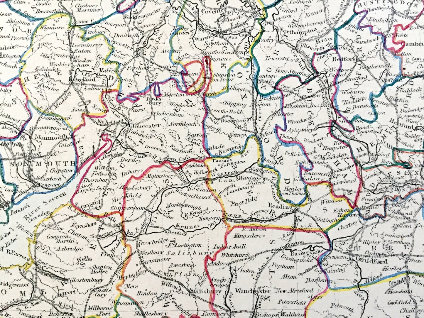
Beautiful, antique map of England & Wales. This is an authentic 1844 engraving, published in the Society for the Diffusion of Useful Information Atlas. This map is original and is NOT a reproduction.
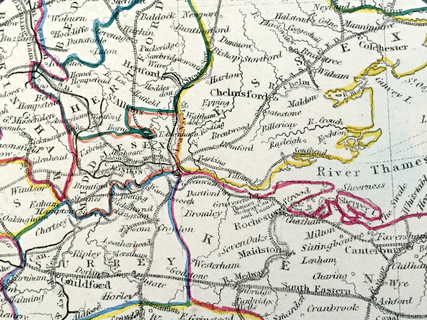
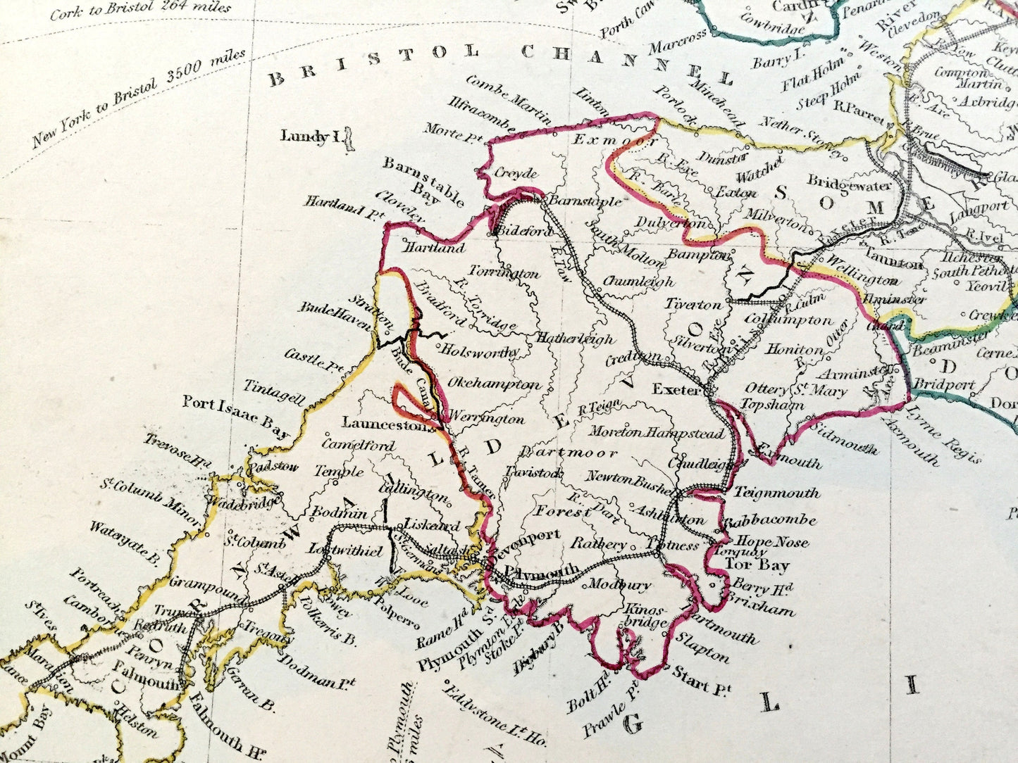
See what Great Britain looked like over 175 years ago. Hand colored. Verso is blank. Lots of intricate, charming details like mountains, deserts, lakes, trade routes, canals, rivers and older city and region names. At some point, the map was mounted on a thicker archival paper backing.
Perfect for the historian, map-lover, the curious or just as a conversation starter. Wonderful and rare. Vintage maps such as these make great gifts.
Edition of 1844, printed 1844
Dimensions: 14" width x 17 1/4" height
----
Features
Points of Interest: England, York, Durham, Lincoln, Derby, Nottingham, North Riding, West Riding, East Riding, North Sea, Humber River, The Wash, North York Moors, Wales, Scotland, Ireland, Isle of Man, Northumberland, Cumberland, Westmorland, Chester, Cheshire, Flint, Anglesey, Lancashire, Liverpool, Lancaster, Manchester, Edinburgh, Glasgow, Islay, Isle of Arran, Kintyre, Irish Sea, River Mersey, North Channel, Solway Firth, Morecambe Bay, Cornwall, Devon, Dorset, Somerset, Gloucester, Monmouth, Hereford, Worcester, Montgomery, Merioneth, Pembroke, Carmarthen, Cardigan, Dorchester, Plymouth, Exmoor, Cardiff, Bristol, Shrewsbury, English Channel, St. George’s Channel, Cardigan Bay, Bristol Channel, Carmarthen Bay, Dartmoor Forest, France, Sussex, Surrey, Kent, Isle of Wight, Buckingham, Warwick, Oxford, Essex, Suffolk, Norfolk, Cambridge, Leicester, Northampton, Hertford, London, Chichester, Brighton, Portsmouth, Salisbury, Winchester, Birmingham, Coventry, Strait of Dover, River Thames, Salisbury Plain.
The Society for the Diffusion of Useful Knowledge (SDUK) was founded in 1826 with the object of publishing information to people who were unable to obtain formal teaching, or who preferred self-education. Their publications were intended for the working class and the middle class, as an antidote to the more radical output of the pauper presses.
----
Condition: Good Vintage condition, commensurate with age. This map is in great shape for being more than 175 years old. Light wear and coloration as can be seen in the photographs, but this will read as vintage character when framed.
----
We will happily adjust shipping price for multiple purchases. Maps are rolled up and shipped in sturdy mailing tubes, never folded.
Couldn't load pickup availability
Share