My Store
Antique 1850 Switzerland Map by John Dower, Ward & Lock – Germany, Liechtenstein, Zurich, Lucerne, Lake Geneva, Alps, Mountains Active
Antique 1850 Switzerland Map by John Dower, Ward & Lock – Germany, Liechtenstein, Zurich, Lucerne, Lake Geneva, Alps, Mountains Active
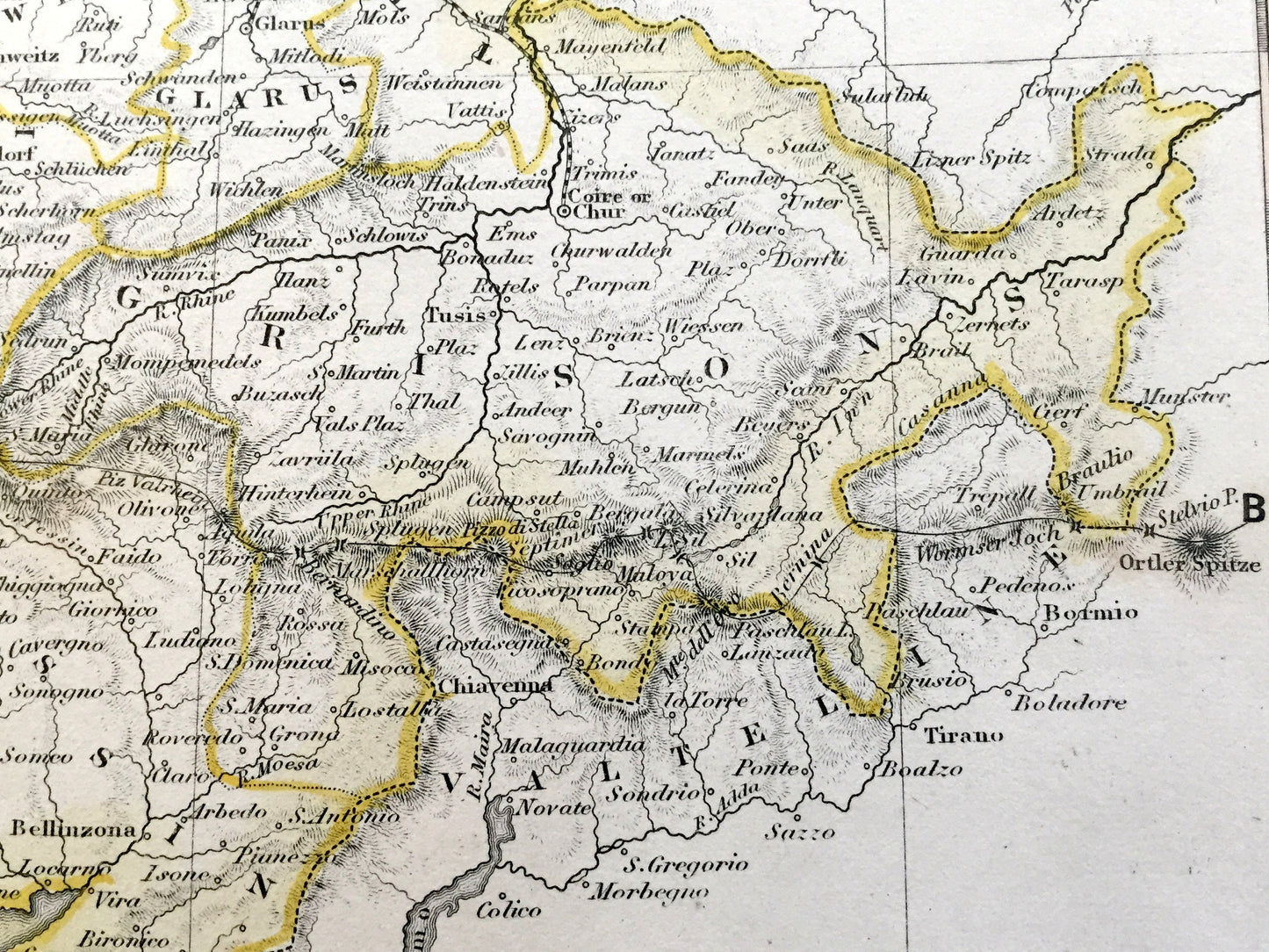
Beautiful, antique map of Switzerland, including surrounding areas of Italy and Germany. This is an authentic 1850 lithograph by J Dower, published by Ward & Lock, Ltd., Pentonville, London. It is an original, sourced from Petermann's "Atlas of Physical Geography" and is NOT a computer reproduction. Includes a mountain profile in the bottom border.
See what Switzerland looked like over 170 years ago. Lots of charming, intricate details and contours, including mountains, islands, rivers, cities and countries. Hand-colored. Verso is blank.
Perfect for the historian, map-lover, the curious or just as a conversation starter. Wonderful and rare. Vintage maps such as these make great gifts.
Edition of 1850, printed 1850
Dimensions: 11 3/4" width x 9 1/4" height
----
Features
Points of Interest: Switzerland, France, Italy, Liechtenstein, Germany, Bern, Geneva, Basel, Konstanz, Lucerne, Zug, Zürich, Lausanne, Neuchâtel, Fribourg, Aosta, Como, Besançon, Lake Geneva, Rhône River, Alps, Jura Mountains, Lake Neuchâtel, Lake Constance, Lake Maggiore, Lake Como, Mont Blanc, and many more.
----
Condition: Very Good Vintage condition, commensurate with age. This map is in incredible shape for being over 170 years old. The paper quality is strong and the colors bright bright. Has light wear, foxing and toning, as well as pencil in lower right margin, but this will all read as vintage character when framed.
----
We will happily adjust shipping price for multiple purchases. Maps are rolled up and shipped in sturdy mailing tubes, never folded.
Couldn't load pickup availability
Share