My Store
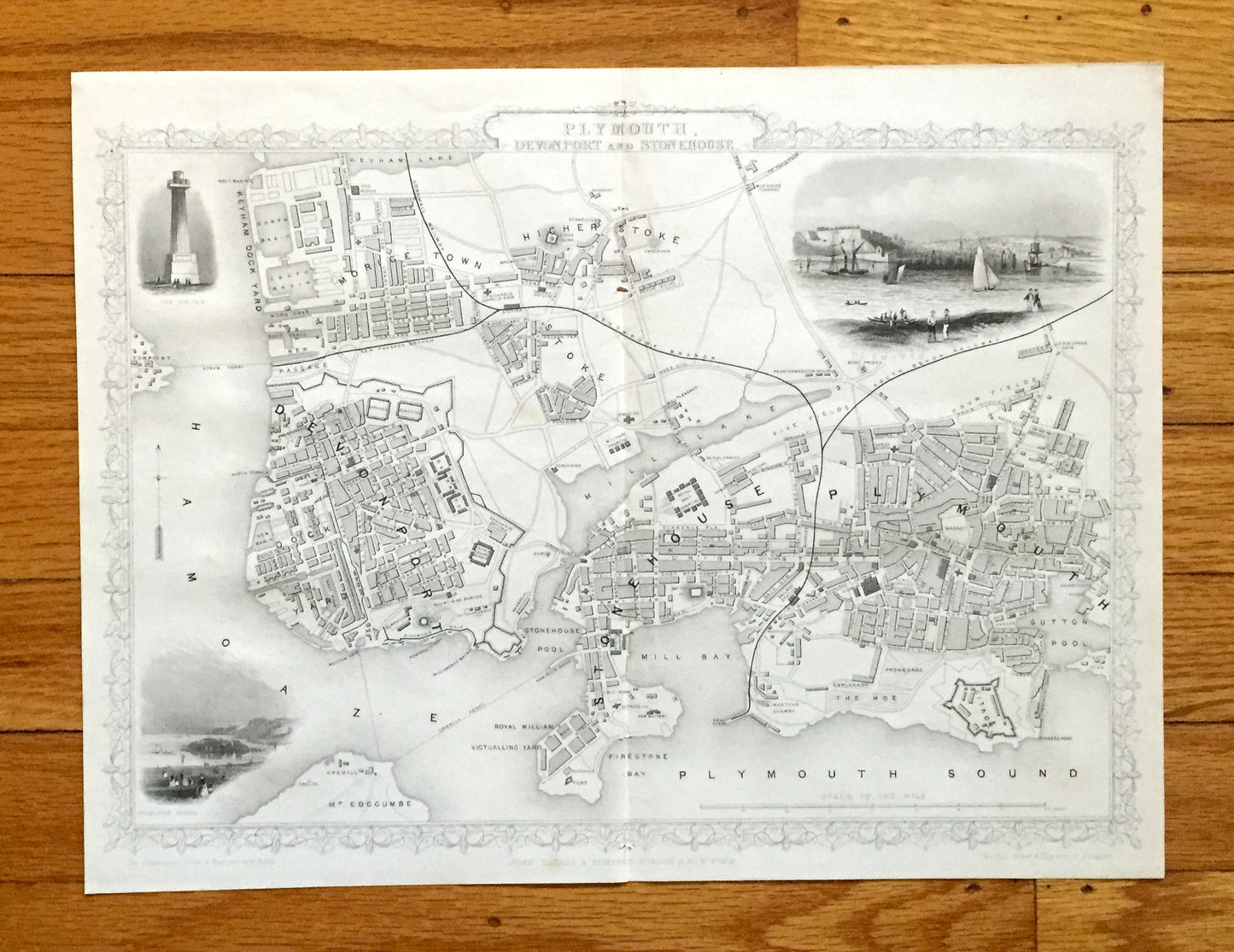
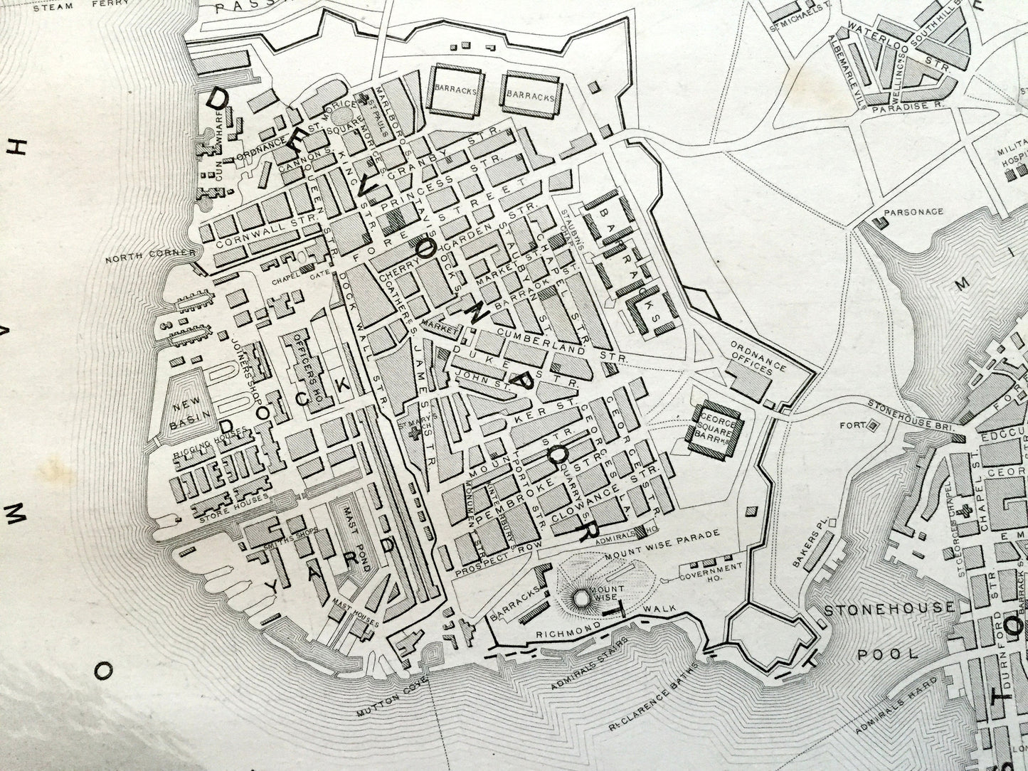
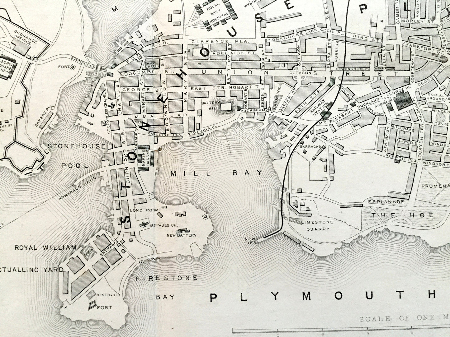
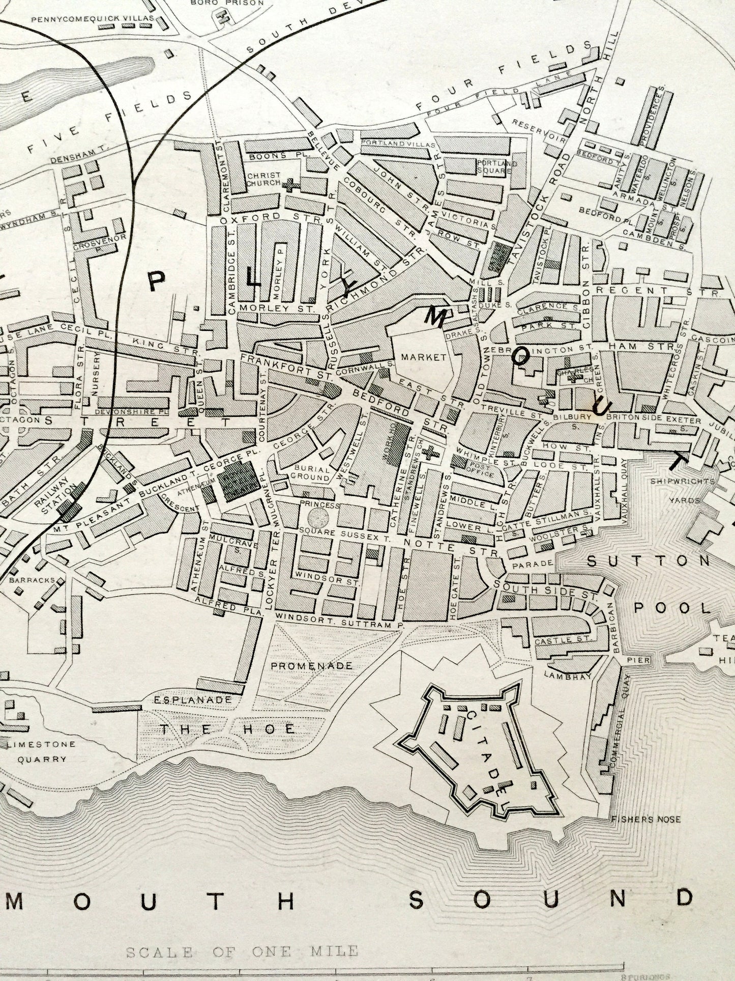
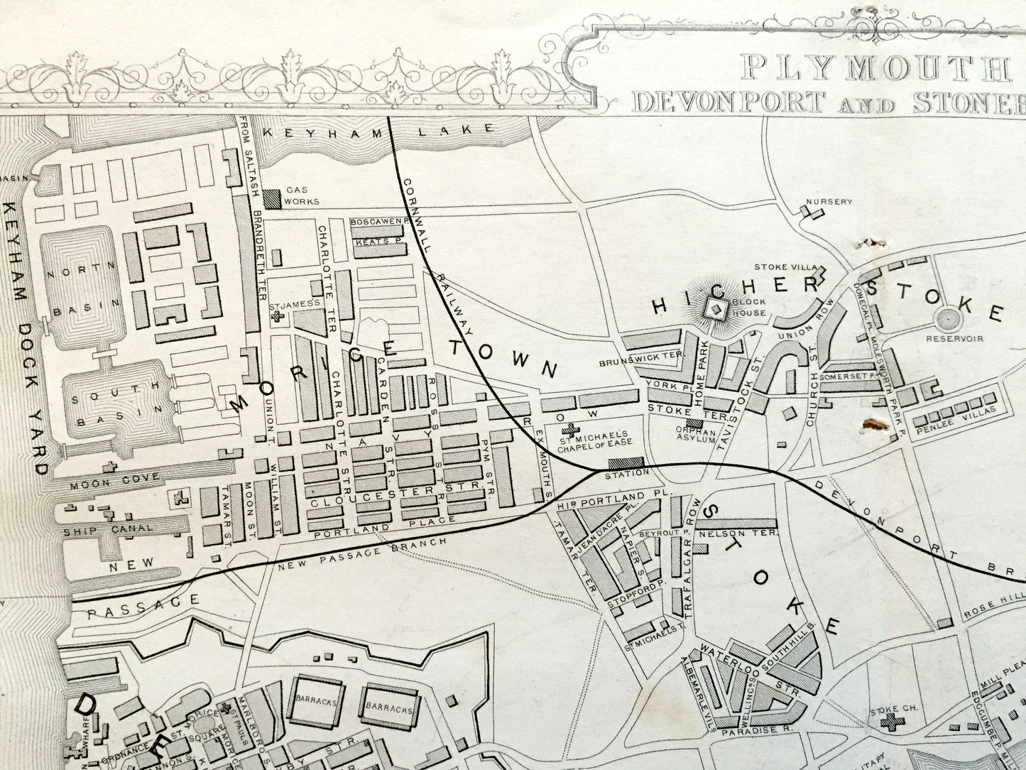
Antique 1851 Plymouth, England Map by John Rapkin from Tallis Atlas – Exeter, Devonport, Stonehouse, Devon County, Great Britain, UK
Antique 1851 Plymouth, England Map by John Rapkin from Tallis Atlas – Exeter, Devonport, Stonehouse, Devon County, Great Britain, UK
Beautiful, antique map of Plymouth, Devonport & Stonehouse, England, including three handsome vignettes of the area. This is an authentic print from the "Illustrated World Atlas," published in 1851 by John Tallis. It is an original and is NOT a computer reproduction.
See what Plymouth looked like over 170 years ago. Lots of charming, intricate details and geological contours, including streets, parks, bridges, rivers, churches, castles and other landmarks and points of interest. Verso is blank.
Perfect for the historian, map-lover, the curious or just as a conversation starter. Wonderful and rare. Vintage maps such as these make great gifts.
Edition of 1851, printed 1851
Dimensions: 14 1/2" width x 11" height
----
Condition: Very Good Vintage condition, commensurate with age. This map is in incredible shape for being over 170 years old. Has light edge-wear, toning and fold line from atlas as-issued, but this will flatten easily and all will add to vintage character when framed.
----
We will happily adjust shipping price for multiple purchases. Maps are rolled up and shipped in sturdy mailing tubes, never folded.
Couldn't load pickup availability
Share