My Store
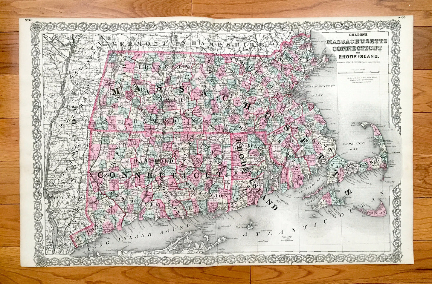
Antique 1855 New England County Map by Coltons – Massachusetts, Connecticut, Rhode Island, Cape Cod, Martha's Vineyard, Boston Berkshires MA
Antique 1855 New England County Map by Coltons – Massachusetts, Connecticut, Rhode Island, Cape Cod, Martha's Vineyard, Boston Berkshires MA
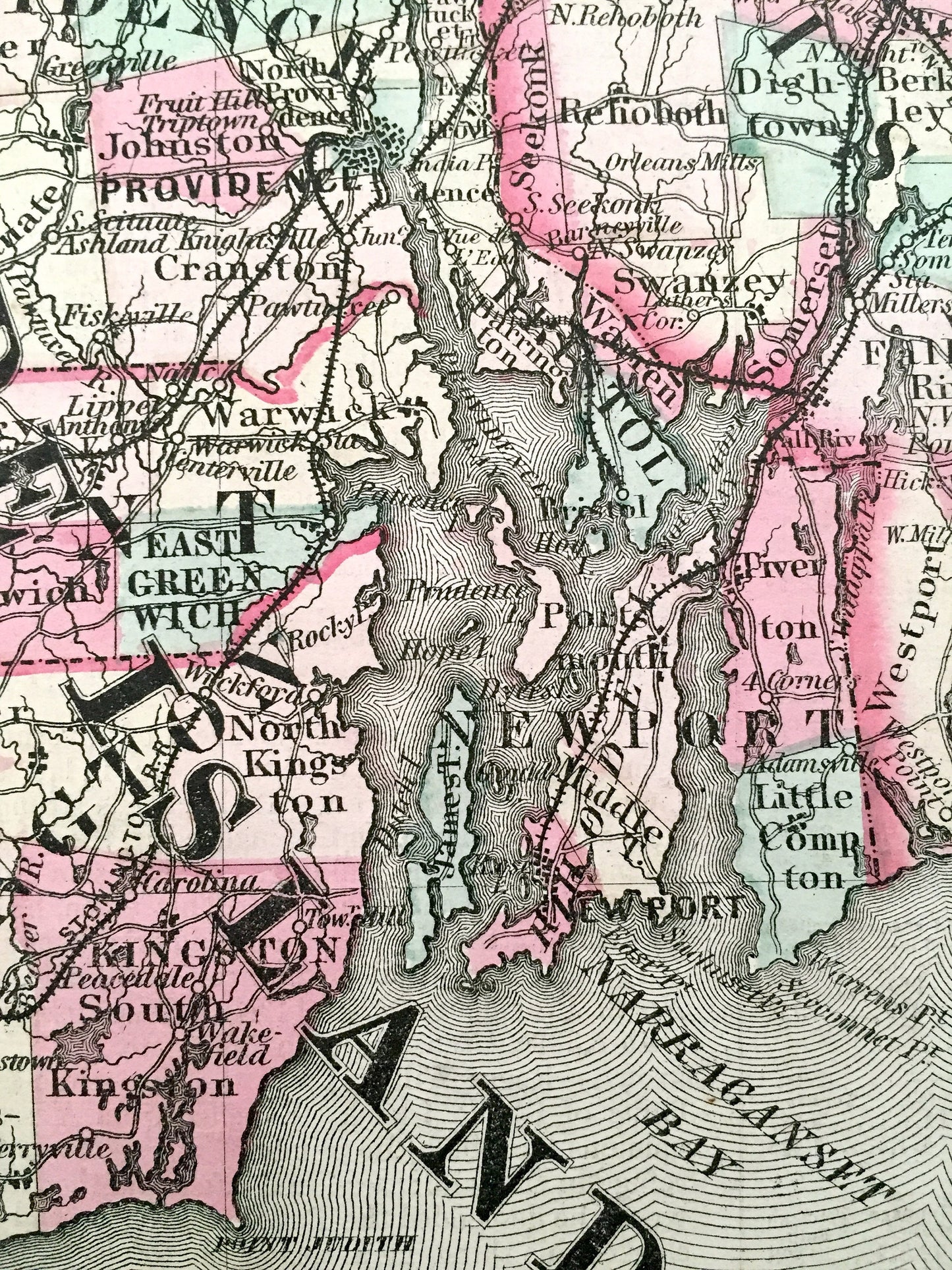
Beautiful, antique map of the counties of lower New England—Massachusetts, Connecticut and Rhode Island. This is an authentic 1882 engraving from GW & CB Colton and NOT a computer reproduction.
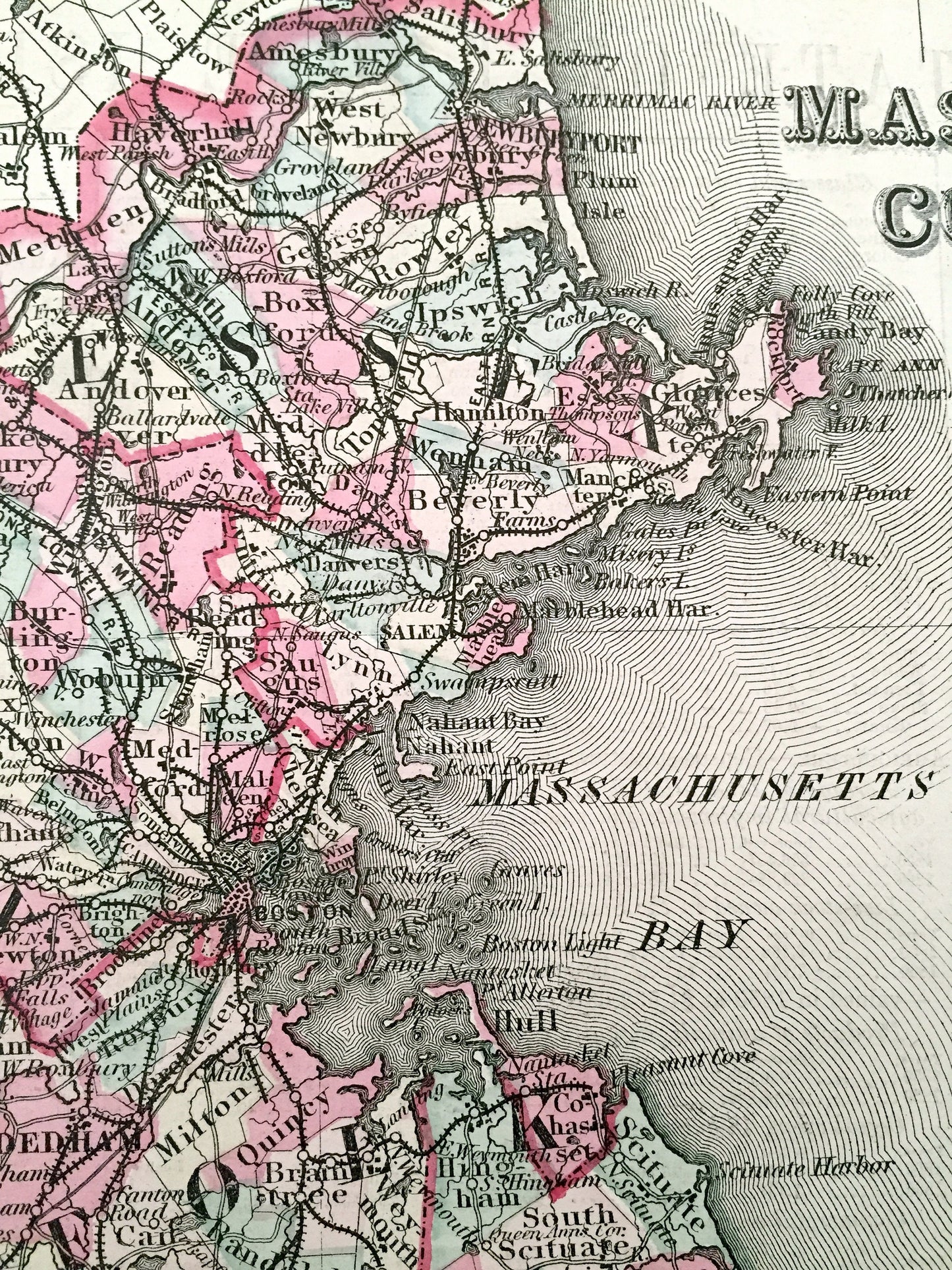
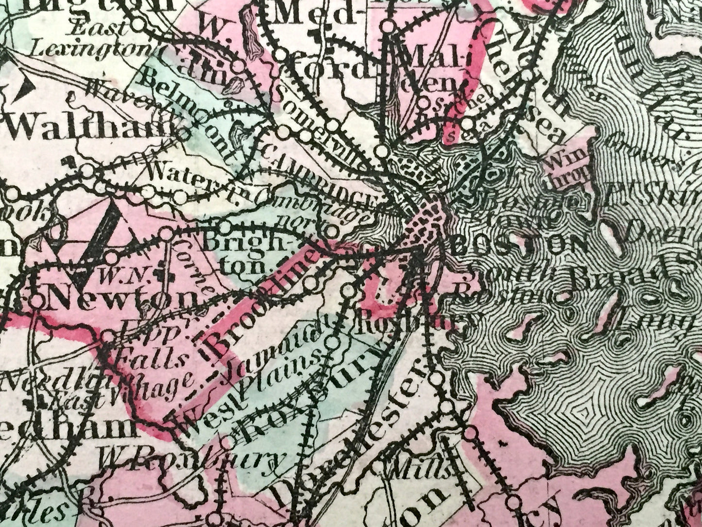
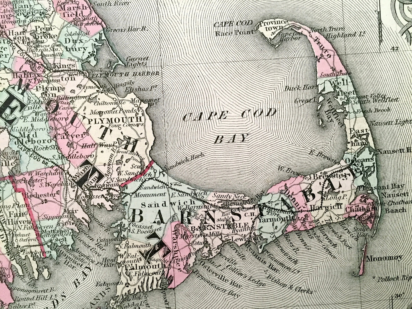
See what Massachusetts, Connecticut and Rhode Island looked like over 160 years ago. Lots of charming, intricate details, decorative border and geological contours, including mountains, islands, counties, railroads and rivers. Hand colored. Verso is information on the states of Rhode Island and Massachusetts.
Perfect for the historian, map-lover, the curious or just as a conversation starter. Wonderful and rare. Vintage maps such as these make great gifts.
Edition of 1855, printed 1855
Dimensions: 28" width x 17 1/2" height
----
Features
Points of Interest: Berkshire, Franklin, Hampden, Hampshire, Worcester, Middlesex, Essex, Norfolk, Bristol, Plymouth, Barnstable, Dukes, Litchfield, Fairfield, Hartford, New Haven, Middlesex, Tolland, New London, Windham, New London, Providence, Kent, Washington, Bristol, Newport, Boston, Cape Cod, Buzzards Bay, Boston Harbor, Cape Ann, Nantucket, Martha's Vineyard, Elizabeth Islands, Vineyard Sound, Lond Island Sound, Block Island, Hartford, Providence, Kingston.
----
Condition: Good Vintage condition, commensurate with age. This map is in great shape for being over 160 years old. Light edge-wear and toning, but this will all read as vintage character when framed.
----
We will happily adjust shipping price for multiple purchases. Maps are rolled up and shipped in sturdy mailing tubes, never folded.
Couldn't load pickup availability
Share