My Store
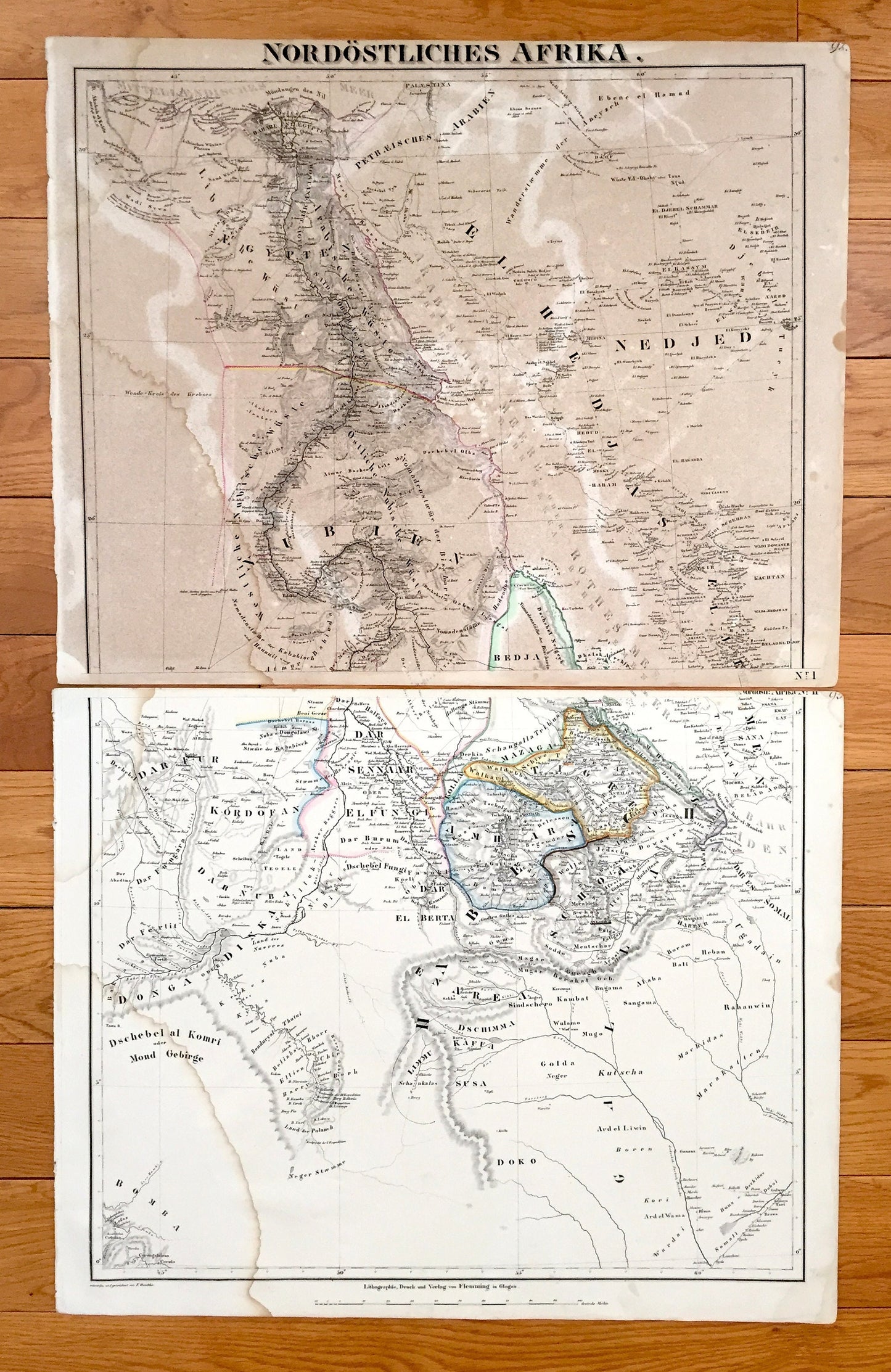
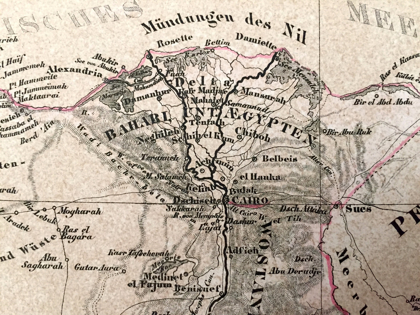
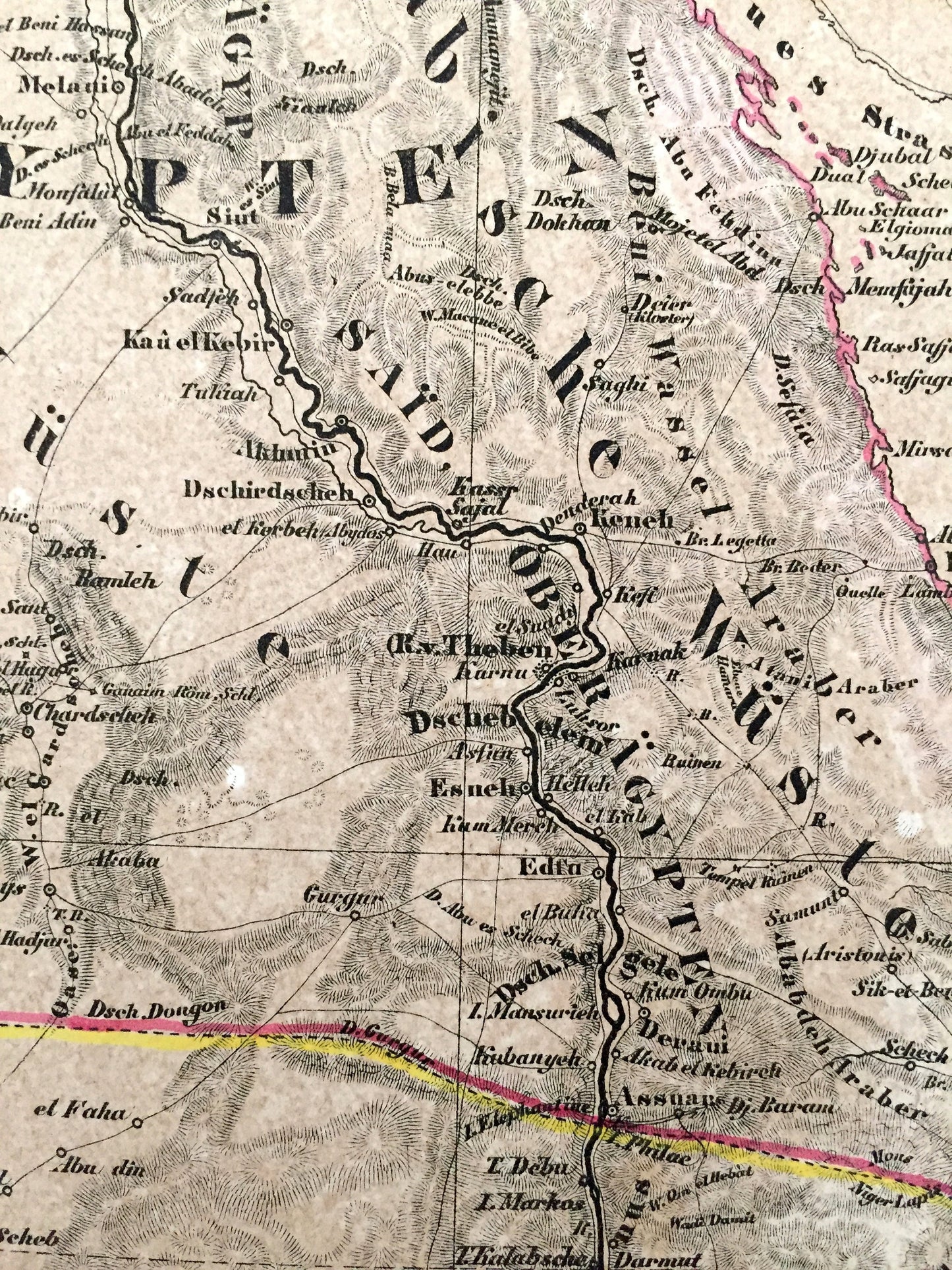
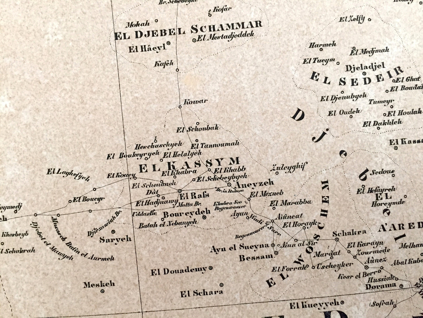
Antique 1855 Northeast Africa Map from Sohr Berghaus Atlas by Carl Flemming – Nordöstliches Afrika, Egypt, Saudi Arabia, Cairo, Mecca, Aden
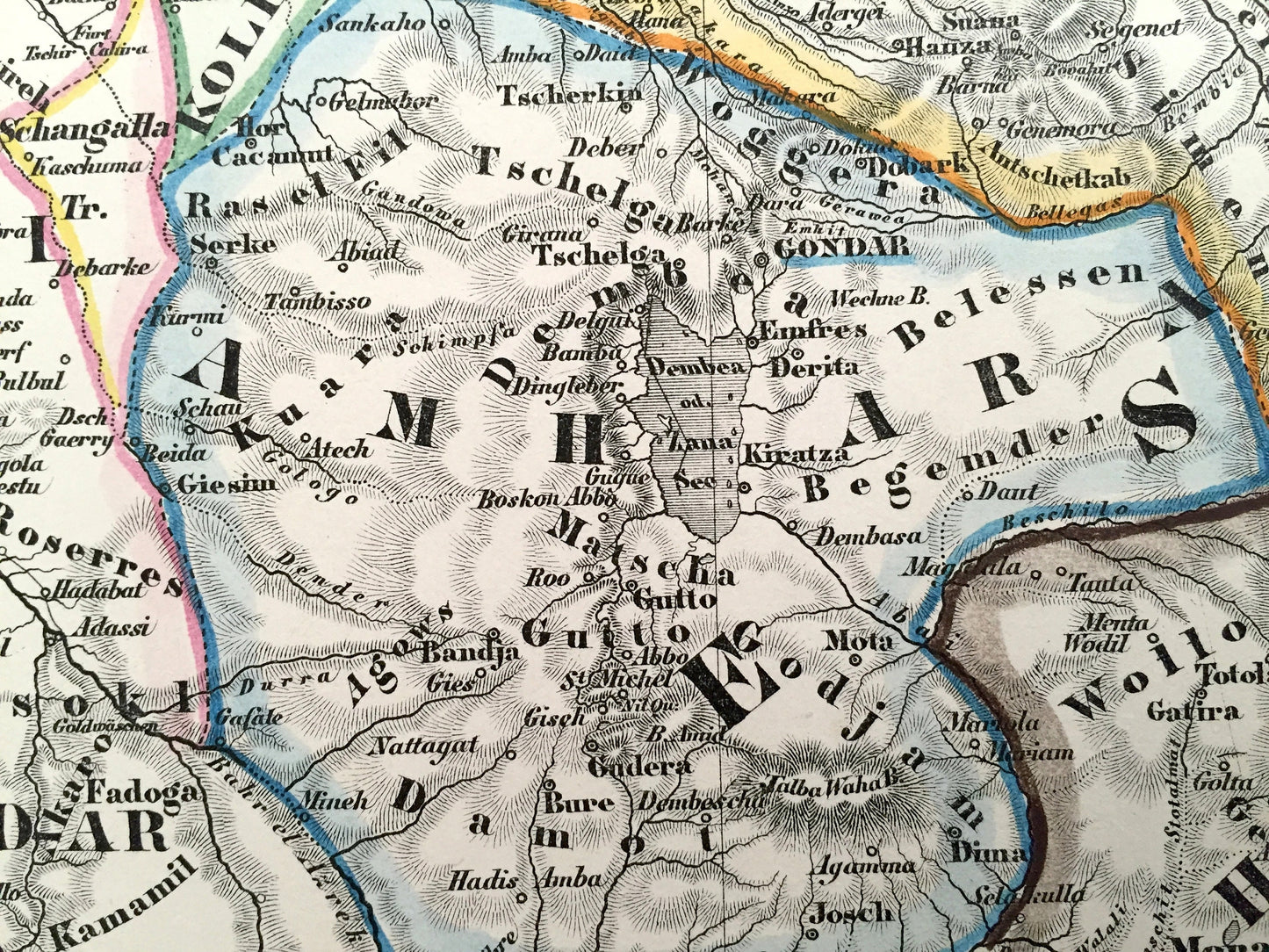
Antique 1855 Northeast Africa Map from Sohr Berghaus Atlas by Carl Flemming – Nordöstliches Afrika, Egypt, Saudi Arabia, Cairo, Mecca, Aden
Beautiful, antique maps of Northeastern Africa (Nordöstliches Afrika) by Carl Flemming. These are authentic maps taken from the renowned Sohr Berghaus Atlas published in 1855 and NOT a computer reproduction.
See what Africa looked like more than 170 years ago. Lots of charming, intricate details and contours, including mountains, rivers, lakes and place names. All text is in German. Hand-colored. Verso is blank. Map is split into 2 sheets. Listing is to purchase all.
Perfect for the historian, map-lover, the curious or just as a conversation starter. Wonderful and rare. Vintage maps such as these make great gifts.
Edition of 1855, printed 1855
Dimensions: 17 1/2" width x 28" height
----
Points of Interest: Africa, Egypt, Sudan, Eritrea, Saudi Arabia, Ethiopia, Yemen, Djibouti, Israel, Palestine, Cairo, Alexandria, Mecca, Jeddah, Medina, Aswan, Luxor, Dahlak Archipelago, Khartoum, Sana'a, Aden, Nile River, Red Sea, Gulf of Aden, Mediterranean Sea.
Condition: Good Vintage condition, commensurate with age. These maps are in incredible shape for being over 170 years old. Have edge-wear and water stains, but this will add to vintage character and their authenticity when framed.
----
We will happily adjust shipping price for multiple purchases. Maps are rolled and shipped fully-insured in sturdy mailing tubes, never folded.
Couldn't load pickup availability
Share