My Store
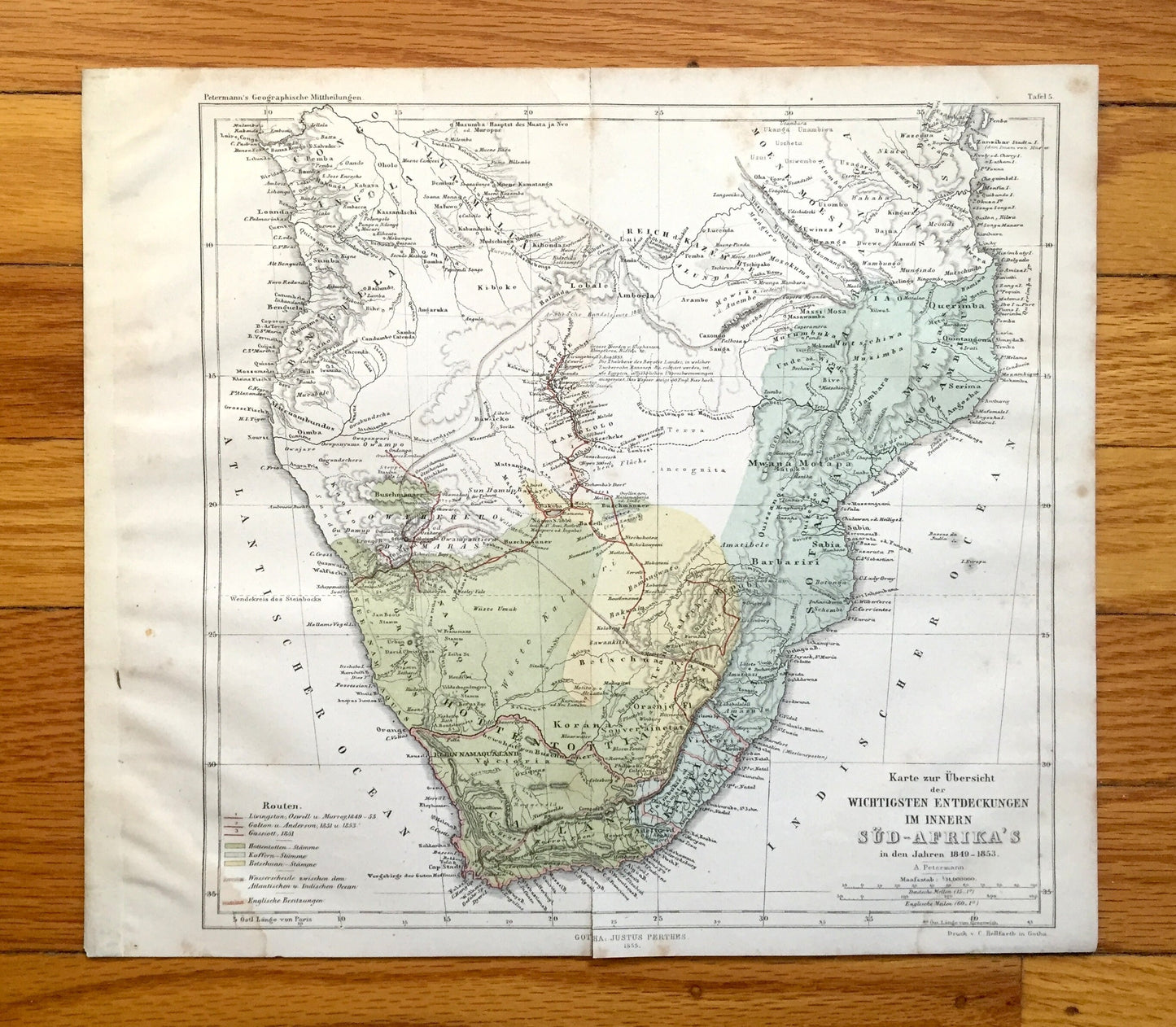
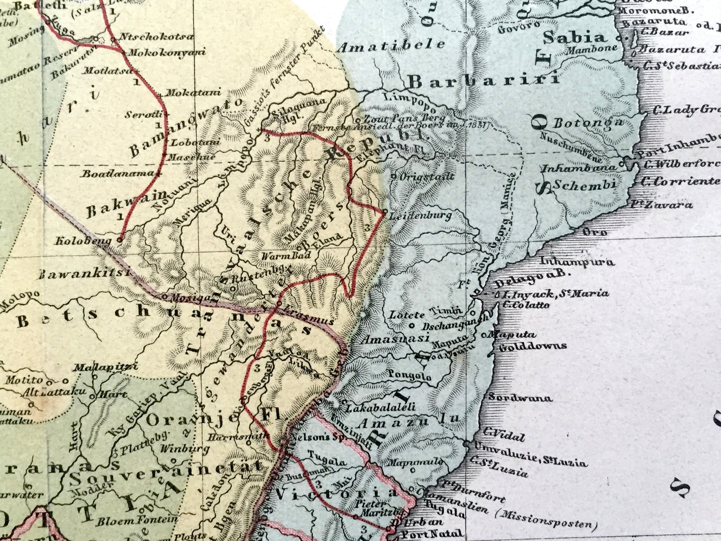
Antique 1855 South Africa Map from Petermann's Geographische Mitteilungen Atlas by Justus Perthes – Das Capland, Cape Town, Johannesburg
Antique 1855 South Africa Map from Petermann's Geographische Mitteilungen Atlas by Justus Perthes – Das Capland, Cape Town, Johannesburg
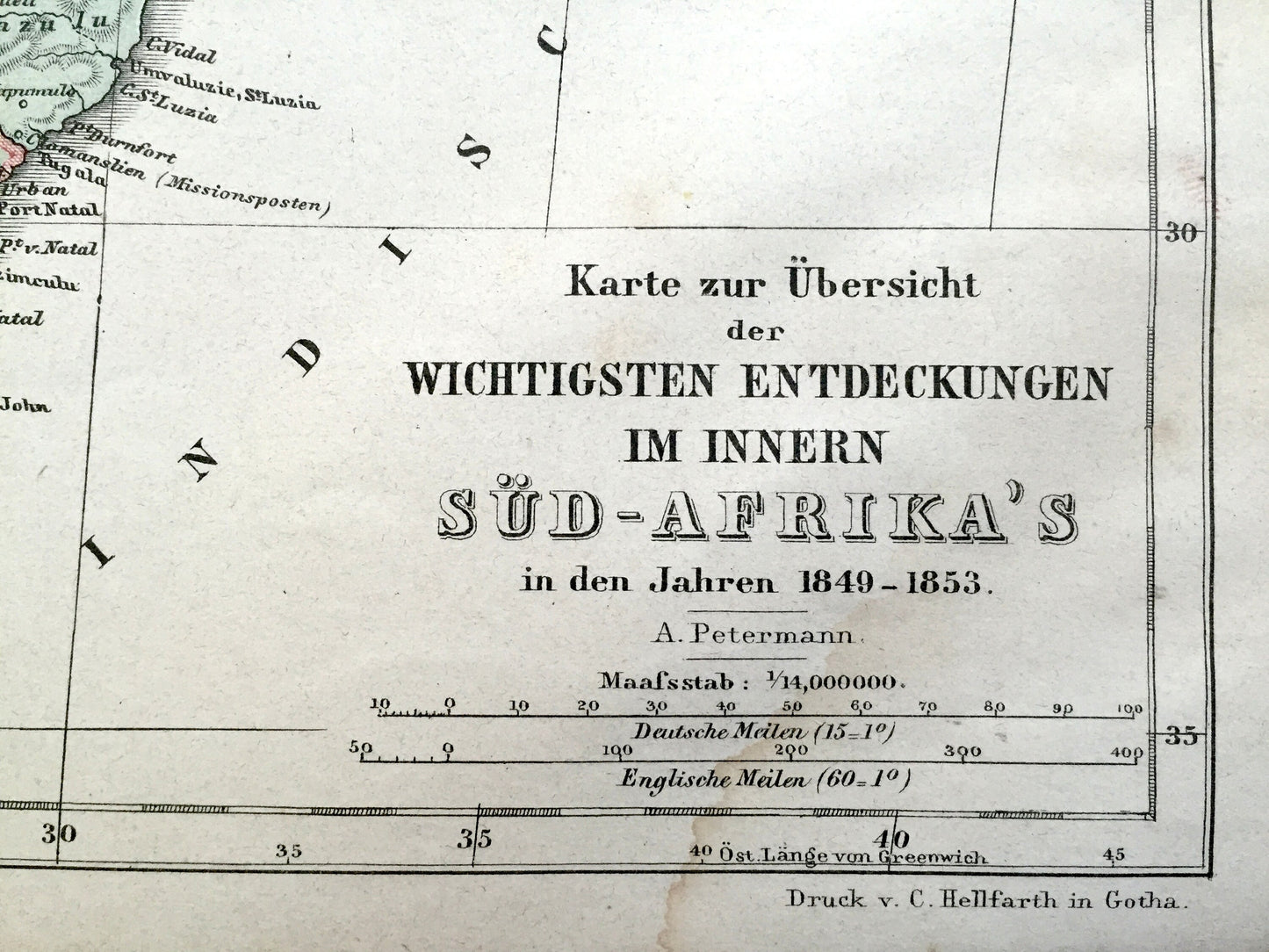
Beautiful, antique map of South Africa by Justus Perthes, as well as many modern countries to the north. Map is translated in English as: "Map summarizing the most important discoveries in the interior of South Africa in the years 1849-1853." This is an authentic map taken from Petermann's renowned "Geographische Mitteilungen" published in 1855 and is NOT a computer reproduction.
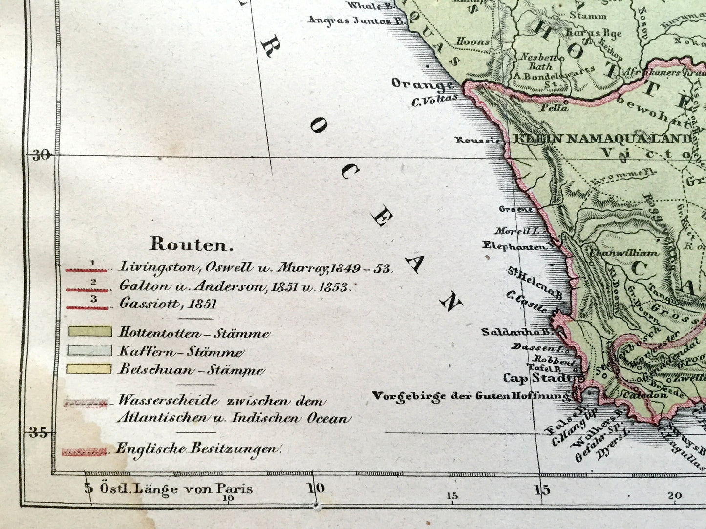
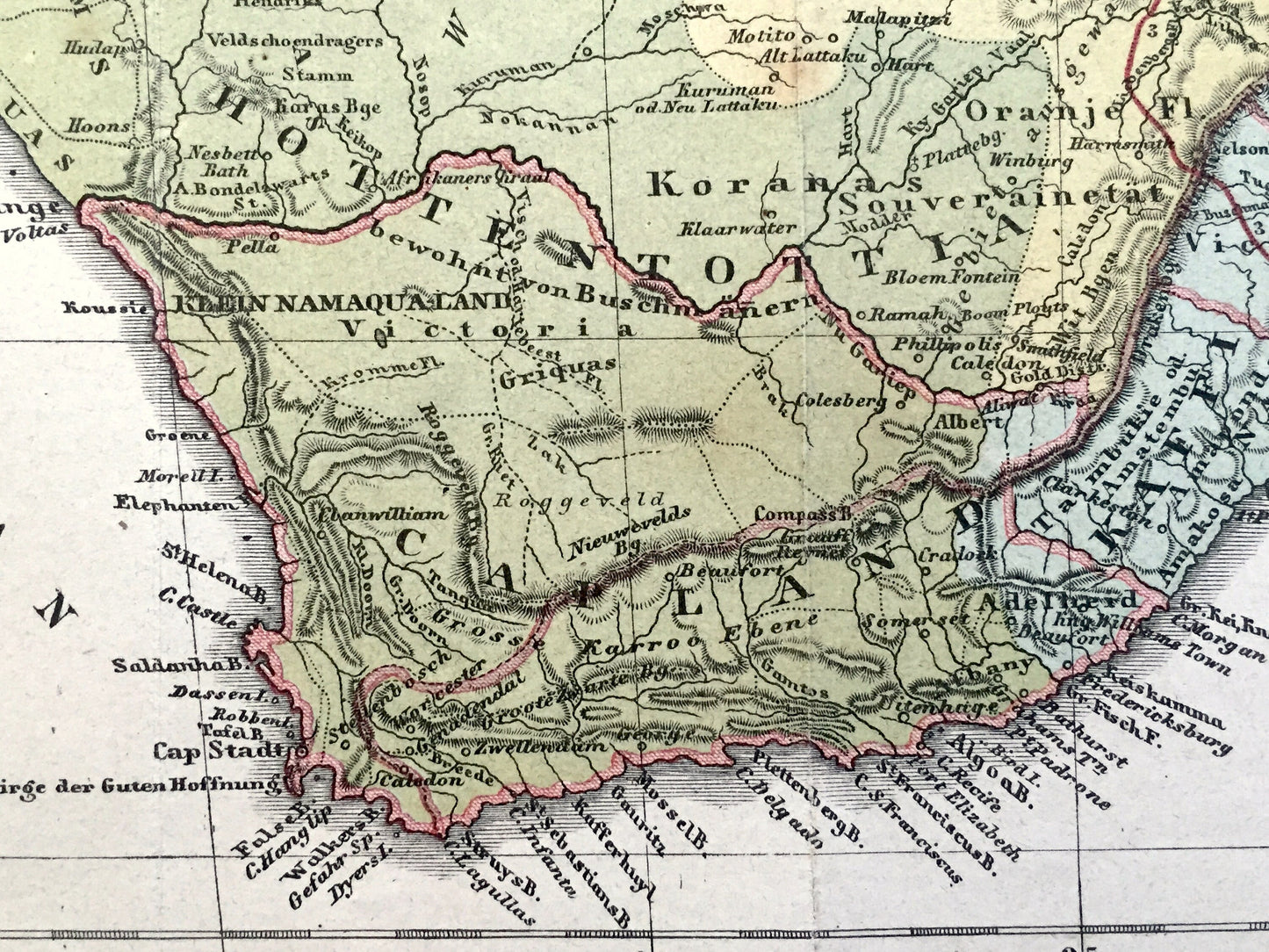
See what South Africa looked like more than 165 years ago. Lots of charming, intricate details and contours, including mountains, rivers, lakes and place names. All text is in German. Color-coded to show the various native populations along with the routes of Livingston, Galton and Gassiott. Verso is blank.
Perfect for the historian, map-lover, the curious or just as a conversation starter. Wonderful and rare. Vintage maps such as these make great gifts.
Edition of 1855, printed 1855
Dimensions: 12" width x 10 1/2" height
----
Condition: Good Vintage condition, commensurate with age. This map is in great shape for being over 165 years old. Has light wear, foxing, staining, toning and old atlas fold lines, as well as small separation at this fold, and slight wrinkling, but this will flatten easily and all will add to vintage character and its authenticity when framed.
----
We will happily adjust shipping price for multiple purchases. Maps are rolled and shipped fully-insured in sturdy mailing tubes, never folded.
Couldn't load pickup availability
Share