My Store
Antique 1862 Vermont & New Hampshire Map by S.A. Mitchell – Lake Champlain, Winnipesaukee, Squam, White, Green Mountains, Burlington, Maine
Antique 1862 Vermont & New Hampshire Map by S.A. Mitchell – Lake Champlain, Winnipesaukee, Squam, White, Green Mountains, Burlington, Maine
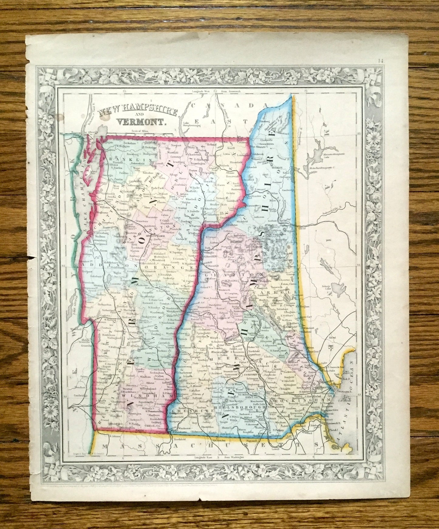
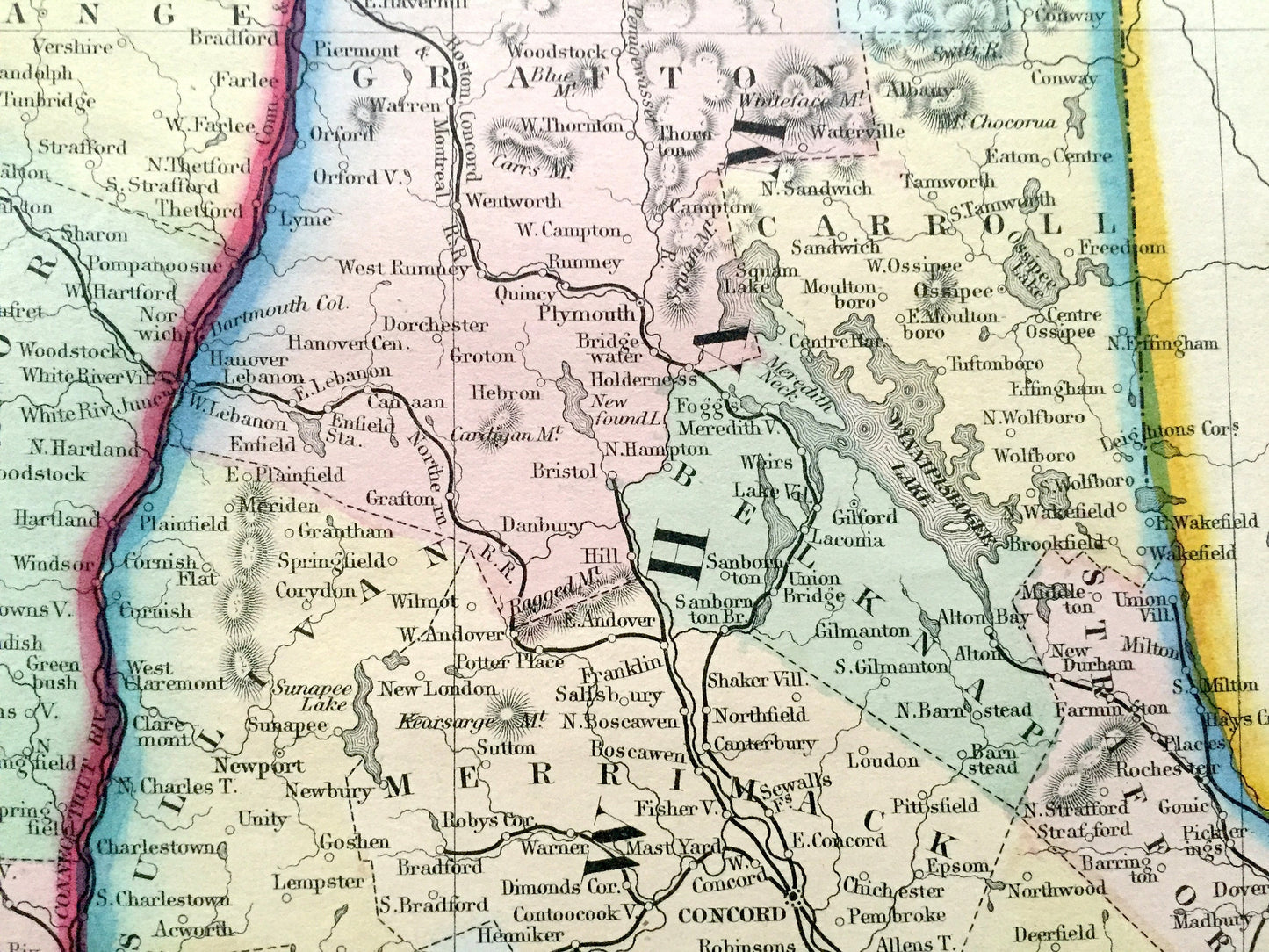
Beautiful, antique map of Vermont and New Hampshire. This is an authentic 1862 engraving from S. August Mitchell's "New General Atlas" and NOT a computer reproduction.
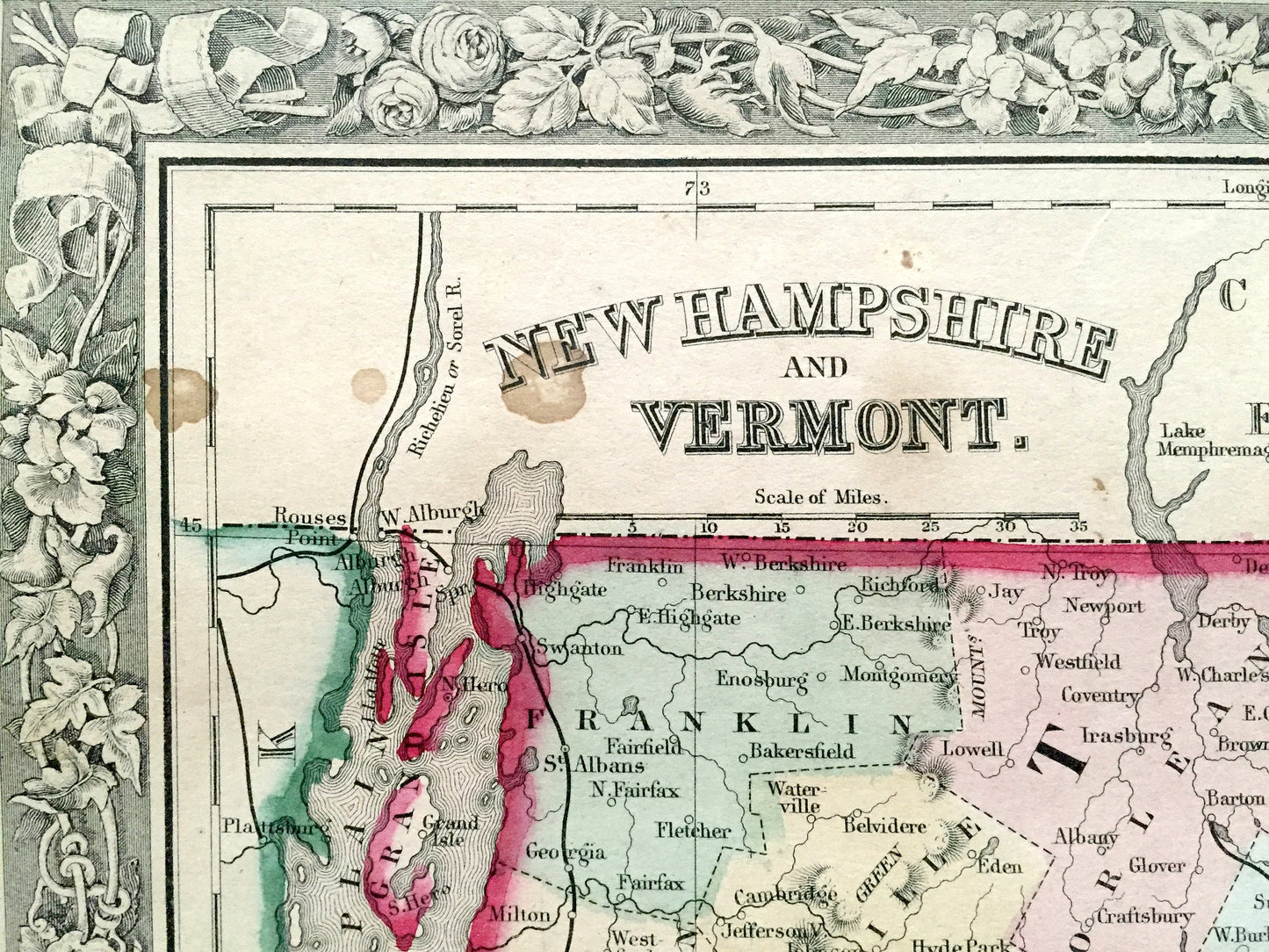
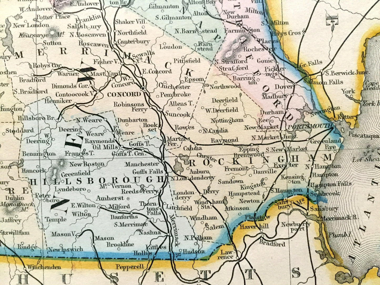
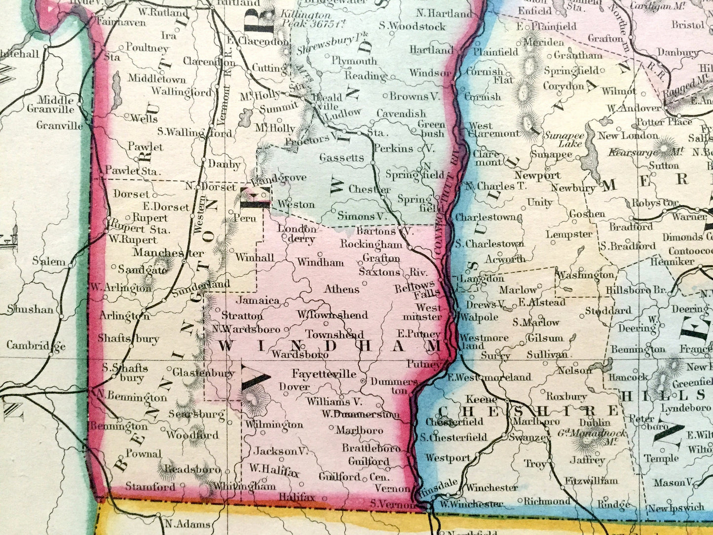
See what New England looked like over 160 years ago. Lots of charming, intricate details and geological contours, including mountains, islands, counties and rivers. Hand colored. Verso is blank.
Perfect for the historian, map-lover, the curious or just as a conversation starter. Wonderful and rare. Vintage maps such as these make great gifts.
Edition of 1862, printed 1862
Dimensions: 12 1/2" width x 15 1/4" height
----
Features
Points of Interest: New England, Canada, New York, Vermont, New Hampshire, Lake Champlain, Lake Winnipesaukee, Squam Lake, Lake George, White Mountains, Green Mountains, Burlington, Montpelier, Brattleboro, Concord, Nashua, Portsmouth, Mt. Washington, Atlantic Ocean, Kittery, Maine, and much more.
----
Condition: Good or "Very Vintage" condition, commensurate with age. This map is in great shape for being over 160 years old. Has some real foxing and toning, but this will all read as vintage character when framed.
----
We will happily adjust shipping price for multiple purchases. Maps are rolled up and shipped in sturdy mailing tubes, never folded.
Couldn't load pickup availability
Share