My Store
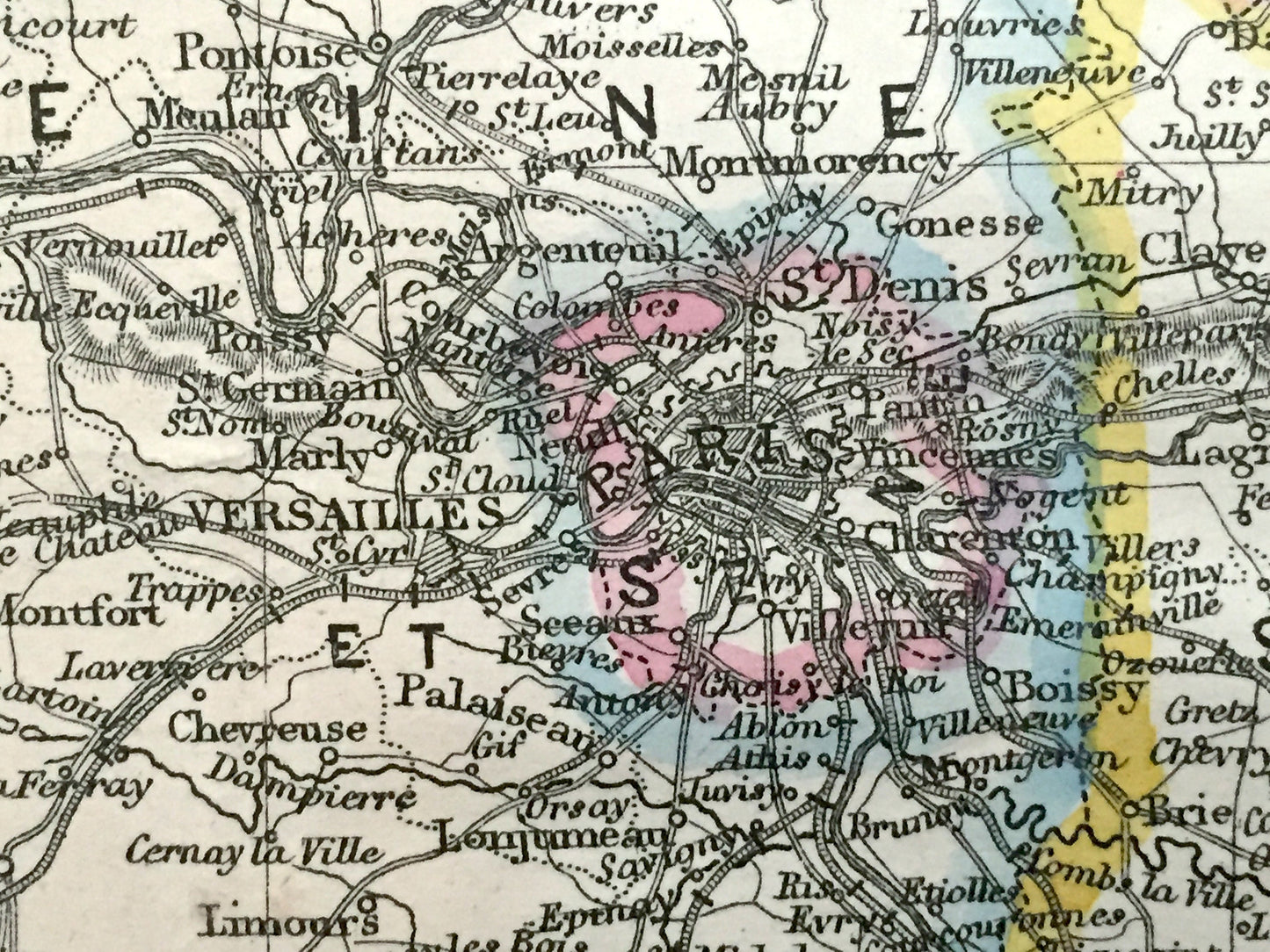
Antique 1863 France Map by Lowry & Weekly Dispatch – Paris, Versailles, Bordeaux, Strasbourg, Rennes, Nice, Seine River, Pyrenees Mountains
Antique 1863 France Map by Lowry & Weekly Dispatch – Paris, Versailles, Bordeaux, Strasbourg, Rennes, Nice, Seine River, Pyrenees Mountains
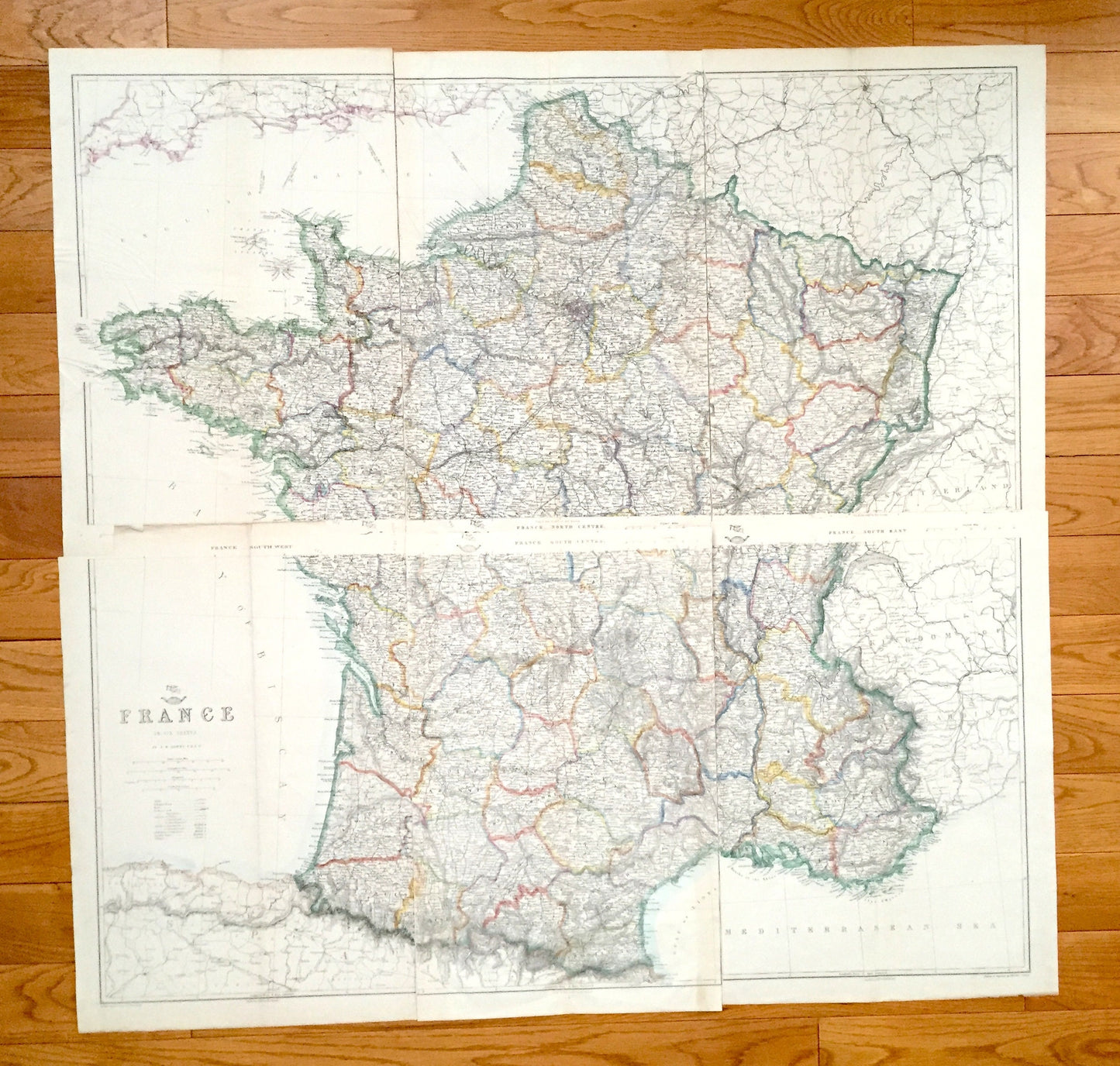
Beautiful, antique maps of France by J. W. Lowry, from the English Channel to the Mediterranean Sea. These are authentic maps taken from the Weekly Dispatch World Atlas published in 1863 and NOT a computer reproduction. Map is split into SIX sheets. Listing is to purchase all.
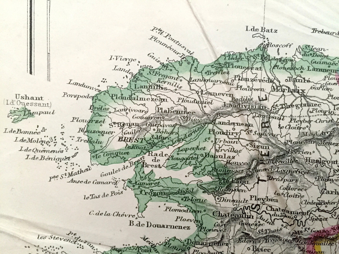
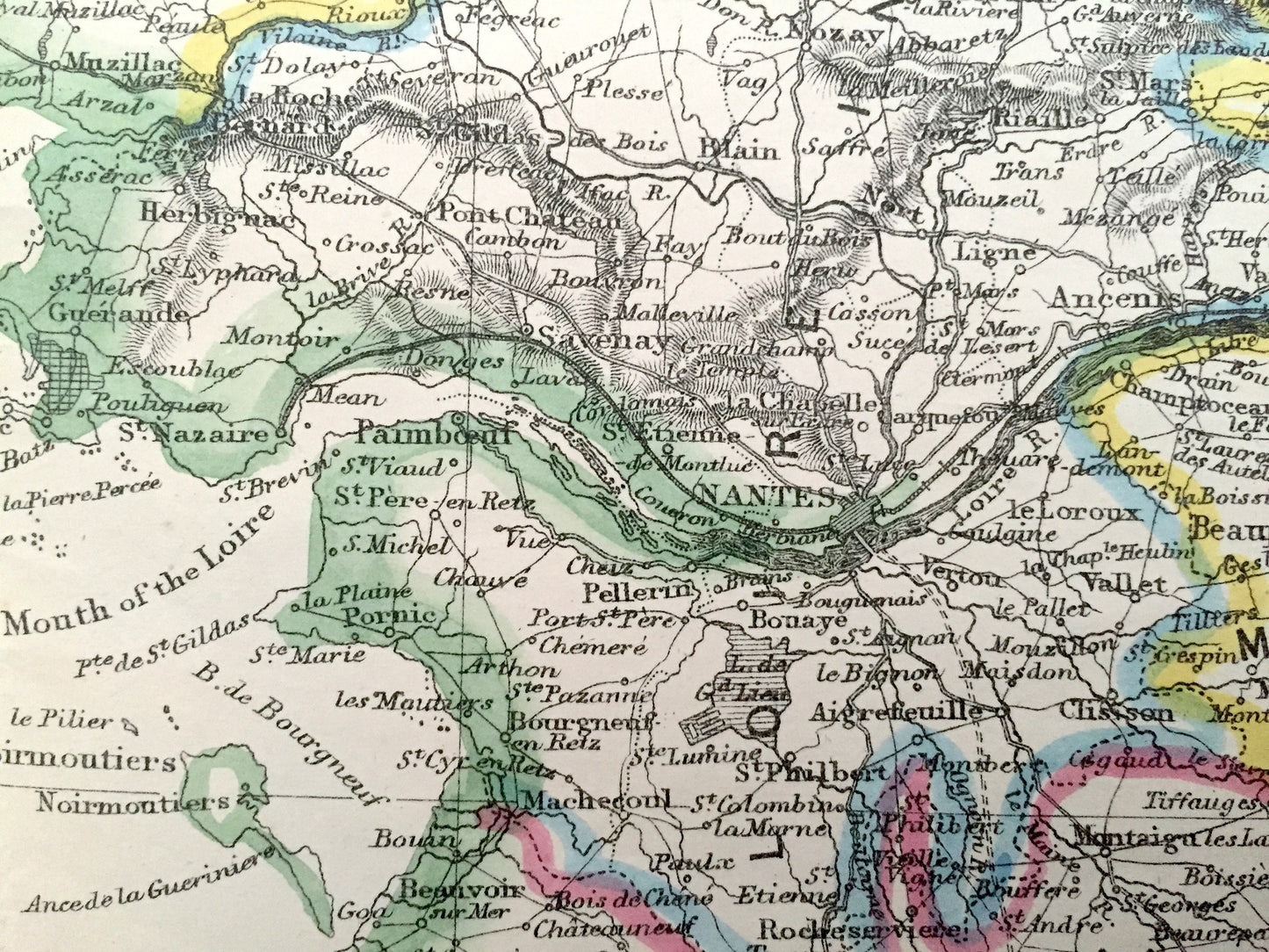
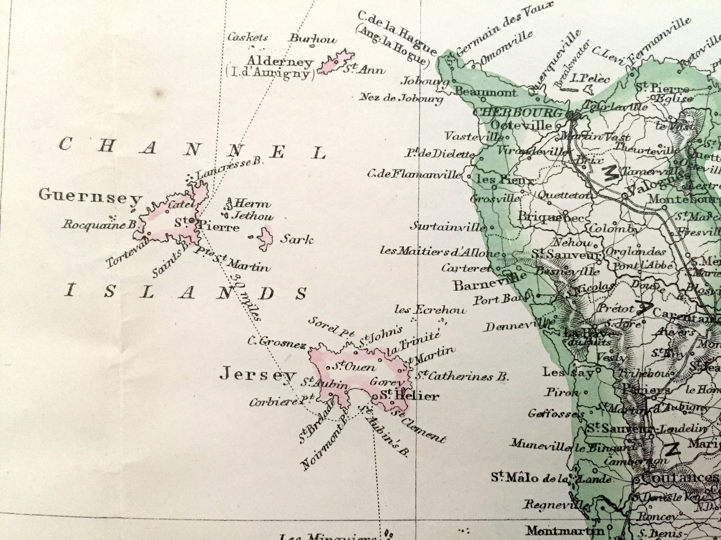
See what France looked like more than 150 years ago, during the Second French empire under the reign of Napoleon III! Lots of charming, intricate details and contours, including mountains, rivers, lakes, railroads and city names. Hand-colored. Verso is blank.
Perfect for the historian, map-lover, the curious or just as a conversation starter. Wonderful and rare. Vintage maps such as these make great gifts.
Edition of 1863, printed 1863
Dimensions: 37" width x 37 3/4" height
----
Points of Interest: France, England, Guernsey, Jersey, Manche, Calvados, Nantes, Quimper, Brest, Cherbourg, Rennes, Isle of Wight, Cornwall, Devon, Exeter, Dorset, English Channel, Loire River
Belgium, Paris, Versailles, Somme, Pas-de-Calais, Caen, Le Havre, Tours, Orléans, Bourges, Brussels, Ghent, Seine River, Strait of Dover, Luxembourg, Germany, Switzerland, Prussia, Hesse, Strasbourg, Metz, Besançon, Dijon, Bern, Lucerne, Zürich, Cologne, Rhine River, Lake Neuchâtel, Jura Mountains
Spain, Bordeaux, La Rochelle, Saintes, Île de Ré, Île d'Oléron, Pamplona, Bilbao, San Sebastián, Gironde River, Pyrenees Mountains, Bay of Biscay, Andorra, Dordogne, Poitiers, Toulouse, Carcassonne, Tulle, Montpellier, Gulf of Lion, Italy, Kingdom of Sardinia, Piedmont, Marseilles, Nice, Monaco, Avignon, Valence, Lyon, Grenoble, Geneva, Turin, Aosta, Îles d'Hyères, Lake Geneva, Mediterranean Sea, Lake Maggiore, Rhône River, Alps.
Condition: Good Vintage condition, commensurate with age. These maps are in great shape for being over 150 years old. Have light wear and toning, but this will add to vintage character when framed.
----
We will happily adjust shipping price for multiple purchases. Maps are rolled up and shipped in sturdy mailing tubes, never folded.
Couldn't load pickup availability
Share