My Store
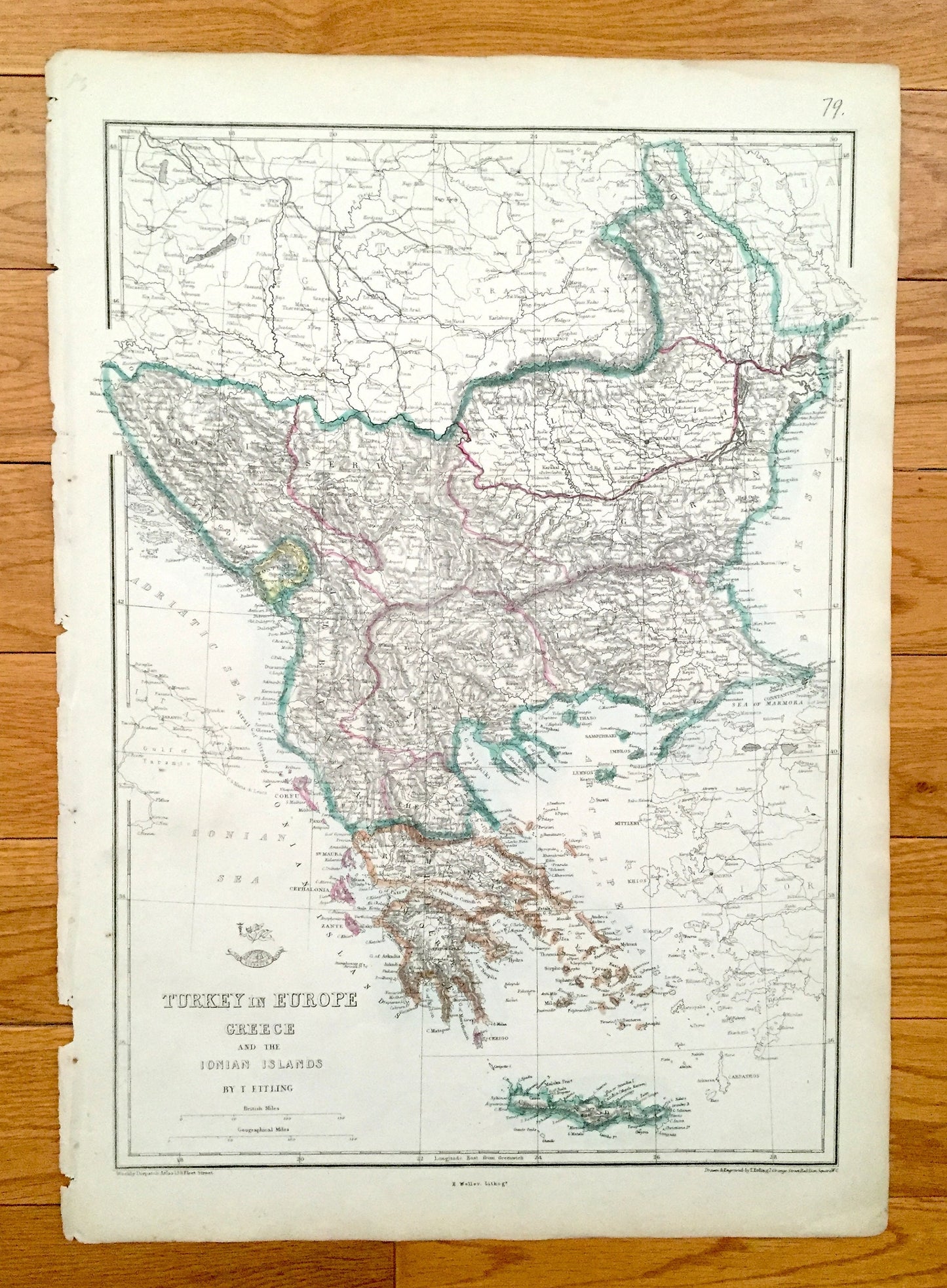
Antique 1863 Turkey and Greece Map by Ettling & Weekly Dispatch – Albania, Bulgaria, Romania, Serbia, Athens, Istanbul, Dubrovnik, Cyclades
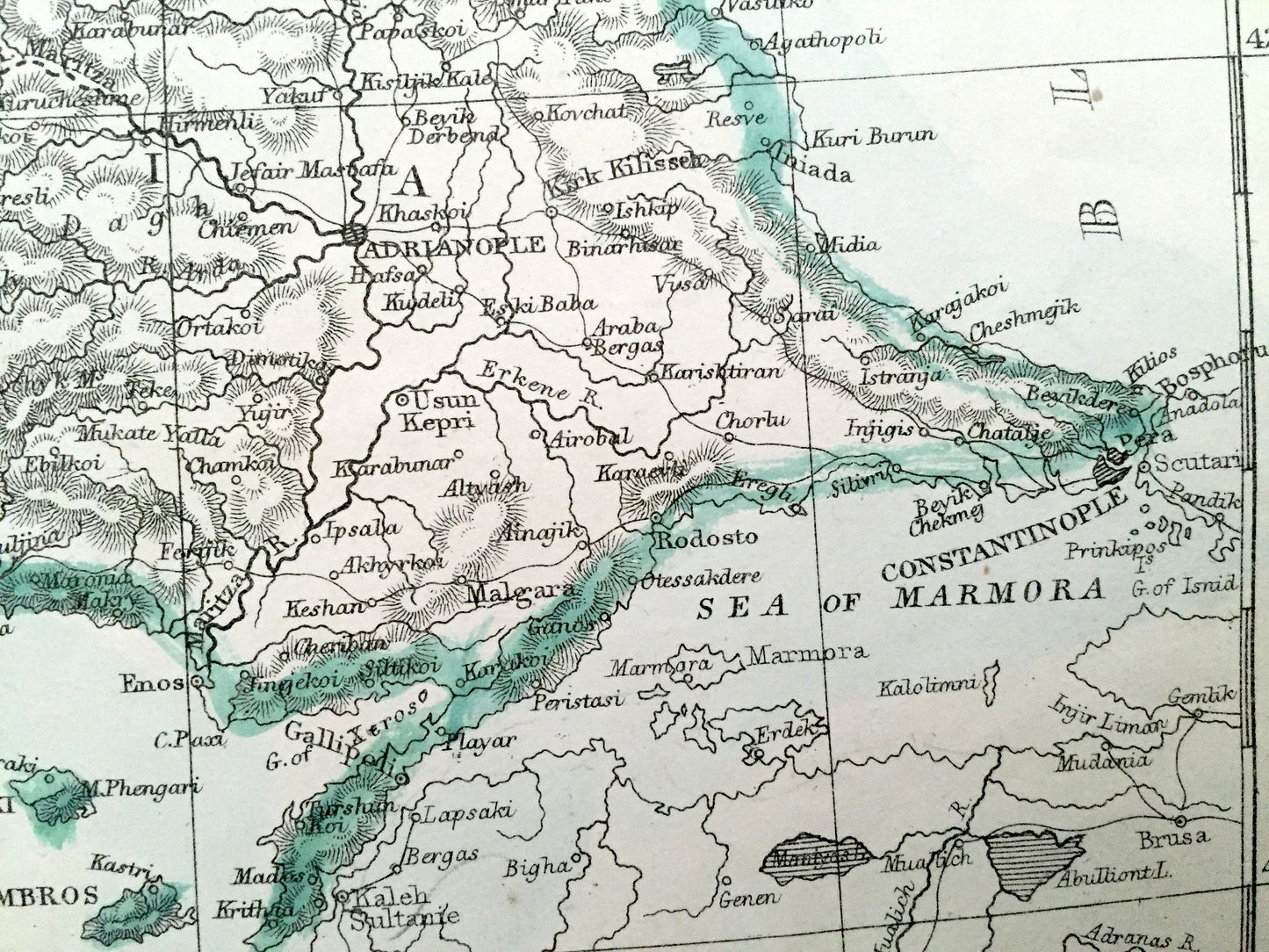
Antique 1863 Turkey and Greece Map by Ettling & Weekly Dispatch – Albania, Bulgaria, Romania, Serbia, Athens, Istanbul, Dubrovnik, Cyclades
Beautiful, antique map of Turkey and Greece by T. Ettling, from the western stretches of the Danube River to the Aegean Sea. This is an authentic map taken from the Weekly Dispatch World Atlas published in 1863 and NOT a computer reproduction.
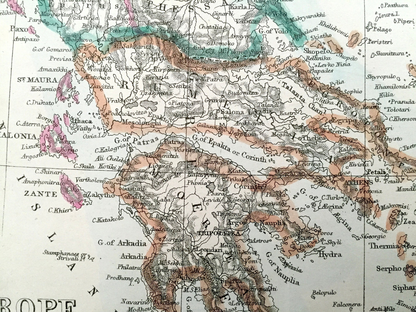
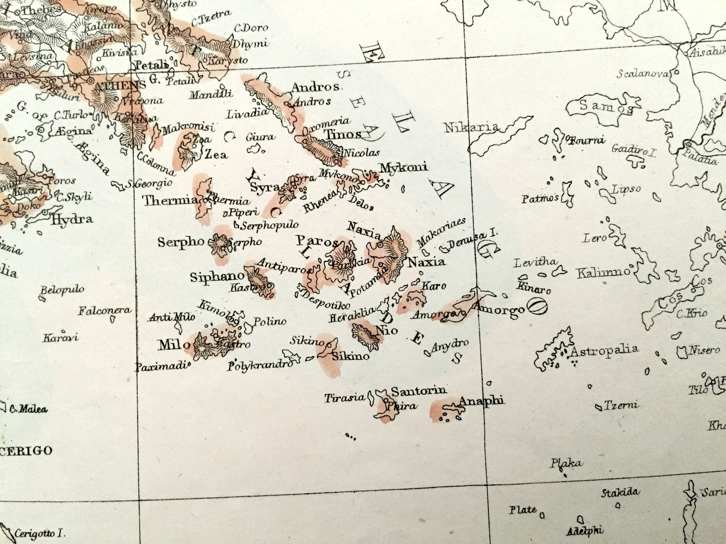
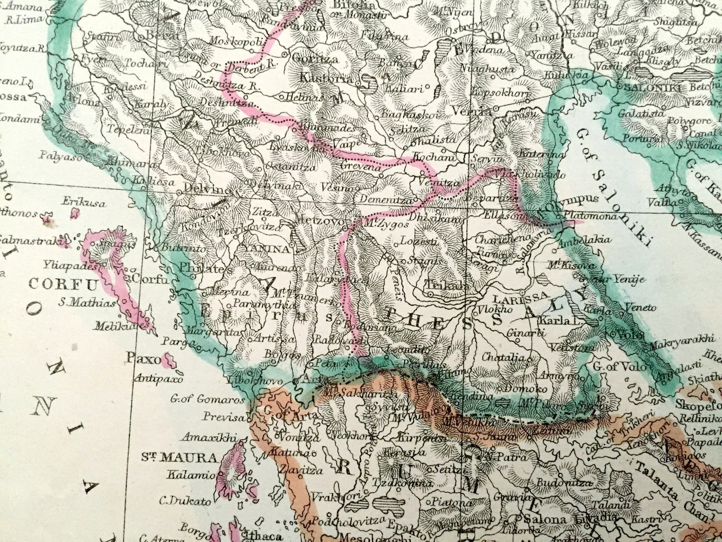
See what Turkey and Greece looked like more than 150 years ago, when the Ottoman Empire still spanned over much of the region! Lots of charming, intricate details and contours, including mountains, rivers, lakes, railroads and city names. Hand-colored. Verso is blank.
Perfect for the historian, map-lover, the curious or just as a conversation starter. Wonderful and rare. Vintage maps such as these make great gifts.
Edition of 1863, printed 1863
Dimensions: 13 1/2" width x 19" height
----
Points of Interest: Greece, Asia Minor, Turkey, Albania, Macedonia, Bulgaria, Kosovo, Montenegro, Bosnia and Herzegovina, Croatia, Dalmatia, Austria, Hungary, Serbia, Moldova, Romania, Transylvania, Wallachia, Russia, Crete, Ionian Islands, Italy, Athens, Thessaloniki, Istanbul, Tirana, Dubrovnik, Bucharest, Edirne, Cyclades, Chișinău, Sofia, Danube River, Adriatic Sea, Ionian Sea, Aegean Sea, Black Sea, Gulf of Salonika, Sea of Marmara, Carpathian Mountains.
Condition: Very Good condition, commensurate with age. This map is in incredible shape for being over 150 years old. Has light wear and toning, but this will add to vintage character when framed.
----
We will happily adjust shipping price for multiple purchases. Maps are rolled up and shipped in sturdy mailing tubes, never folded.
Couldn't load pickup availability
Share