My Store
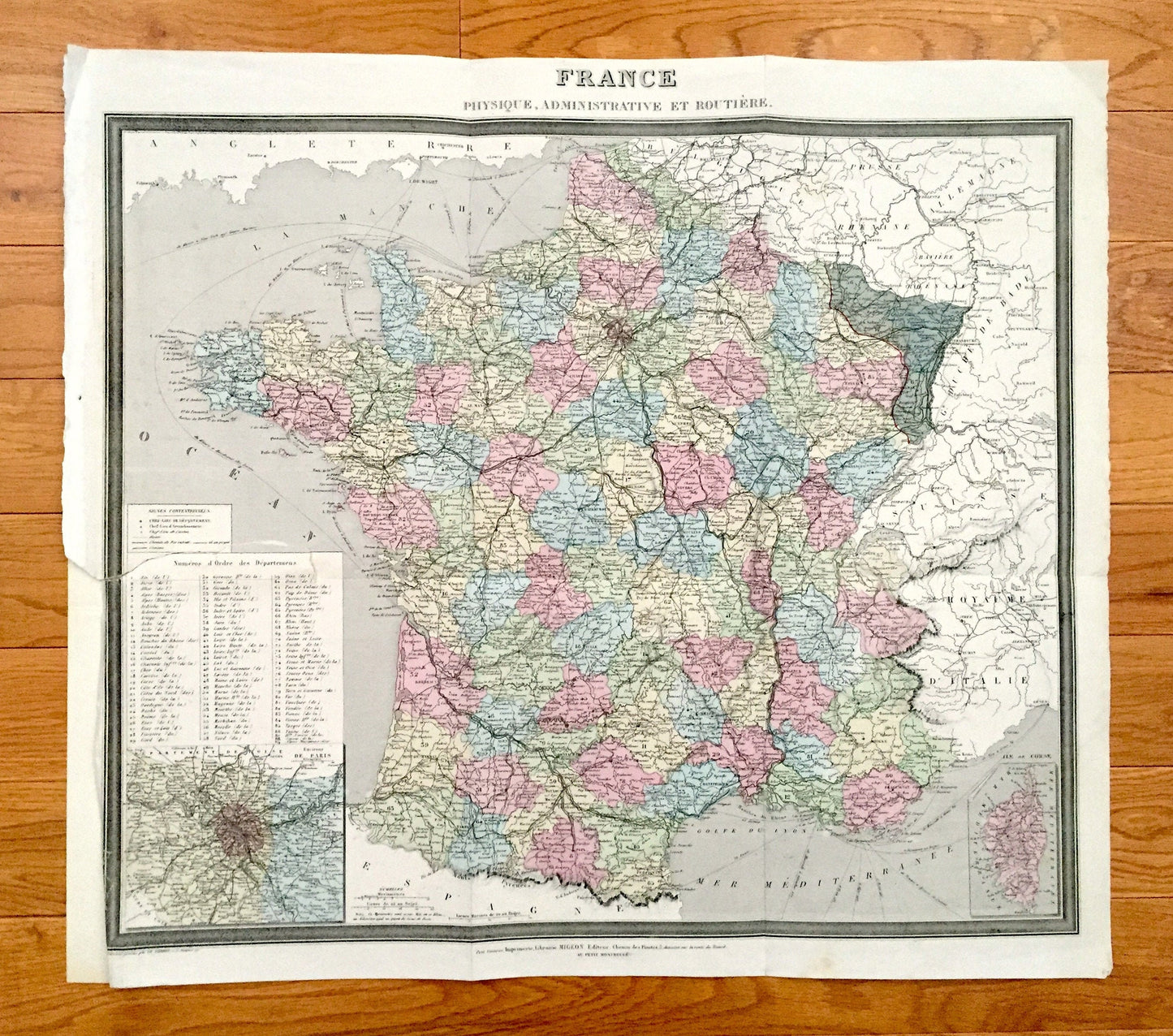
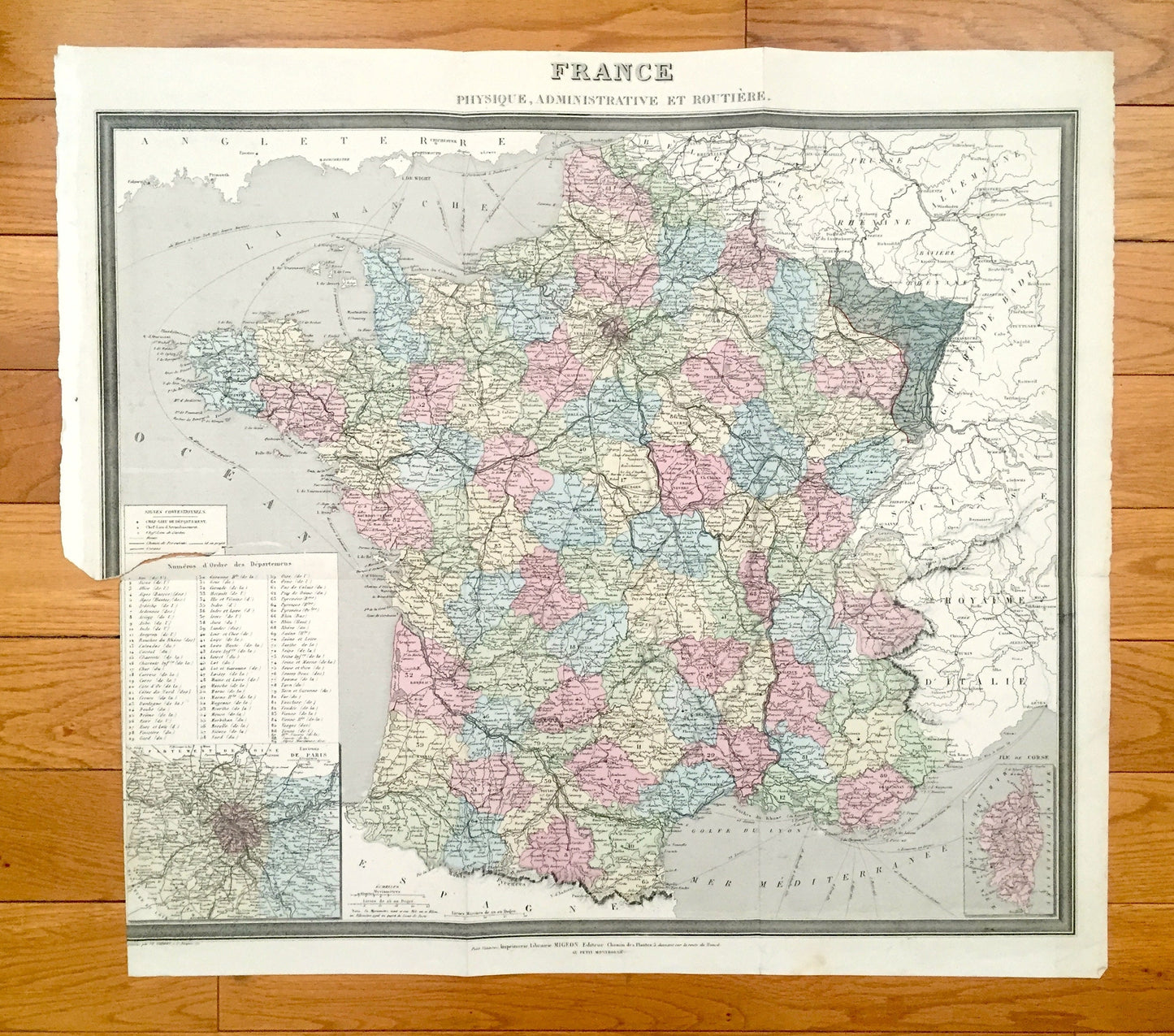
Antique 1869 France Map from Atlas National by Migeon – Paris, Marseilles, Toulouse, Bordeaux, Lille, Nantes, Lyon, Corisica, Normandy
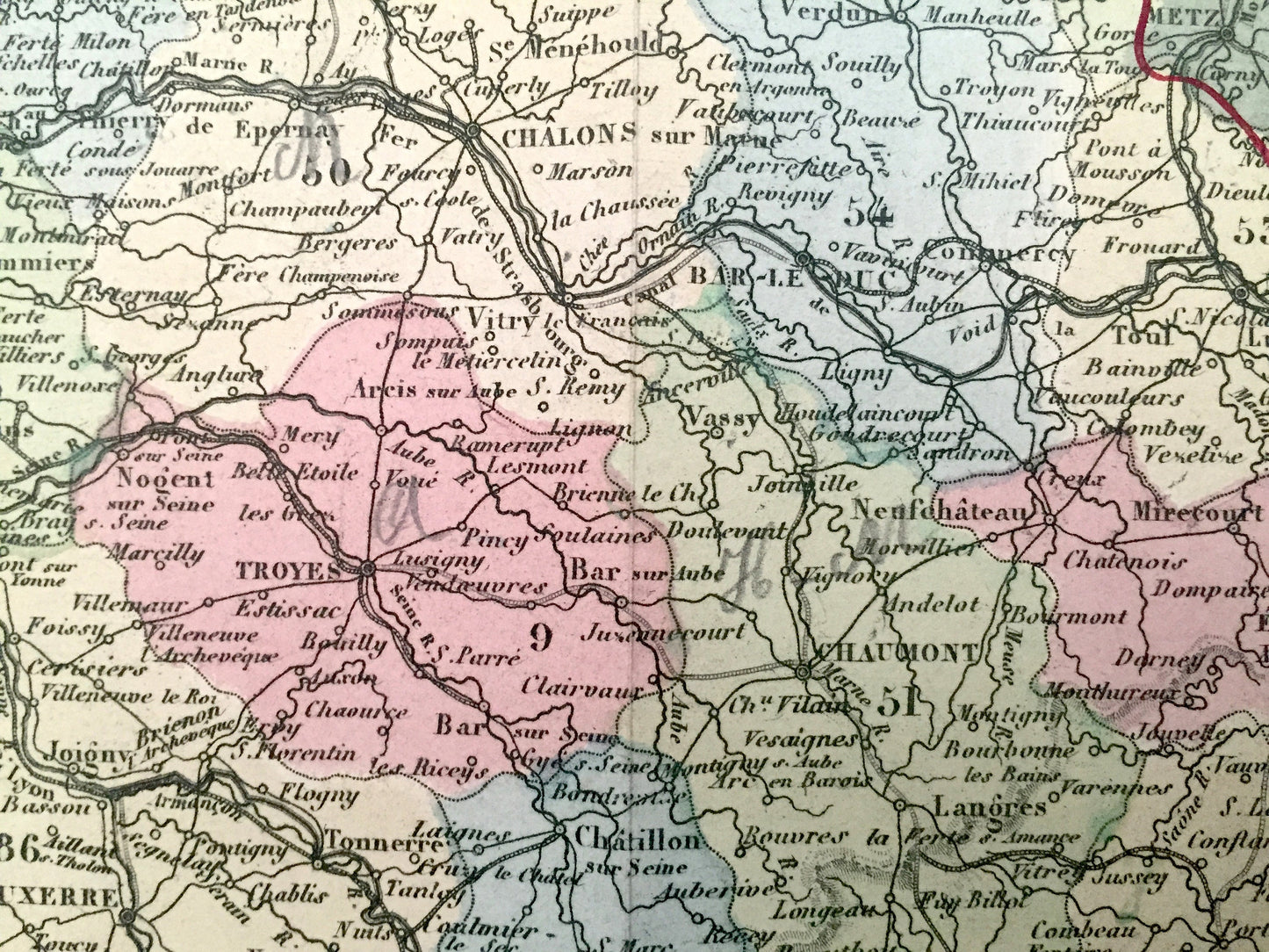
Antique 1869 France Map from Atlas National by Migeon – Paris, Marseilles, Toulouse, Bordeaux, Lille, Nantes, Lyon, Corisica, Normandy
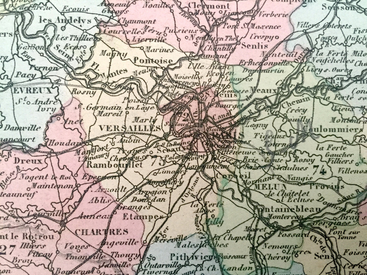
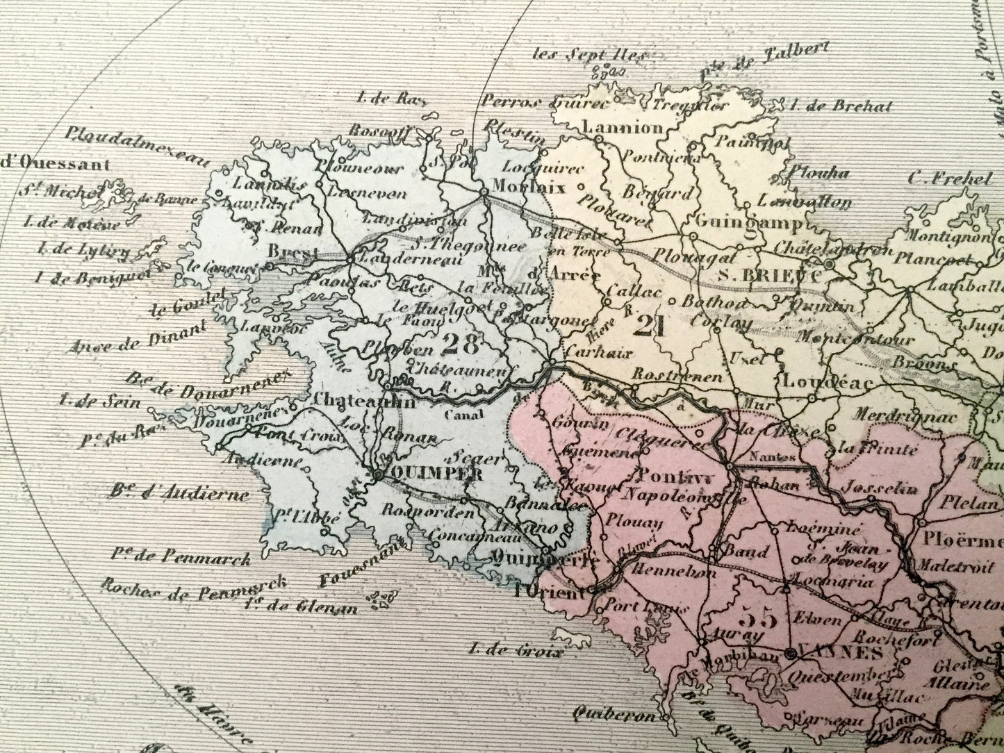
Beautiful, antique fold-out map of France by J. Migeon, with insets of Paris and environs & Corsica. This is an authentic map taken from the renowned Atlas National published in 1869 and NOT a computer reproduction.
See what France looked like more than 150 years ago. Lots of charming, intricate details and contours, including mountains, rivers, lakes and place names. All text is in French. Hand-colored. Verso is blank.
Perfect for the historian, map-lover, the curious or just as a conversation starter. Wonderful and rare. Vintage maps such as these make great gifts.
Edition of 1869, printed 1869
Dimensions: 24" width x 21" height
----
Points of Interest: France, England, Belgium, Germany, Switzerland, Spain, Italy, Corsica, Jersey, Guernsey, Paris, Versailles, Lille, Nantes, Rennes, Rouen, Marseilles, Montpellier, Bordeaux, Toulouse, Lyon, Tours, Orléans, English Channel, Bay of Biscay, Mediterranean Sea, Gulf of Lion, Pyrenees, Loire River, Rhône River, Seine River.
Condition: Good Vintage condition, commensurate with age. This map is in incredible shape for being over 150 years old. Has light wear, a tear halfway up left margin, and folds as-issued, but these will flatten easily and all will add to vintage character and its authenticity when framed. Binding tear out in bottom left corner is easily concealed by placing similar-toned paper behind the print when framing.
----
We will happily adjust shipping price for multiple purchases. Shipped fully-insured and folded to preserve integrity of print.
Couldn't load pickup availability
Share