My Store
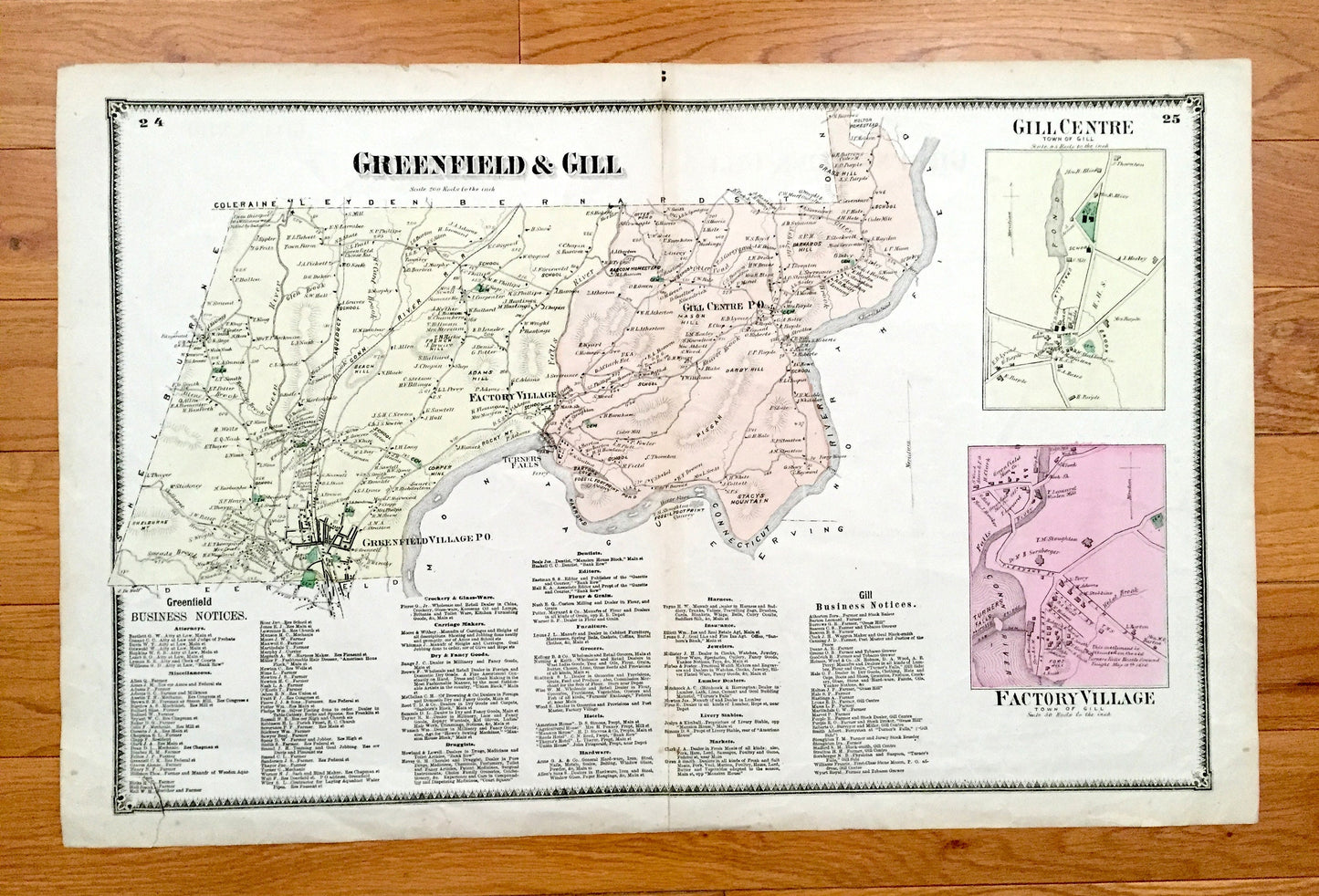
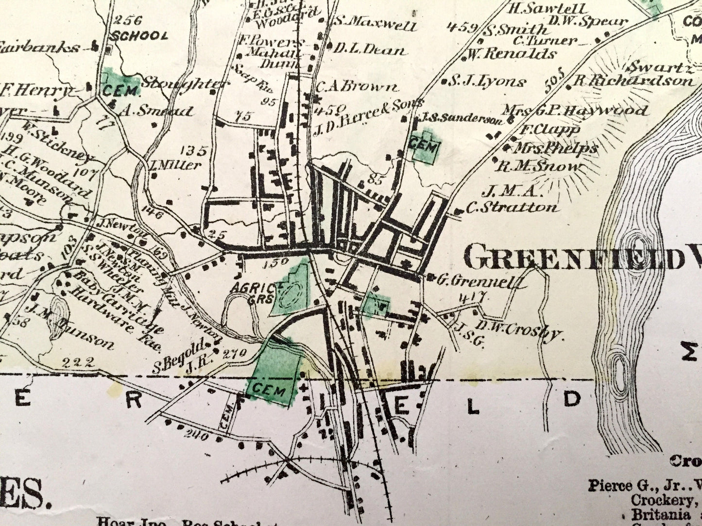
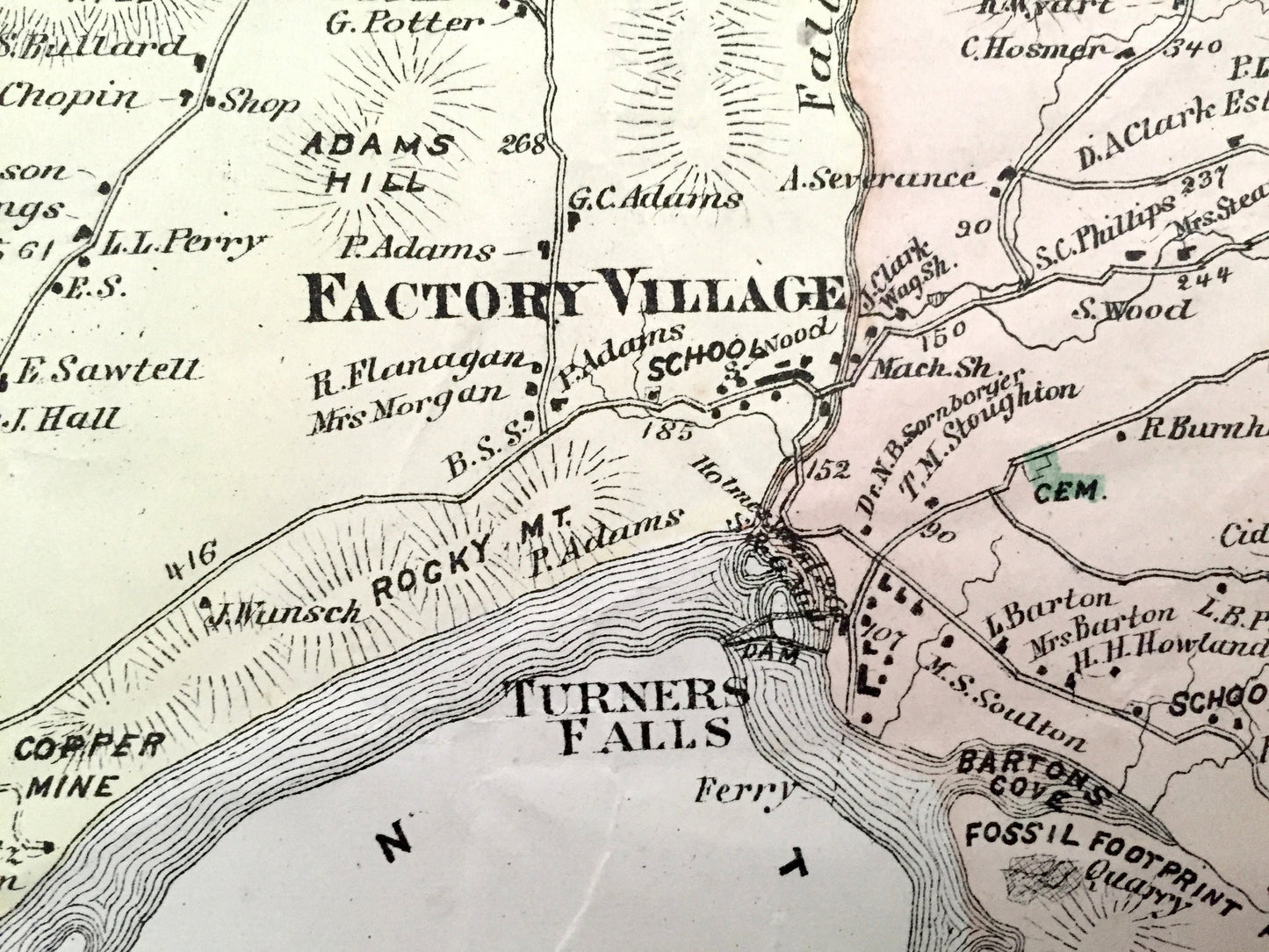
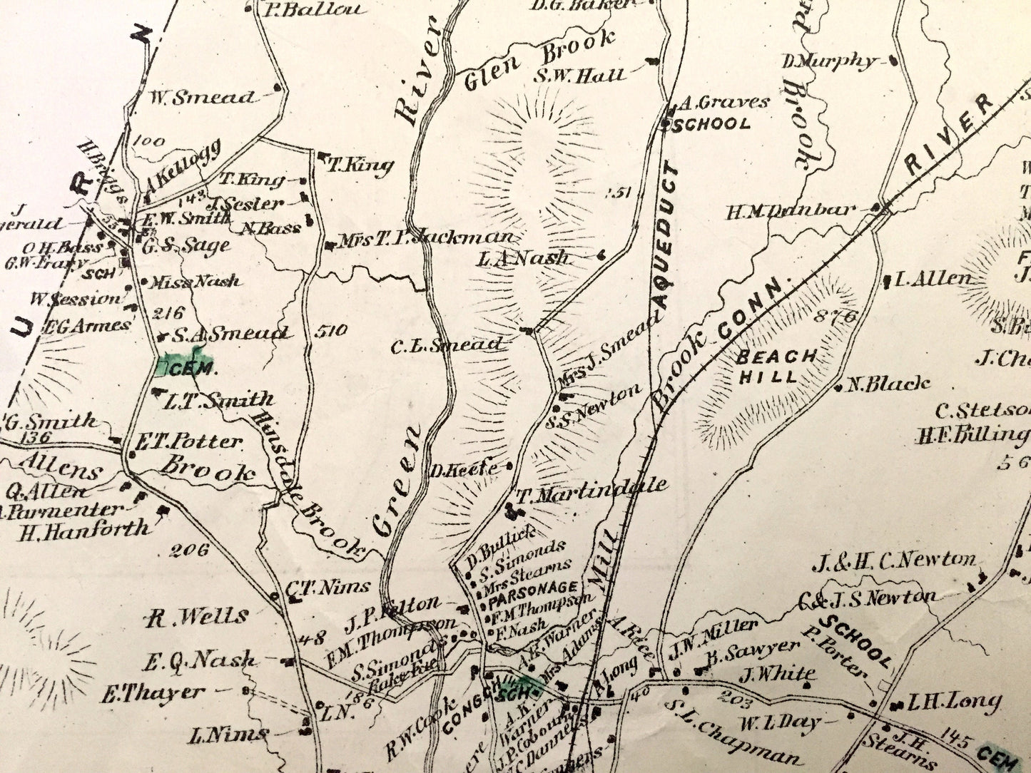
Antique 1871 Greenfield & Gill, Massachusetts Map from F.W. Beers Atlas of Franklin County – Factory Village, Turners Falls, Riverside, MA
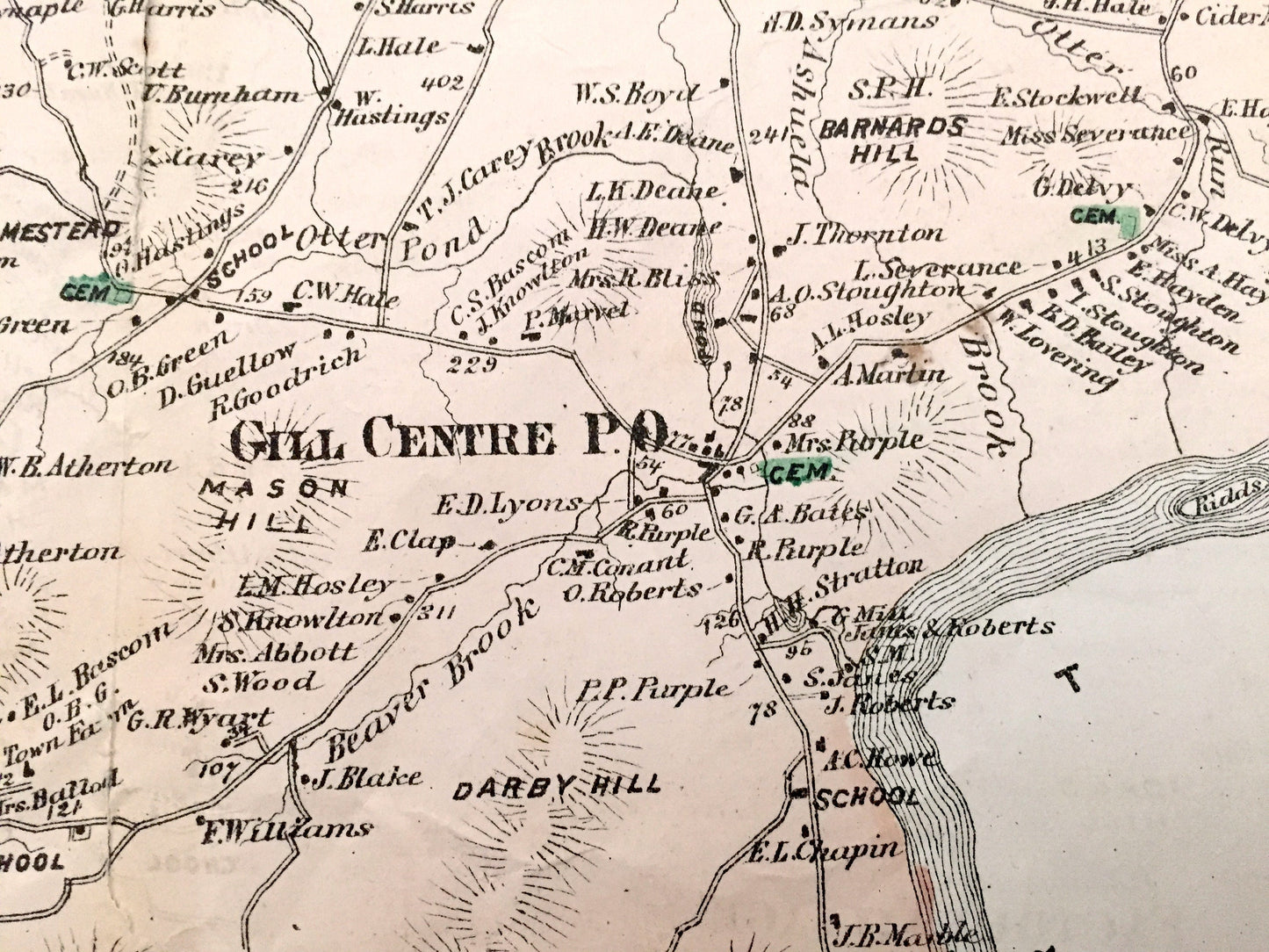
Antique 1871 Greenfield & Gill, Massachusetts Map from F.W. Beers Atlas of Franklin County – Factory Village, Turners Falls, Riverside, MA
Beautiful, antique map of Greenfield & Gill, Massachusetts with insets of Gill Centre & Factory Village. This is an authentic map taken from F.W. Beer's Atlas of Franklin County published in 1871 and is NOT a computer reproduction.
See what Massachusetts looked like more than 145 years ago. Lots of charming, intricate details and contours, including main roads, hills, rivers, ponds and the names of property owners at the time. Hand-colored. Verso has Taunton Business Notices.
Perfect for the historian, map-lover, the curious or just as a conversation starter. Wonderful and rare. Vintage maps such as these make great gifts.
Edition of 1871, printed 1871
Dimensions: 24" width x 15 1/2" height
----
Cities, Villages & Points of Interest: Franklin County, Greenfield, Gill, Factory Village, Turner's Falls, Connecticut River, Beach Hill, Shelburne Mountain, Stacys Mountain, Pisgay, Darby Hill, Bascom Homestead, Grass Hill, Green River, Falls River, Bartons Cove and property owners' names.
Condition: Good Vintage condition, commensurate with age. This map is in incredible shape for being almost 150 years old. Light edge-wear, foxing, toning, a small tear in bottom left margin area and separations at fold but this will read as vintage character when framed.
----
We will happily adjust shipping price for multiple purchases. Maps are rolled up and shipped in sturdy mailing tubes, never folded.
Couldn't load pickup availability
Share