My Store
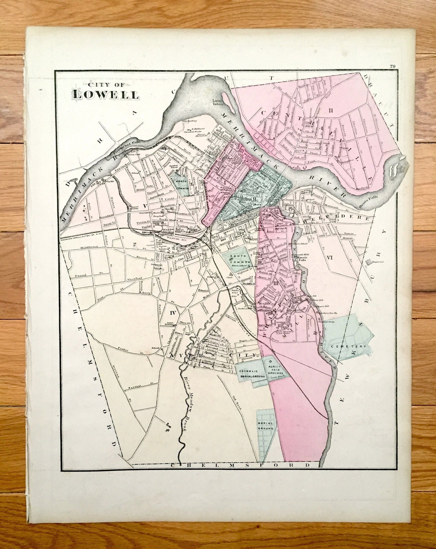
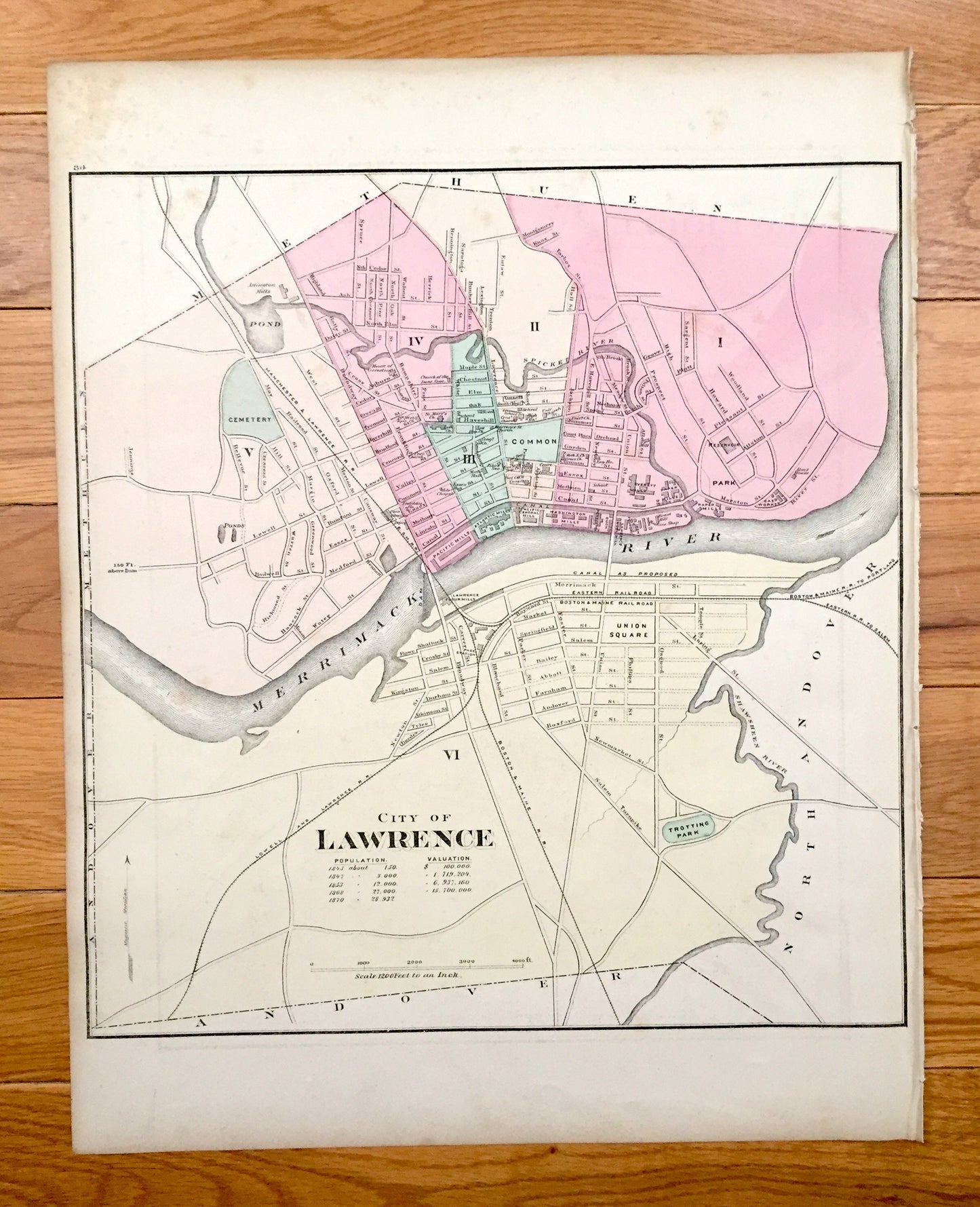
Antique 1871 Lowell & Lawrence, Massachusetts Double-Sided Topographical Map from Stedman and Lyon Atlas – Belvidere, Merrimack, Middlesex
Antique 1871 Lowell & Lawrence, Massachusetts Double-Sided Topographical Map from Stedman and Lyon Atlas – Belvidere, Merrimack, Middlesex
Beautiful, antique double-sided map of Lowell and Lawrence, Massachusetts. These are authentic maps by Walling & Gray taken from Stedman, Brown & Lyon's "Official Topographical Atlas of Massachusetts" published in 1871 and NOT a computer reproduction.
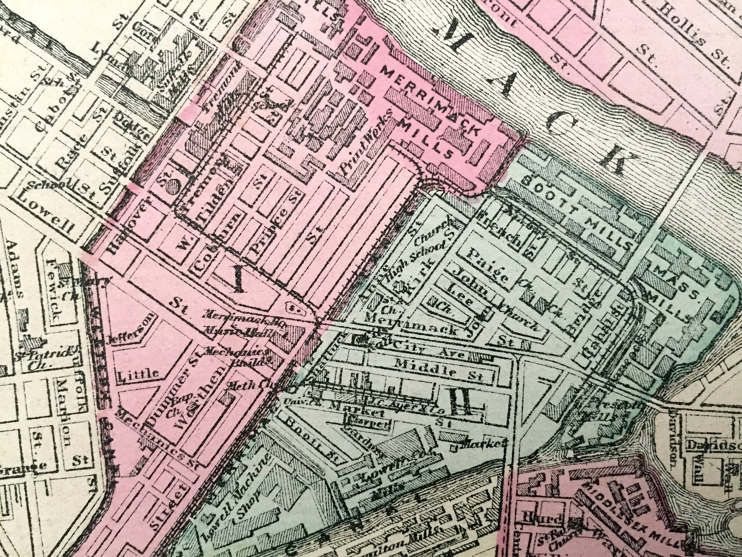
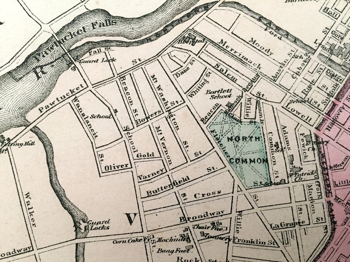
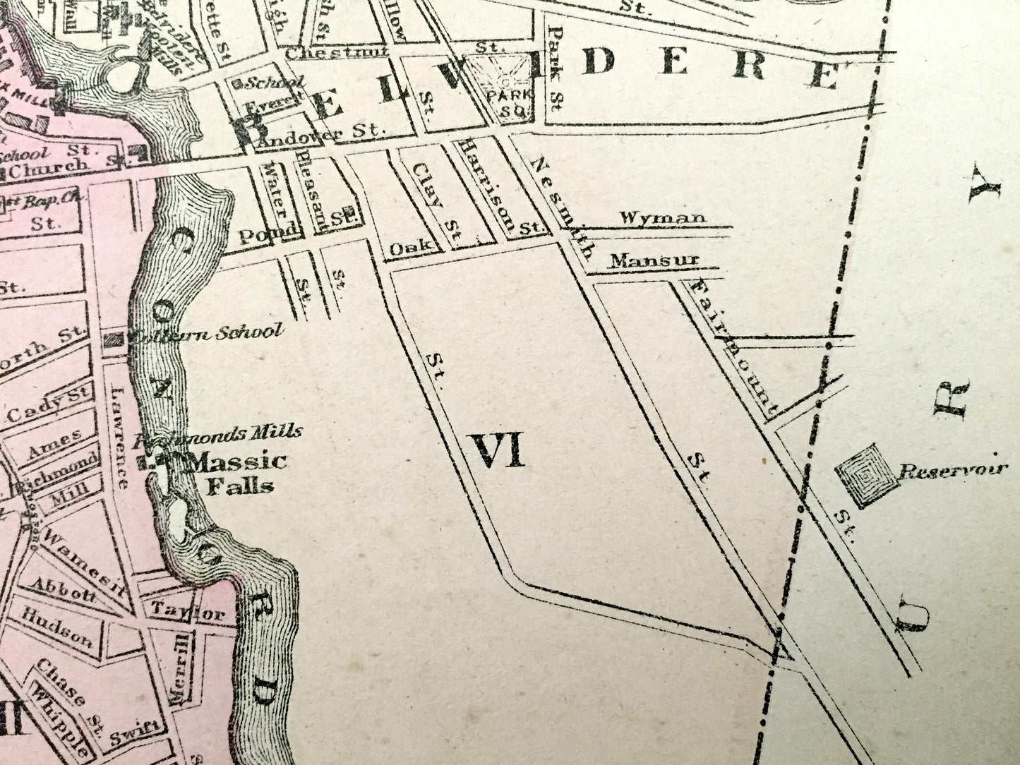
See what Massachusetts looked like 150 years ago. Lots of charming, intricate details and contours, including hills, rivers, lakes, villages, parks, roads, railroads and important buildings and landmarks. Hand colored.
Perfect for the historian, map-lover, the curious or just as a conversation starter. Wonderful and rare. Vintage maps such as these make great gifts.
Edition of 1871, printed 1871
Dimensions: 13 1/4" width x 17" height
----
Condition: Good Vintage condition, commensurate with age. This map is in great shape for being 150 years old. Some edge-wear and toning, all of which will add to vintage character when framed.
(Picture of atlas front page is for reference and not included.)
----
We will happily adjust shipping price for multiple purchases. Maps are rolled up and shipped in sturdy mailing tubes, never folded.
Couldn't load pickup availability
Share