My Store
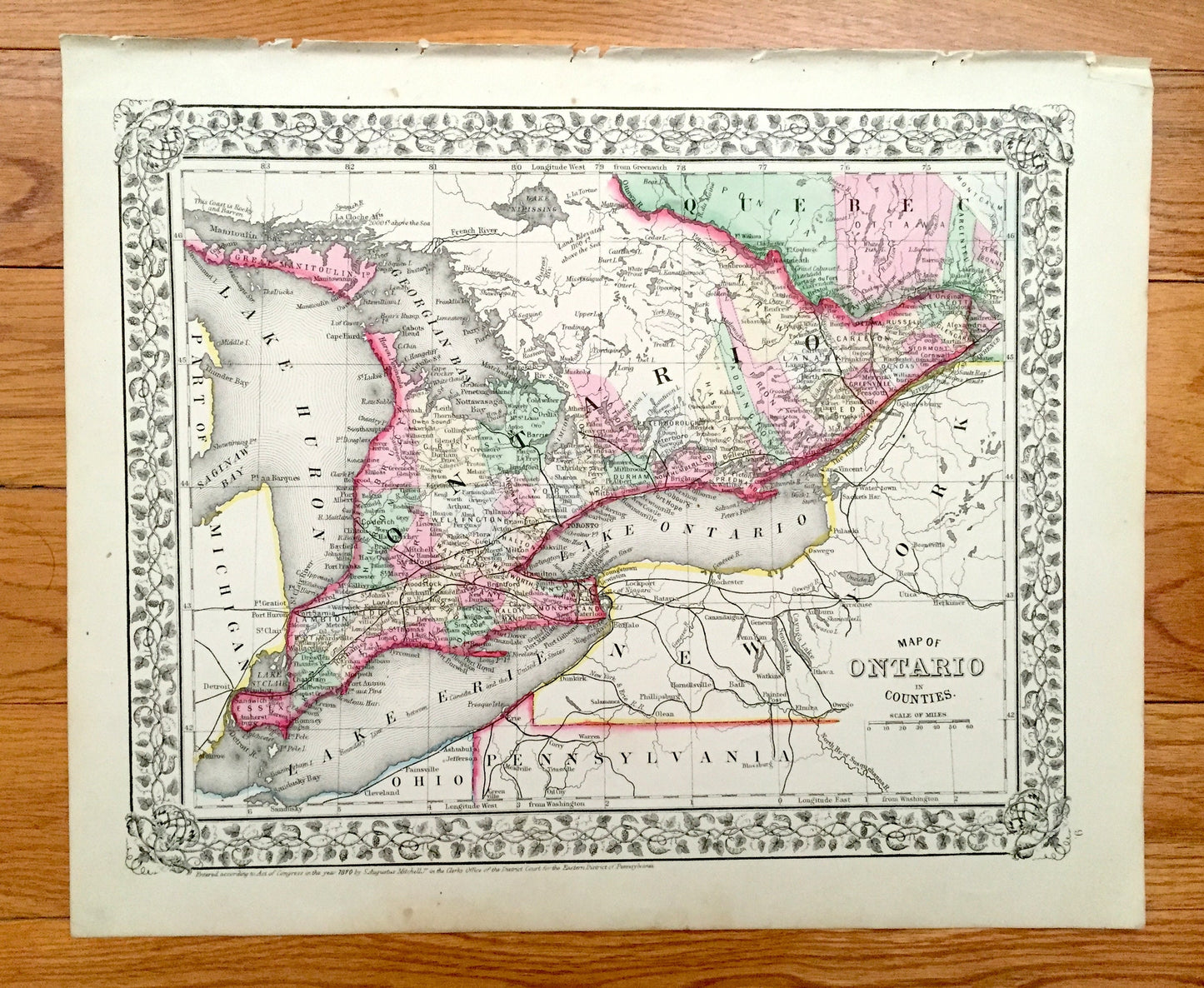
Antique 1871 Ontario, Canada Map by S.A. Mitchell – Toronto, Ottawa, Windsor, London, Niagara Falls, Michigan, New York, Thousand Islands
Antique 1871 Ontario, Canada Map by S.A. Mitchell – Toronto, Ottawa, Windsor, London, Niagara Falls, Michigan, New York, Thousand Islands
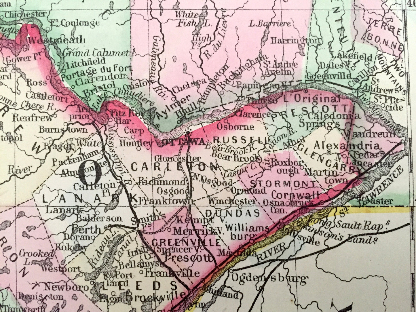
Beautiful, antique map of Ontario, Canada, including Ottawa, Toronto, Windsor, Niagara Falls, Sudbury, Emo, Thunder Bay and the Great Lakes. This is an authentic 1871 engraving from S. August Mitchell and NOT a computer reproduction.
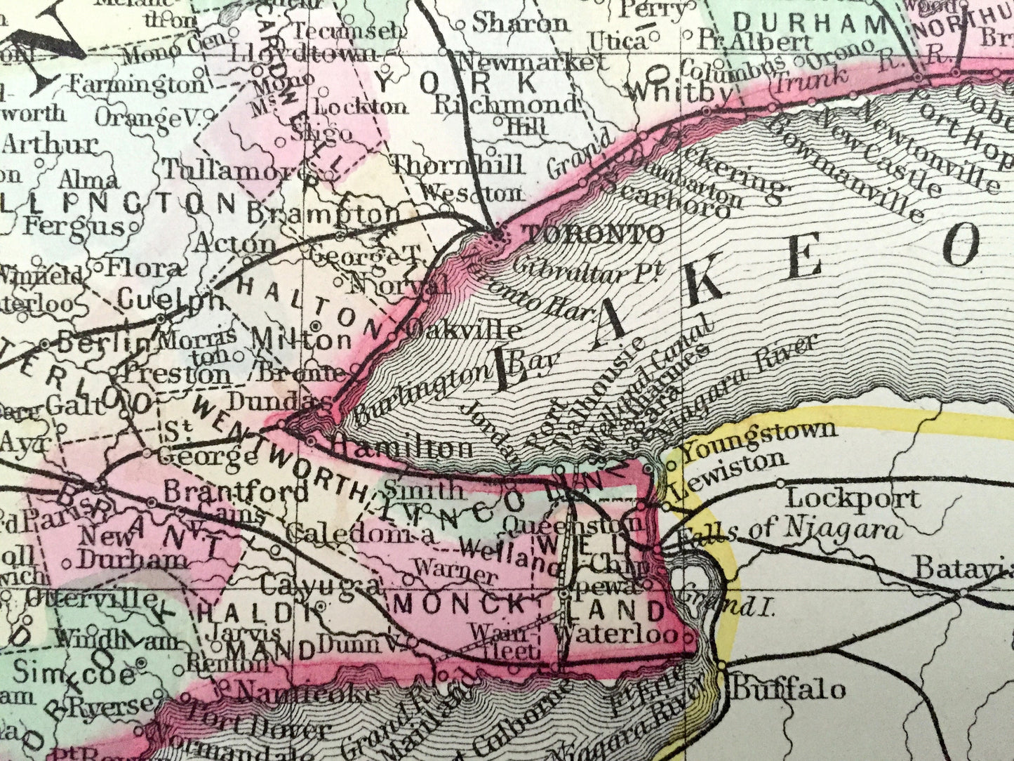
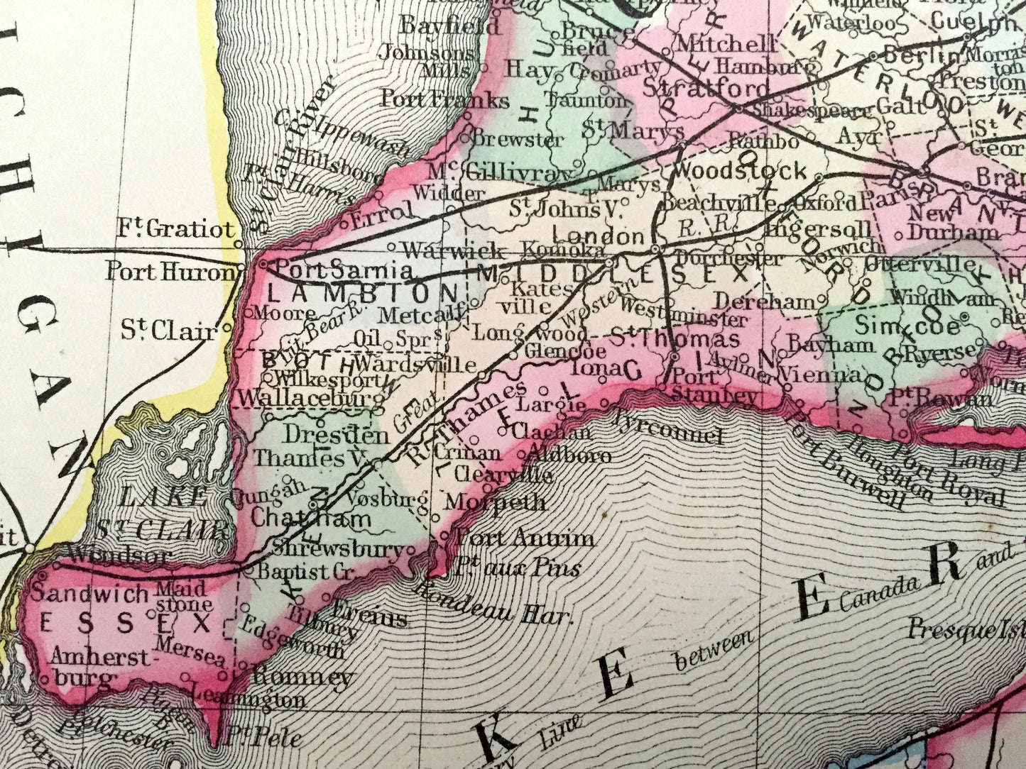
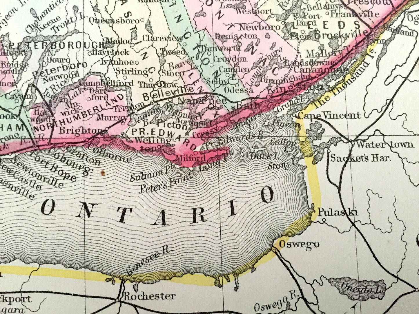
See what Canada looked like over 150 years ago. Lots of charming, intricate details and geological contours, including mountains, islands, counties and rivers. Hand colored. Verso is blank.
Perfect for the historian, map-lover, the curious or just as a conversation starter. Wonderful and rare. Vintage maps such as these make great gifts.
Edition of 1870, printed 1871
Dimensions: 15 1/4" width x 12 1/2" height
----
Features
Points of Interest: Ontario, Lake Michigan, Lake Erie, Lake Ontario, Georgian Bay, Saginaw Bay, Thousand Islands, St. Lawrence Seaway, River Severn, Nottawasaga Bay, Ottawa River, Toronto, Ottawa, Lake St. Clair, Windsor, Emo, Thunder Bay, Niagara Falls, London, Hamilton, Kitchener, St. Catharines, Oshawa, and many more.
----
Condition: Very Good Vintage condition, commensurate with age. This map is in great shape for being 150 years old. Light foxing, edge-wear and toning, but this will all read as vintage character when framed.
(Cover and front page shown for informational purposes and not included.)
----
We will happily adjust shipping price for multiple purchases. Maps are rolled up and shipped in sturdy mailing tubes, never folded.
Couldn't load pickup availability
Share