My Store
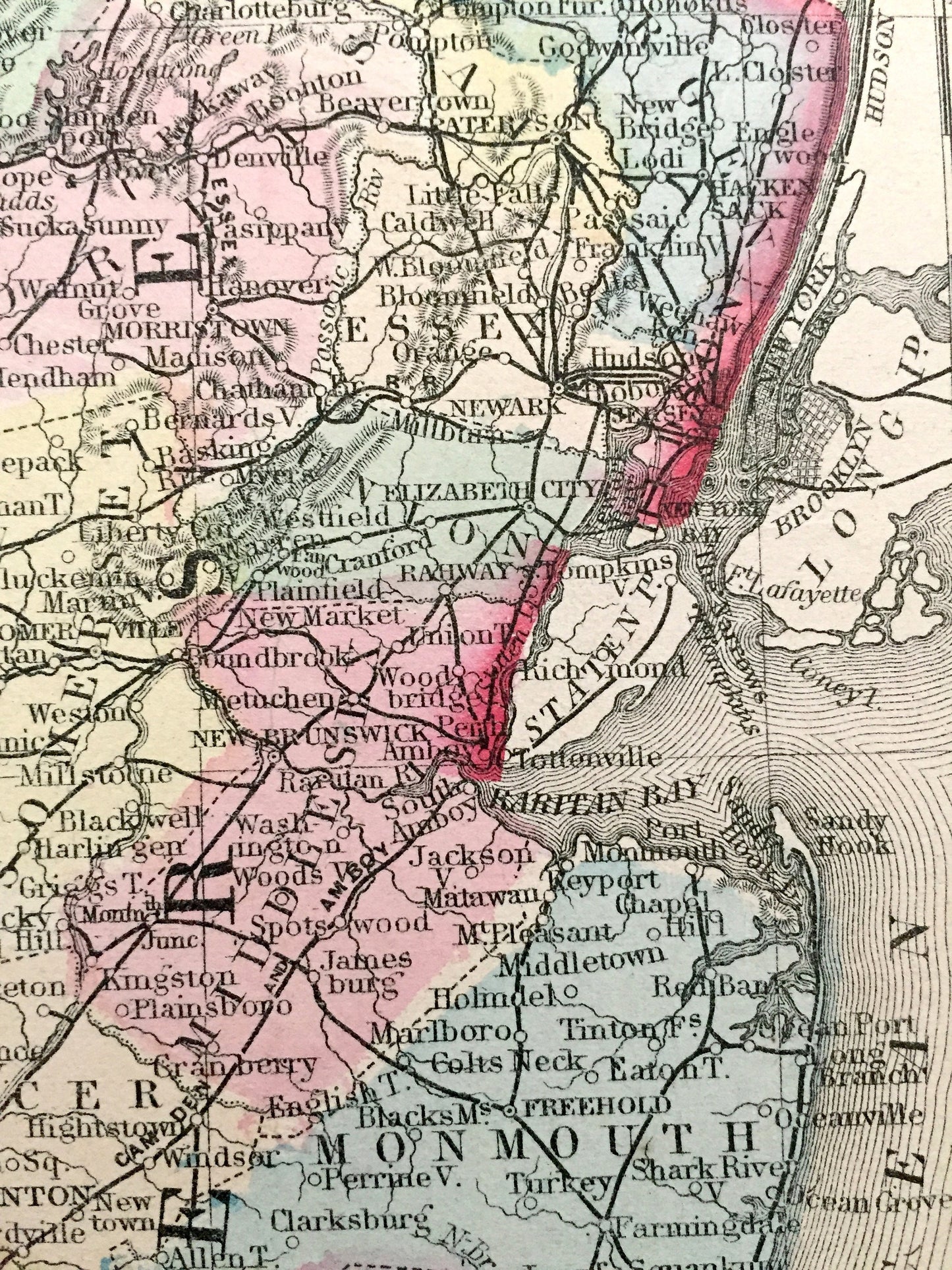
Antique 1874 Maryland, New Jersey & Delaware State Map by S.A. Mitchell – Baltimore, Washington DC, Wilmington, Pennsylvania, Cape May NJ MD
Antique 1874 Maryland, New Jersey & Delaware State Map by S.A. Mitchell – Baltimore, Washington DC, Wilmington, Pennsylvania, Cape May NJ MD
Beautiful, antique map of Maryland, New Jersey & Delaware. This is an authentic 1874 engraving from S. August Mitchell and NOT a computer reproduction.
See what the mid-Atlantic region looked like almost 150 years ago. Lots of charming, intricate details and geological contours, including mountains, islands, counties and rivers. Hand colored. Verso is blank.
Perfect for the historian, map-lover, the curious or just as a conversation starter. Wonderful and rare. Vintage maps such as these make great gifts.
Edition of 1874, printed 1874
Dimensions: 15 1/4" width x 12 1/2" height
----
Features
Points of Interest: Maryland, New Jersey, Delaware, Chesapeake Bay, Delaware Bay, Atlantic Ocean, Potomac River, Virginia, West Virginia, Pennsylvania, New York, Hudson River, Cape May, Jersey Shore, Raritan Bay, Delaware River, Long Island, Susquehanna River, Baltimore, Washington D.C., Philadelphia, New York City, Trenton, Wilmington, and many more.
----
Condition: Very Good condition, commensurate with age. This map is in incredible shape for being over 140 years old. Light foxing and toning, but this will all read as vintage character when framed.
----
We will happily adjust shipping price for multiple purchases. Maps are rolled up and shipped in sturdy mailing tubes, never folded.
Couldn't load pickup availability
Share