My Store
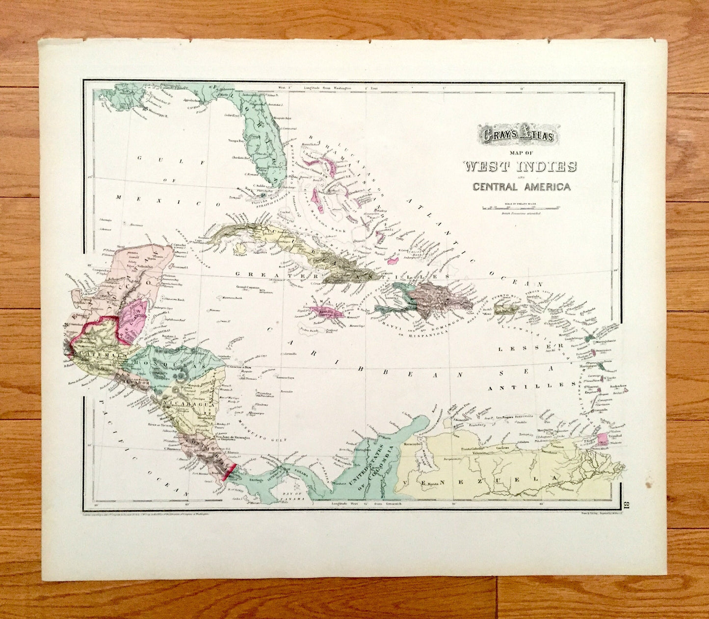
Antique 1874 West Indies and Central America / Mexico Map from OW Gray's Atlas of United States of America; Stedman, Brown, Lyon – Caribbean
Antique 1874 West Indies and Central America / Mexico Map from OW Gray's Atlas of United States of America; Stedman, Brown, Lyon – Caribbean
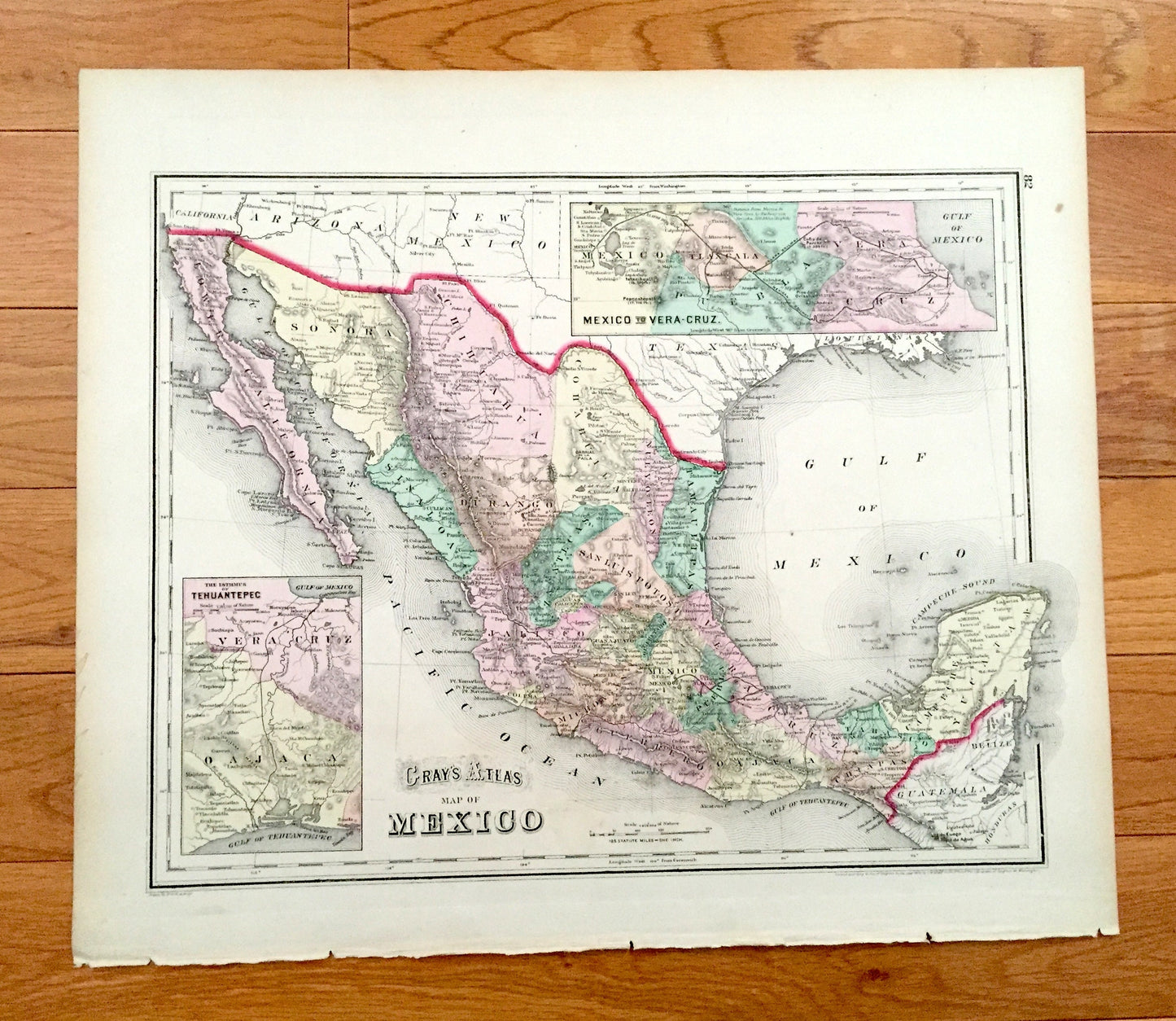
Iconic, antique double-sided map of the West Indies and Central America on one side, and Mexico on the other, taken from "O.W. Gray's Atlas of the United States and General Maps of the World," published by Stedman, Brown & Lyon in 1874. This map is original and is NOT a modern reproduction.
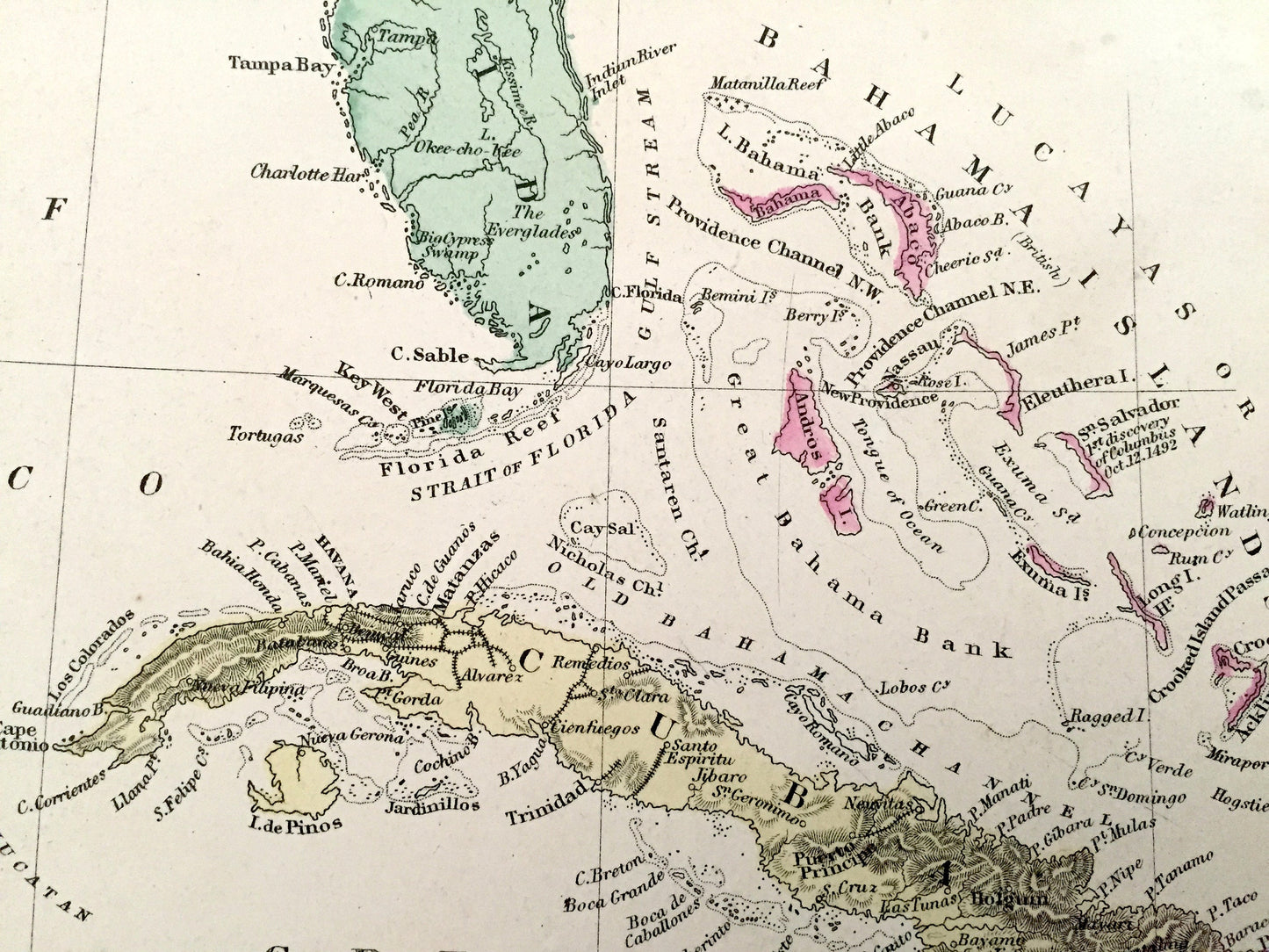
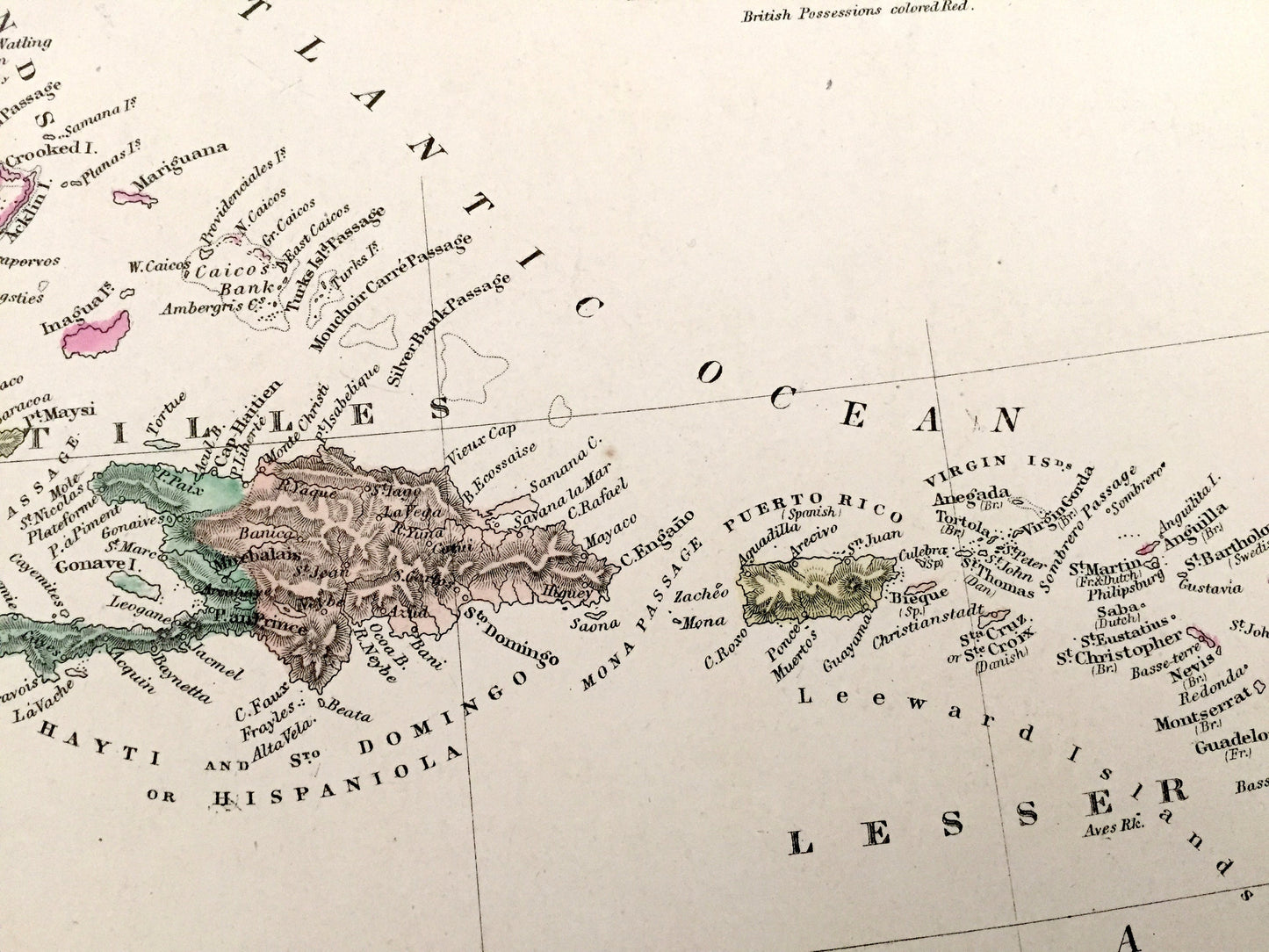
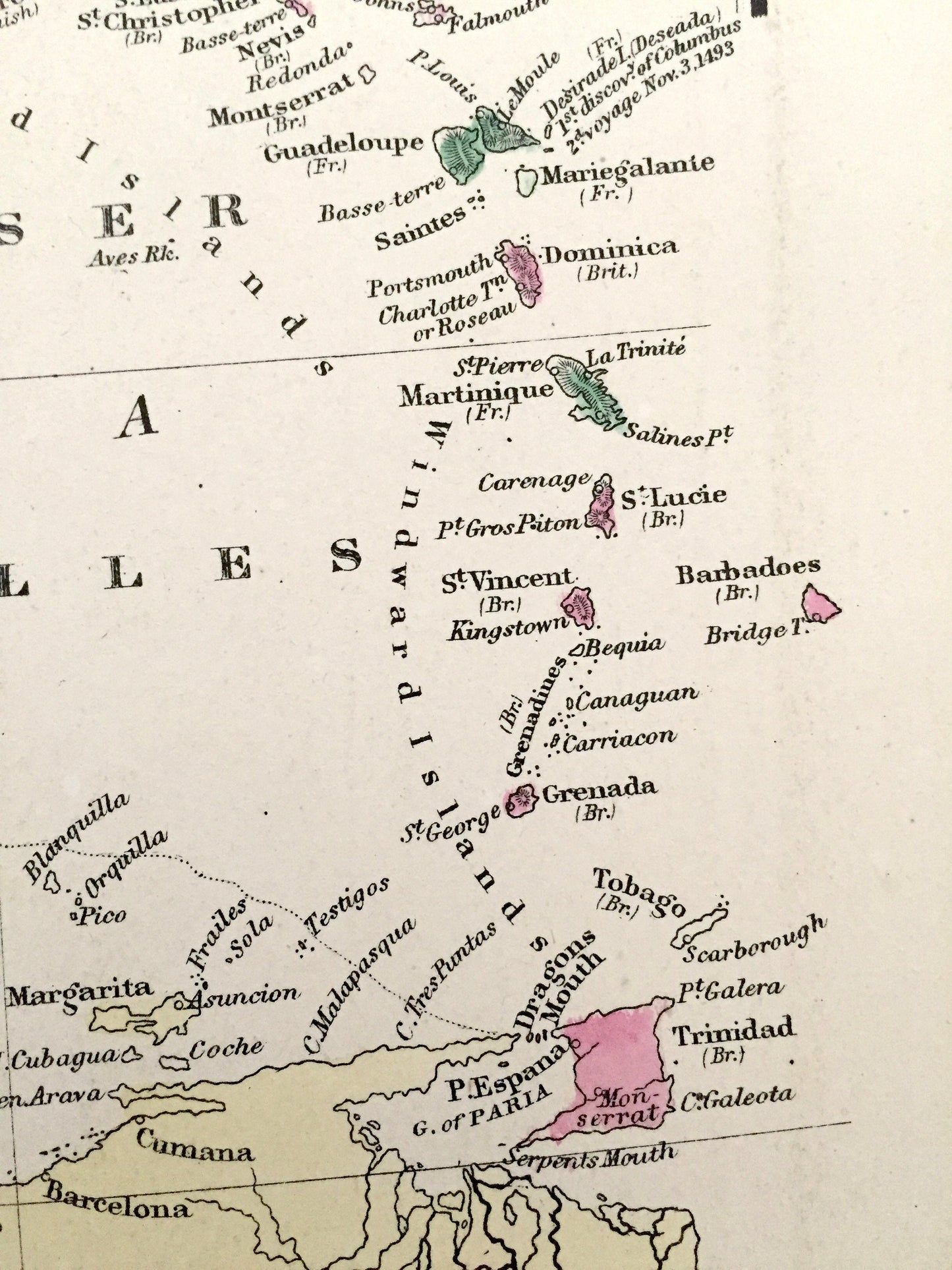
An incredibly beautiful print of two regions of the globe. Many fine details. Hand-colored. Country of origin: United States.
Perfect for the historian, map-lover, the curious or just as a conversation starter. Wonderful and rare. Vintage prints such as these make great gifts.
Edition of 1873, printed 1874
Dimensions: 17" width x 14 3/4" height
----
Countries: Mexico, United States, Guatemala, Honduras, San Salvador, Nicaragua, Costa Rica, Belize, Panama, Columbia, Venezuela, Cuba, Haiti, Dominican Republic, Jamaica, Virgin Islands, Bahama Islands, Leeward Islands, Windward Islands, Trinidad and Tobago, Martinique, Barbados, Grenada.
Condition: Very Good Vintage condition, commensurate with age. This map is in great shape for being 150 years old. Light edge-wear and toning, but this will read as vintage character when framed.
(Picture of atlas cover and front matter included for informational purposes and not included.)
----
We will happily adjust shipping price for multiple purchases. Maps are rolled up and shipped in sturdy mailing tubes, never folded.
Couldn't load pickup availability
Share