My Store
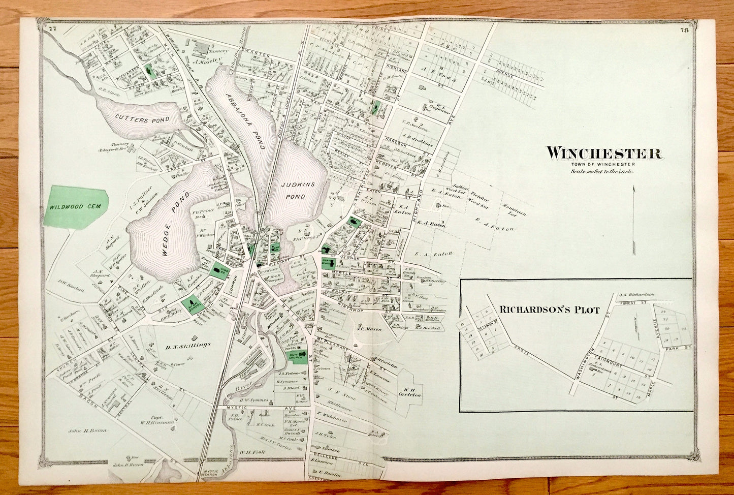
Antique 1875 Winchester & Stow, Massachusetts Map from J.B. Beers Atlas of Middlesex County – Lower Village, Rock Bottom, Assabet, Aberjona
Antique 1875 Winchester & Stow, Massachusetts Map from J.B. Beers Atlas of Middlesex County – Lower Village, Rock Bottom, Assabet, Aberjona
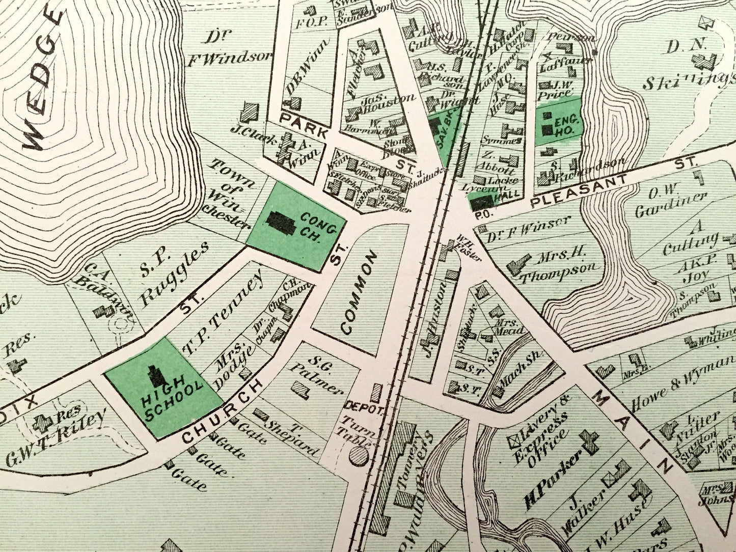
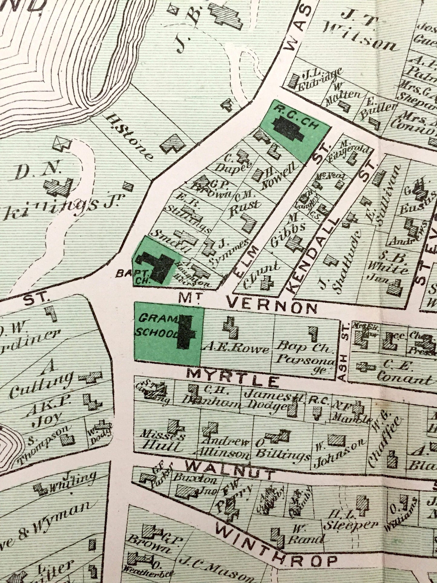
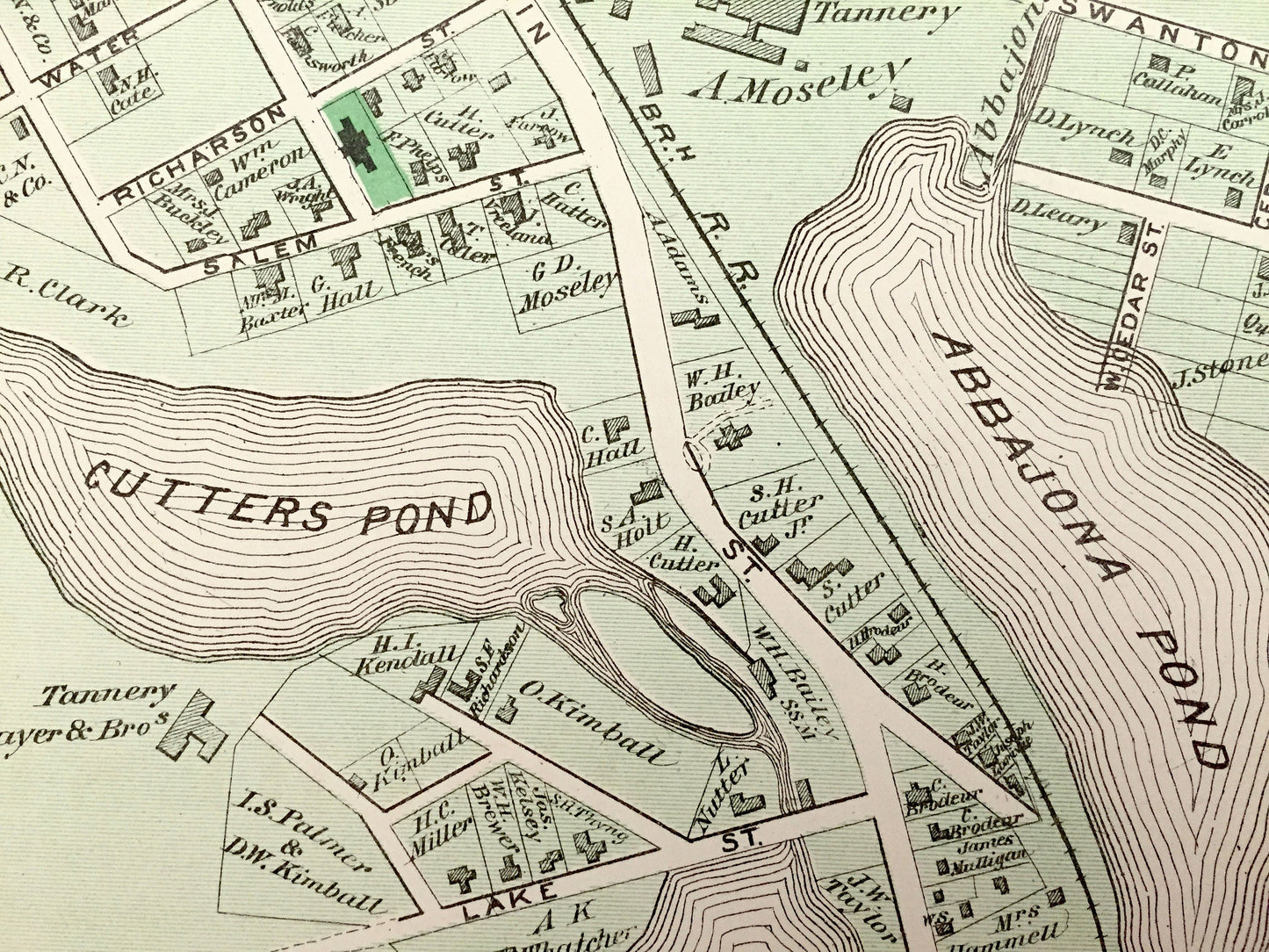
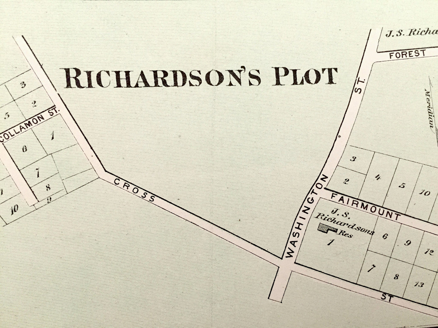
Beautiful, antique map of Winchester, Massachusetts including an inset of Richardson's Plot. Opposite side is Stow, Massachusetts. This is an authentic map taken from J.B. Beer's Atlas of Middlesex County published in 1875 and NOT a computer reproduction.
See what Winchester and Stow looked like more than 140 years ago. Lots of charming, intricate details and contours, including main roads, hills, rivers, ponds and the names of property owners at the time. Hand colored.
Perfect for the historian, map-lover, the curious or just as a conversation starter. Wonderful and rare. Vintage maps such as these make great gifts.
Edition of 1875, printed 1875
Dimensions: 23 3/4" width x 15 1/2" height
----
Cities, Villages & Points of Interest: Winchester, Richardson's Plot, Wedge Pond, Judkins Pond, Abbajona Pond, Cutters Pond, Abbajona River (Aberjona), Wildwood Cemetery, Abbajona Brook, Mystic Station, Stow, Assabet River, Boons Pond, Boons Plains, Marble Hill, Spindle Hill, Assabet Brook, Rock Bottom, Lower Village, Stow Centre, Flagg Hill, Heathen Meadow Brook, Honey Pot Hill, and many more ponds, hills, roads, railroads, rivers and property owners' names.
Condition: Very Good condition, commensurate with age. This map is in incredible shape for being almost 150 years old. Some light edge-wear and one fold as issued, all of which will read as vintage character when framed.
----
We will happily adjust shipping price for multiple purchases. Maps are rolled up and shipped in sturdy mailing tubes, never folded.
Couldn't load pickup availability
Share