My Store
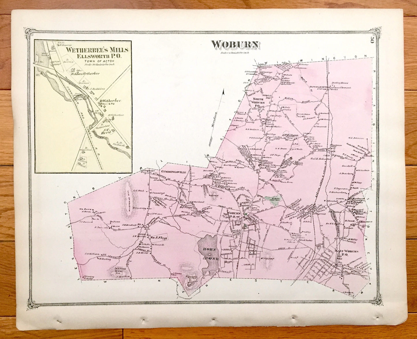
Antique 1875 Woburn & Burlington, Massachusetts Map from J.B. Beers Atlas of Middlesex County – Cummingsville, Havenville, Horn Pond, MA
Antique 1875 Woburn & Burlington, Massachusetts Map from J.B. Beers Atlas of Middlesex County – Cummingsville, Havenville, Horn Pond, MA
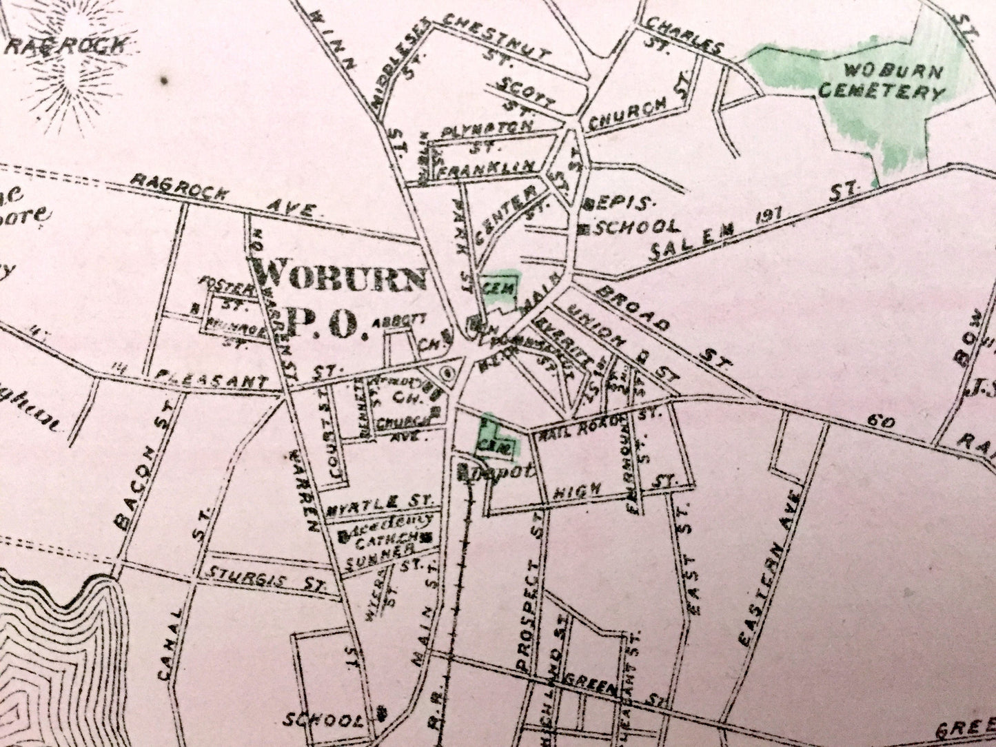
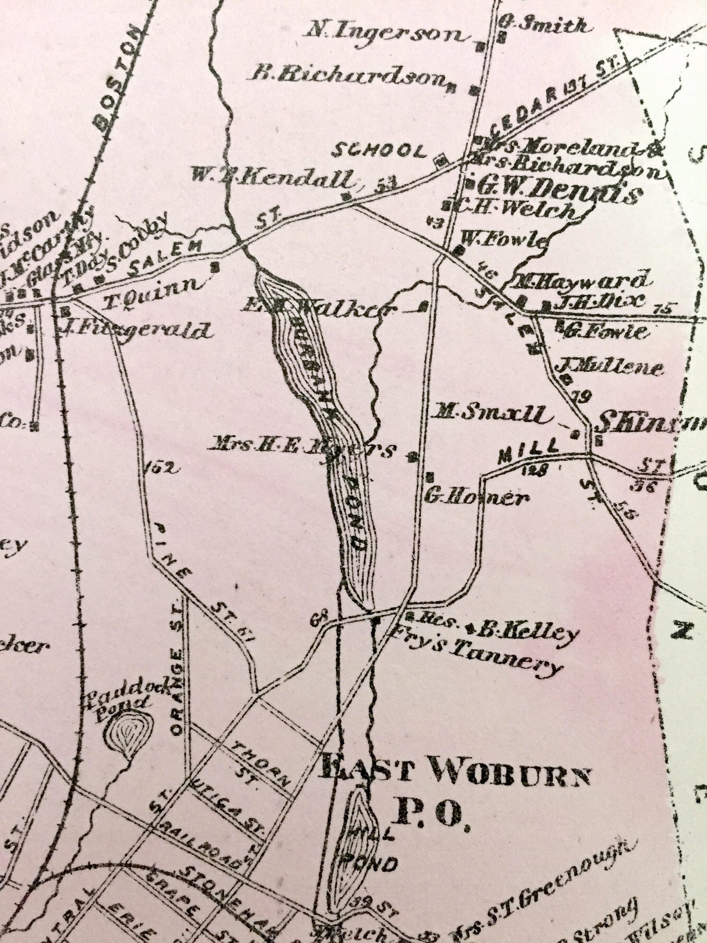
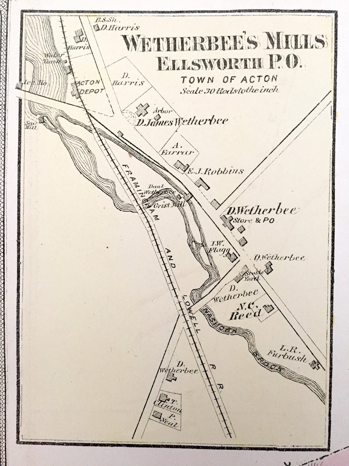
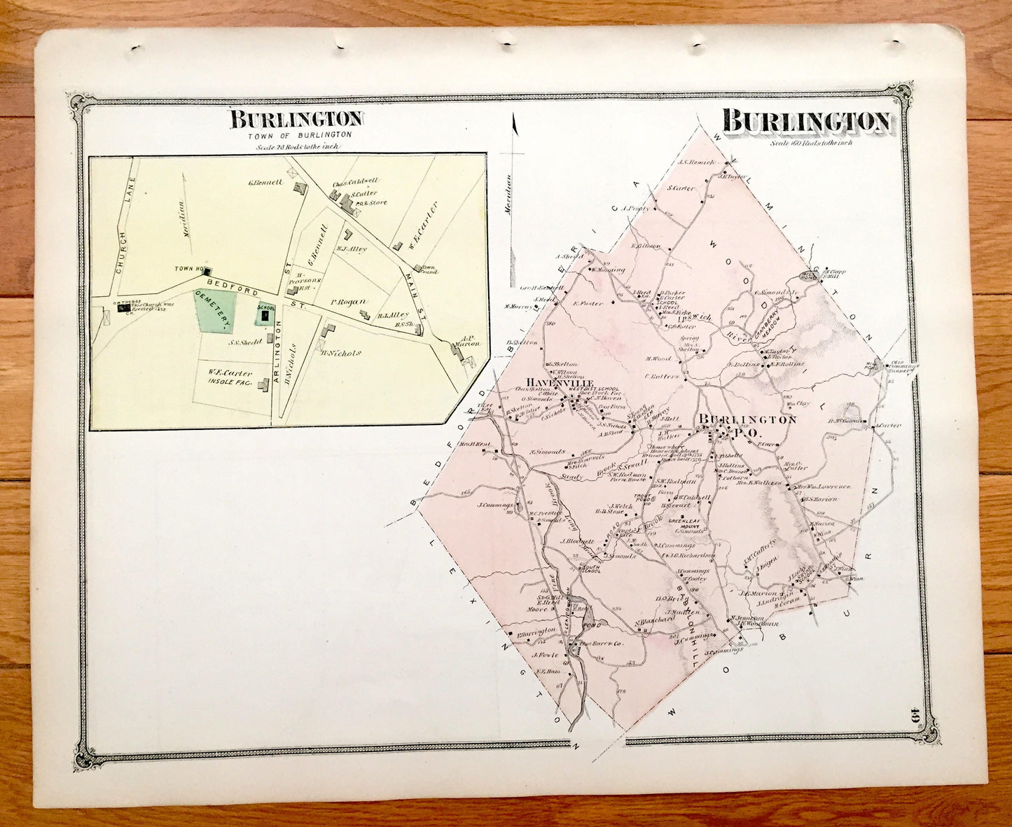
Beautiful, antique map of Woburn, Massachusetts with an inset of Wetherbee's Mills, Acton. Opposite side Burlington, Massachusetts, including an inset of Burlington Town Center. This is an authentic map taken from J.B. Beer's Atlas of Middlesex County published in 1875 and NOT a computer reproduction.
See what Woburn and Burlington looked like more than 140 years ago. Lots of charming, intricate details and contours, including main roads, hills, rivers, ponds and the names of property owners at the time. Hand colored.
Perfect for the historian, map-lover, the curious or just as a conversation starter. Wonderful and rare. Vintage maps such as these make great gifts.
Edition of 1875, printed 1875
Dimensions: 15 1/2" width x 12 3/4" height
----
Cities, Villages & Points of Interest: Woburn, North Woburn, Cummingsville, East Woburn, Wetherbee's Mills, Ellsworth, Acton, Horn Pond, Whispering Hill, Lions Hill, Mount Pleasant, Burbank Pond, Willow Brook, Paddock Pond, Rag Rock, Nashoba Brook, Burlington, Havenville, Vine Brook, Mill Pond, Ipswich River, Sandy Brook, Greenleaf Mount, and many more ponds, hills, roads, railroads, rivers and property owners' names.
Condition: Very Good condition, commensurate with age. This map is in incredible shape for being almost 150 years old. Some light edge-wear and atlas binding holes, all of which will read as vintage character when framed.
----
We will happily adjust shipping price for multiple purchases. Maps are rolled up and shipped in sturdy mailing tubes, never folded.
Couldn't load pickup availability
Share