My Store
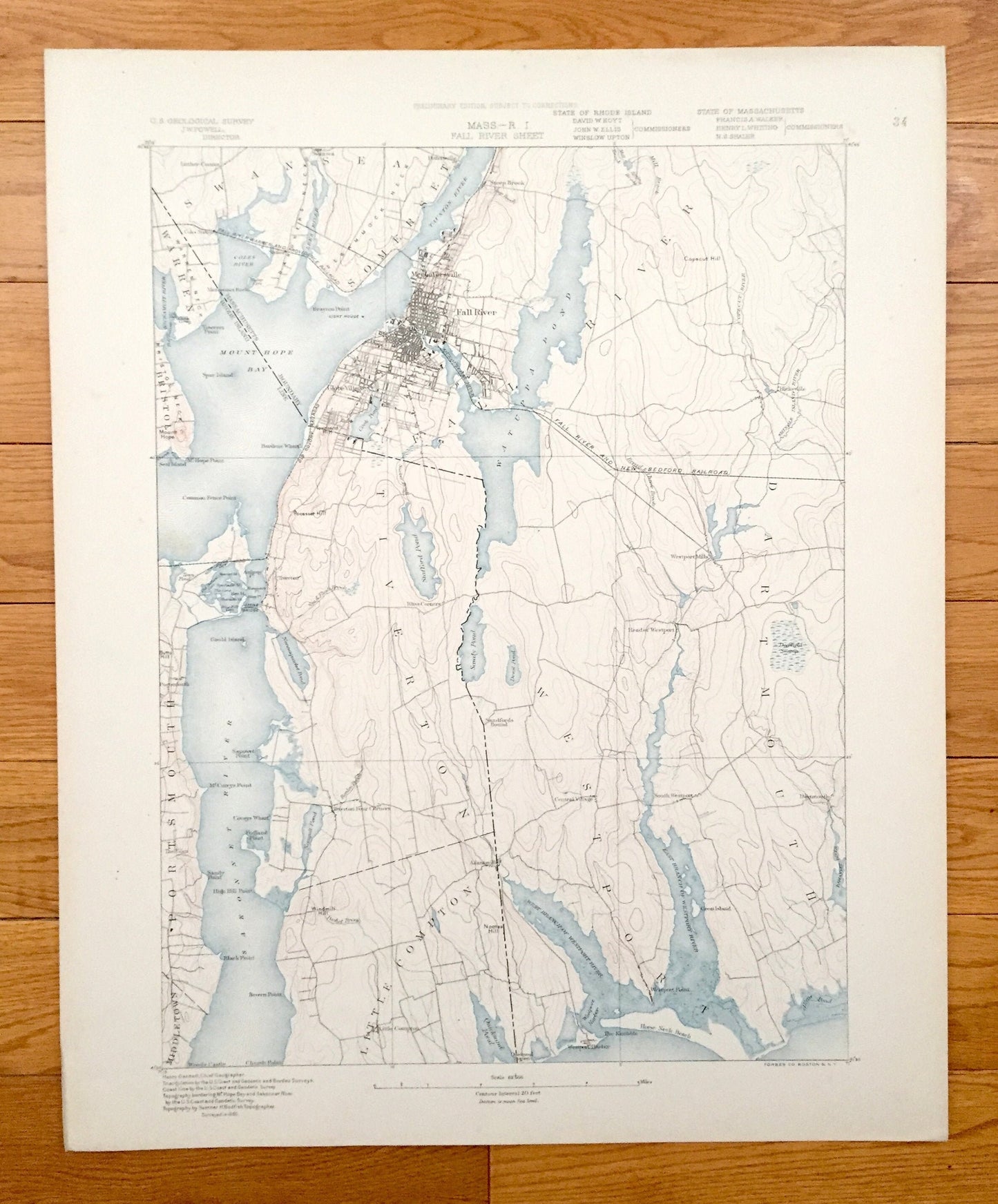
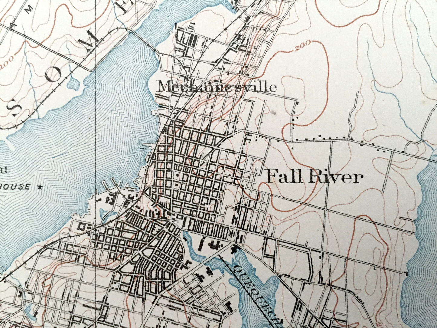
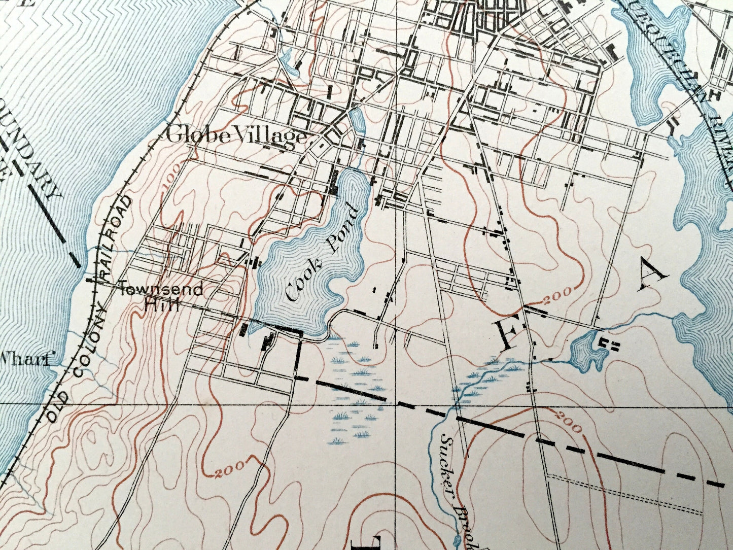
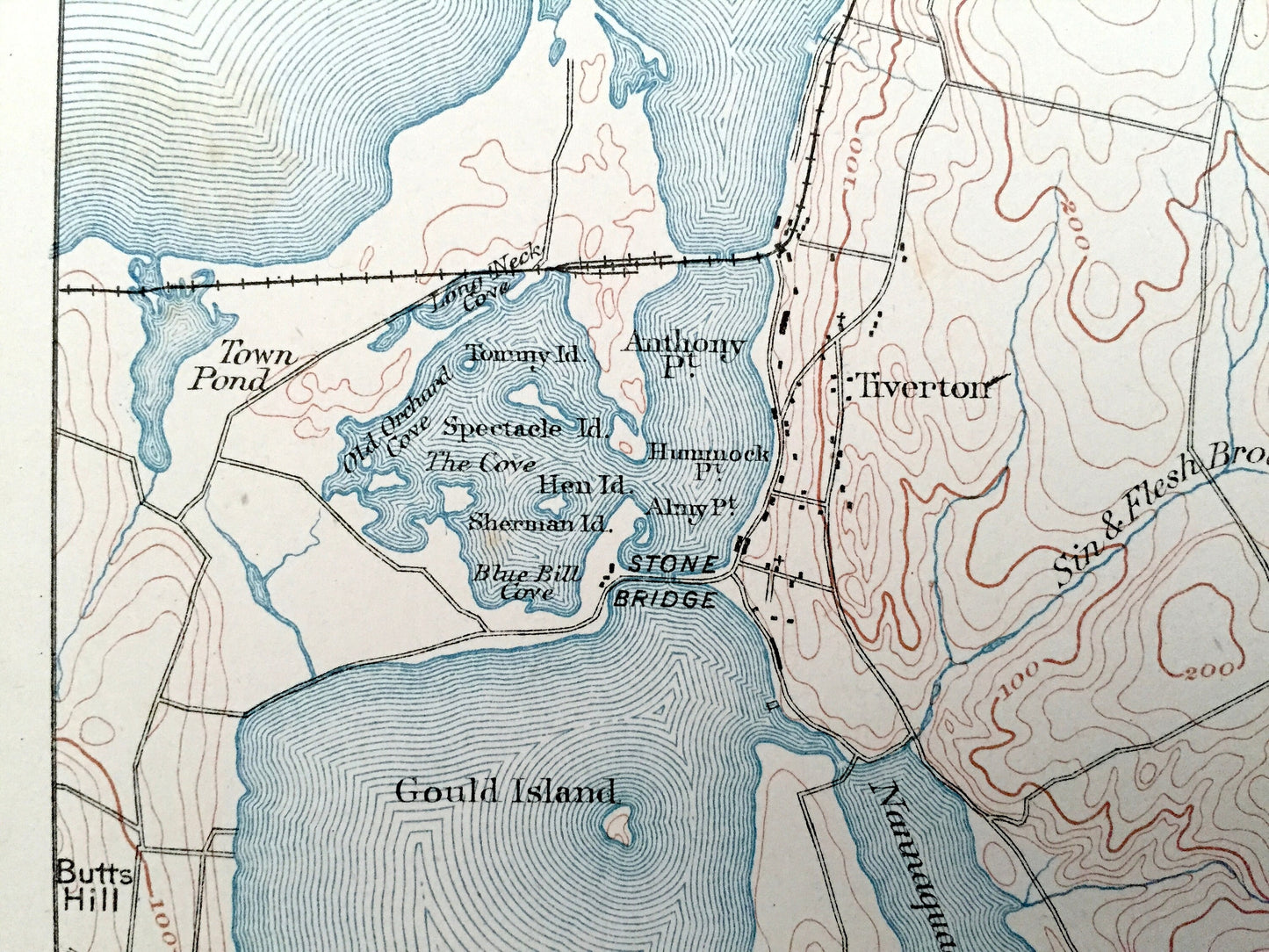
Antique 1885 Fall River, Massachusetts US Geological Survey Topographic Map – Sakonnet River, Swansea, Westport & Tiverton, Rhode Island, MA
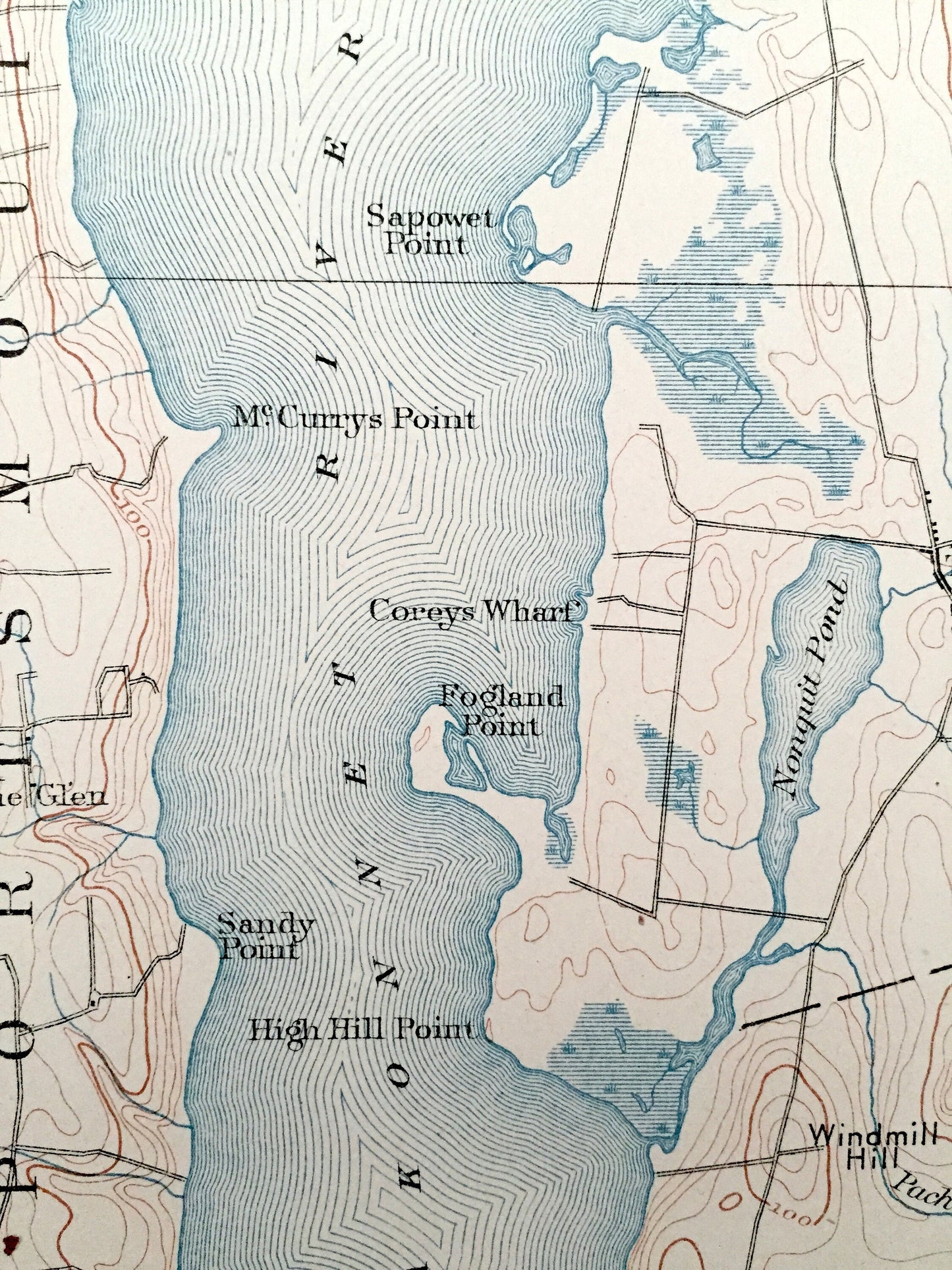
Antique 1885 Fall River, Massachusetts US Geological Survey Topographic Map – Sakonnet River, Swansea, Westport & Tiverton, Rhode Island, MA
Beautiful, antique map of Fall River and surrounding area including, Swansea, Dartmouth and Somerset Massachusetts and Tiverton, Rhode Island on the Sakonnet River. This is an authentic 1885 print from the U.S. Geological Survey and NOT a computer reproduction.
See what these towns on Mount Hope Bay looked like over 130 years ago. Lots of intricate details and geological contours. Map even has little squares for every house that existed at the time. The USGS cartographers were very thorough back then!
Perfect for the historian, map-lover, the curious or just as a conversation starter. Wonderful and rare. Vintage maps such as these make great gifts.
Edition of 1885, printed 1885
Dimensions: 17" width x 21" height
----
Features
Cities & Towns: MASSACHUSETTS: Swansea, Somerset, Fall River, Westport, Dartmouth, Luther Corner, Pottersville, Steep Brook, Mechanicsville, Glove Village, Westport Mills, Head of Westport, Standfords Bound, Central Village, South Westport, Westport Point, Westport Harbor, Hicksville.
RHODE ISLAND: Warren, Bristol, Portsmouth, Middletown, Tiverton, Little Compton, The Glen, Tiverton Four Corners, Adamsville.
Points of Interest: Mount Hope Bay, Sakonnet River, Watuppa Pond, Westport River, Taunton River, Lees River, Coles over, Kickamutt River, Sewammock Neck, Gardners Neck, Warren Neck, Bristol Neck, Queequchan River, Cook Pond, Stafford Pond, Stone Bridge, The Cove, Butts Hill, Sawdy Pond, Devol Pond, Sin & Flesh Brook, Nannaquacket Pond, Deerfield Swamp, The Knubble, Horse Neck Beach, Quicksand Pond, Allens Pond, Shingle Island River, Coppecut River, Copecut Hill, and more roads, houses, ponds, hills, streams, islands, harbors, swamps.
Condition: Very Good Vintage condition, commensurate with age. This map is in great shape for being almost 140 years old. Has very light edge-wear, but this will all read as vintage character when framed.
----
We will happily adjust shipping price for multiple purchases. Maps are rolled up and shipped in sturdy mailing tubes, never folded.
Couldn't load pickup availability
Share