My Store
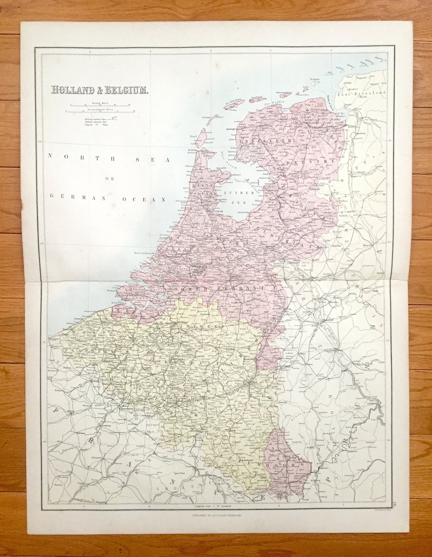
Antique 1888 Holland and Belgium Map from A & C Black's World Atlas – France, Germany, Amsterdam, Brussels, Ghent, North Sea, Moselle River
Antique 1888 Holland and Belgium Map from A & C Black's World Atlas – France, Germany, Amsterdam, Brussels, Ghent, North Sea, Moselle River
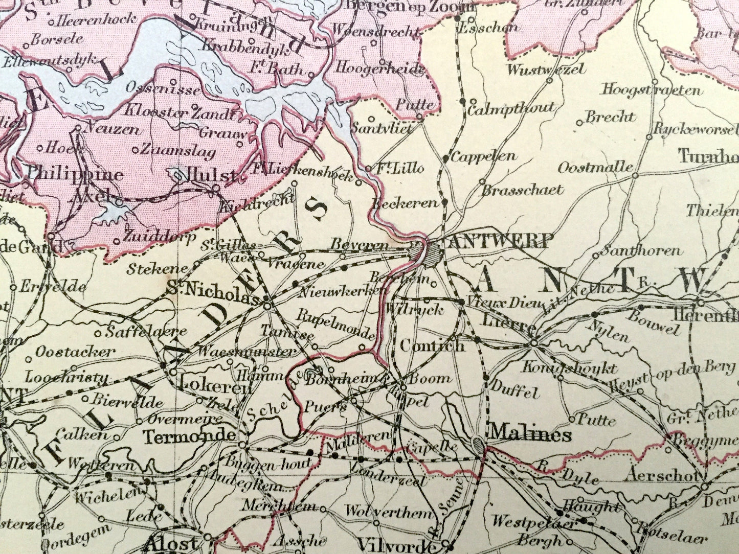
Beautiful, antique map of Holland and Belgium, including France and the Rhine River. This is an authentic 1888 lithograph from A & C Black's "General Atlas of the World" and NOT a computer reproduction.
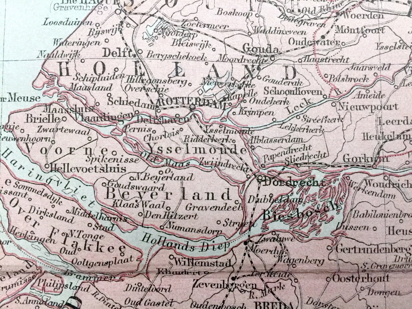
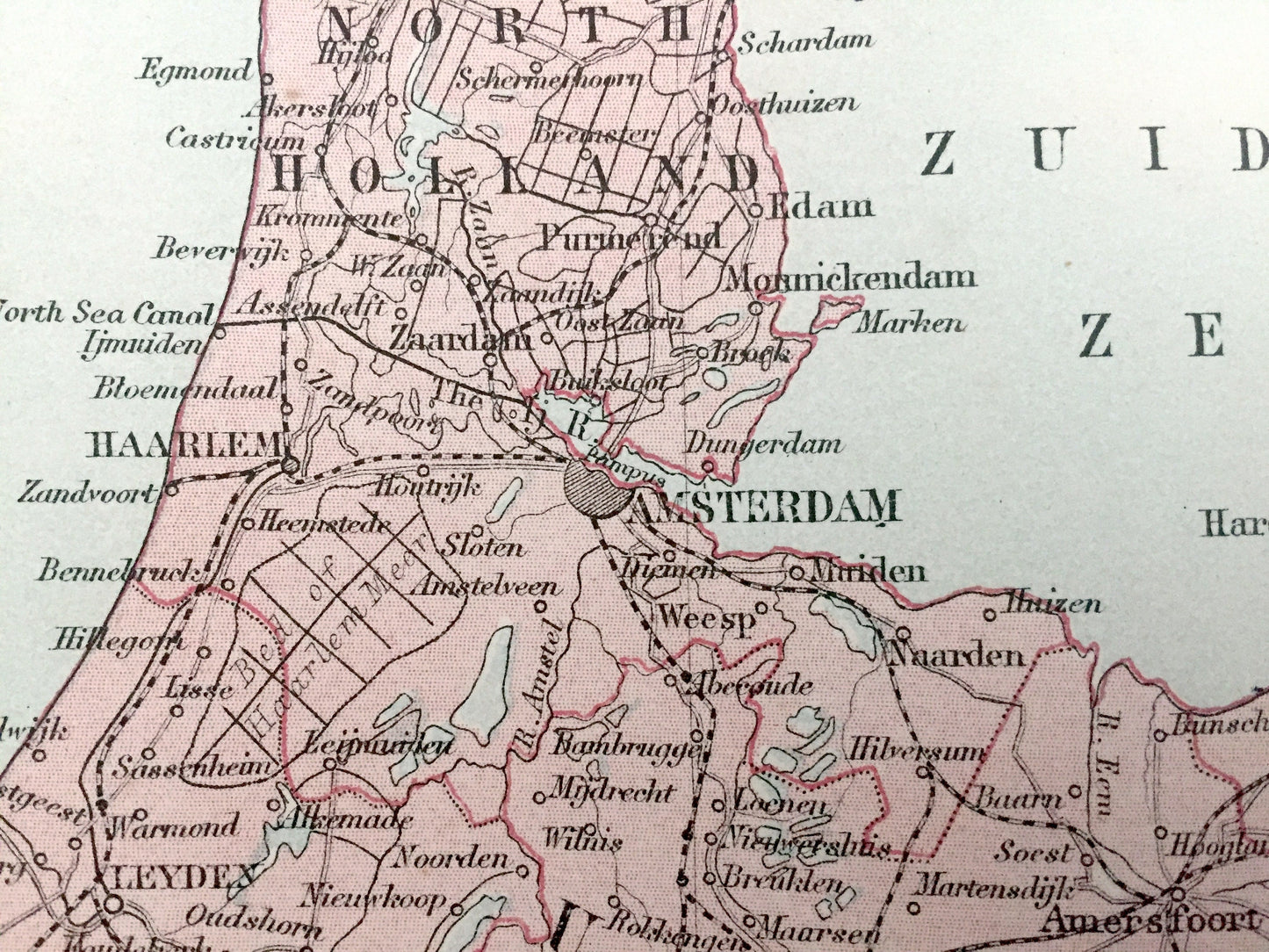
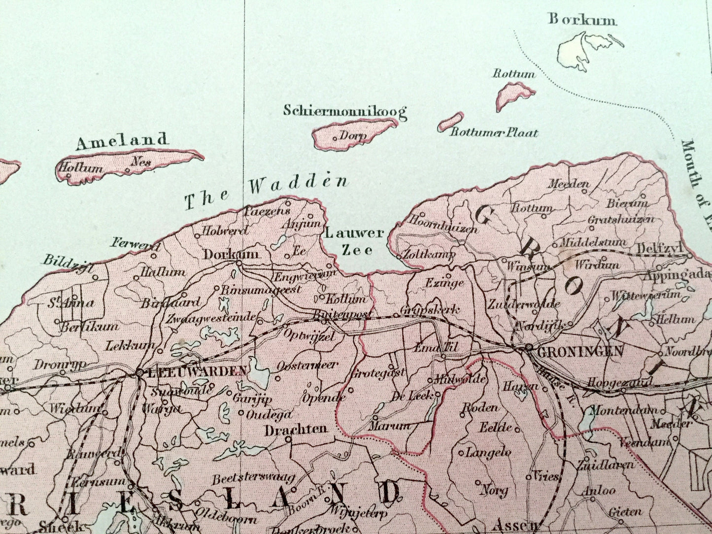
See what the Netherlands, Belgium, France & Germany looked like over 130 years ago. Lots of charming, intricate details and contours, including mountains, islands, rivers, cities and countries. Verso is blank.
Perfect for the historian, map-lover, the curious or just as a conversation starter. Wonderful and rare. Vintage maps such as these make great gifts.
Edition of 1888, printed 1888
Dimensions: 17 3/4" width x 23 1/2" height
----
Features
Points of Interest: Holland, Belgium, France, Prussia, Germany, Luxembourg, Amsterdam, The Hague, Rotterdam, Utrecht, Arnhem, Groningen, Eindhoven, Brussels, Antwerp, Ghent, Bruges, Charleroi, Liège, Namur, Bastogne, Mons, Ostend, Dunkirk, Lille, Bonn, Cologne, Düsseldorf, Münster, Aix-la-Chapelle, North Sea, Markermeer, IJsselmeer, Moselle River, Bourtang Marsh, The Dollart, Waal River, Rhine River, and many more.
----
Condition: Good Vintage condition, commensurate with age. This map is in incredible shape for being over 130 years old. The paper quality is strong and the colors bright bright. Has light wear and a fold as issued in the atlas, but this will all read as vintage character when framed.
----
We will happily adjust shipping price for multiple purchases. Maps are rolled up and shipped in sturdy mailing tubes, never folded.
Couldn't load pickup availability
Share