My Store
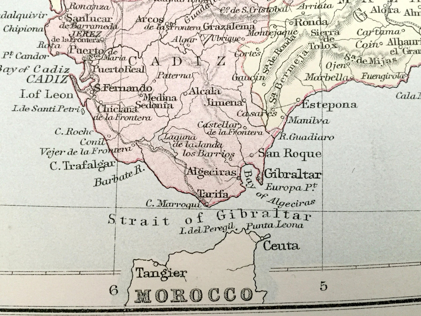
Antique 1888 Spain and Portugal Map from A & C Black's World Atlas – Madrid, Barcelona, Lisbon, Coimbra, Serra da Estrela, Gulf of Valencia
Antique 1888 Spain and Portugal Map from A & C Black's World Atlas – Madrid, Barcelona, Lisbon, Coimbra, Serra da Estrela, Gulf of Valencia
Beautiful, antique map of Spain and Portugal, including France and the Balearic Islands. This is an authentic 1888 lithograph from A & C Black's "General Atlas of the World" and NOT a computer reproduction.
See what Spain, Portugal, France & Morocco looked like over 130 years ago. Lots of charming, intricate details and contours, including mountains, islands, rivers, cities and countries. Verso is blank.
Perfect for the historian, map-lover, the curious or just as a conversation starter. Wonderful and rare. Vintage maps such as these make great gifts.
Edition of 1888, printed 1888
Dimensions: 23 1/4" width x 17 3/4" height
----
Features
Points of Interest: Spain, Portugal, Algeria, France, Andorra, Morocco, Balearic Islands, Madrid, Toledo, Bilbao, Valencia, Barcelona, Seville, Málaga, Salamanca, Gibraltar, Mallorca, Ibiza, Palma, Lisbon, Porto, Coimbra, Braga, Viseu, Faro, Tangier, Oran, Algiers, Toulouse, Montpellier, Pyrenees Mountains, Bay of Biscay, Strait of Gibraltar, Atlantic Ocean, Mediterranean Sea, Gulf of Lion, Gulf of Valencia, Serra da Estrela, Sierra de Guadarrama, and many more.
----
Condition: Good Vintage condition, commensurate with age. This map is in incredible shape for being over 130 years old. The paper quality is strong and the colors bright bright. Has light wear and a fold as issued in the atlas and a small 1" separation at the fold at the top, but this will all read as vintage character when framed.
----
We will happily adjust shipping price for multiple purchases. Maps are rolled up and shipped in sturdy mailing tubes, never folded.
Couldn't load pickup availability
Share