My Store
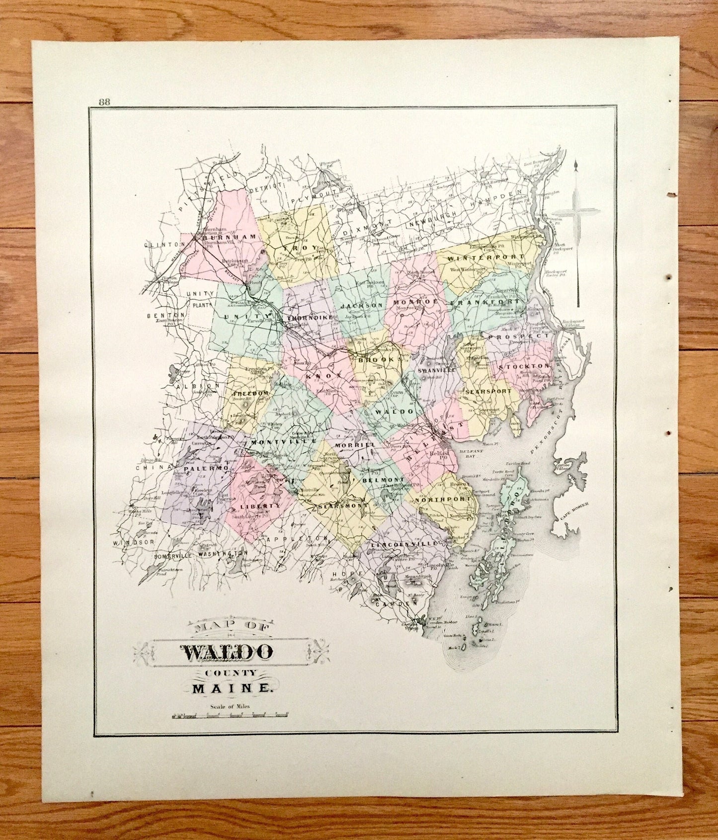
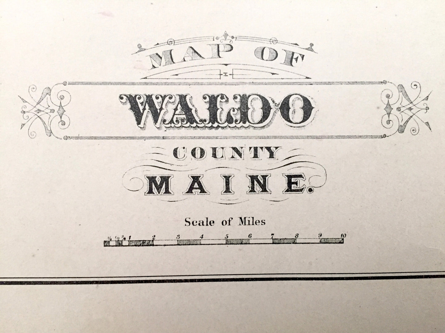
Antique 1888 Waldo County, Maine Map by George N. Colby & Company – Belfast, Searsport, Stockton, Islesboro Northport Fairfield Skowhegan ME
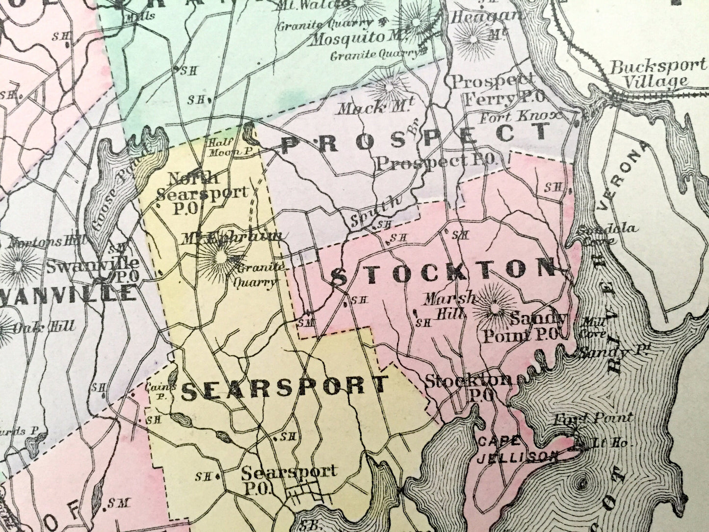
Antique 1888 Waldo County, Maine Map by George N. Colby & Company – Belfast, Searsport, Stockton, Islesboro Northport Fairfield Skowhegan ME
Beautiful, antique map of Waldo County, Maine, including Belfast, Searsport, Stockton, Prospect, Northport, Lincolnville, Islesboro & Waldo. This is an authentic map taken from George N. Colby & Co.'s Atlas of Waldo County published in 1888 and NOT a computer reproduction. Verso is a pair of maps of smaller villages Fairfield & Skowhegan.
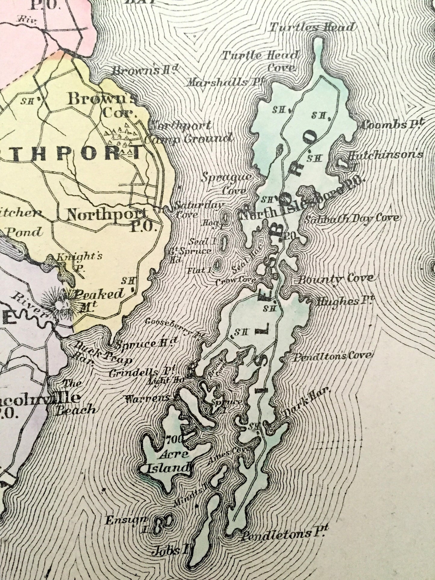
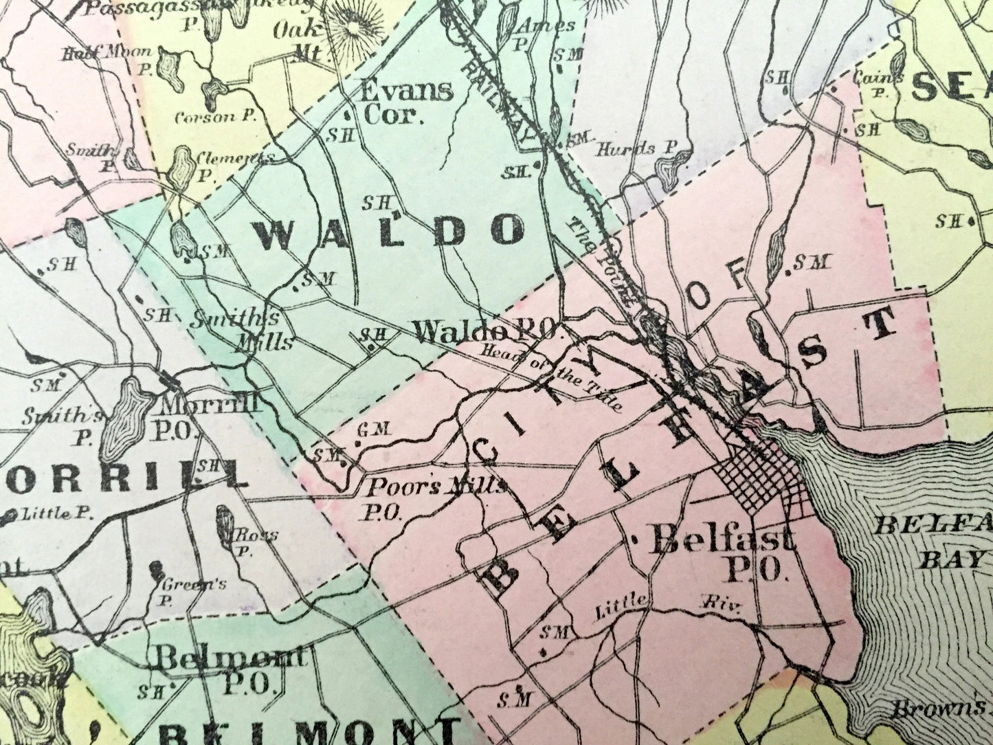
See what the coast of Maine looked like over 130 years ago in the late 19th century. Lots of charming, intricate details and contours, including main roads and streets, rivers, islands, points, ponds, lakes, railroads and post offices. Hand-painted.
Perfect for the historian, map-lover, the curious or just as a conversation starter. Wonderful and rare. Vintage maps such as these make great gifts.
Edition of 1888, printed 1888
Dimensions: 15 1/2" width x 18 1/4" height
----
Features
Cities & Towns: Burnham, Troy, Unity, Freedom, Montville, Palermo, Liberty, Thorndike, Knox, Morrill, Searsmont, Jackson, Monroe, Brooks, Waldo, Belfast, Northport, Belmont, Lincolnville, Winterport, Frankfort, Prospect, Stockton, Searsport, Islesboro.
Points of Interest: Penobscot River, Penobscot Bay, Cape Rosier, Belfast Bay, Pitcher Pond, Bounty Cove, Unity Pond, Sheepscut Great Pond, Quantabacook Pond, Goose Pond, Kennebec River, and many more towns, villages, ponds, rivers, island, coves and mountains.
----
Condition: Good Vintage condition, commensurate with age. This map is in great shape for being over 130 years old. Some edge-wear and toning, all of which will read as vintage character when framed.
----
We will happily adjust shipping price for multiple purchases. Maps are rolled up and shipped in sturdy mailing tubes, never folded.
Couldn't load pickup availability
Share