My Store
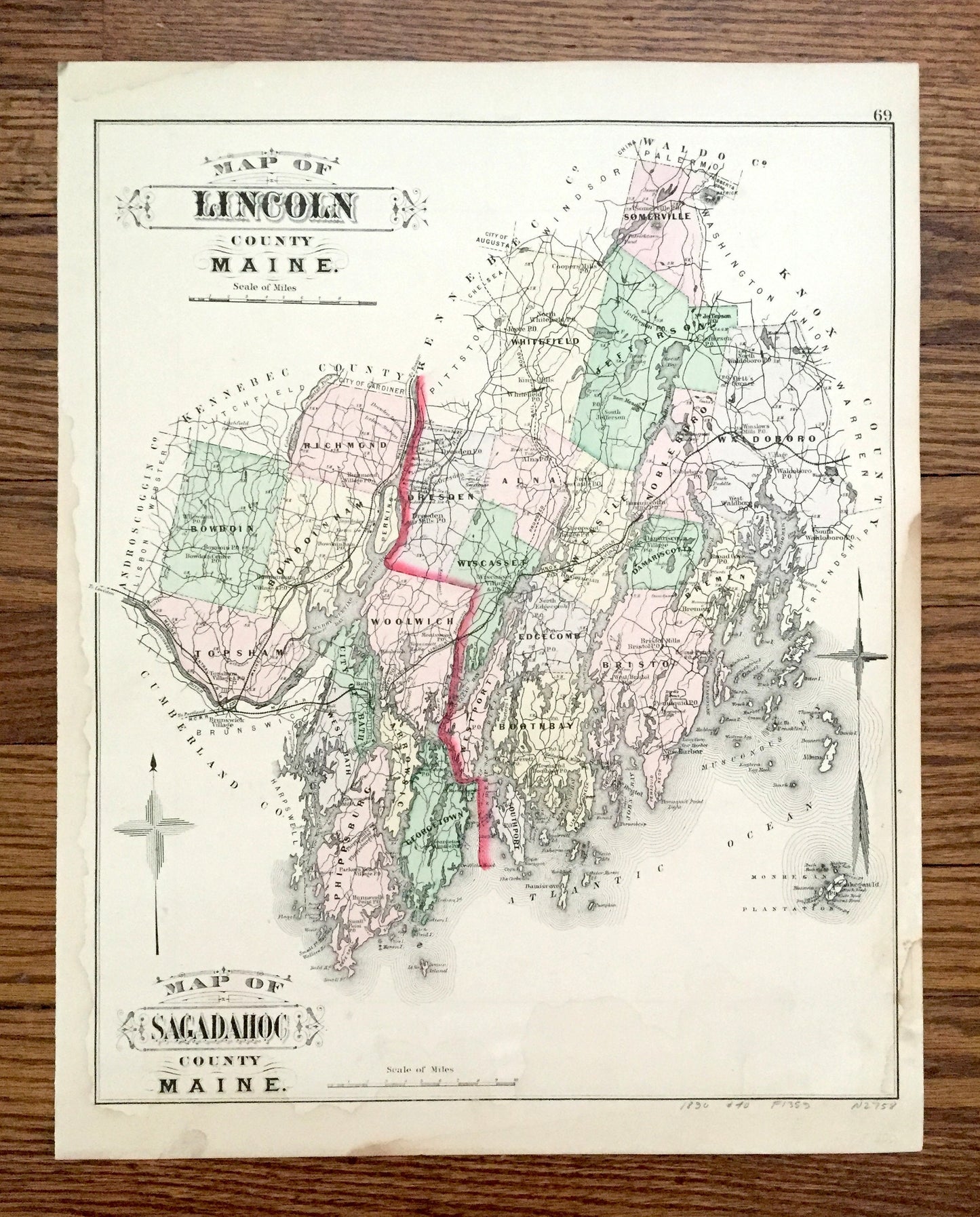
Antique 1890 Sagadahoc and Lincoln County, Maine Map by George N. Colby & Company – Bath, Boothbay, Phippsburg, Topsham, Bristol, Bowdoin ME
Antique 1890 Sagadahoc and Lincoln County, Maine Map by George N. Colby & Company – Bath, Boothbay, Phippsburg, Topsham, Bristol, Bowdoin ME
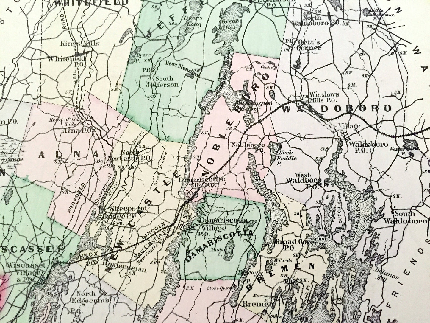
Beautiful, antique map of Sagadahoc County and Lincoln County, Maine. This is an authentic map taken from George N. Colby & Company's Atlas of Knox County published in 1890 and is NOT a computer reproduction. Opposite side is a the northwestern, Rangeley Lake area of Maine, including Oxford and Franklin County, as well as New Hampshire.
See what Maine looked like over 130 years ago in the late 19th century. Lots of charming, intricate details and contours, including main roads, railroads, lakes and ponds, rivers and islands.
Perfect for the historian, map-lover, the curious or just as a conversation starter. Wonderful and rare. Vintage maps such as these make great gifts.
Edition of 1890, printed 1890
Dimensions: 13 1/4" width x 17" height
----
Features
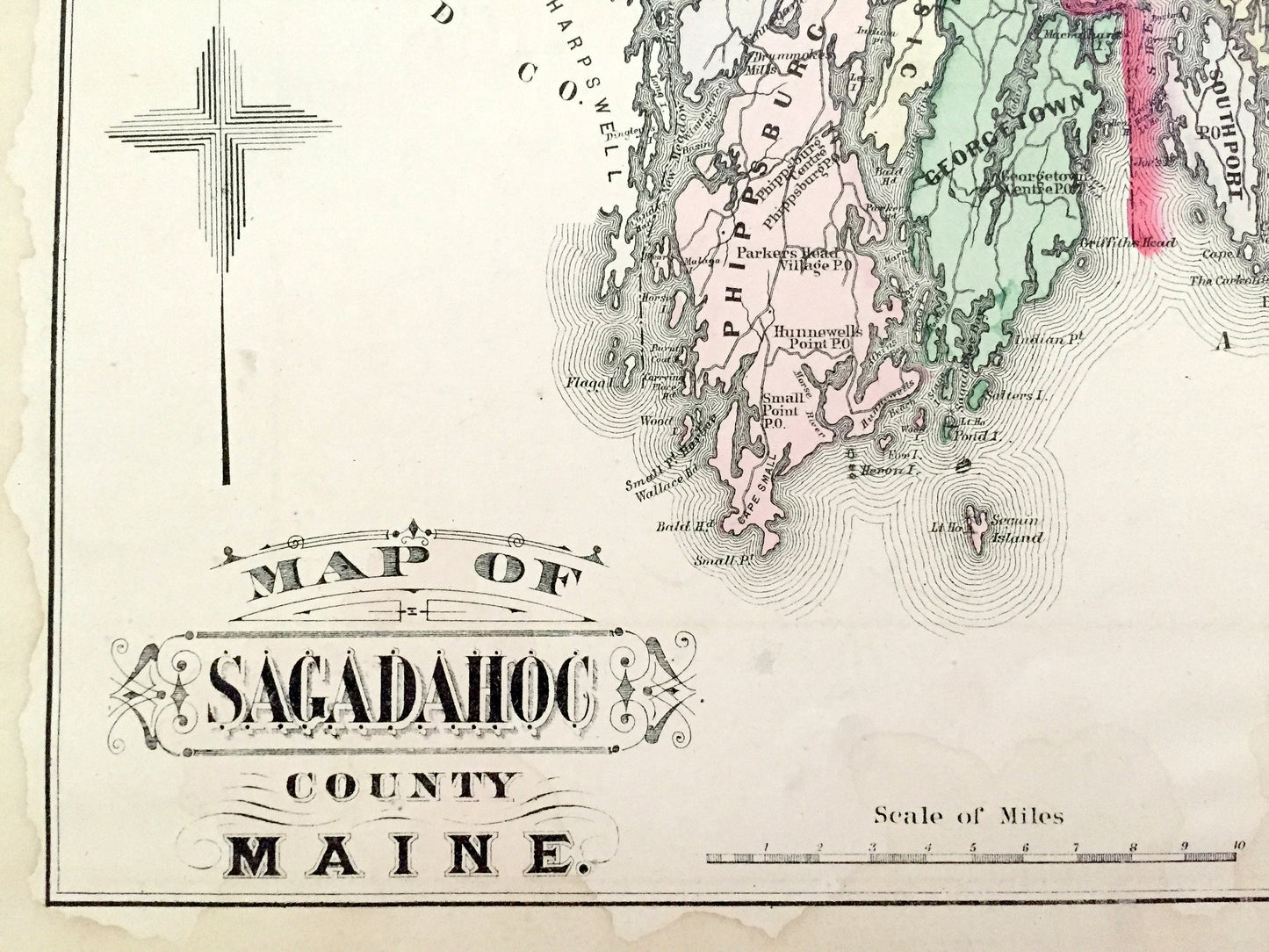
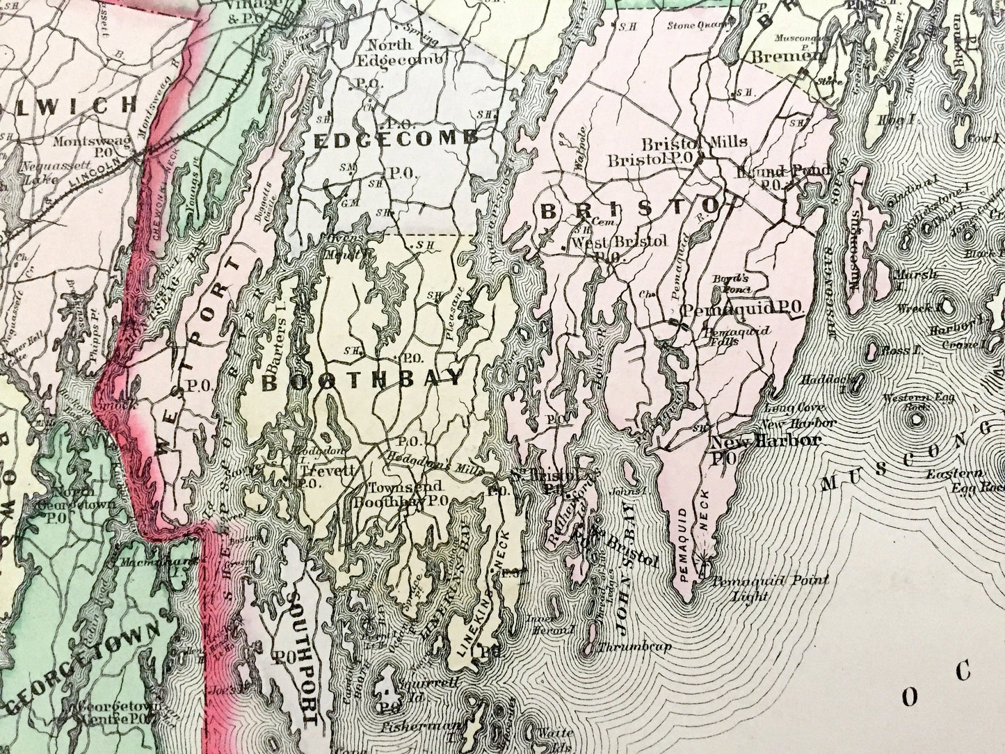
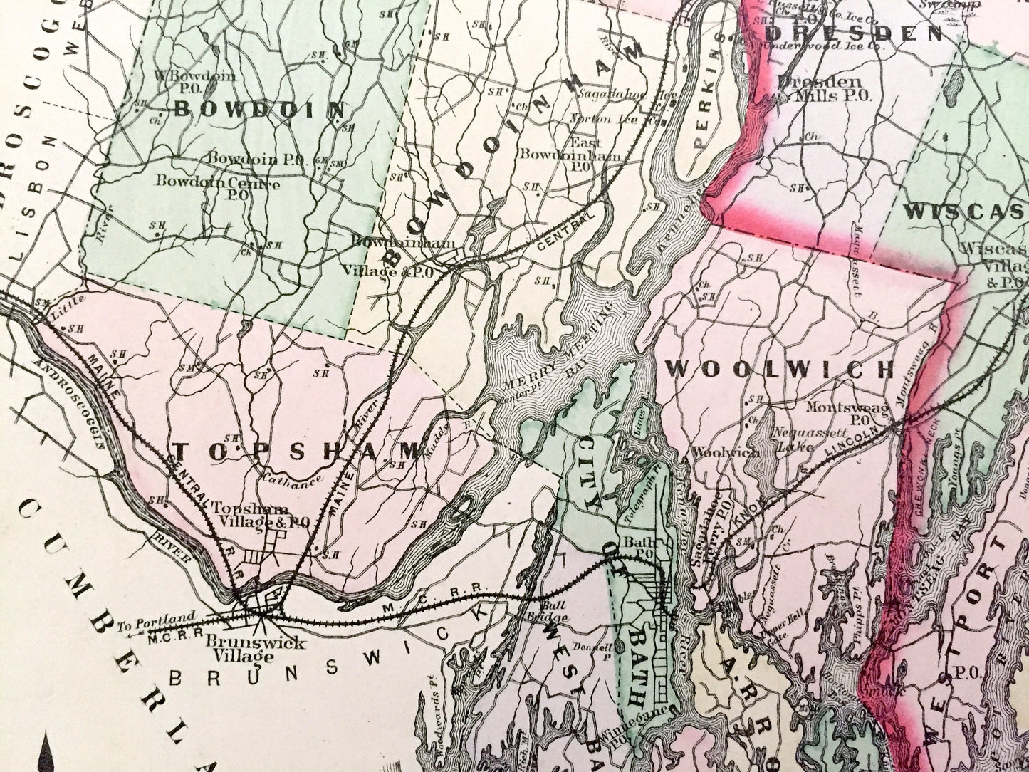
Cities & Towns: Bowdoin, Topsham, Richmond, Bowdoinham, Perkins, Bath, West Bath, Phippsburg, Georgetown, Arrowsic, Woolwich, Dresen, Wiscasset, Westport, Southport, Boothbay, Edgecomb, Alna, Whitefield, New Castle, Somerville, Jefferson, Bristol, Bremen, Damariscotta, Nobleboro, Waldoboro, Brunswick Village, Pemaquid, New Harbor, Townsend, Sheepscot Bridge, Kings Mills, Broad Cove, Monhegan Plantation.
Reverse Side: Carlisle Grants, Clarkesville, Dixville, Atkinson & Gilmanton Academy Grants, Dartmouth College Grants, Wentworth Locations, Millsfield, Errol, Dummer, Cambridge, Milan, Lincoln Plantation, Rangeley, Dallas Plantation, Grafton, Andover, Byron, Roxbury, Phillips, Avon, Temple, Carthage, WIlton, Mexico.
Points of Interest: Sagadahoc County, Lincoln County, Atlantic Ocean, Androscoggin River, Kenebec River, Sheepscot River, Medomak River, Muscongus Bay, Mongehan Island, Allens Island, Friendship Island, Damiscove Island, Sequin Island, Linekins Bay, Linekins Neck, Great Bay, Pemaquid Pond, Patrick Mountain, Johns Bay, Barters Island, Merry Meeting Bay and many, many more towns, villages, ponds, rivers, roads, railroads, beaches, islands, coves and mountains.
----
Condition: Good Vintage condition, commensurate with age. This map is in great shape for being over 130 years old. Some foxing and toning, as well as light staining and pencil in margin, but this will all add to vintage character when framed.
----
We will happily adjust shipping price for multiple purchases. Maps are rolled up and shipped in sturdy mailing tubes, never folded.
Couldn't load pickup availability
Share