My Store
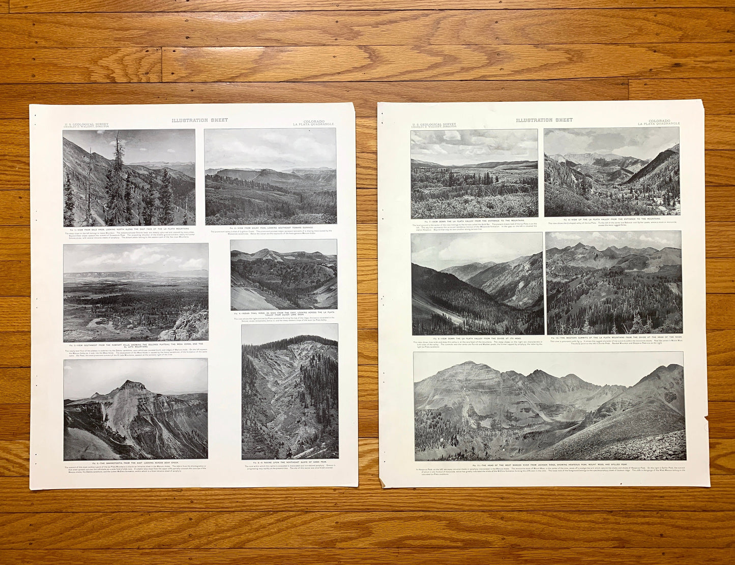
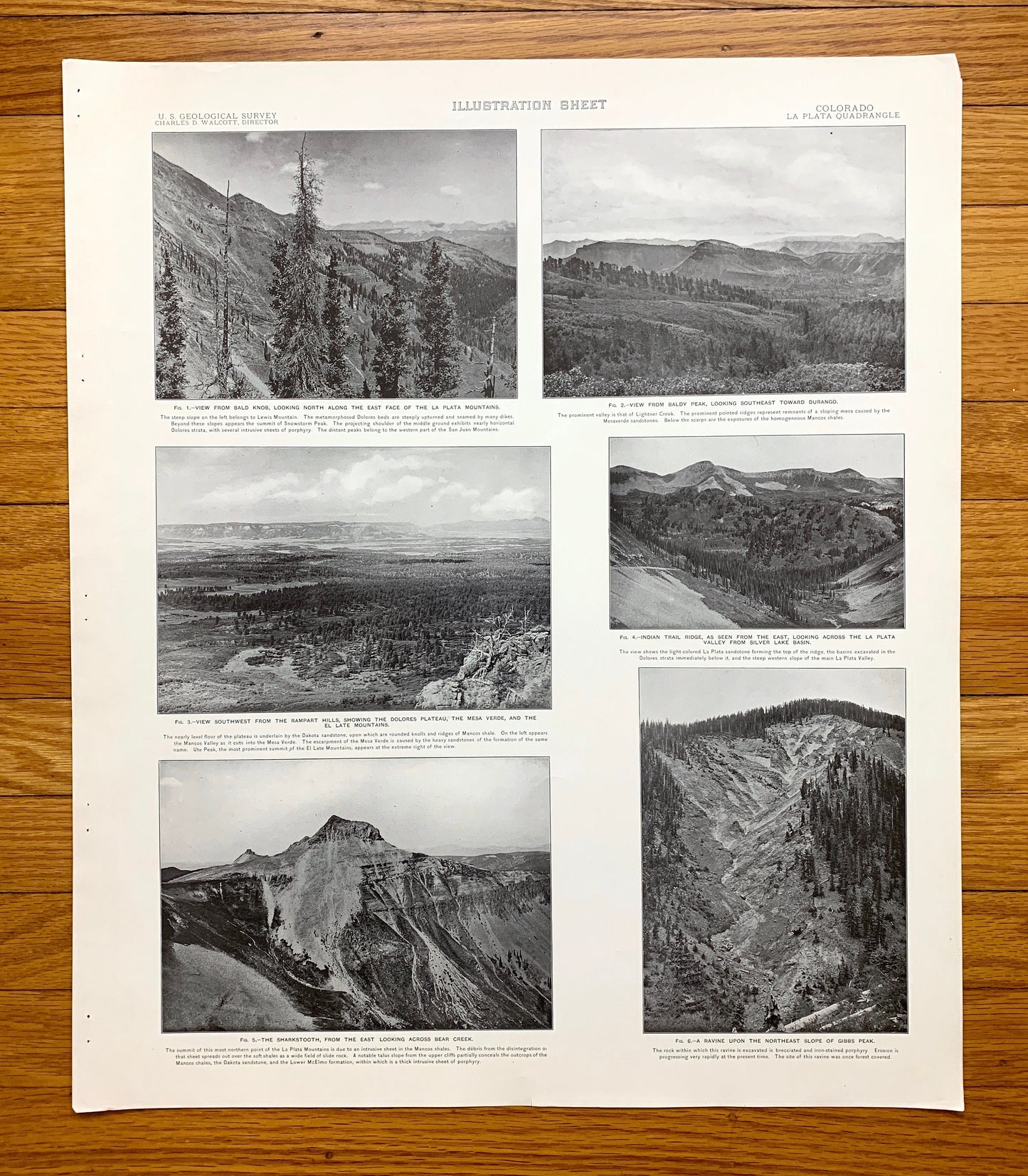
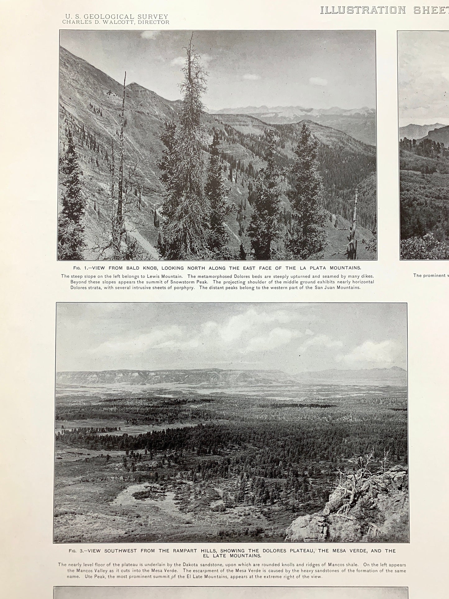
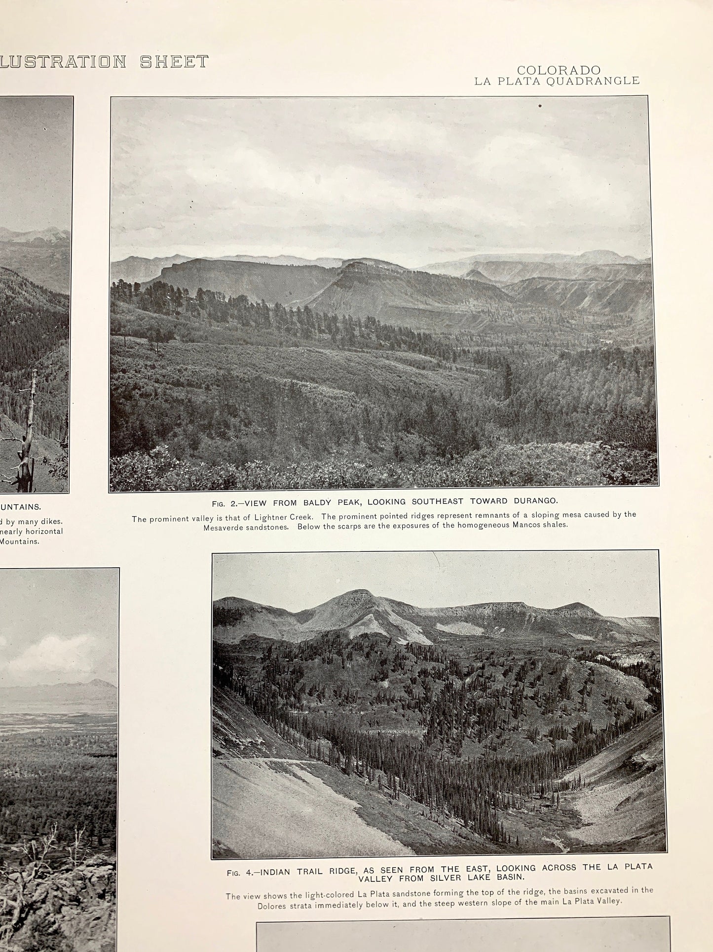
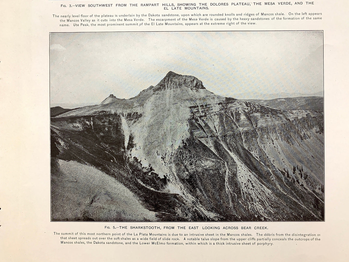
Antique 1899 La Plata, Colorado Rock Formation Photographs – US Geological Survey – Montezuma County, San Juan National Forest CO
Antique 1899 La Plata, Colorado Rock Formation Photographs – US Geological Survey – Montezuma County, San Juan National Forest CO
Beautiful, antique double plates of photographs of various rock formations of the La Plata, Colorado and surrounding La Plata & Montezuma County area. These are authentic 1899 edition, 1899 prints from the U.S. Geological Survey and are NOT computer reprints. They are from a Geologic Atlas folio.
See what Colorado looked like more than 120 years ago. Perfect for the historian, rock-lover, the curious or just as a conversation starter. Very rare. Vintage prints such as these make great gifts.
Edition of 1899, printed 1899
Dimensions: 18 1/2" width x 22" height
----
Features
Cities & Towns: La Plata, Dix, Cima, Mayday, Hesperus, Ute Junction.
Points of Interest: La Plata County, Montezuma County, San Juan National Forest, La Plata Mountains, La Plata River, Thompson Park, The Hogback, Deep Canyon, Manco River, Hesperus Peak, Cumberland Basin, Madden Peak, Parrott Peak, Deadwood Mountain, Silver Mountain, Baldy Peak, Ohlwiler Ridge, Gold Bar, Eagle Pass, Mt Moss, Spiller Peak, Schuber Flat, and lots more hills, mountains, creeks, gulches, houses, roads and railroads..
Condition: Good Vintage condition, commensurate with age. These prints in great shape for being 120 years old. Has some edge wear and toning and staple holes in the margin but this will add to character when framed.
----
We will happily adjust shipping price for multiple purchases. Maps and prints are rolled up and shipped in sturdy mailing tubes, never folded.
Couldn't load pickup availability
Share