My Store
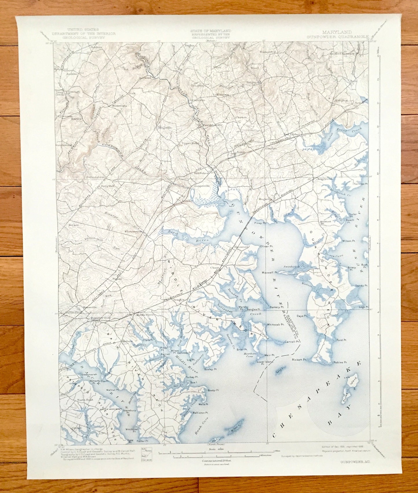
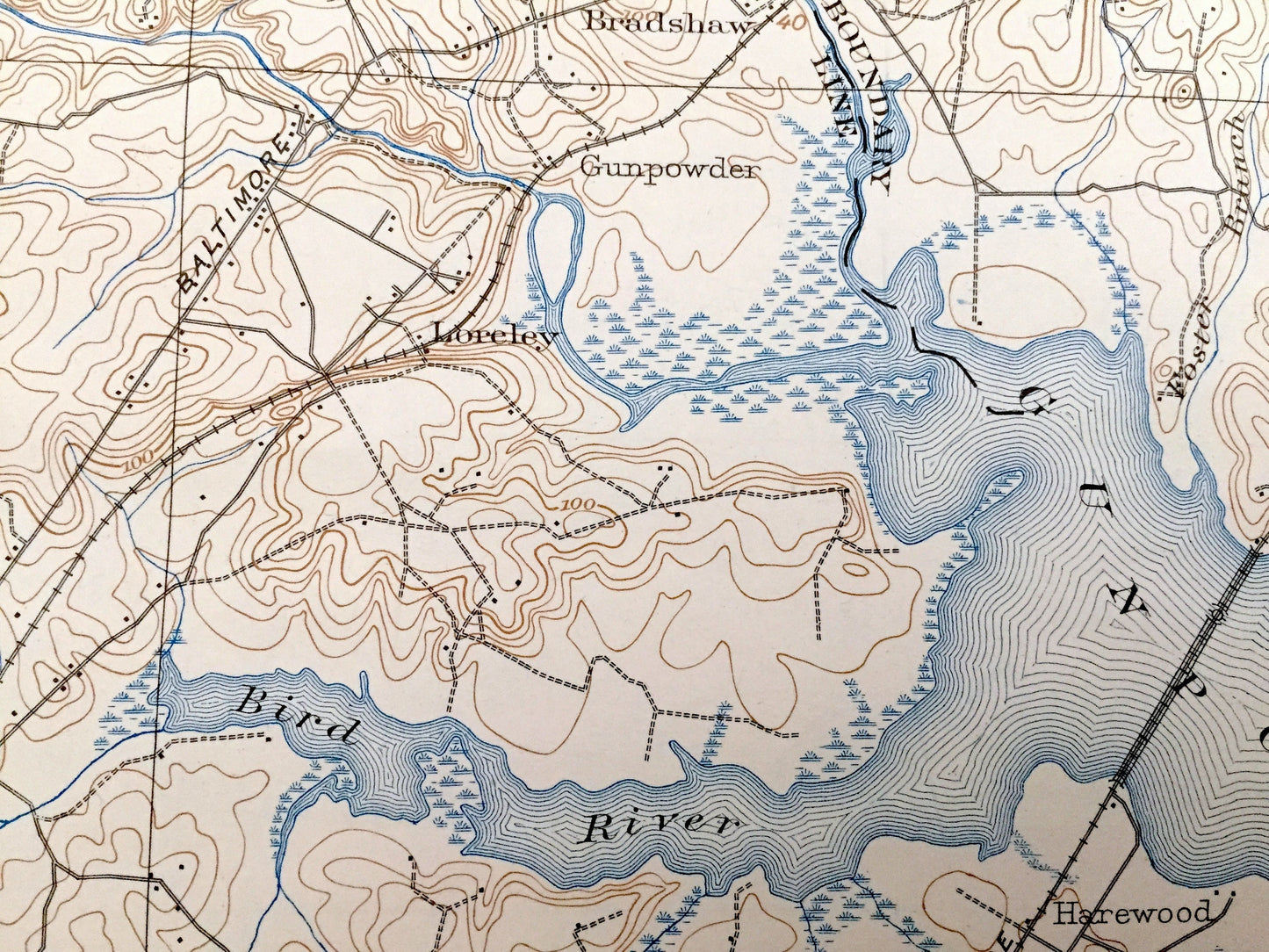
Antique 1901 Aberdeen Proving Ground, Maryland US Geological Survey Map – Gunpowder Falls, Chesapeake Bay, Baltimore & Harford County, MD
Antique 1901 Aberdeen Proving Ground, Maryland US Geological Survey Map – Gunpowder Falls, Chesapeake Bay, Baltimore & Harford County, MD
Beautiful, antique map of northern Chesapeake Bay, Maryland. Includes Gunpowder Falls and large parts of Baltimore and Harford Counties, just northeast of Baltimore, MD. This is an authentic 1901 edition, 1938 print from the U.S. Geological Survey and NOT a computer reproduction.
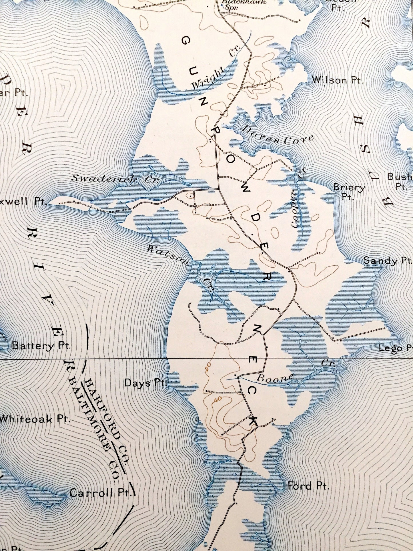
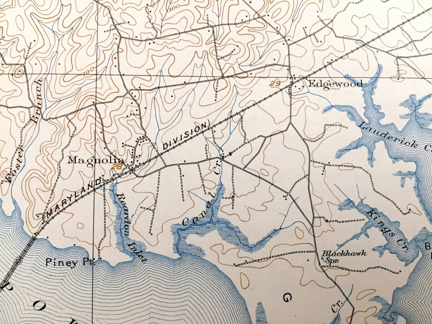
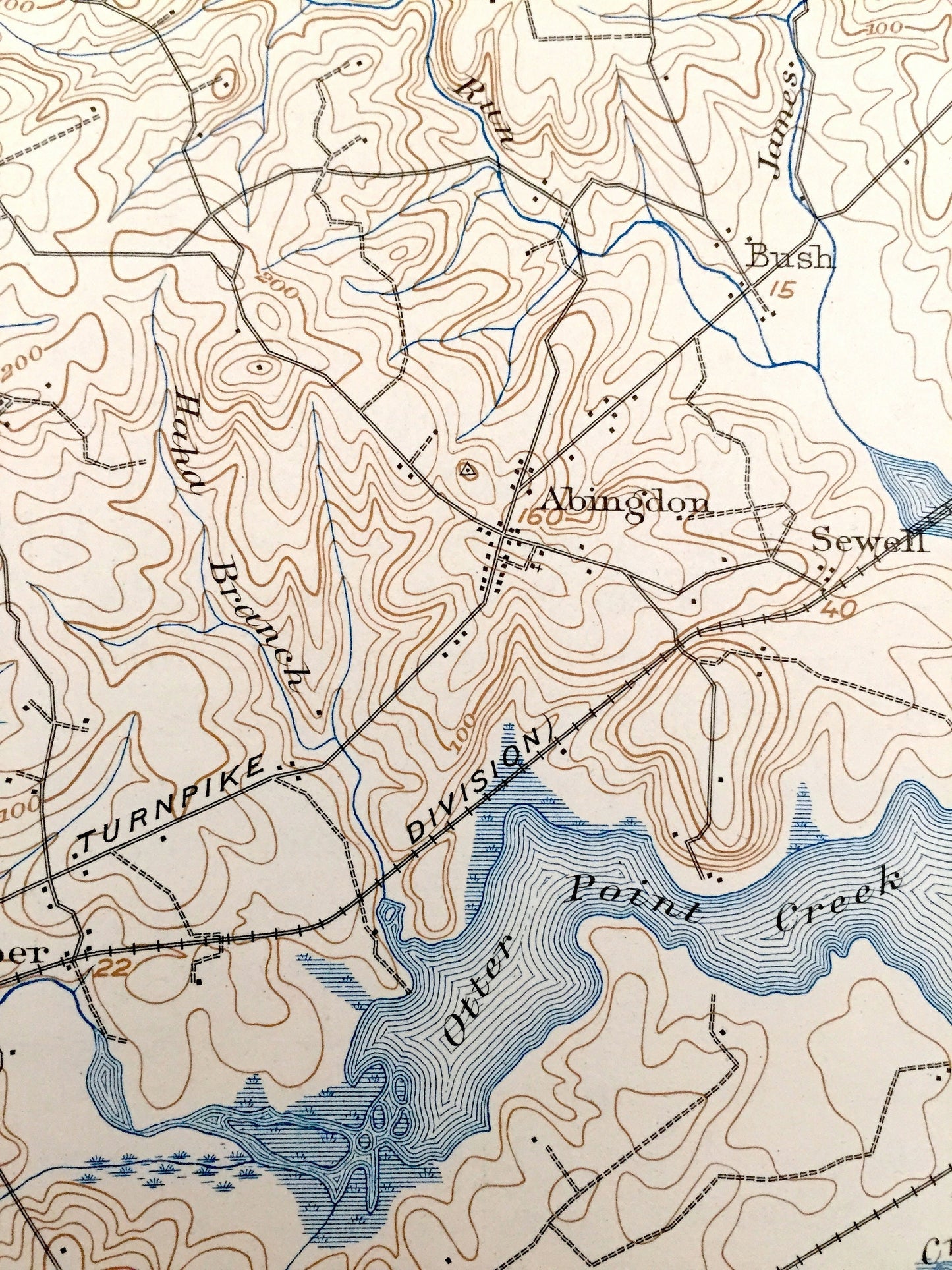
See what Maryland looked like more than 120 years ago. Lots of intricate details and geological contours. Map even has little squares for every house that existed at the time. The USGS cartographers were very thorough back then! On the back is a description of topographic symbols and map guide.
Perfect for the historian, map-lover, the curious or just as a conversation starter. Wonderful and rare. Vintage maps such as these make great gifts.
Edition of 1901, printed 1939
Dimensions: 16 1/2" width x 20" height
----
Features
Cities & Towns: (Most of which will be founded later) Bel Air, Hyde, Baldwin, Gittings, Mountvista, Glenarm, Greenwood, Kingsville, Lynchs Corner, Wilna, Stockton, Clayton, Mountain, Jerusalem, Franklinville, Emmorton, Harford Furnace, Abingdon, Bush Norris Corner, Van Bibber, Edgewood, Germantown, Perry Hall, Loreley, Gunpowder, Bradshaw, Magnolia, Necker, White Marsh, Harewood, Poplar, Battle Grove, Inverness, Gray Manor, Beechwood, Lynnhurst, Walters, more.
Points of Interest: (most of which will be named later) Chesapeake Bay, Aberdeen Proving Ground (here spelled as Grounds), Army Chemical Center, Gunpowder Neck, Gunpowder River, Bush River, Middle River, Back River, Dundee Creek, Saltpeter Creek, Seneca Creek, Frog Mortar Creek, Otter Point Creek, Gunpowder Falls, Bird River, Pooles Island, Carroll Island, Miller Island, Middle River Neck, Patapsco River Neck, Philadelphia Wilmington and Baltimore Railroad, and lots more hills, brooks, creeks, towns, schools, churches, roads, coves, islands and marshes.
Condition: Very Good Vintage condition, commensurate with age. This map is in great shape for being over 70 years old. Light wear, but this will add to vintage character when framed.
----
We will happily adjust shipping price for multiple purchases. Maps are rolled up and shipped in sturdy mailing tubes, never folded.
Couldn't load pickup availability
Share