My Store
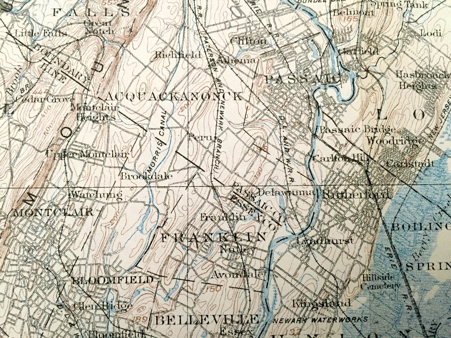
Antique 1902 New Jersey, New York & Pennsylvania US Geological Survey Topographic Map – Hudson River Valley, Montclair, Upstate, Passaic, NJ
Antique 1902 New Jersey, New York & Pennsylvania US Geological Survey Topographic Map – Hudson River Valley, Montclair, Upstate, Passaic, NJ
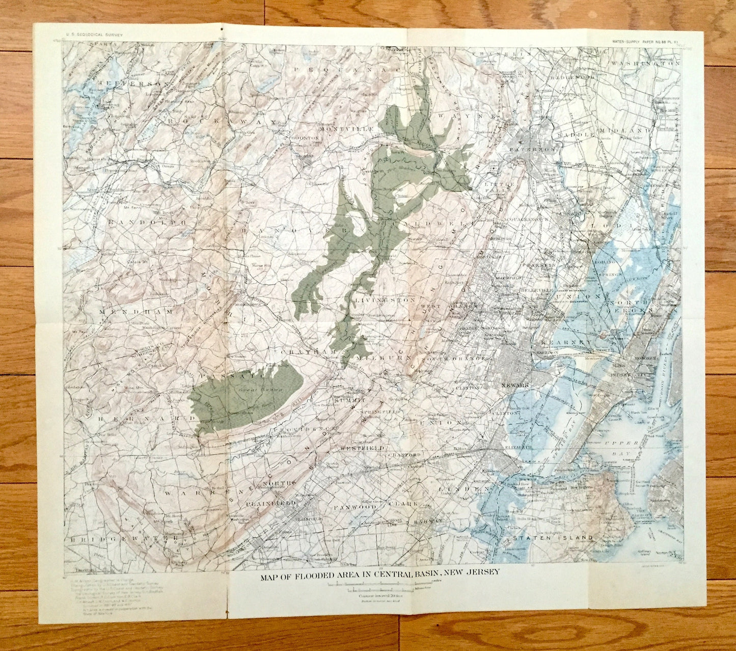
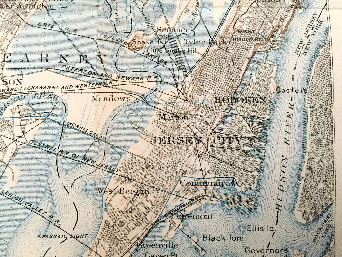
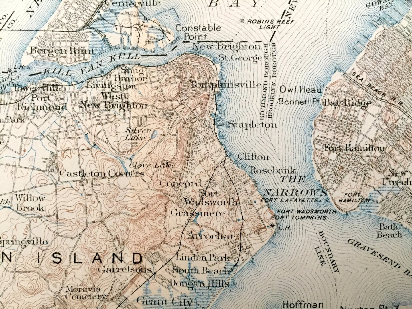
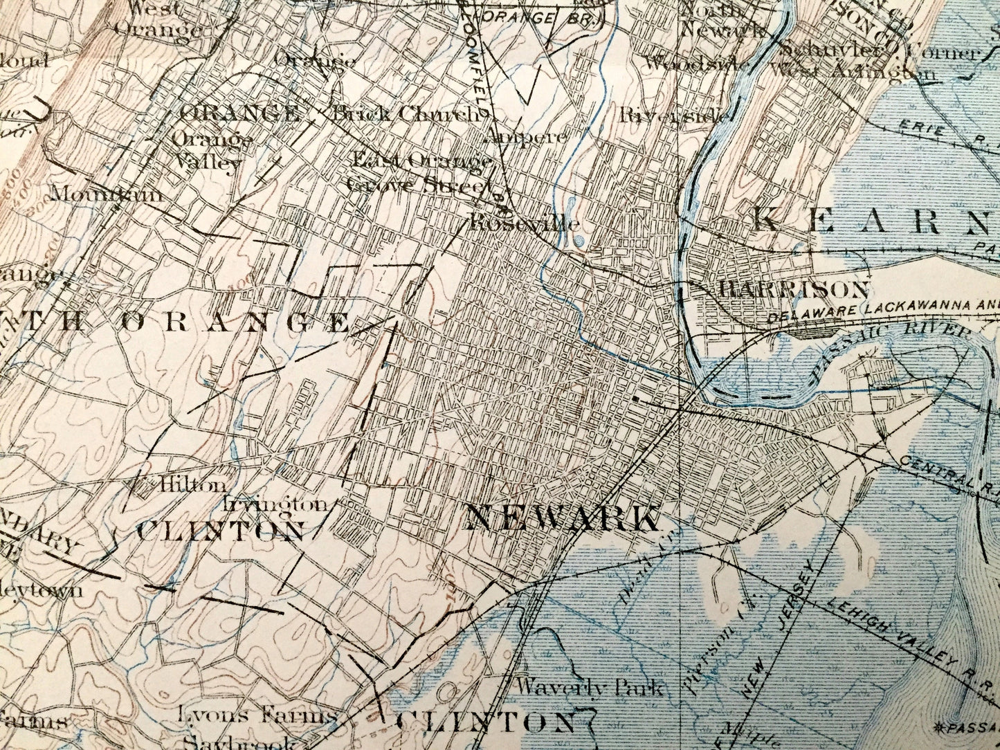
Beautiful, antique map of New Jersey west of New York City entitled "Map of Flooded Area in Central Basin, New Jersey". This is an authentic 1902 print from the U.S. Geological Survey and is NOT a computer reprint.
See what New Jersey & New York looked like over 120 years ago. Lots of intricate details and geological contours. Map even has every house and building that existed at the time. The USGS cartographers were very thorough back then! Verso is blank.
Perfect for the historian, map-lover, the curious or just as a conversation starter. Wonderful and rare. Vintage maps such as these make great gifts.
Surveyed 1897, Printed 1902
Dimensions: 19 1/4" width x 17" height
----
Condition: Good Vintage condition, commensurate with age. This map is in great shape for being over 120 years old. Has edge-wear, fold lines, discoloration (mainly in that top right section) and some separations were the maps were joined together, but this will read as vintage character when framed. Folds will flatten easily.
----
We will happily adjust shipping price for multiple purchases. This particular will be shipped fully-insured and folded, to keep integrity of fold lines and prevent any more separations in the rolling process.
Couldn't load pickup availability
Share