My Store
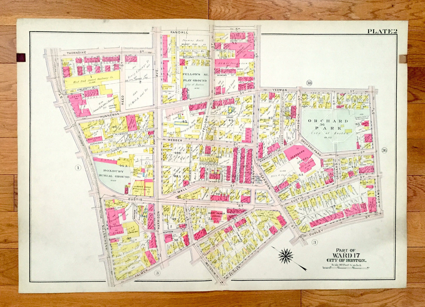
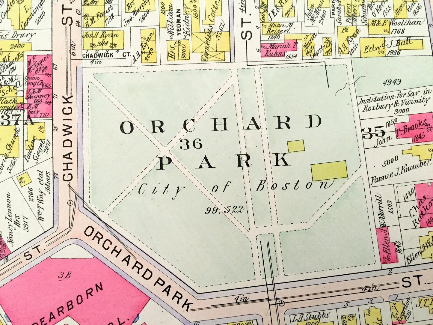
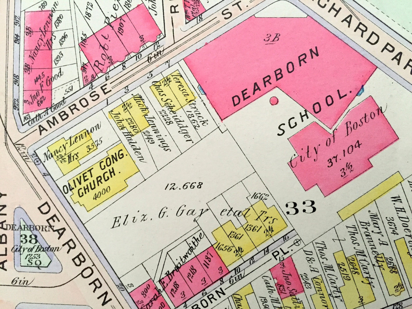
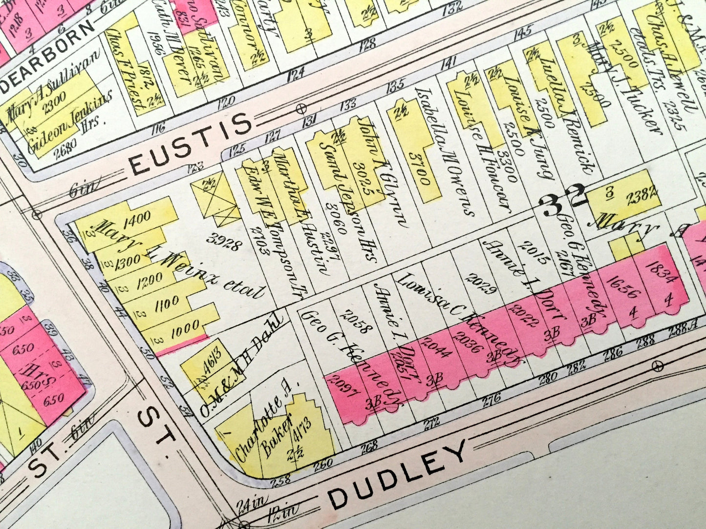
Antique 1906 Roxbury, Massachusetts Map from GW Bromley Atlas – Boston, Suffolk County, Orchard Park, Mt Pleasant, South of Washington
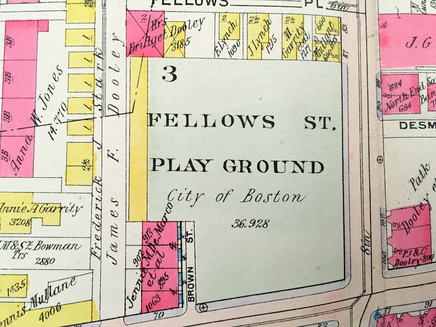
Antique 1906 Roxbury, Massachusetts Map from GW Bromley Atlas – Boston, Suffolk County, Orchard Park, Mt Pleasant, South of Washington
Beautiful, antique map of the Orchard Park area of Roxbury, Massachusetts between Dudley Square and South of Washington. This is an authentic map (Plate #2) taken from G.W. Bromley's "Atlas of the City Boston, Roxbury" published in 1906 and NOT a computer reproduction.
See what Roxbury looked like more than 110 years ago. Lots of charming, intricate details and contours, including streets, rivers, gardens, squares, houses, buildings and the names of property owners at the time. Hand colored. Verso is blank.
Perfect for the historian, map-lover, the curious or just as a conversation starter. Wonderful and rare. Vintage maps such as these make great gifts.
Edition of 1906, printed 1906
Dimensions: 32" width x 22 1/2" height
----
Condition: Very Good Vintage condition, commensurate with age. This map is in great shape for being over 110 years old. Some edge-wear, toning and atlas leather index tabs in margin corners, all of which will add to vintage character when framed. Colors are still very bright.
(Picture of atlas and title page is for reference and not included.)
----
We will happily adjust shipping price for multiple purchases. Maps are rolled up and shipped in sturdy mailing tubes, never folded.
Couldn't load pickup availability
Share