My Store
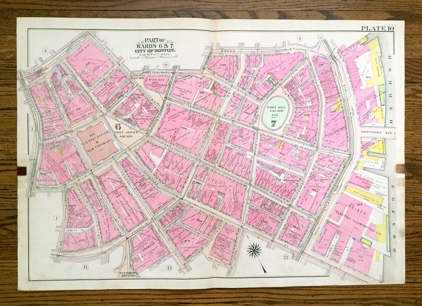
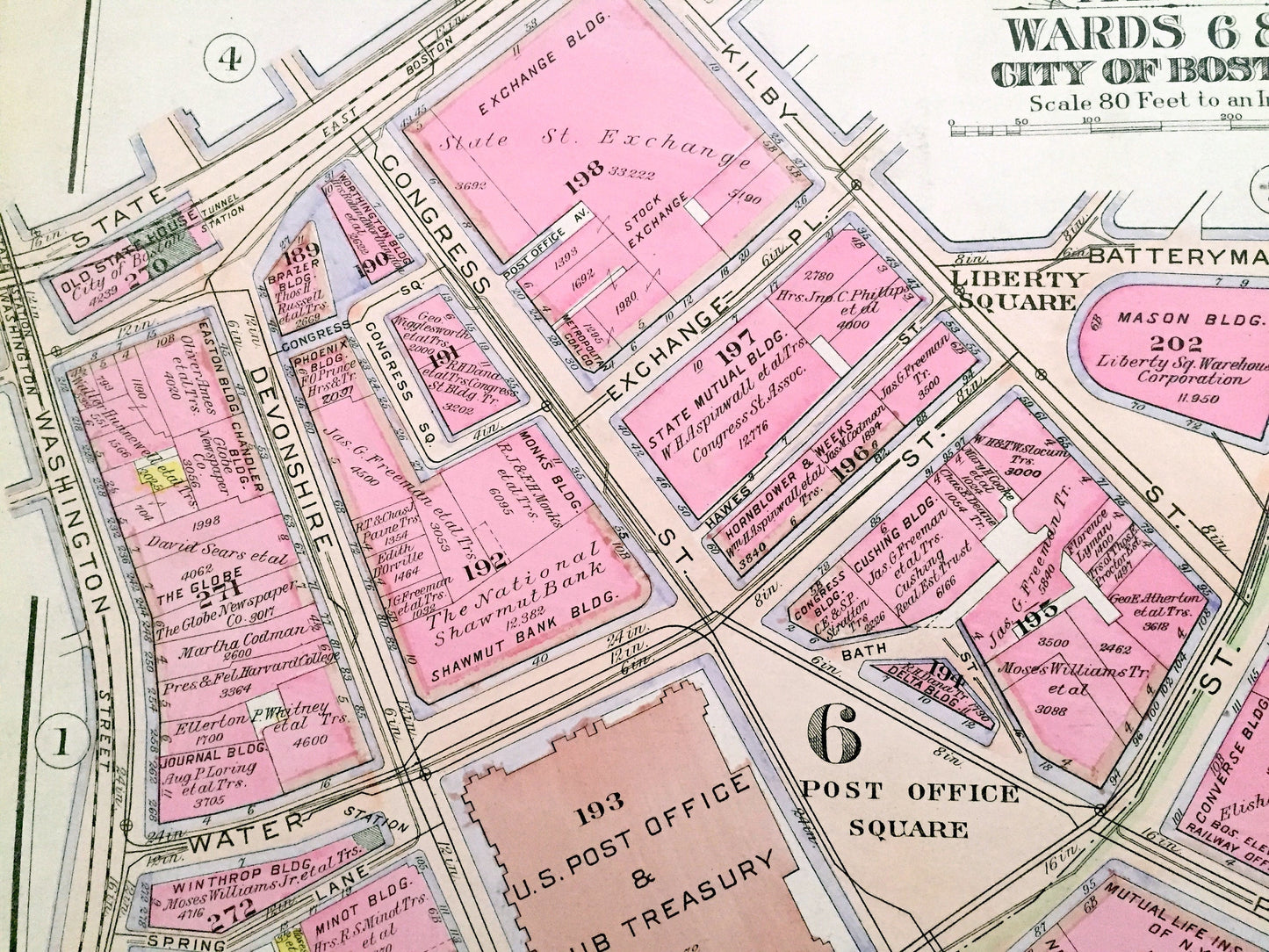
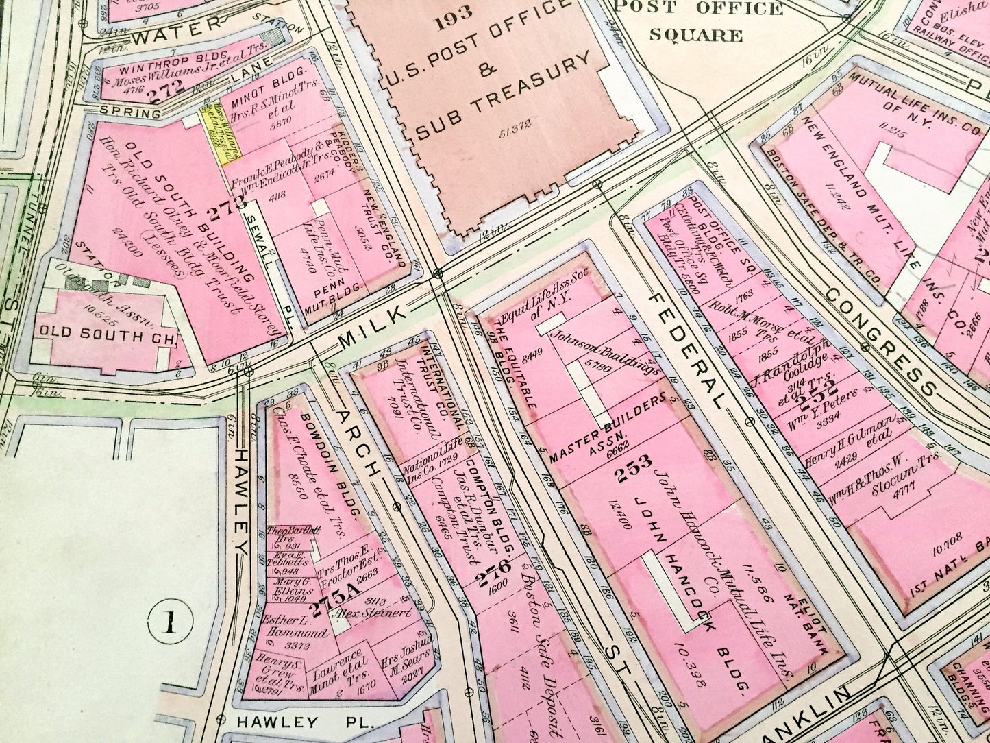
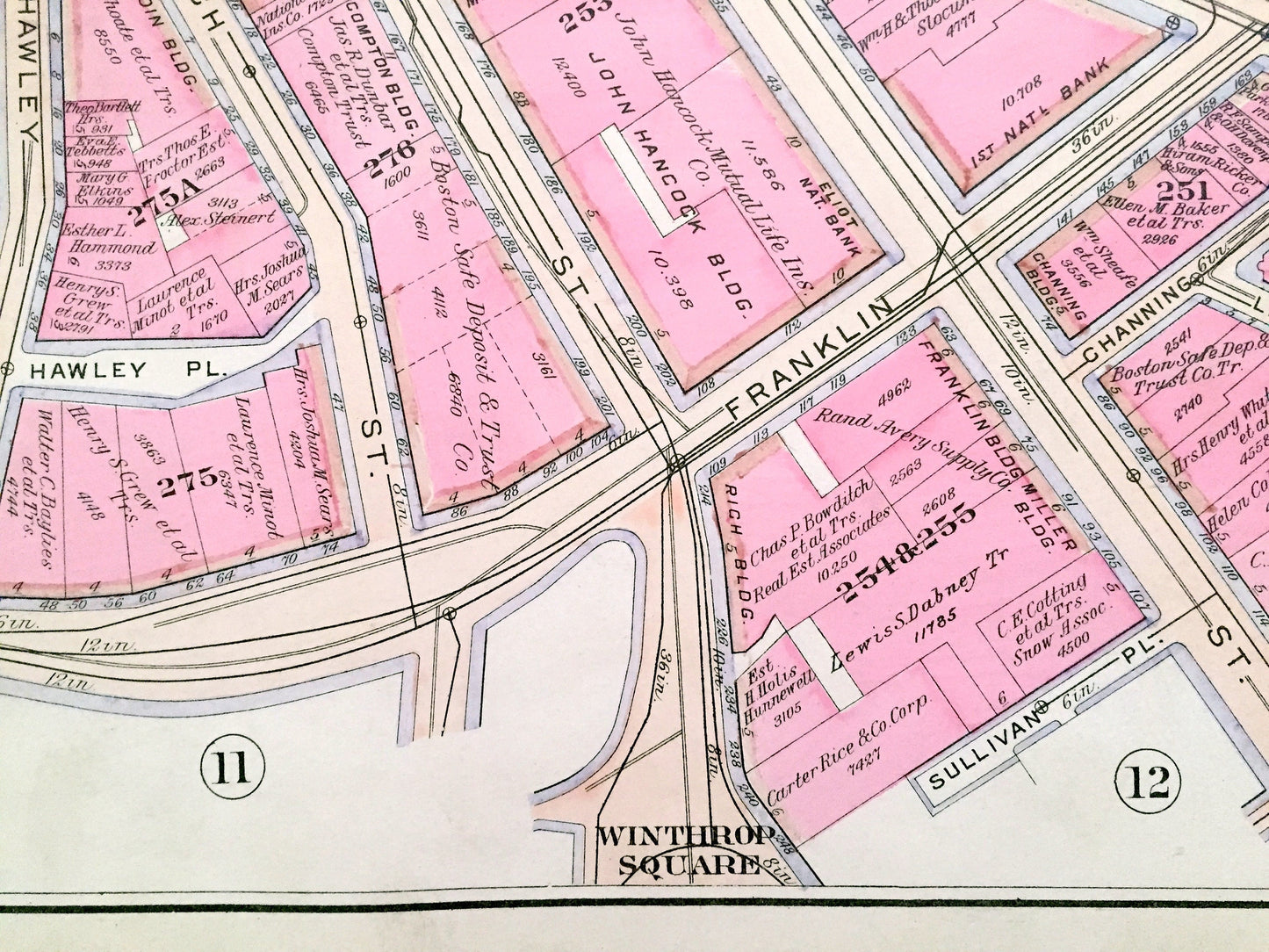
Antique 1908 Boston, Massachusetts Map from G.W. Bromley Atlas – Downtown, Waterfront, Financial District, Post Office, Fort Hill Square, MA
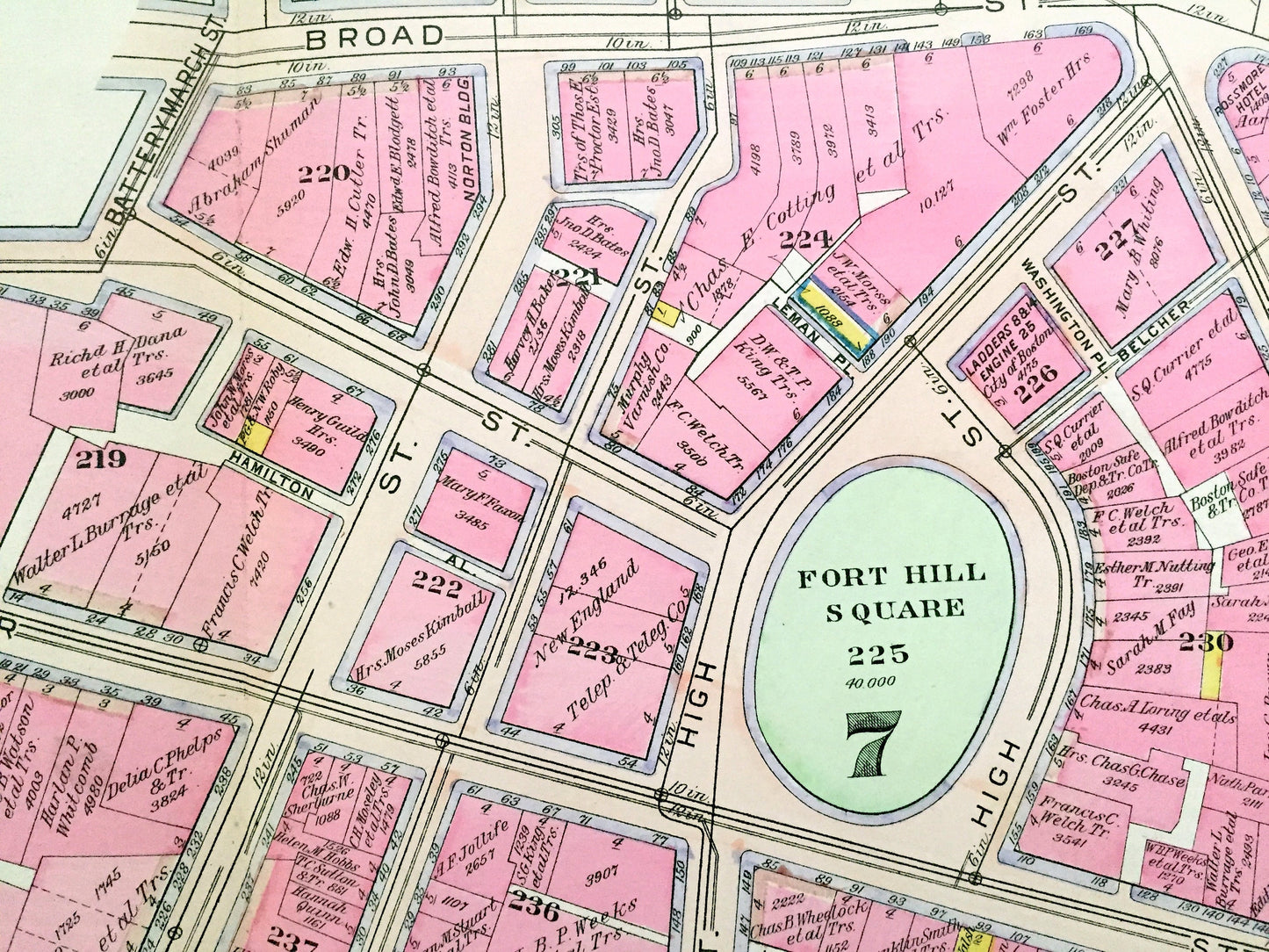
Antique 1908 Boston, Massachusetts Map from G.W. Bromley Atlas – Downtown, Waterfront, Financial District, Post Office, Fort Hill Square, MA
Beautiful, antique map of the Downtown, Waterfront & Financial District Neighborhoods of Boston, Massachusetts. This is an authentic map (Plate #10) taken from G.W. Bromley's "Atlas of the City of Boston, Boston Proper and Back Bay" published in 1908 and is NOT a computer reproduction.
See what Boston looked like more than 110 years ago. Lots of charming, intricate details and contours, including main streets, rivers, gardens, squares, houses and the names of property owners at the time. Hand colored. Verso is blank. Map is backed on sturdy canvas.
Perfect for the historian, map-lover, the curious or just as a conversation starter. Wonderful and rare. Vintage maps such as these make great gifts.
Edition of 1908, printed 1908
Dimensions: 32" width x 22 1/4" height
----
Cities, Neighborhoods & Points of Interest: Boston, Post Office Square, Fort Hill Square, Winthrop Square, Liberty Square, Rose Fitzgerald Kennedy Greenway, Milk Street, Franklin Street, Atlantic Avenue, and many other streets, houses, churches, schools, wharves and land property owners' names.
Condition: Good Vintage condition, commensurate with age. This map is in great shape for being over 110 years old. Some edge-wear, dust and toning, as well as the old atlas leather tab in upper left corner, all of which will add to vintage character when framed.
(Picture of atlas front page is for reference and not included.)
----
We will happily adjust shipping price for multiple purchases. Maps are rolled up and shipped in sturdy mailing tubes, never folded.
Couldn't load pickup availability
Share