My Store
Antique 1908 North End, Boston, Massachusetts Map from G.W. Bromley Atlas – West End, Boston Garden, Bullfinch Triangle, Charles River, MA
Antique 1908 North End, Boston, Massachusetts Map from G.W. Bromley Atlas – West End, Boston Garden, Bullfinch Triangle, Charles River, MA
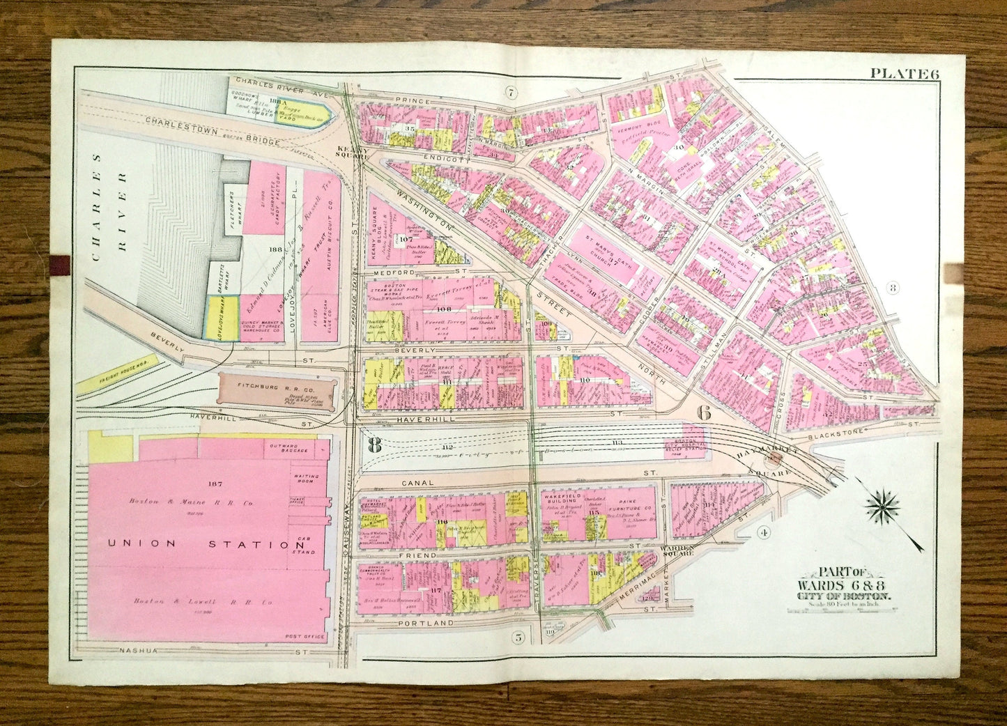
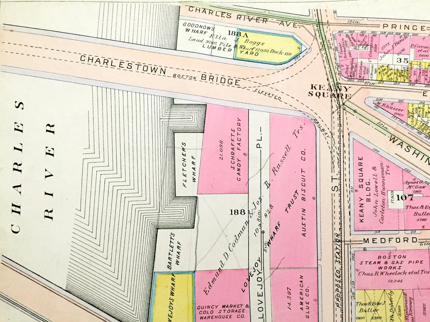
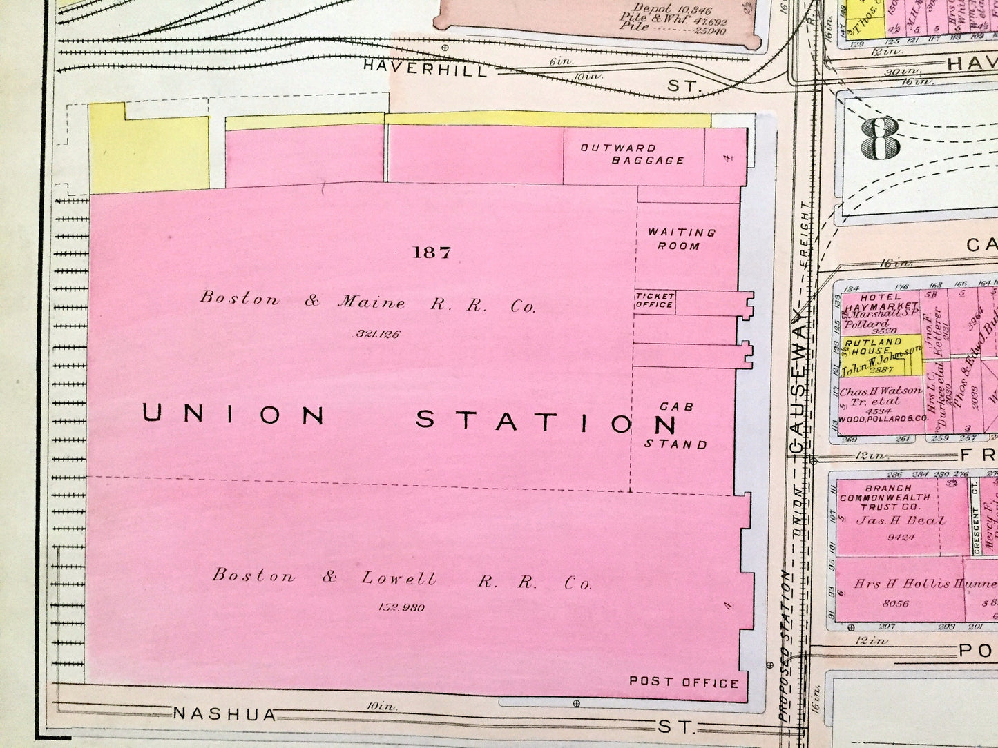
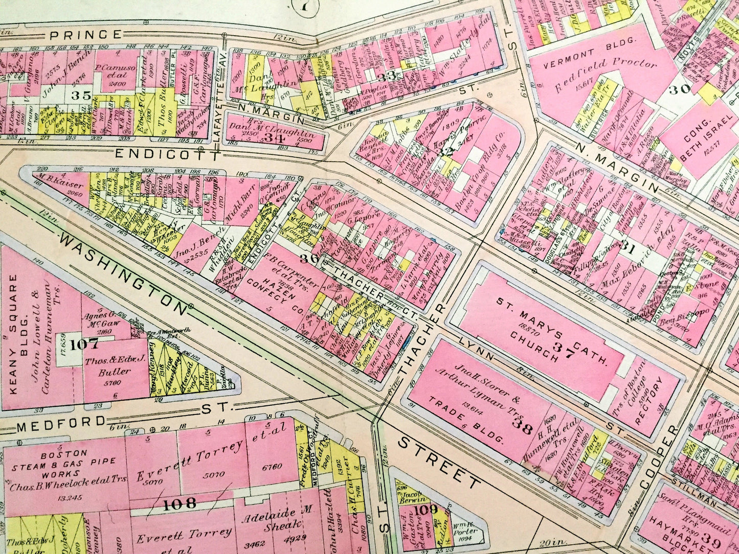
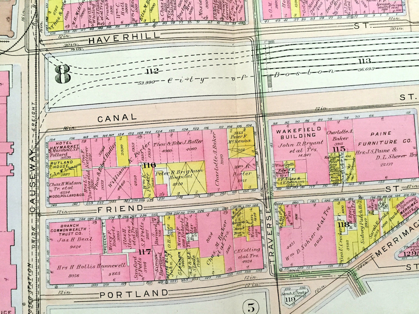
Beautiful, antique map of the North End, West End and Bullfinch Triangle Historic District Neighborhoods of Boston, Massachusetts, including the future site of North Station and Boston Garden. This is an authentic map (Plate #6) taken from G.W. Bromley's "Atlas of the City of Boston, Boston Proper and Back Bay" published in 1908 and is NOT a computer reproduction.
See what Boston looked like more than 110 years ago. Lots of charming, intricate details and contours, including main streets, rivers, gardens, squares, houses and the names of property owners at the time. Hand colored. Verso is blank. Map is backed by thick, sturdy canvas.
Perfect for the historian, map-lover, the curious or just as a conversation starter. Wonderful and rare. Vintage maps such as these make great gifts.
Edition of 1908, printed 1908
Dimensions: 32" width x 22 1/4" height
----
Cities, Neighborhoods & Points of Interest: Boston, Charles River, North End, West End, Haymarket Square, Keany Square, Warren Square, Union Station, North Station, Charles River Bridge and many other streets, houses, churches, schools, wharves and land property owners' names.
Condition: Good Vintage condition, commensurate with age. This map is in great shape for being over 110 years old. Some edge-wear, dust and toning, as well as the old atlas leather tab on margin, but this will all add to vintage character when framed.
(Picture of atlas front page is for reference and not included.)
----
We will happily adjust shipping price for multiple purchases. Maps are rolled up and shipped in sturdy mailing tubes, never folded.
Couldn't load pickup availability
Share