My Store
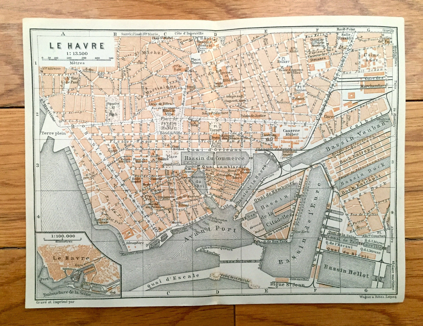
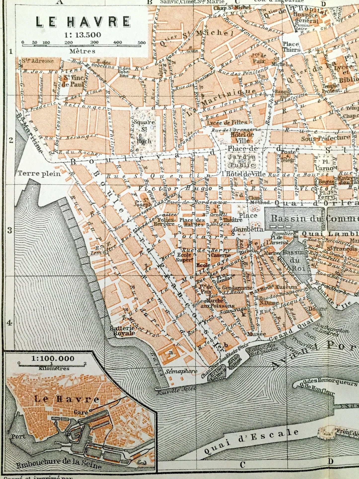
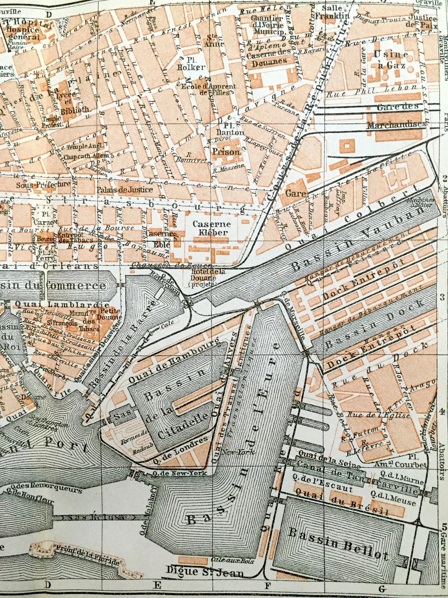
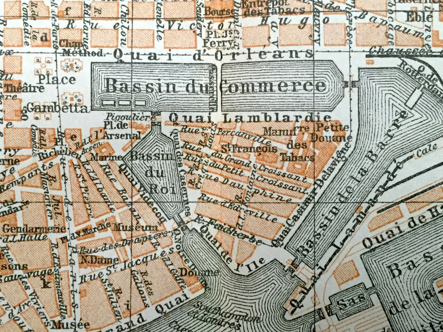
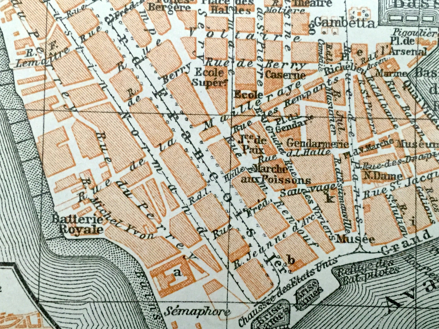
Antique 1909 Le Havre, France Map from Baedekers Guide Atlas – Seine River, Normady, English Channel, Port, Bassin, Boulevard de Strasbourg
Antique 1909 Le Havre, France Map from Baedekers Guide Atlas – Seine River, Normady, English Channel, Port, Bassin, Boulevard de Strasbourg
Beautiful, antique map of Le Havre, France. This is an authentic print from "Baedeker's Handbook for Travelers: Northern France, from Belgium and the English Channel to the Loire," published in 1909 and NOT a computer reproduction.
See what Le Havre looked like over 110 years ago. Lots of charming, intricate details and geological contours, including roads, rivers, mountains, train stations, gardens, towers, churches and other landmarks and points of interest. Verso is blank.
Perfect for the historian, map-lover, the curious or just as a conversation starter. Wonderful and rare. Vintage maps such as these make great gifts.
Edition of 1909, printed 1909
Dimensions: 8 1/8" width x 6 1/8" height
----
Condition: Very Good condition, commensurate with age. This map is in incredible shape for being over 100 years old. Some light wear but this will read as vintage character when framed.
(Picture of atlas and front matter is shown for information purposes and not included.)
----
We will happily adjust shipping price for multiple purchases. Maps are rolled up and shipped in sturdy mailing tubes, never folded.
Couldn't load pickup availability
Share