My Store
Antique 1915 Elizabeth & Galena, Illinois Rock Formation Photographs – US Geological Survey Topographic Map – Fossils, Joe Daviess County IL
Antique 1915 Elizabeth & Galena, Illinois Rock Formation Photographs – US Geological Survey Topographic Map – Fossils, Joe Daviess County IL
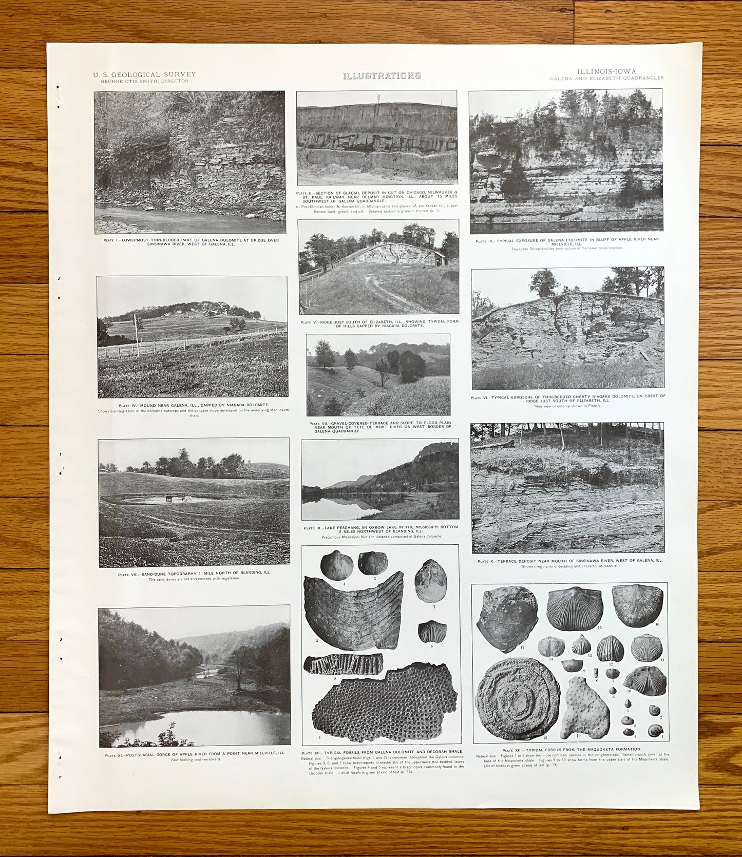
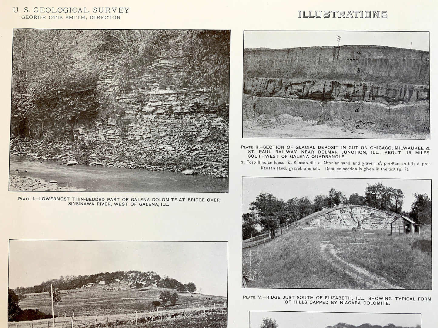
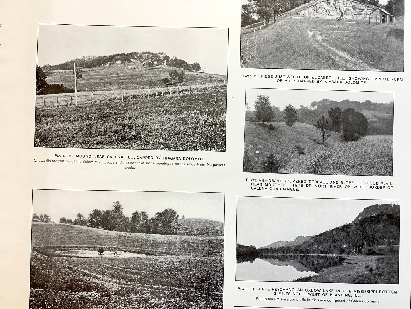
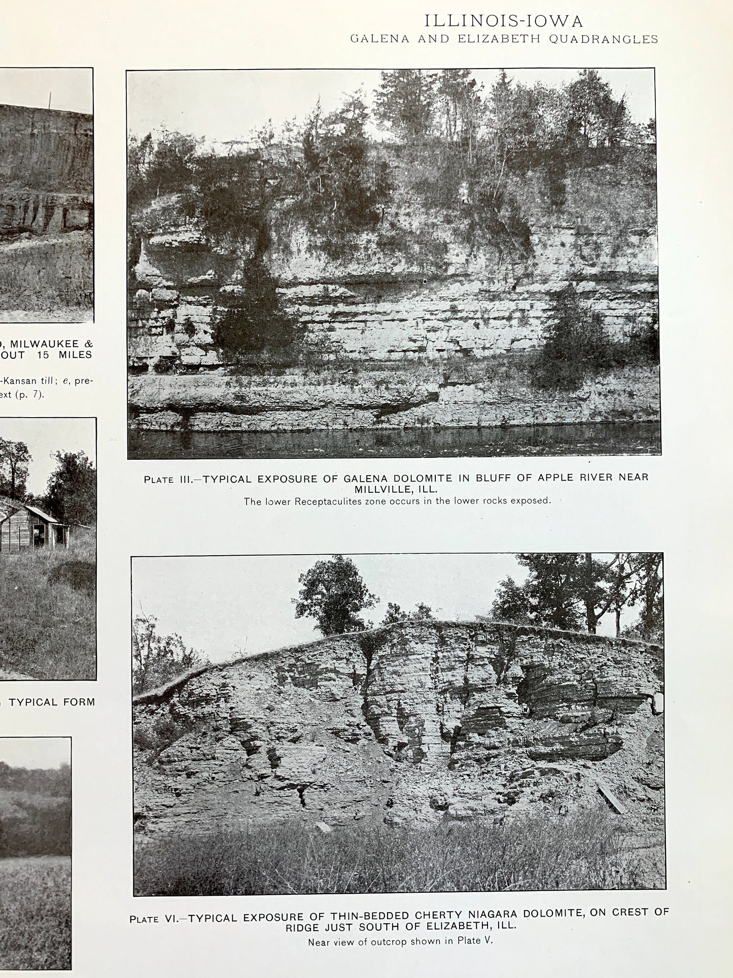
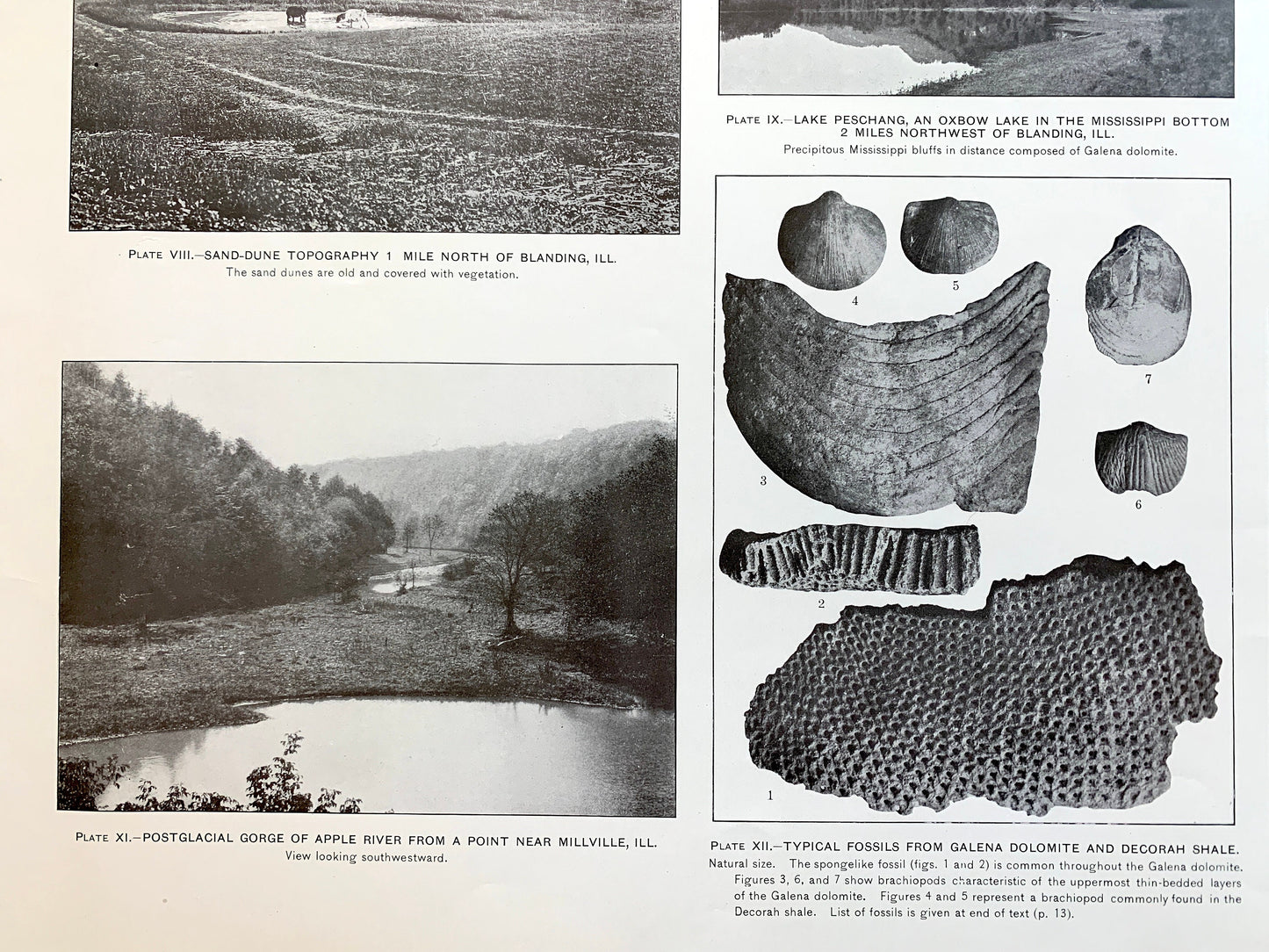
Beautiful, antique plate of photographs of various rock formations of the Elizabeth, Galena, Stockton, Apple River, Scales Mound, Illinois and surrounding area. This is an authentic 1915 edition, 1915 print from the U.S. Geological Survey and NOT a computer reproduction. It is from a Geologic Atlas folio.
See what Joe Daviess County, Illinois looked like more than a century ago. Perfect for the historian, rock-lover, the curious or just as a conversation starter. Very rare. Vintage prints such as these make great gifts.
Edition of 1915, printed 1915
Dimensions: 18 1/2" width x 22 1/2" height
----
Features
Cities & Towns: Scales Mound, Apple River, Warren, Guilford, Thompson, Rush, Elizabeth, Woodbine, Stockton, Hanover, Derinda, Pleasant Valley, Laws Siding, Schapville, Millville, Elmoville.
Points of Interest: Joe Daviess County, Apple River, Mill Creek, Lawhorn Creek, Mt Sumner, Apple River Canyon State Park, Wolf Creek, Squirrel Grove Mound, Wenzel Mound, Pea Ridge, Welsh Hollow, Terrapin Ridge, Chicago Great Western Railroad, and lots more hills, creeks, towns, schools, churches, roads and train tracks.
Condition: Very Good Vintage condition, commensurate with age. This map is in incredible shape for being over 100 years old. Has some edge-wear and staple holes in the margin, but this will add to the real vintage character when framed.
----
We will happily adjust shipping price for multiple purchases. Prints are rolled up and shipped in sturdy mailing tubes, never folded.
Couldn't load pickup availability
Share