My Store
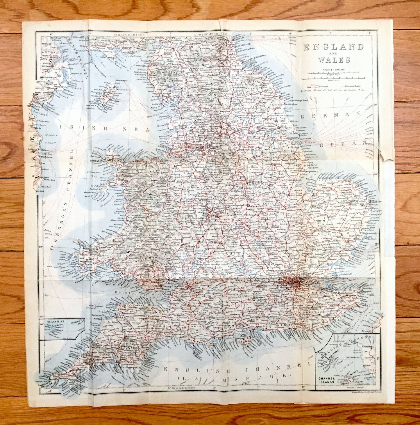
Antique 1927 England & Wales Map from Baedekers Atlas of Great Britain – Ireland, London, Brighton, Dover, Manchester, Leeds, Birmingham, UK
Antique 1927 England & Wales Map from Baedekers Atlas of Great Britain – Ireland, London, Brighton, Dover, Manchester, Leeds, Birmingham, UK
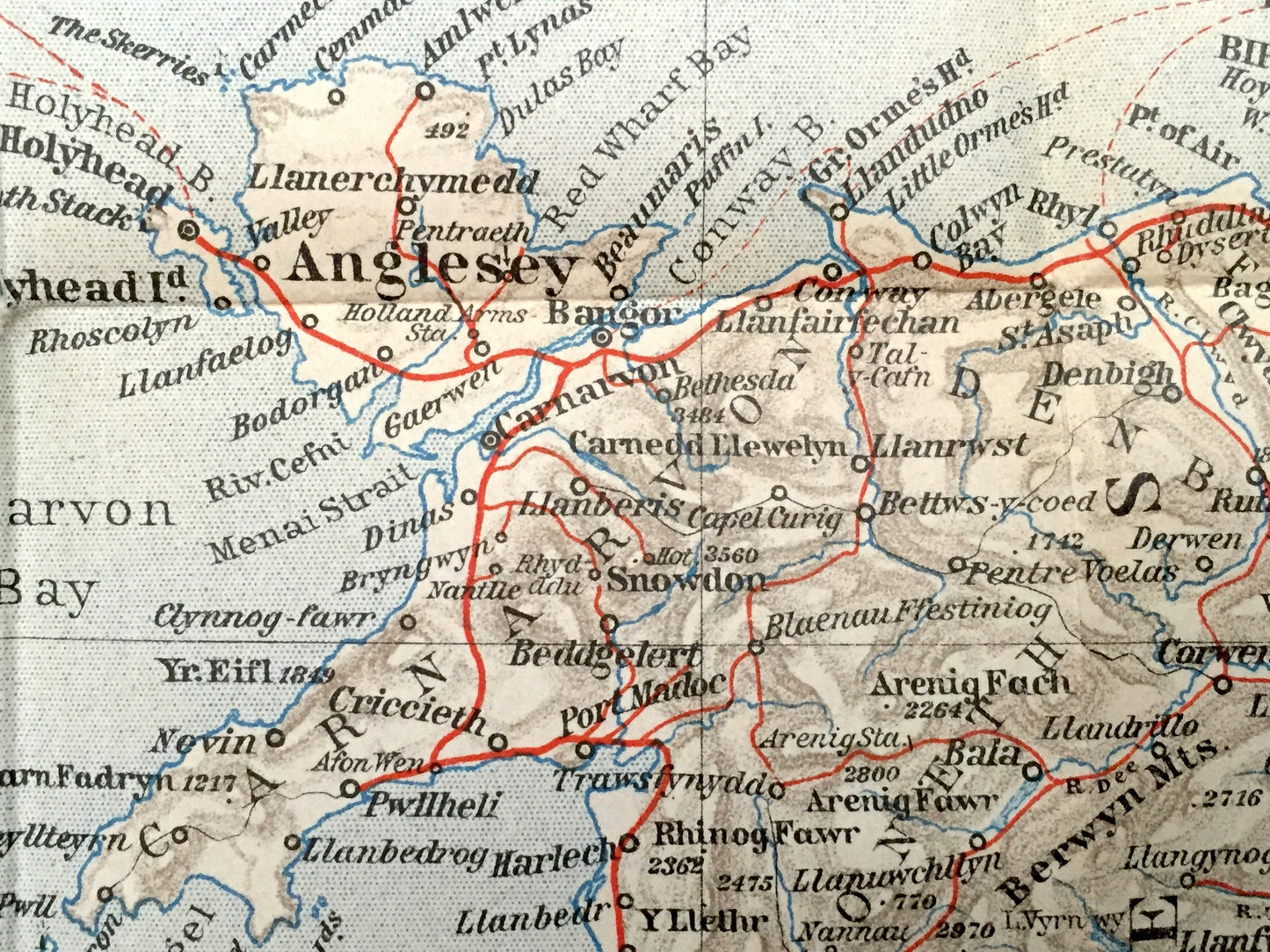
Beautiful, antique map of England & Wales of Great Britain, including parts of Ireland and insets of the Scilly Isles and Channel Islands. This is an authentic print from "Baedeker's Great Britain Handbook for Travelers," published in 1927 and NOT a computer reproduction.
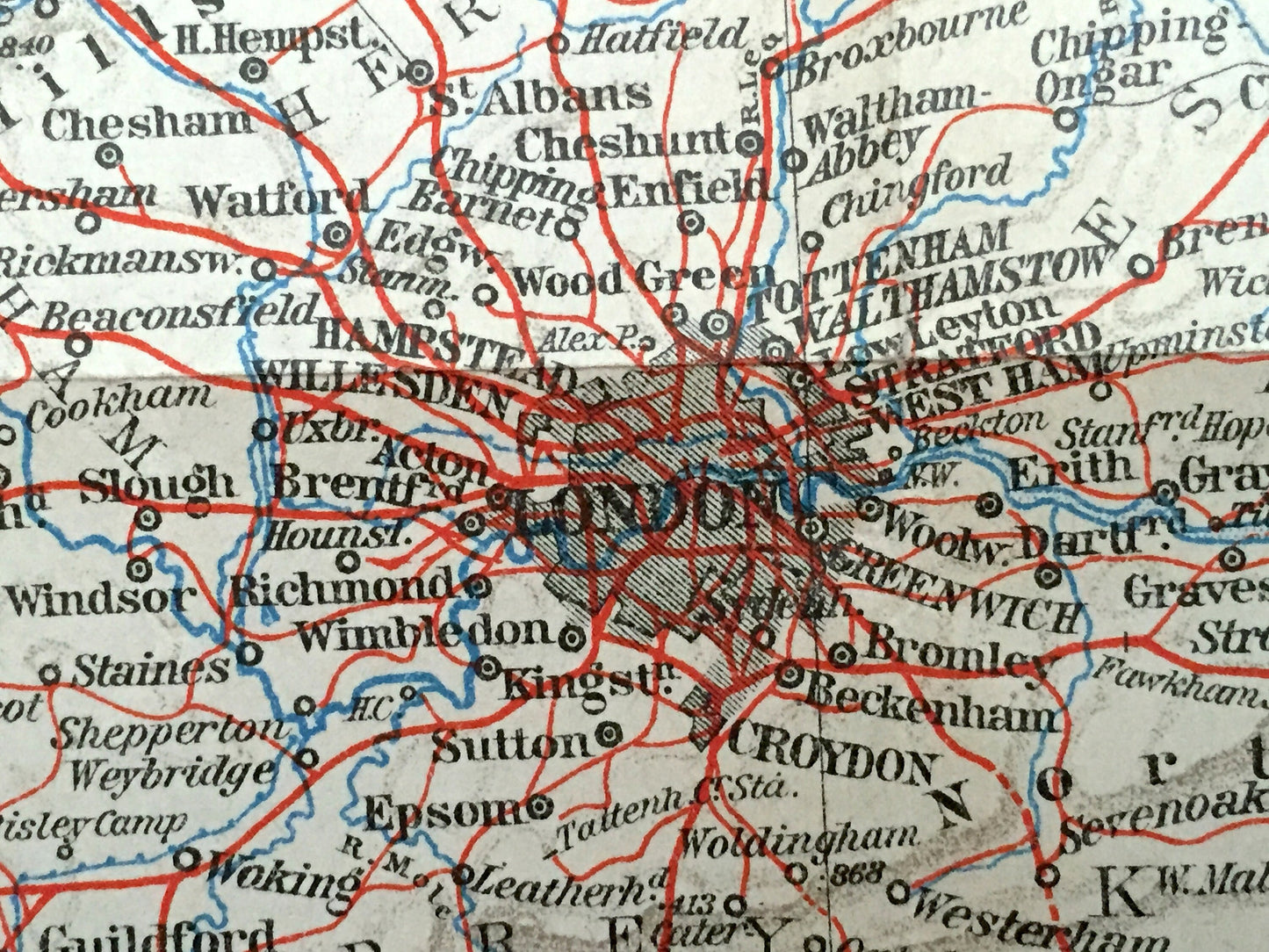
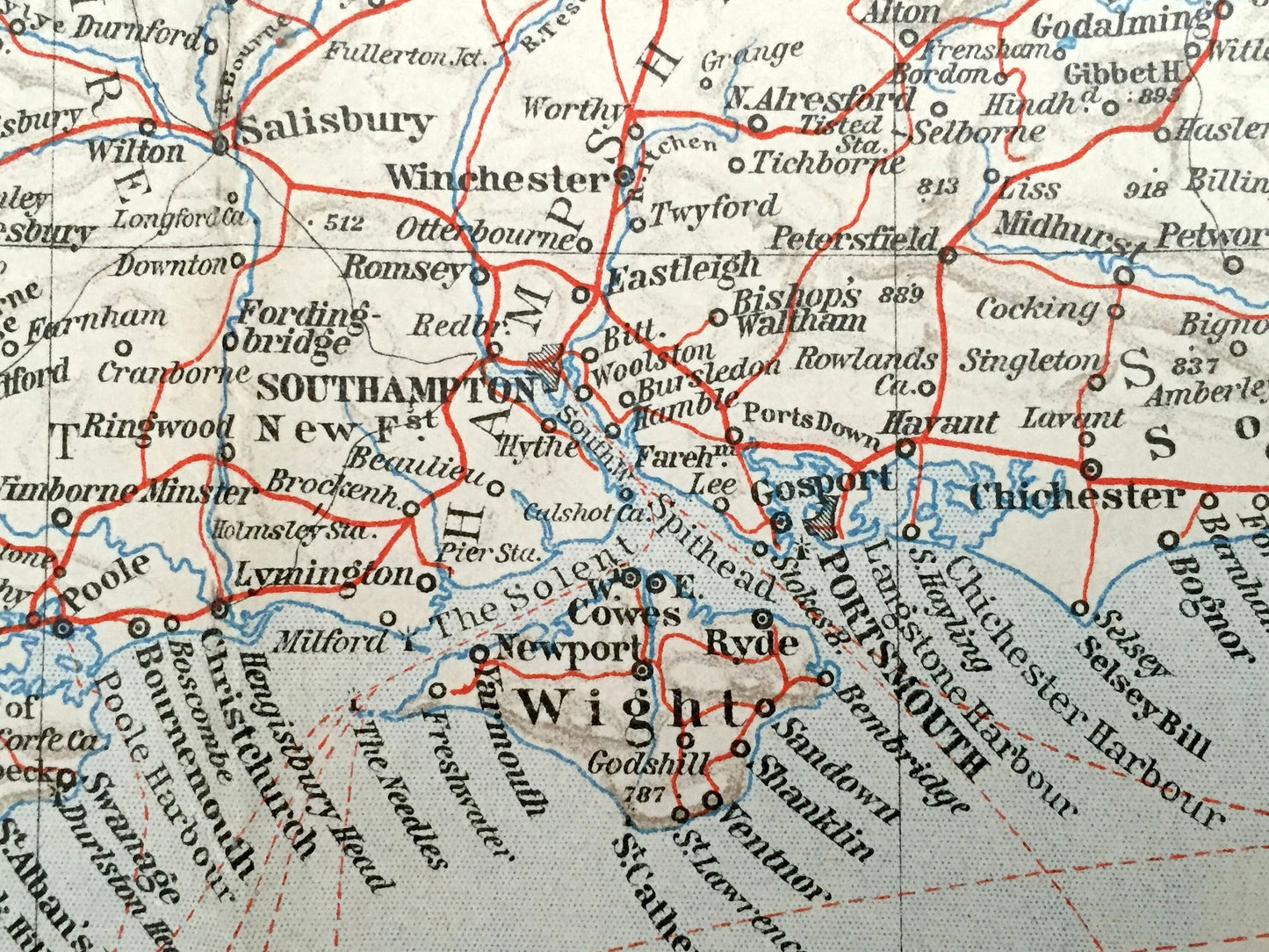
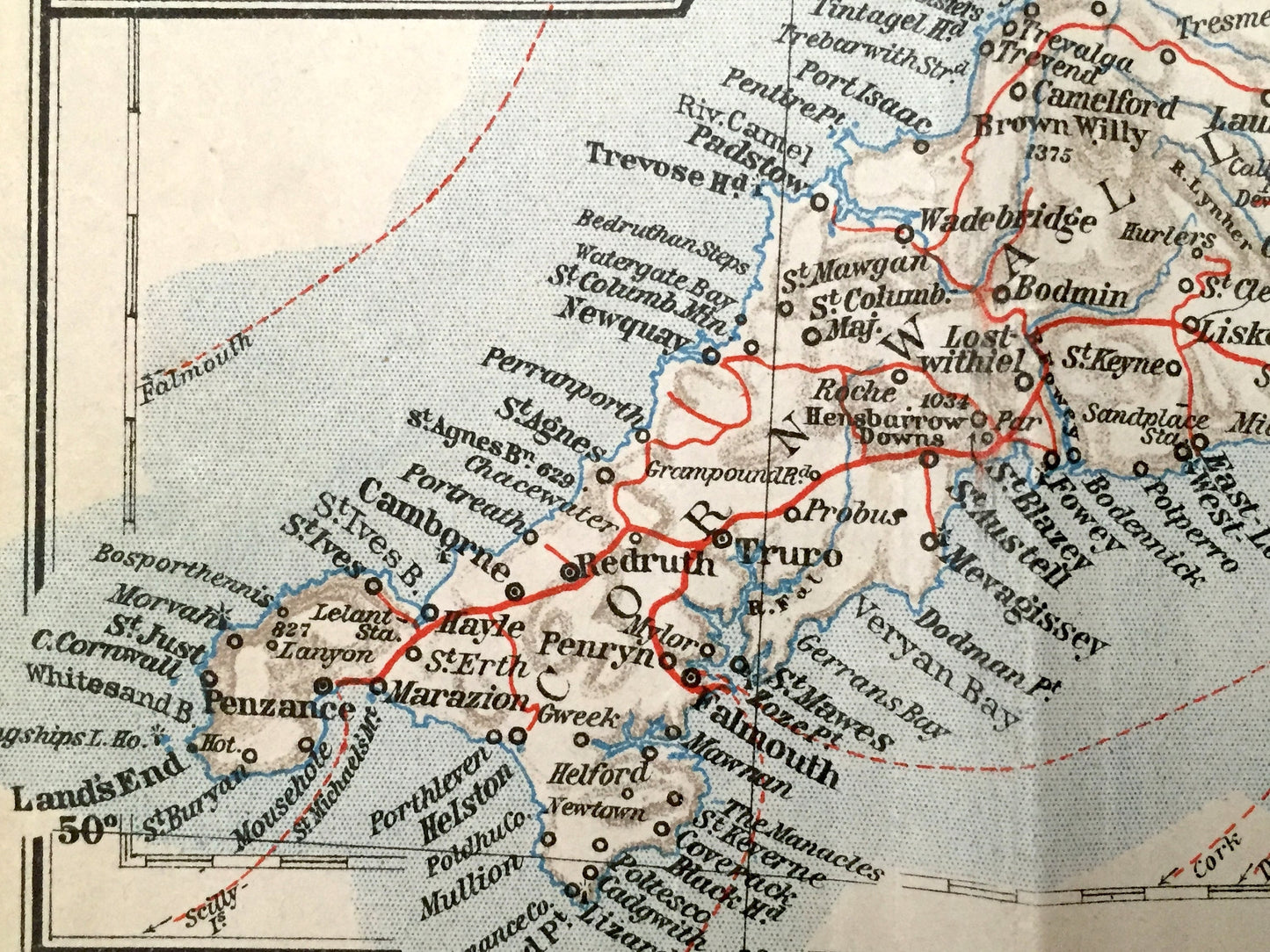
See what England & Wales looked like over 90 years ago. Lots of charming, intricate details and geological contours, including main roads, rivers, mountains, islands, channels and other landmarks and points of interest. Verso is blank.
Perfect for the historian, map-lover, the curious or just as a conversation starter. Wonderful and rare. Vintage maps such as these make great gifts.
Edition of 1927, printed 1927
Dimensions: 15 1/2" width x 16" height
----
Condition: Very Good condition, commensurate with age. This map is in incredible shape for being over 90 years old. Some wear and folds as issued, but this will flatten easily and read as vintage character when framed. Map has a extra piece of paper in top right corner where it was attached to the atlas. Placing similar-colored paper behind the map while framing, as seen in the photos, extends the margin to that width.
Cover and frontspiece photos are for informational purposes only and not included.
----
We will happily adjust shipping price for multiple purchases. Maps are rolled up and shipped in sturdy mailing tubes, never folded.
Couldn't load pickup availability
Share