My Store
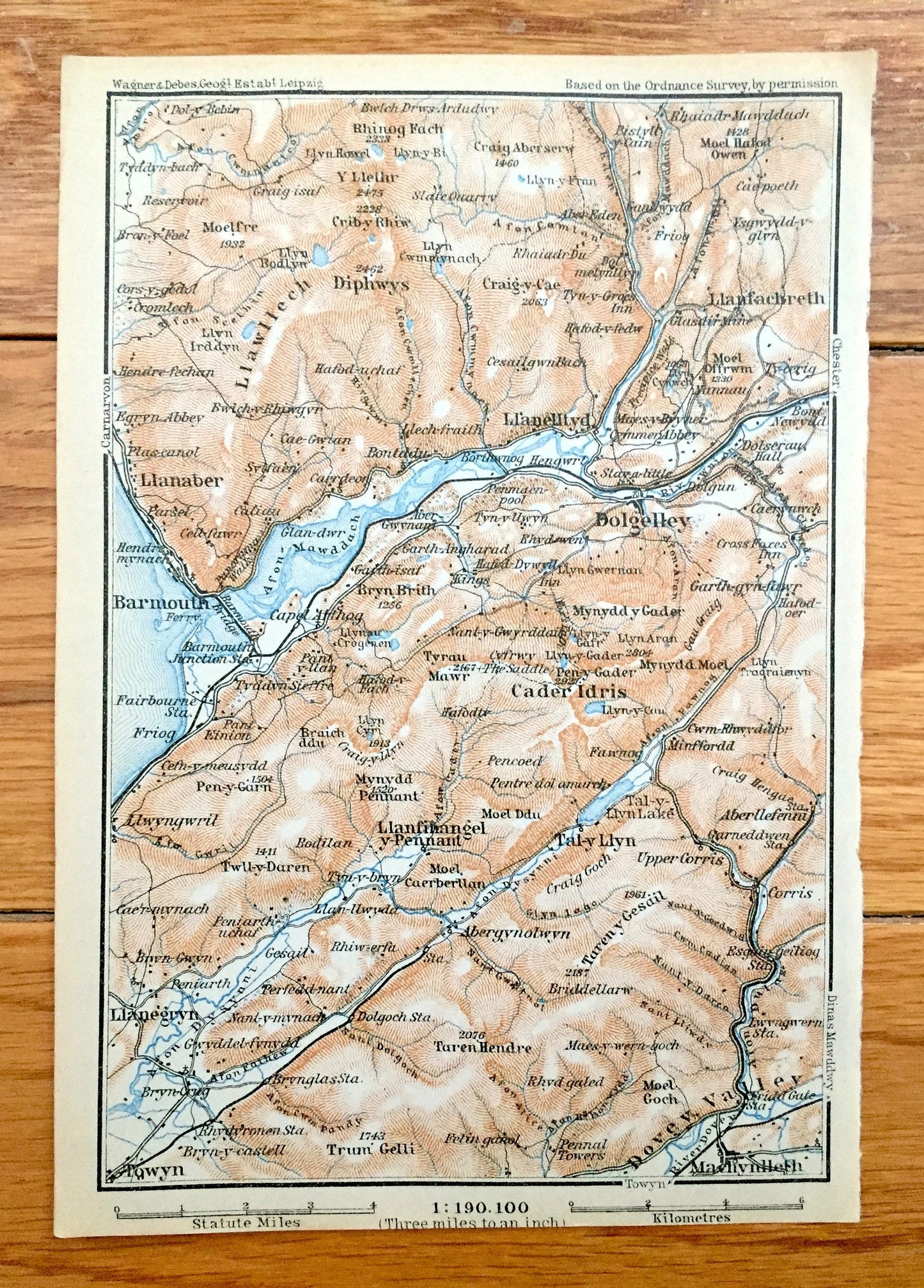
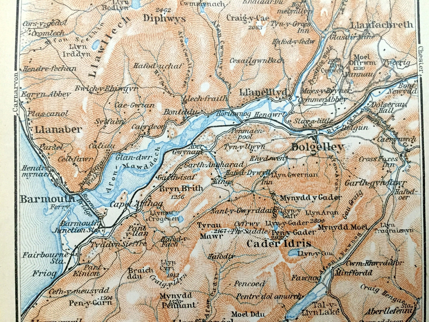
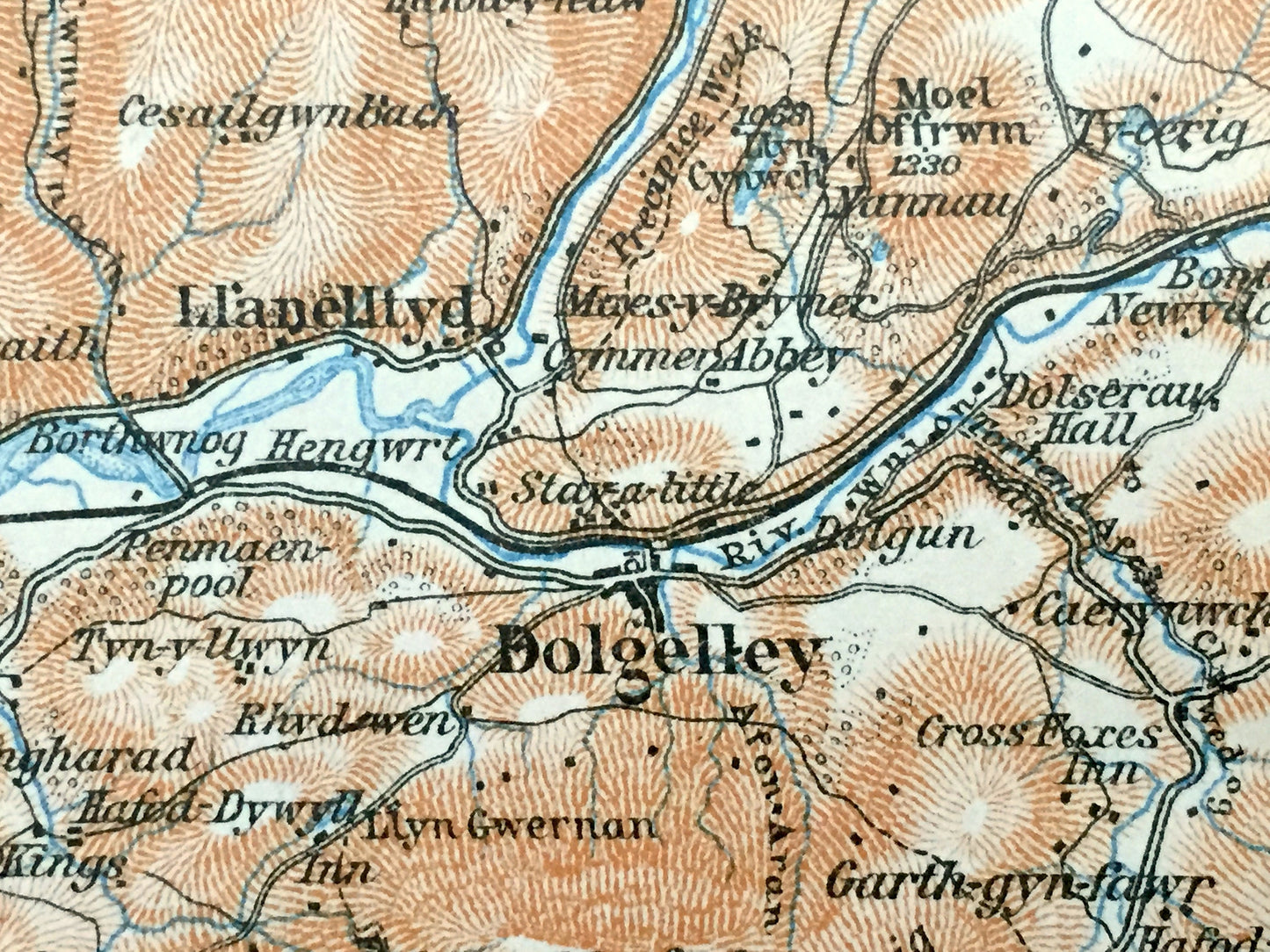
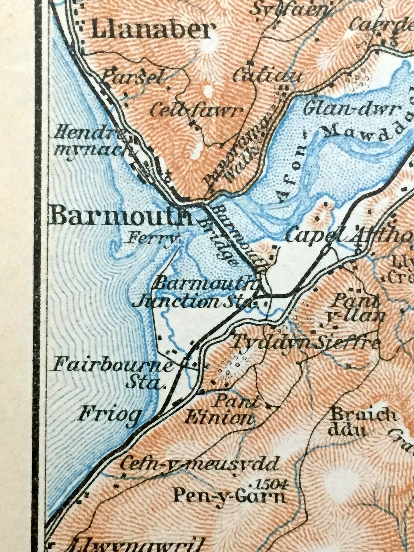
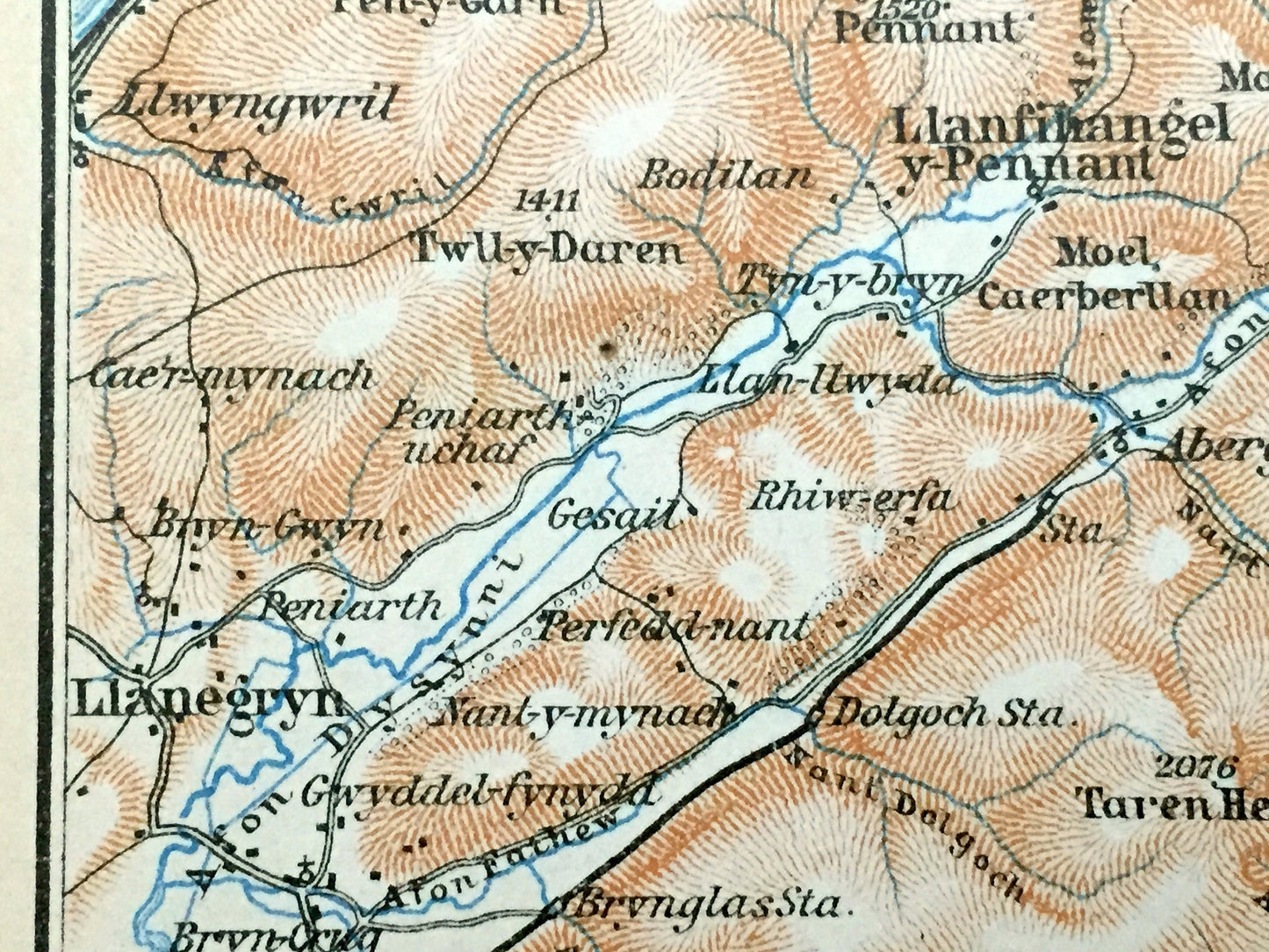
Antique 1927 Gwynedd, Wales Map from Baedekers Atlas of Great Britain – River Mawddach, Barmouth, Dolgelley, Llwyngwril Llanaber Cader Idris
Antique 1927 Gwynedd, Wales Map from Baedekers Atlas of Great Britain – River Mawddach, Barmouth, Dolgelley, Llwyngwril Llanaber Cader Idris
Beautiful, antique map of the River Mawddach Estuary, Wales. This is an authentic print from "Baedeker's Great Britain Handbook for Travelers," published in 1927 and NOT a computer reproduction.
See what Wales looked like almost 100 years ago. Lots of charming, intricate details and geological contours, including streets, parks, bridges, rivers, churches, castles and other landmarks and points of interest. Verso is an architectural rendering of Winchester Cathedral.
Perfect for the historian, map-lover, the curious or just as a conversation starter. Wonderful and rare. Vintage maps such as these make great gifts.
Edition of 1927, printed 1927
Dimensions: 4 1/4" width x 6 1/4" height
----
Condition: Very Good Vintage condition, commensurate with age. This map is in great shape for being over 95 years old. Has light edge-wear but this will add to vintage character when framed.
Cover and frontspiece photos are for informational purposes only and not included.
----
We will happily adjust shipping price for multiple purchases. Maps are rolled up and shipped in sturdy mailing tubes, never folded.
Couldn't load pickup availability
Share