My Store
Antique 1932 New York State Pictorial Map by Everand A. McAvoy – Manhattan, Adirondacks, Catskills, Finger Lakes, Long Island, West Point NY
Antique 1932 New York State Pictorial Map by Everand A. McAvoy – Manhattan, Adirondacks, Catskills, Finger Lakes, Long Island, West Point NY
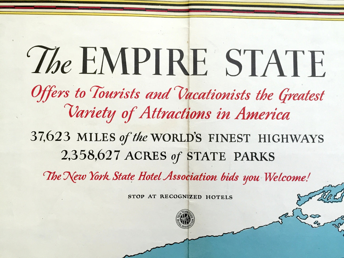
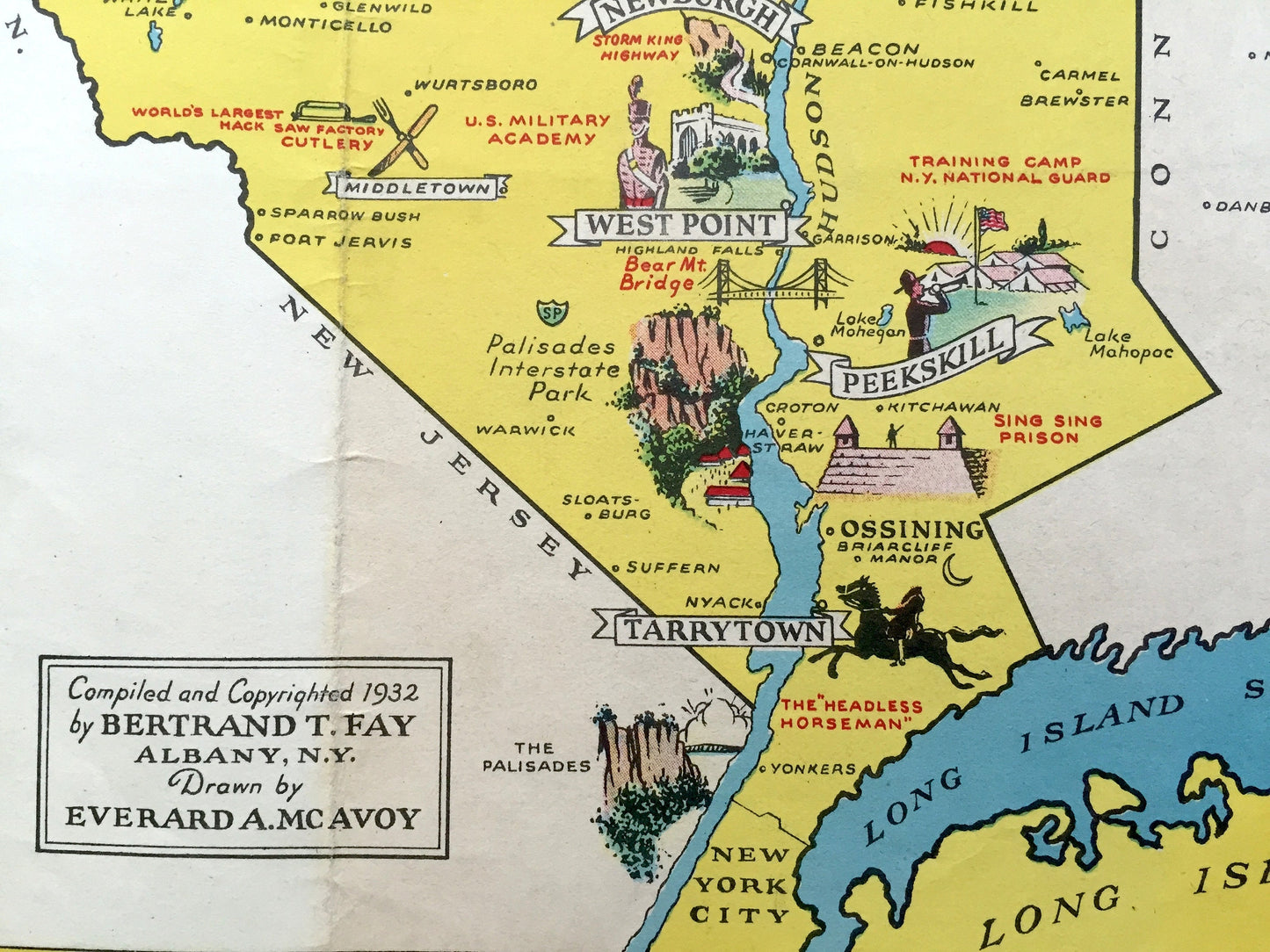
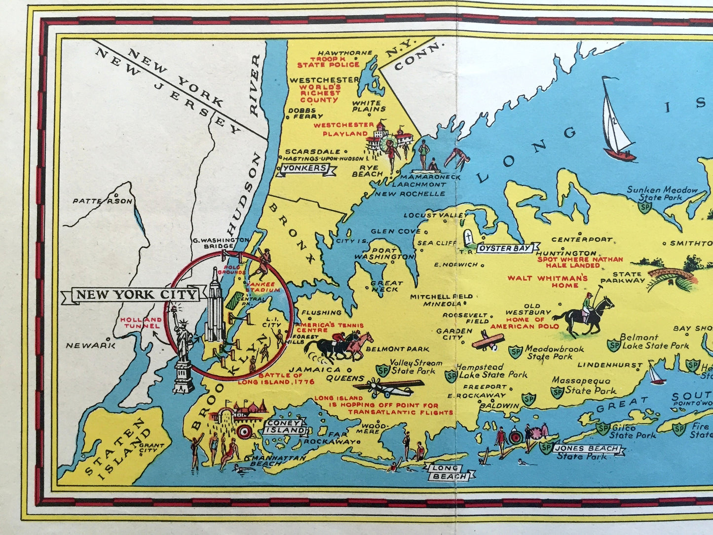
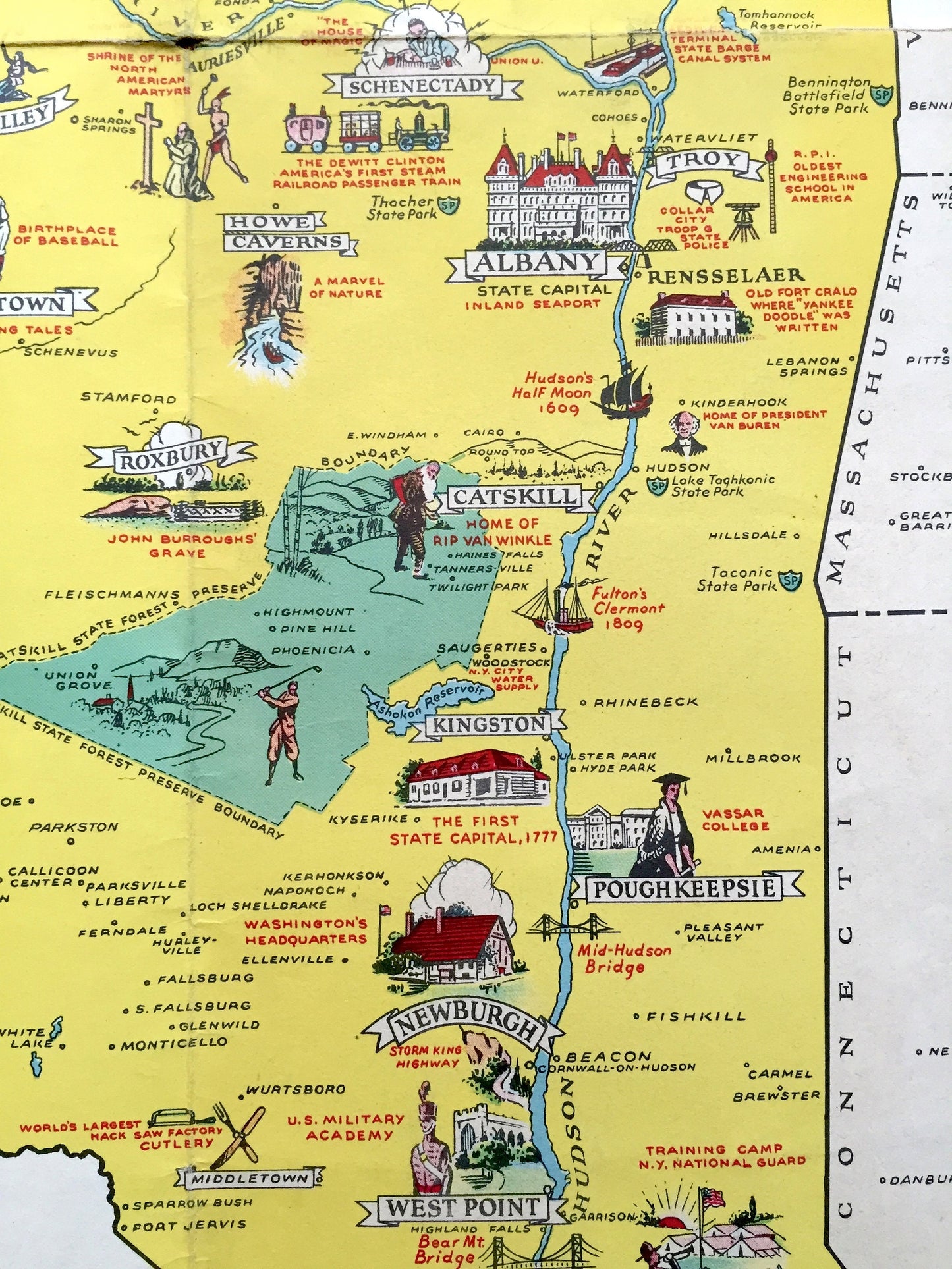
Beautiful, antique pictorial map of New York State from the New York State Hotel Association, published in 1932. Compiled by Bertrand T. Fay; Drawn by Everand A. McAvoy. This is an authentic, original lithograph and is NOT a computer reproduction.
See how New York looked over 90 years ago as illustrated by renowned artist Everand A. McAvoy. Lots of charming, intricate illustrations and details, decorative border and geological contours, including industries of the state, mountains, islands, canals and rivers. With an inset of New York City and Long Island. Reverse side is a tourist guide and history of the Empire State.
Perfect for the historian, map-lover, the curious or just as a conversation starter. Wonderful and rare. Vintage maps such as these make great gifts.
Edition of 1932, printed 1932
Dimensions: 27" width x 22 1/2" height
----
Condition: Good Vintage condition, commensurate with age. This map is in great shape for being over 90 years old. Some edge-wear, scuffing, toning, old tape application in corners, separations at both sides of middle fold, and folds as-issued, but these will flatten easily and all will read as vintage character when framed.
(Atlas cover and front matter shown for informational purposes and not included.)
----
We will happily adjust shipping price for multiple purchases. Maps are rolled up and shipped in sturdy mailing tubes, never folded.
Couldn't load pickup availability
Share