My Store
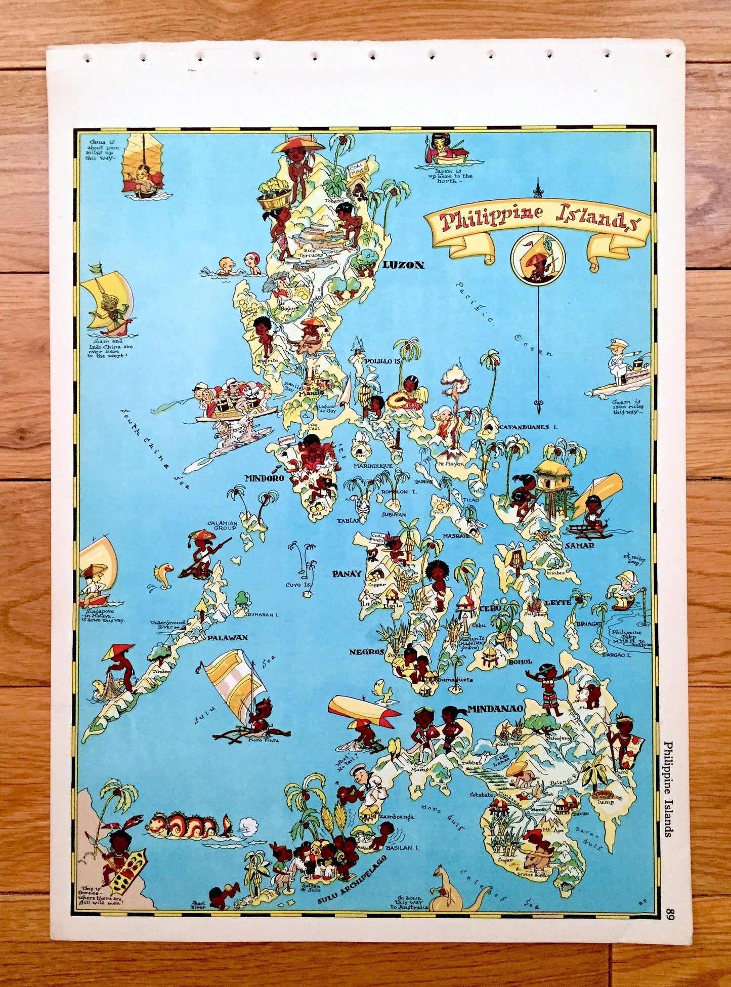
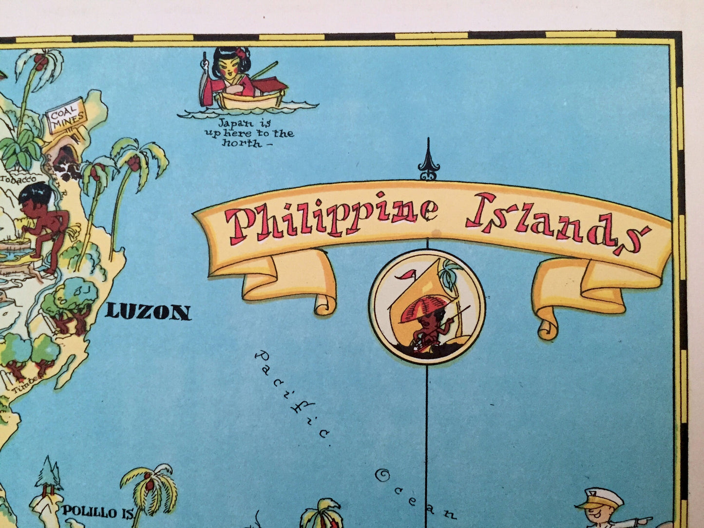
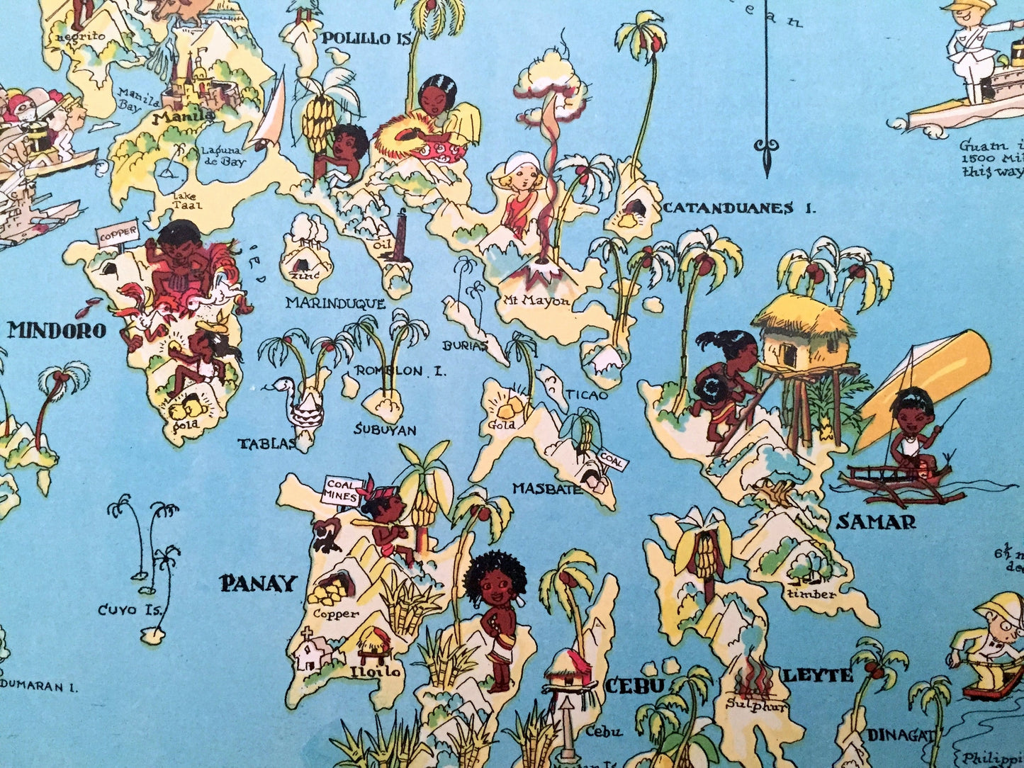
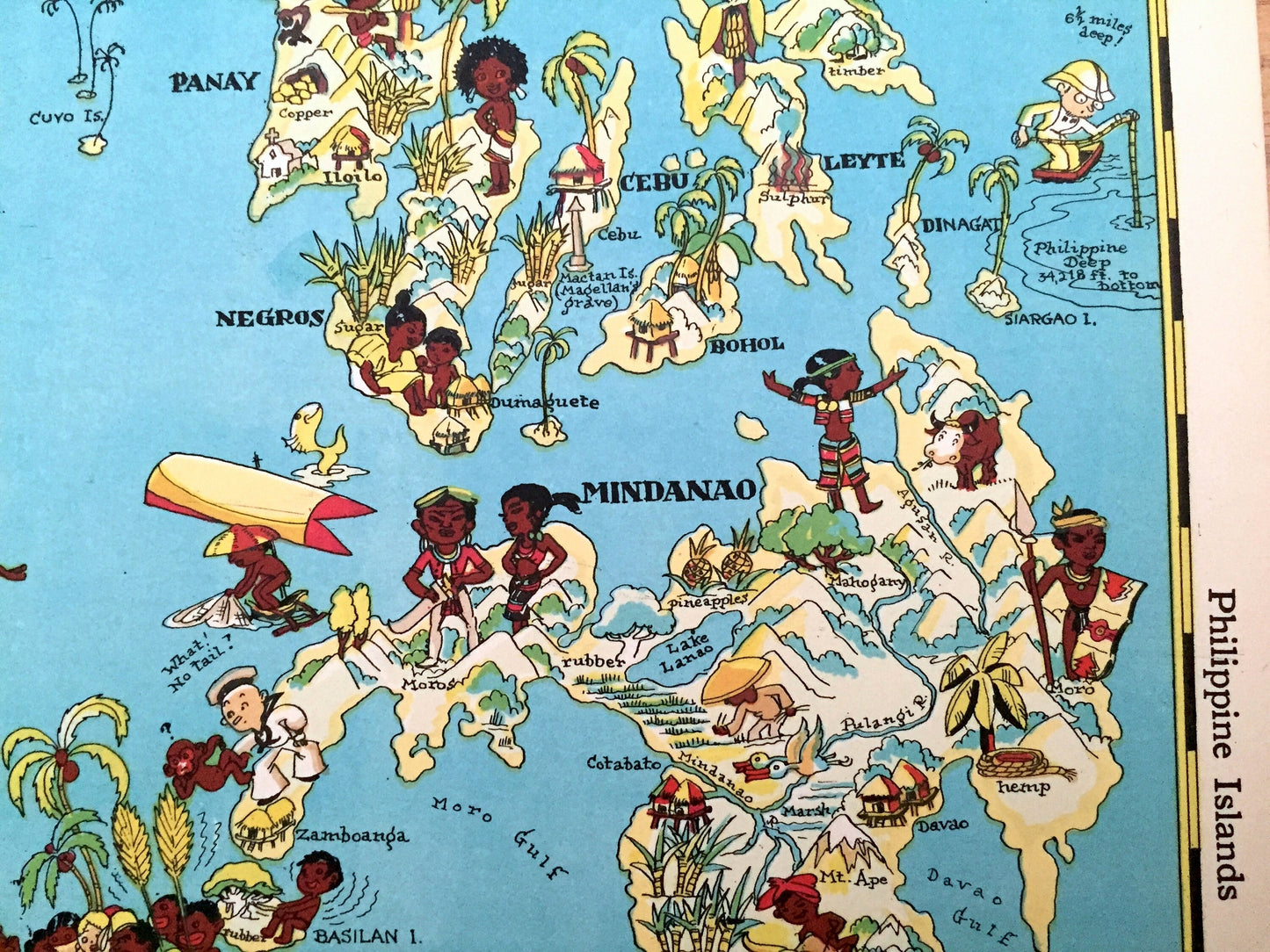
Antique 1935 Philippines Islands Map from Our Gay Geography by Ruth Taylor – Quezon City, Manila, Caloocan, Davao, Luzon, Mindanao, Mindoro
Antique 1935 Philippines Islands Map from Our Gay Geography by Ruth Taylor – Quezon City, Manila, Caloocan, Davao, Luzon, Mindanao, Mindoro
Beautiful, antique pictorial map of The Philippine Islands from "Our Gay Geography" by Frank & Ruth Taylor, published in 1935. This is an authentic print removed from the atlas and is NOT a computer reproduction.
See how the Philippines looked like 90 years ago, as illustrated by renowned artist Ruth Taylor. Lots of charming, intricate illustrations and details, decorative border and geological contours, including industries of the state, mountains, islands, canals and rivers. Verso is a history of Rhode Island.
Perfect for the historian, map-lover, the curious or just as a conversation starter. Wonderful and rare. Vintage maps such as these make great gifts.
Edition of 1935, printed 1935
Dimensions: 9/14" width x 13" height
----
Condition: Very Good Vintage condition, commensurate with age. This map is in great shape for being almost 90 years old. Light edge-wear, toning and small holes along border where map was removed from atlas, but this will all read as vintage character when framed.
(Atlas cover and front matter shown for informational purposes and not included.)
----
We will happily adjust shipping price for multiple purchases. Maps are rolled up and shipped in sturdy mailing tubes, never folded.
Couldn't load pickup availability
Share