My Store
Antique 1953 Pennsylvania Map "Heart of the Alleghenies" by Samuel A. King – Clinton, Lycoming, Centre, Union, Snyder, Mifflin County, PA
Antique 1953 Pennsylvania Map "Heart of the Alleghenies" by Samuel A. King – Clinton, Lycoming, Centre, Union, Snyder, Mifflin County, PA
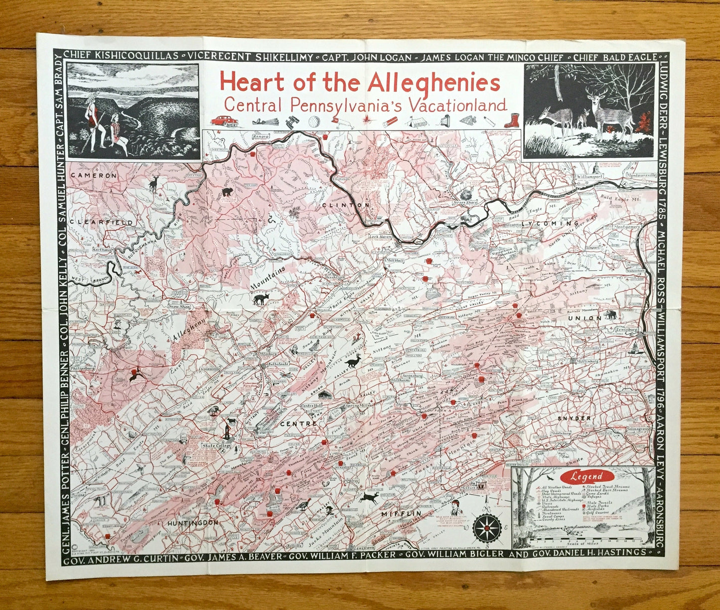
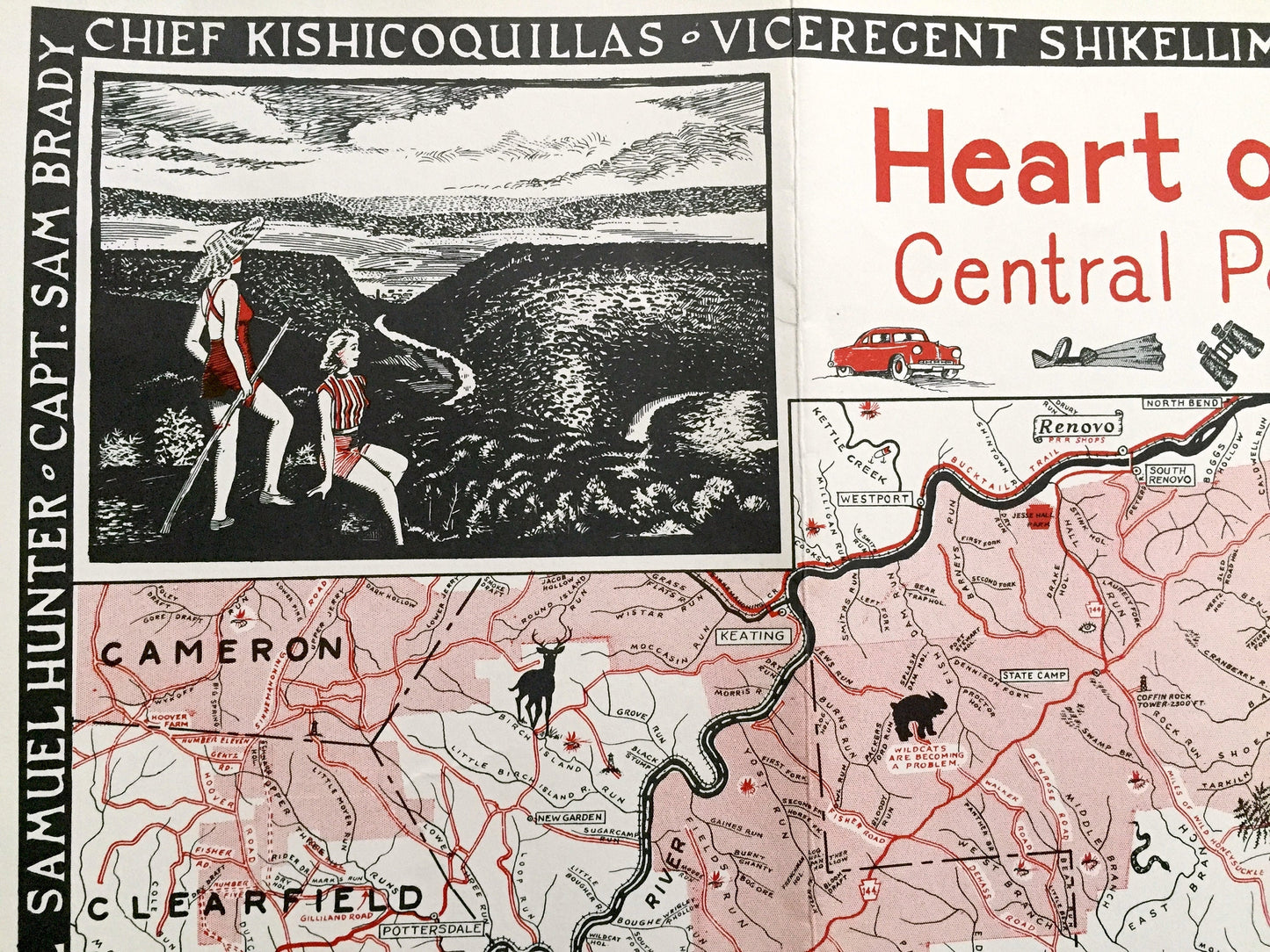
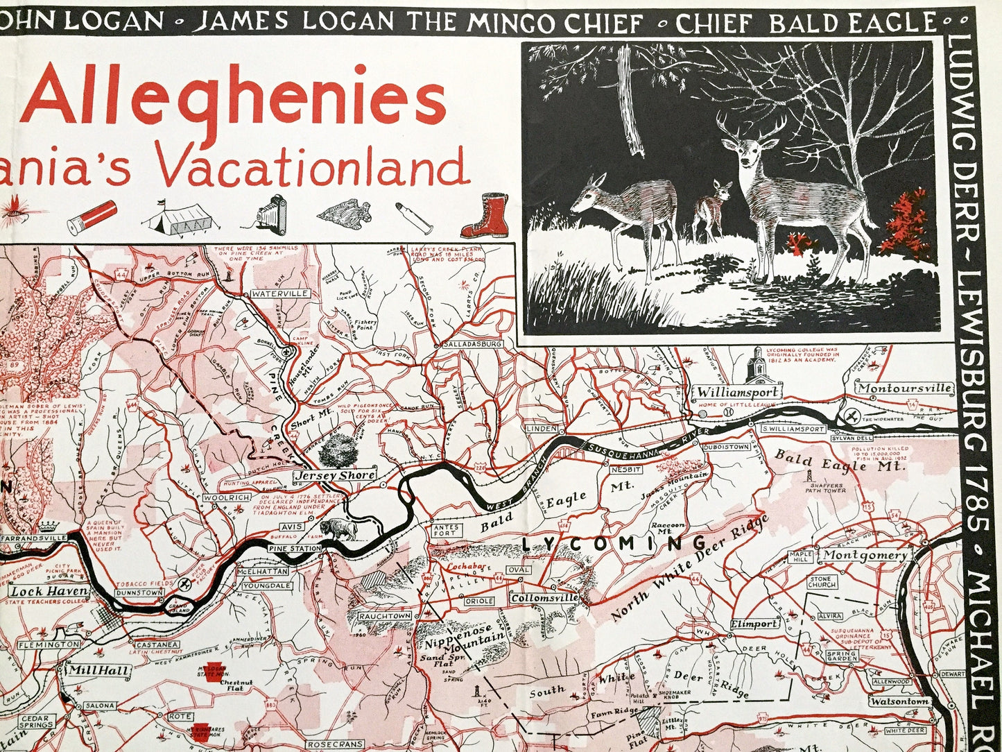
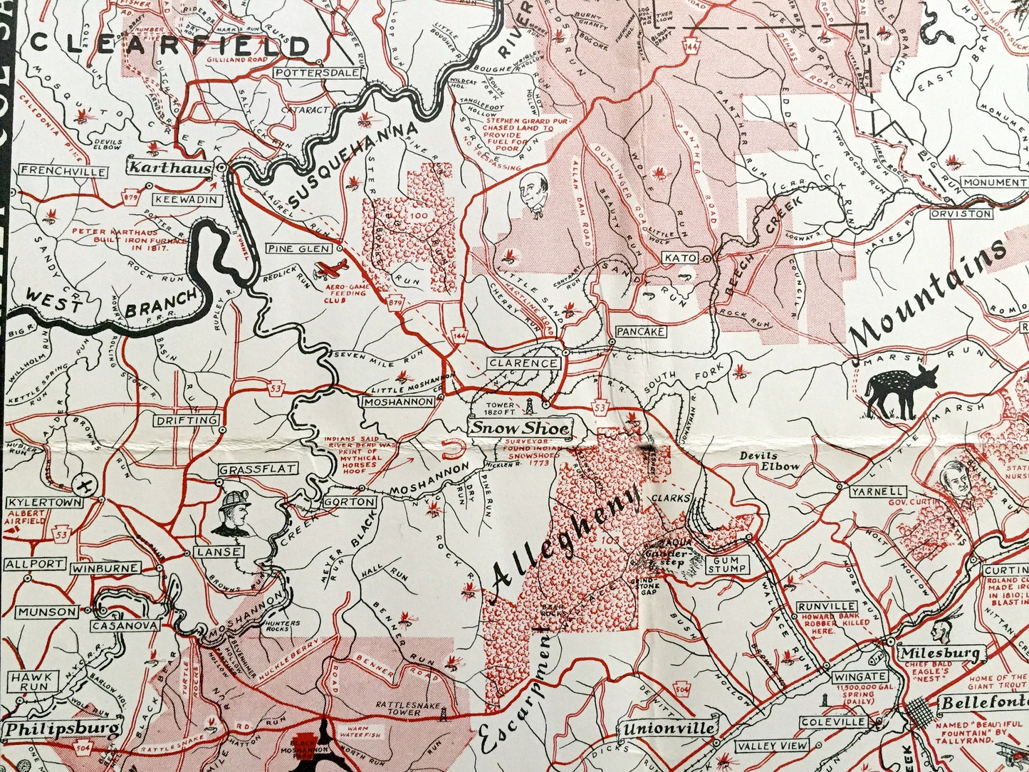
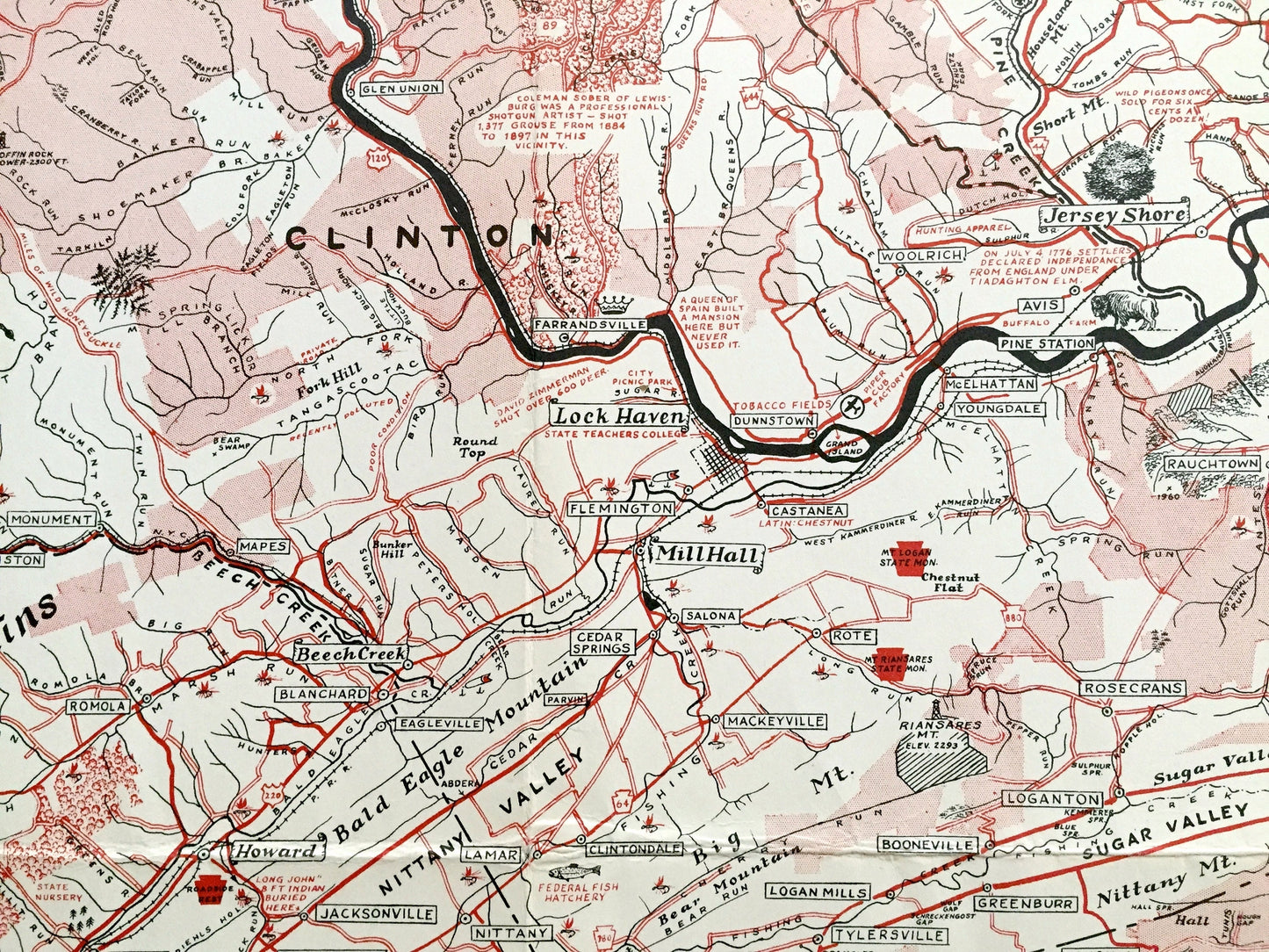
Beautiful, original pictorial map of Central Pennsylvania entitled "Heart of the Alleghenies: Central Pennsylvania's Vacationland" by esteemed historian and artist Samuel A. King, published in 1953. This is an authentic lithograph printed by The Gray Printing Company of Falls Creek, PA and is NOT a computer reproduction. Map is chock full of interesting historical events from every corner of Cameron, Clearfield, Clinton, Lycoming, Huntingdon, Centre, Mifflin, Union and Snyder County. These maps by Samuel King are increasingly rare and sought after.
See what Pennsylvania looked like over 70 years ago. Lots of charming, intricate illustrations and details, decorative corners and border, and geological contours, including industries of the state, mountains, rivers and roads, as well as historical personages and events as the area was settled.
Perfect for the historian, map-lover, the curious or just as a conversation starter. Wonderful and rare. Vintage maps such as these make great gifts.
Edition of 1953, printed 1953
Dimensions: 22 1/2" width x 19" height
----
Condition: Good Vintage condition, commensurate with age. This map is in great shape for being over 70 years old. Has some edge-wear, and toning, small separations at folds and corners, as well as folds as-issued, but these will flatten easily and all will all read as vintage character when framed.
----
We will happily adjust shipping price for multiple purchases. Maps are rolled up and shipped in sturdy mailing tubes, never folded.
Couldn't load pickup availability
Share