My Store
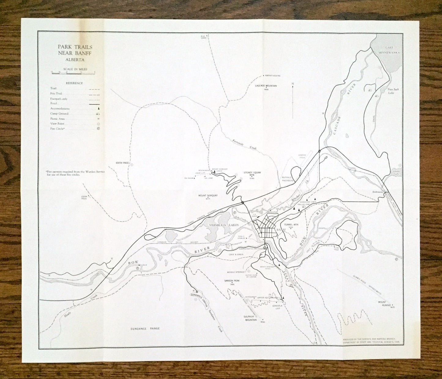
Antique 1965 Banff National Park Trails, Alberta, Canada Geological Survey Topographic Map – Canadian Rockies, Lake Louise, Jasper, Yoho CAN
Antique 1965 Banff National Park Trails, Alberta, Canada Geological Survey Topographic Map – Canadian Rockies, Lake Louise, Jasper, Yoho CAN
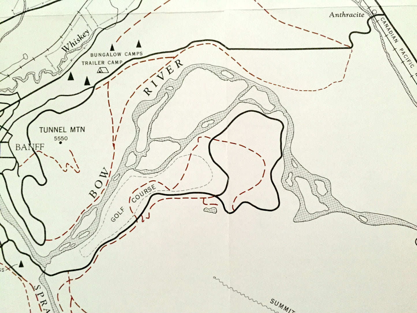
Beautiful, antique map of the Trails near Banff National Park of Alberta, Canada. This is an authentic 1965 print from the Department of Mines and Technical Services and is NOT a computer reproduction.
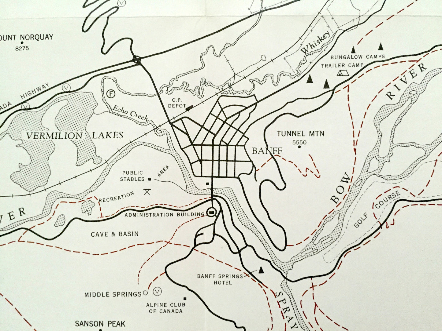
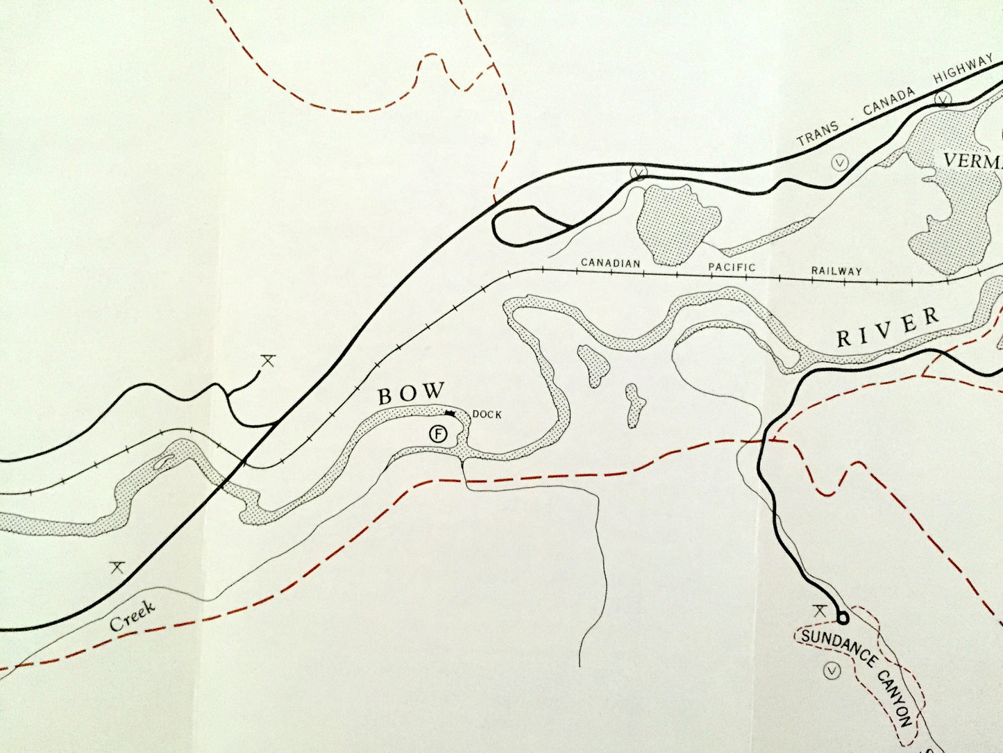
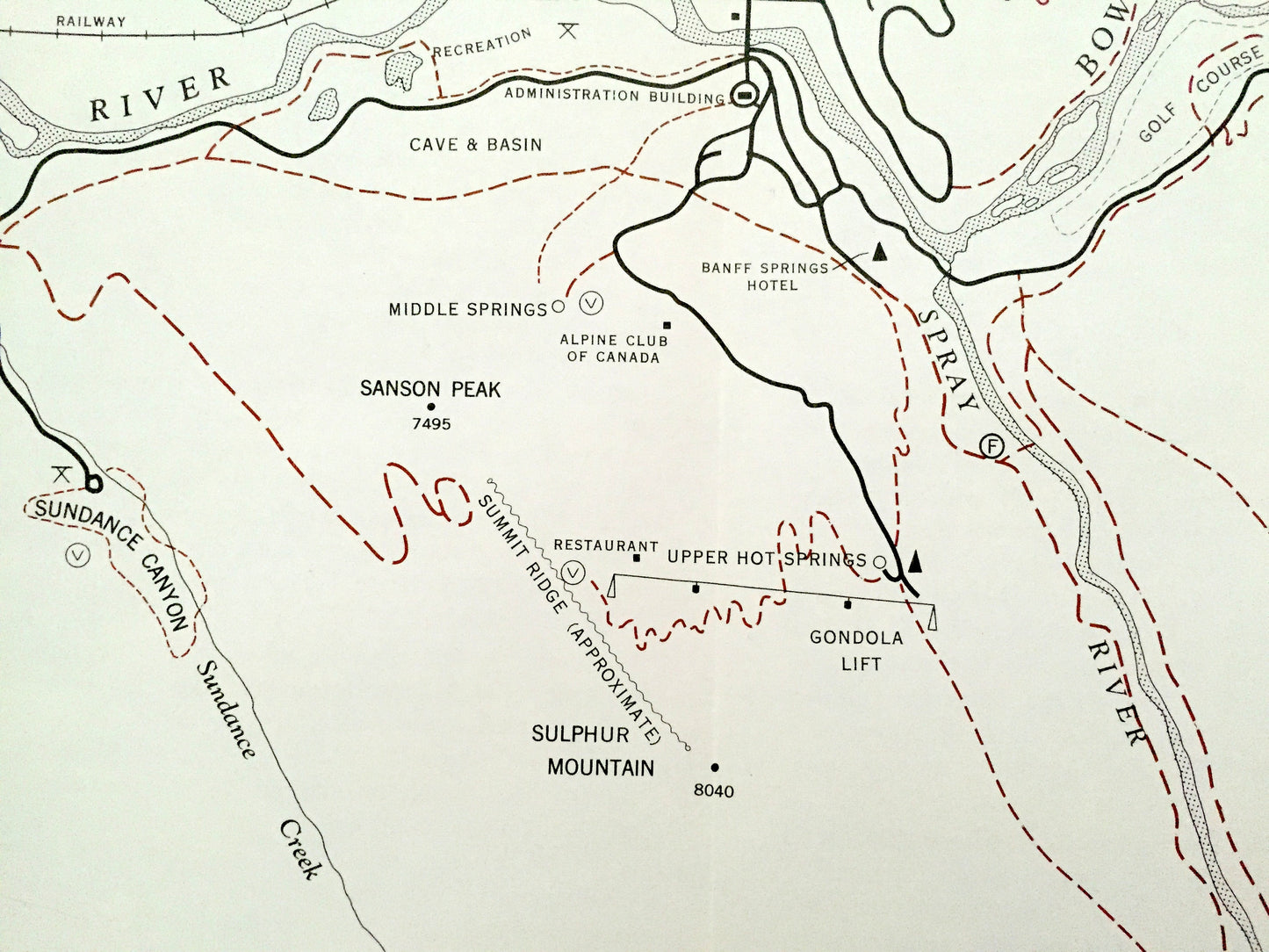
See what the trails of Banff looked like almost 60 years ago. Lots of details and attractions. On the back is a thorough description of Banff and the trails around it.
Perfect for the historian, map-lover, the curious or just as a conversation starter. Wonderful and rare. Vintage maps such as these make great gifts.
Edition of 1965, printed 1965
Dimensions: 20 1/2" width x 17 1/2" height
----
Features
Points of Interest: Banff National Park, Canadian Rockies, Bow River, Cascade River, Lake Minnewanka, Spray River, Stoney Squaw Mountain, Mt Norqouay Lodge, Tunnel Mountain, Sundance Range, Sulphur Mountain, Edith Pass, Cascade Mountain, Amphitheatre, Two Jack Lake, Johnson Lake, Sanson Peak, Alpine Club of Canada, Banff Springs Hotel, and many more roads, buildings, creeks, mountains, ponds, and hills.
Condition: Good Vintage condition, commensurate with age. This map is in great shape for being over 55 years old. Has light wear, toning and folds as-issued, but these will flatten easily and all will add to vintage character when framed.
----
We will happily adjust shipping price for multiple purchases. Map will be shipped folded to preserve original fold lines.
Couldn't load pickup availability
Share