My Store
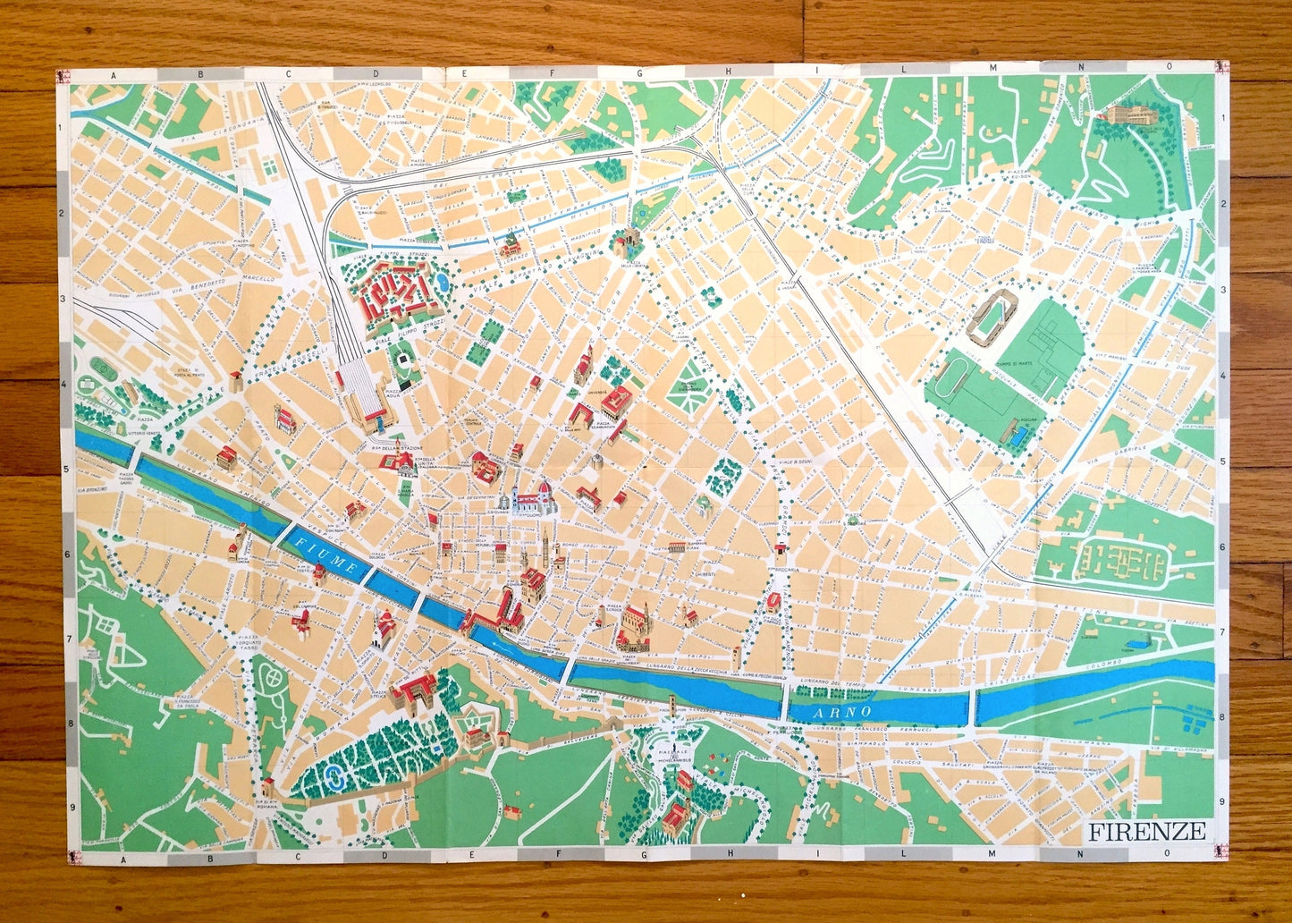
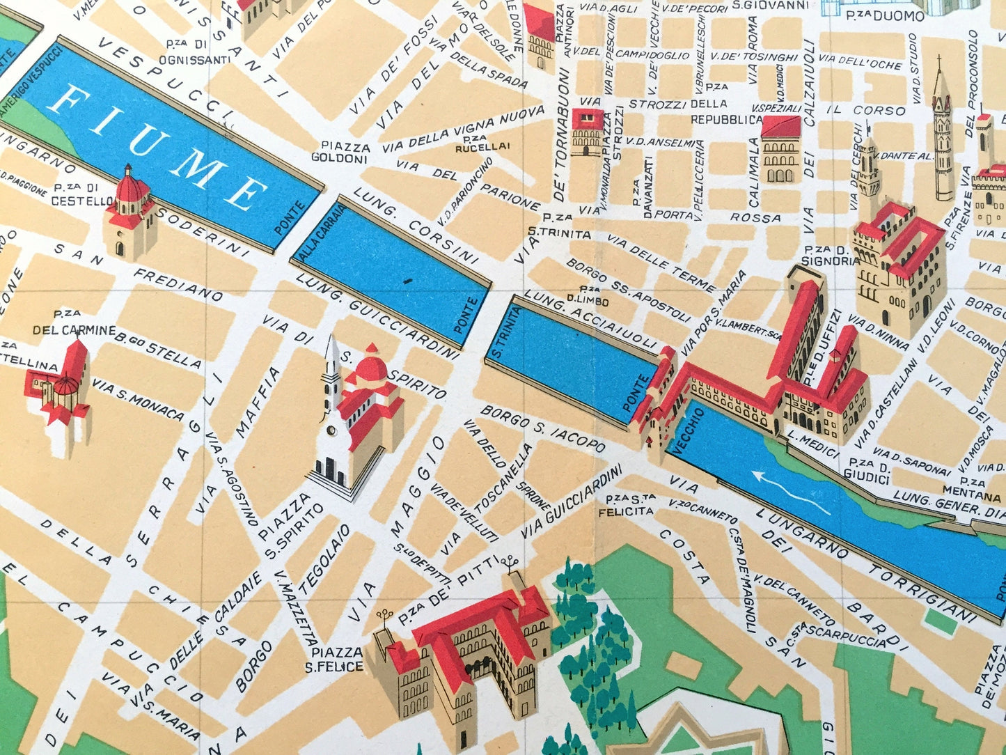
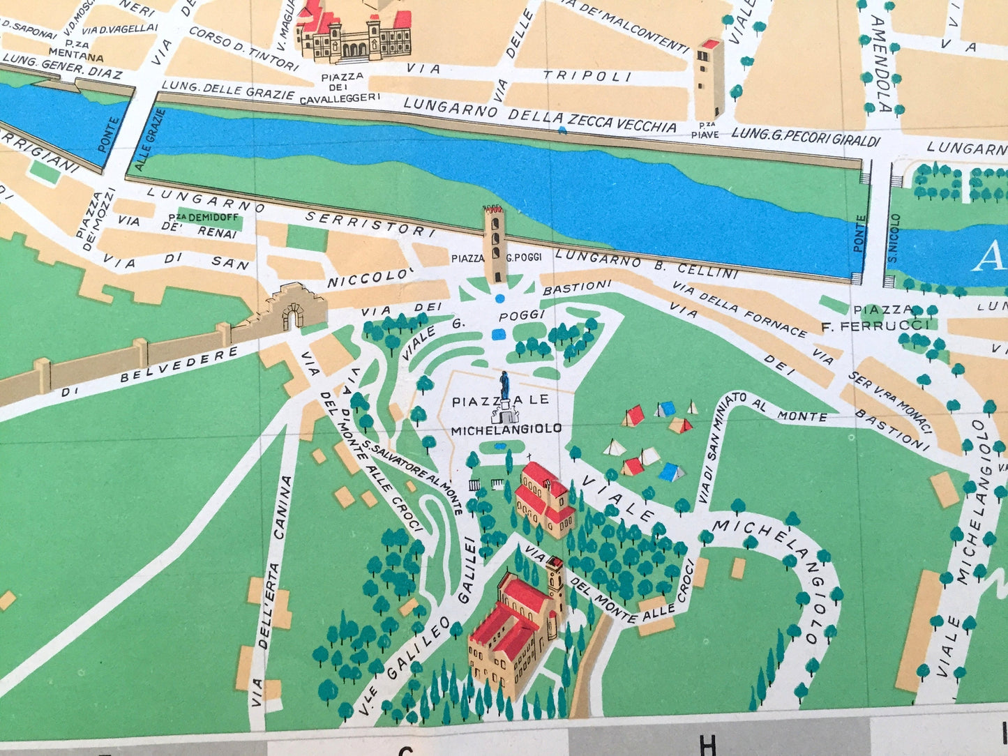
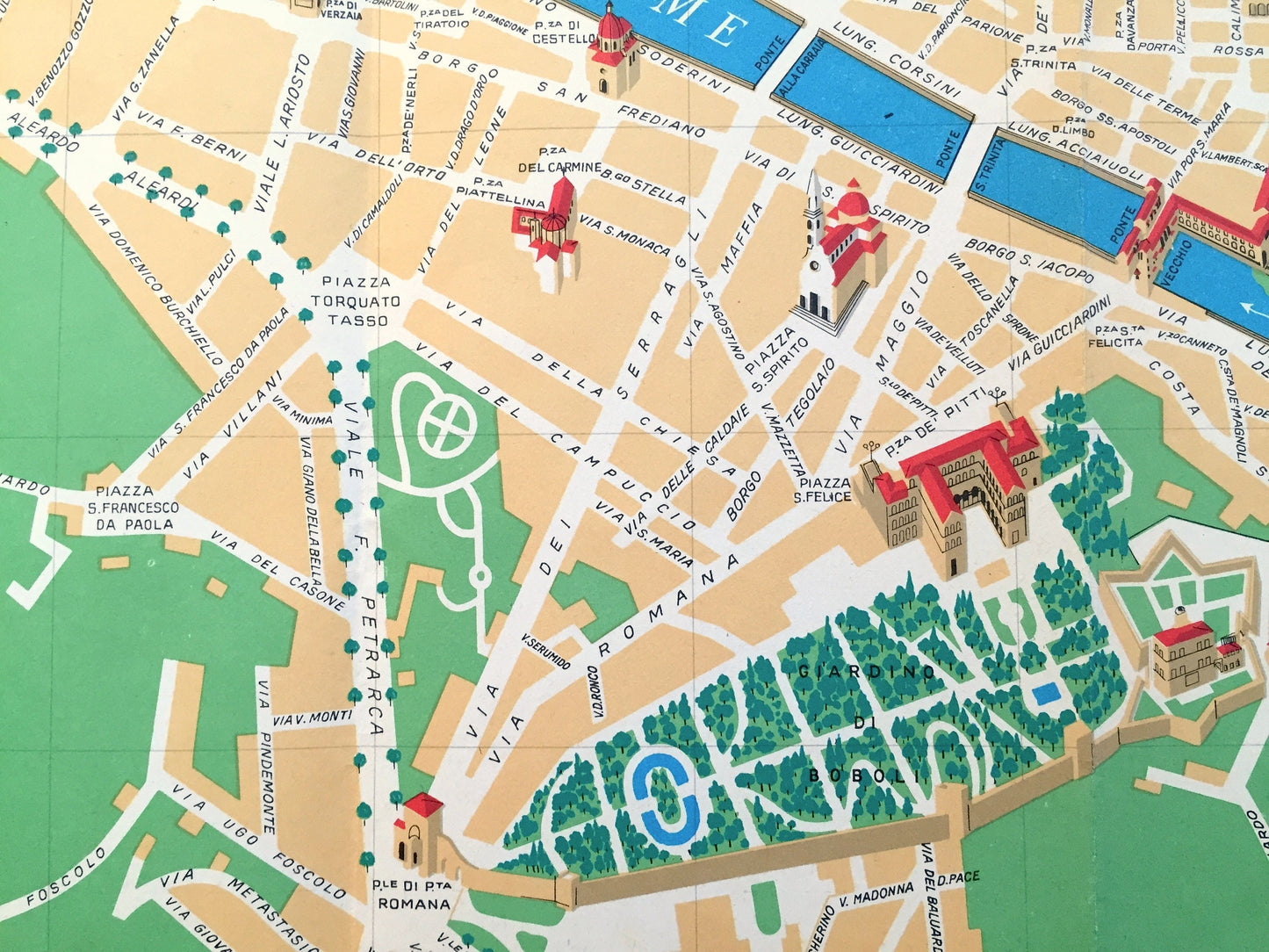
Antique 1970 Pictorial Map of Florence, Italy from Aziendo Autonoma Di Turismo – Firenze, Tuscany, River Arno, Uffizi, Michelangelo, Duomo
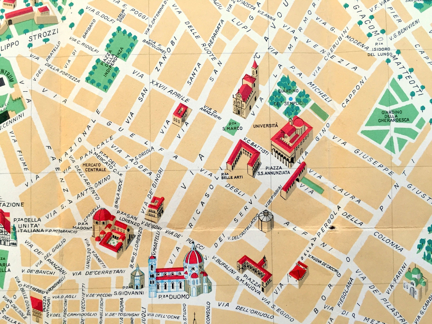
Antique 1970 Pictorial Map of Florence, Italy from Aziendo Autonoma Di Turismo – Firenze, Tuscany, River Arno, Uffizi, Michelangelo, Duomo
Beautiful, antique and colorful tourist map of Florence, Italy. This is an authentic print from Florence's Aziendo Autonoma Di Turismo, published in 1970 and is NOT a computer reproduction.
See what Florence looked like over 50 years ago. Lots of charming, intricate details and contours, including streets, rivers, piazzas, train stations, gardens, basilicas, towers, churches and other landmarks and points of interest. On the reverse side is a street guid and tourist guide to major landmarks, as well as an inset of the region around Florence.
Perfect for the historian, map-lover, the curious or just as a conversation starter. Wonderful and rare. Vintage maps such as these make great gifts.
Edition of 1970, printed 1970
Dimensions: 24 3/4" width x 17" height
----
Condition: Good Vintage condition, commensurate with age. This map is in great shape for being over 50 years old. Some wear, toning and folds as-issued, but these will flatten easily and all will read as vintage character when framed.
----
We will happily adjust shipping price for multiple purchases. Maps are rolled up and shipped in sturdy mailing tubes, never folded.
Couldn't load pickup availability
Share