My Store
Antique Accident, Maryland 1908 US Geological Survey Topographic Map – Selbysport, Sang Run, McHenry Friendsville Deep Creek Pennsylvania MD
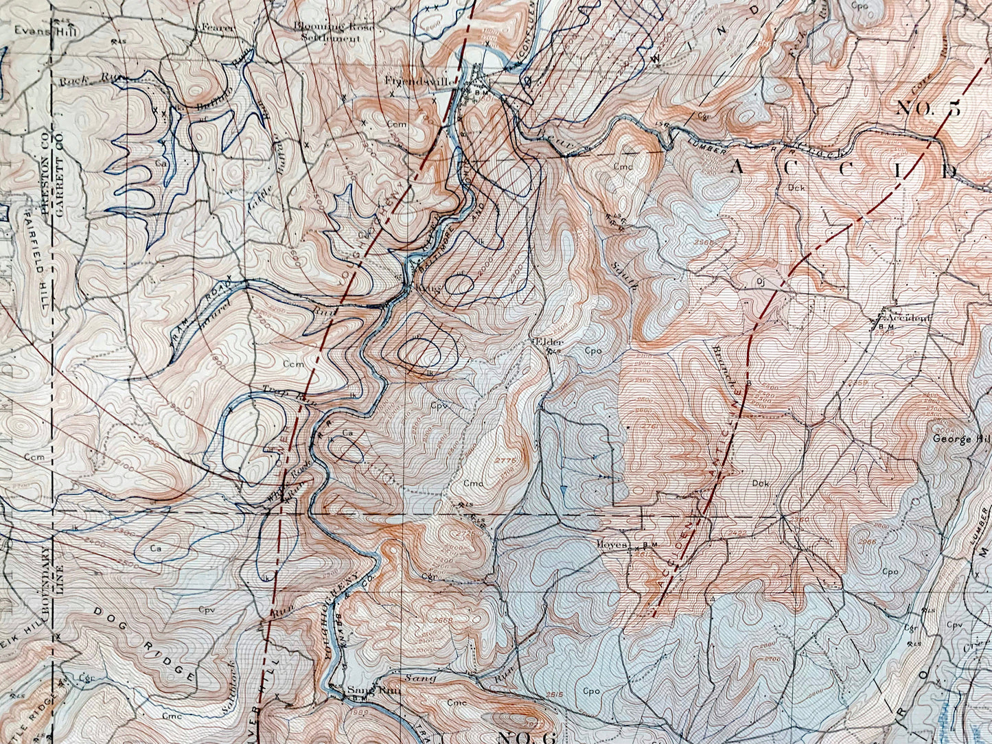
Antique Accident, Maryland 1908 US Geological Survey Topographic Map – Selbysport, Sang Run, McHenry Friendsville Deep Creek Pennsylvania MD
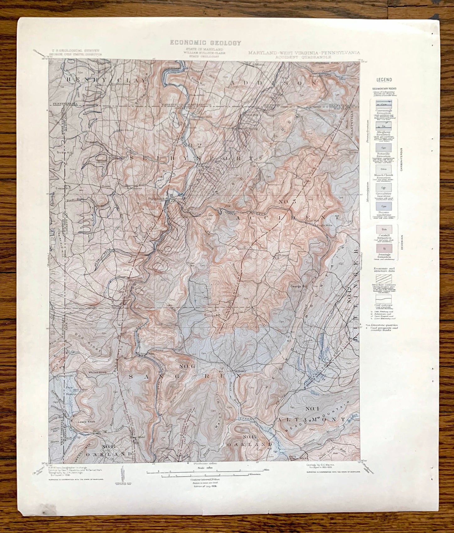
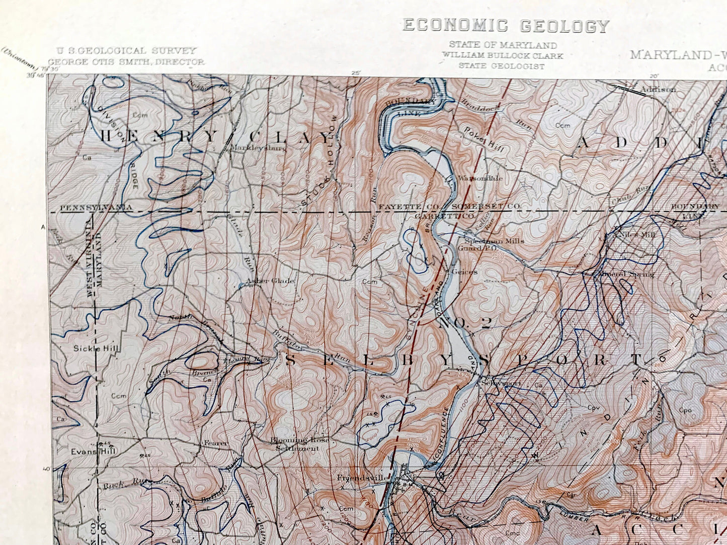
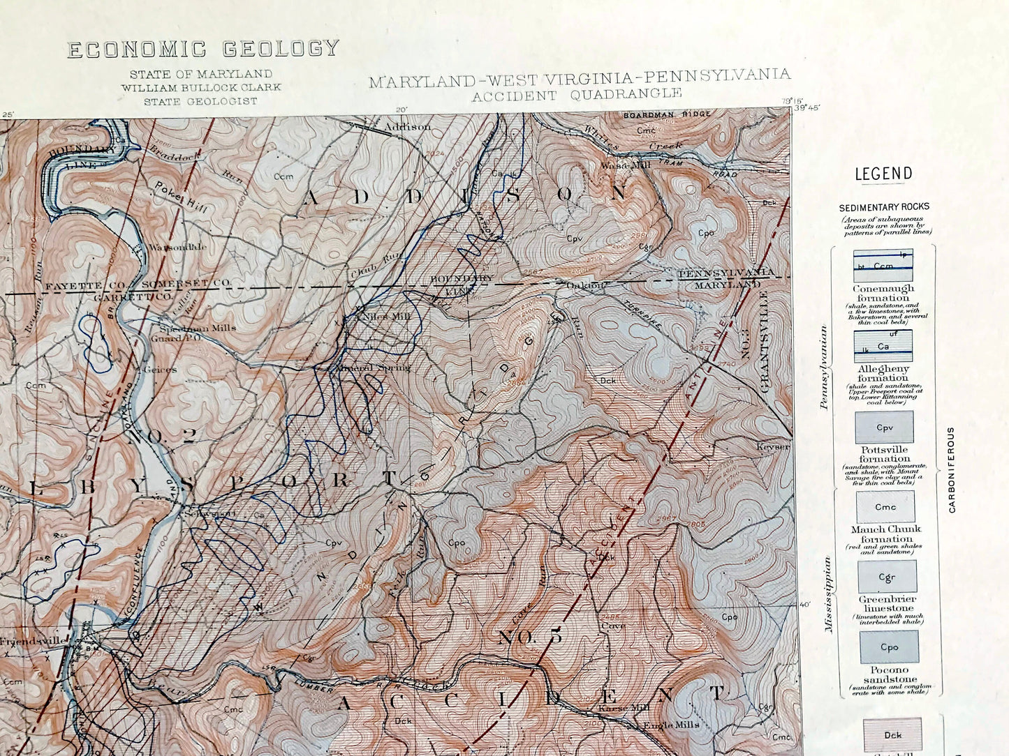
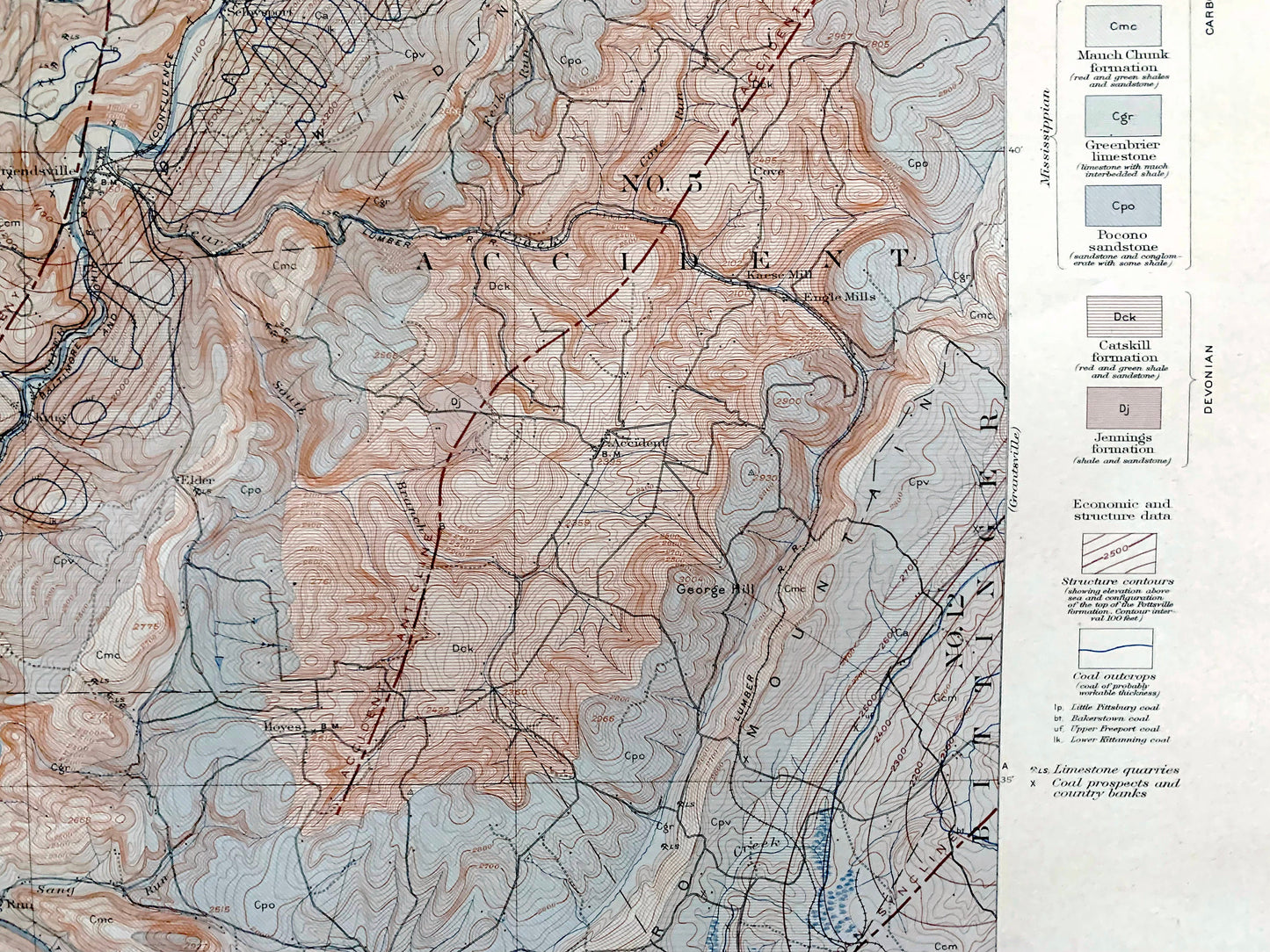
Beautiful, antique economic geology map of Western Maryland around Accident, including Garrett County and parts of Pennsylvania and West Virginia. This is an authentic 1900 edition, 1908 print from the U.S. Geological Survey and NOT a computer reproduction. It is from a Geologic Atlas folio.
See what Western Maryland looked like over 120 years ago before Youngiogheny Lake and Deep Creek Lake were created. Lots of intricate details, sedimentary rock formations and geological contours. Map even has little squares for every house that existed at the time. The USGS cartographers were very thorough back then! This is one of the rare maps where the topographic symbols and map guide are on the front.
Perfect for the historian, map-lover, the curious or just as a conversation starter. Wonderful and rare. Vintage maps such as these make great gifts.
Edition of 1900, printed 1908
Dimensions: 18 1/2" width x 21 1/2" height
----
Features
Cities & Towns: MARYLAND: Asher Glade, Blooming Rose Settlement, Fearer, Selbysport, Niles Mill, Mineral Spring, Speilman Mills, Friendsville, Elder, Krug, Cove, Kease Mill, Eagle Mills, Accident, Bittinger, Craneseville, Browning Mill, Sang Run, Oakland, McHenry, Altamont, Grantsville, Keyser.
PENNSYLVANIA: Henry Clay, Markleysburg, Watsondale, Addison.
WEST VIRGINIA: Disputed Territory, Cranesville.
Points of Interest: Youngiogheny River, Division Ridge, Stuck Hollow, Sickle Hill, Buffalo Run, Poke Hill, Chub Run, Winding Ridge, Boardman Ridge, Fairfield Hill, Tram Road, Negro Mountain, Dog Ridge, River Hill, Nettle Ridge, Lewis Knob, Snaggy Mountain, Marsh Hill, Deep Creek, Meadow Mountain, State Dam, and lots more streams, hills, mountains, houses, roads, turnpikes, cemeteries, churches.
Condition: Good Vintage condition, commensurate with age. This map is in great shape for being over 110 years old. Has staple-holes in margin from folio, foxing, toning and edge-wear but this will all add to vintage character when framed.
----
We will happily adjust shipping price for multiple purchases. Maps are rolled up and shipped in sturdy mailing tubes, never folded.
Couldn't load pickup availability
Share