My Store
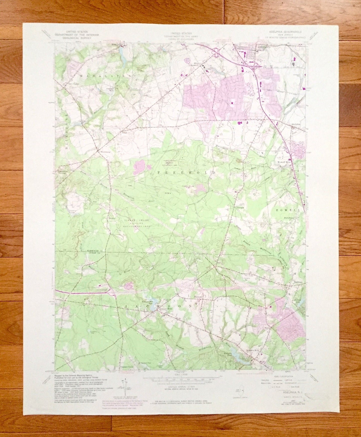
Antique Adelphia, New Jersey 1957 US Geological Survey Topographic Map – Ocean, Monmouth County, Freehold, Manalapan, Howell, Jackson, NJ
Antique Adelphia, New Jersey 1957 US Geological Survey Topographic Map – Ocean, Monmouth County, Freehold, Manalapan, Howell, Jackson, NJ
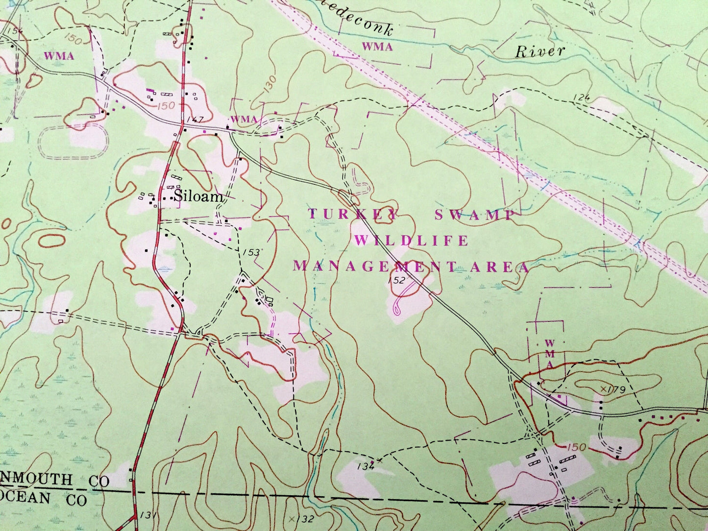
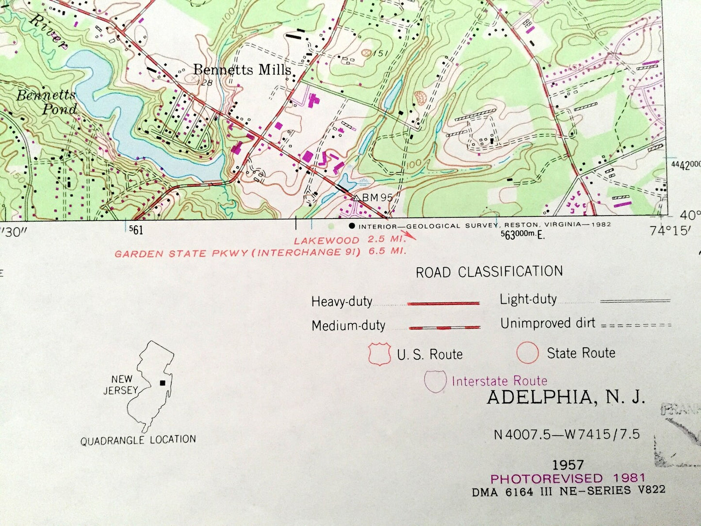
Beautiful, antique map of Adelphia, New Jersey and surrounding Ocean County and Monmouth County areas. This is an authentic 1957 edition, 1982 print from the U.S. Geological Survey and NOT a computer reproduction.
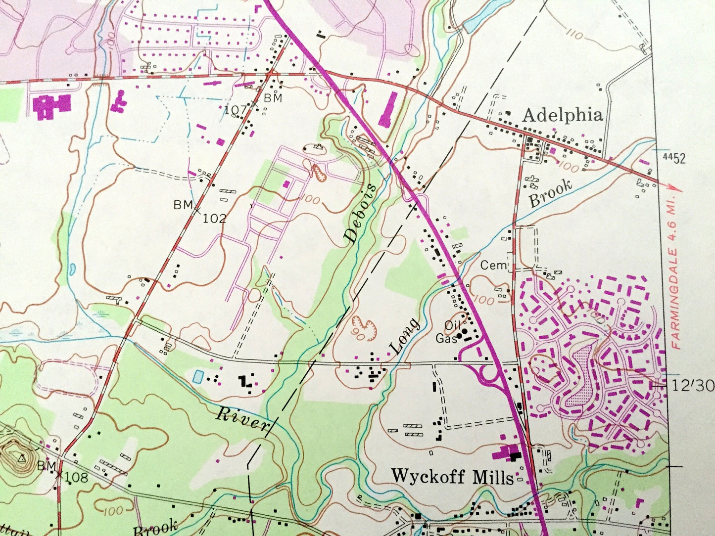
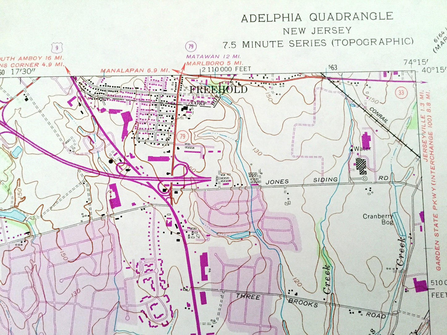
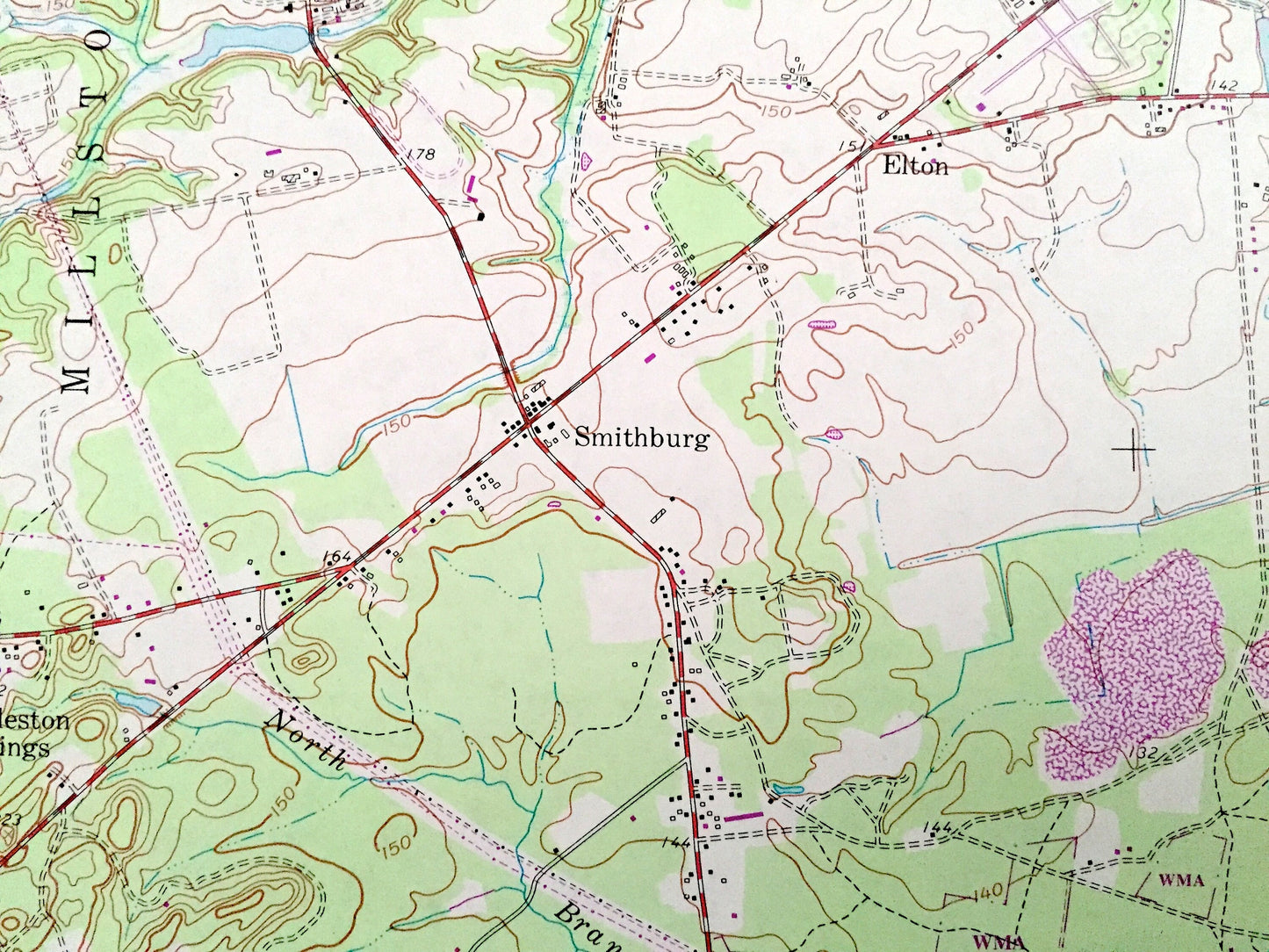
See what New Jersey looked like over 60 years ago. Lots of intricate details and geological contours. Map even has little squares for every house that existed at the time. The USGS cartographers were very thorough back then!
Perfect for the historian, map-lover, the curious or just as a conversation starter. Wonderful and rare. Vintage maps such as these make great gifts.
Edition of 1957, printed 1982
Dimensions: 22" width x 27" height
----
Features
Cities & Towns: Adelphi, Elton, Millstone, West Freehold, Millhurst, Oakland Mills, Carrs Corner, Smithburg, Charleston Springs, Siloam, Georgia, Bennetts Mills, Matthews, Pleasant Grove, Wyckoff Mills, Fort Plains, Hyson, Jackson Mills, Harmony.
Points of Interest: Turkey Swamp Wildlife Management Area, Turkey Swamp Park, Manasquan River, North Branch, Metedeconk River, South Branch Metedeconk River, Applegates Creek, Bennetts Pond, Aldrich Lake, Cranberry Bogs and many more hills, streams, ponds, houses, schools, churches and roads.
Condition: Very Good Vintage condition, commensurate with age. This map is in great shape for being over 35 years old.
----
We will happily adjust shipping price for multiple purchases. Maps are rolled up and shipped in sturdy mailing tubes, never folded.
Couldn't load pickup availability
Share