My Store
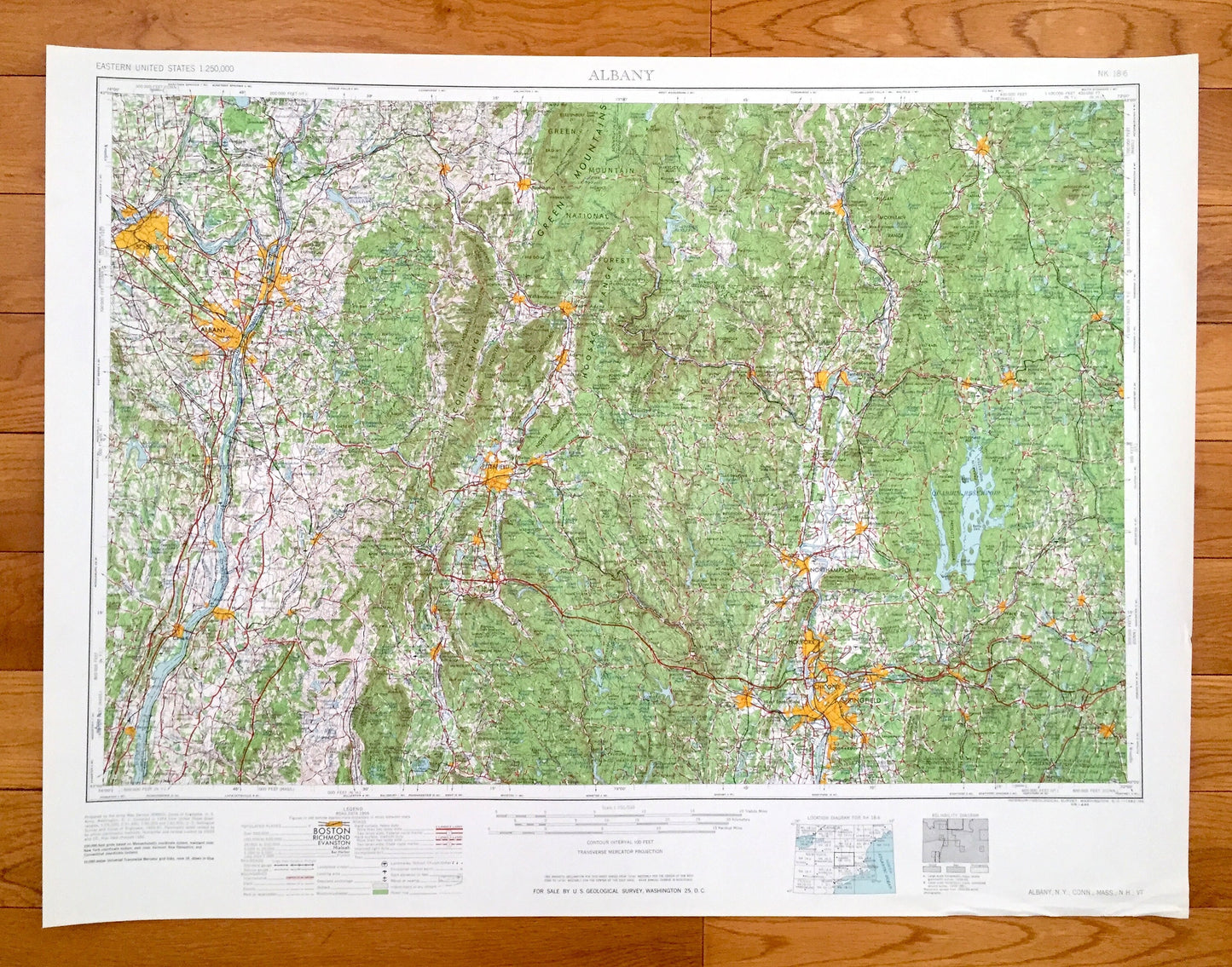
Antique Albany, New York 1962 US Geological Survey Topographic Map – Berkshires, Troy, Schenectady, Hudson, Catskill, Watervliet, Cohoes, MA
Antique Albany, New York 1962 US Geological Survey Topographic Map – Berkshires, Troy, Schenectady, Hudson, Catskill, Watervliet, Cohoes, MA
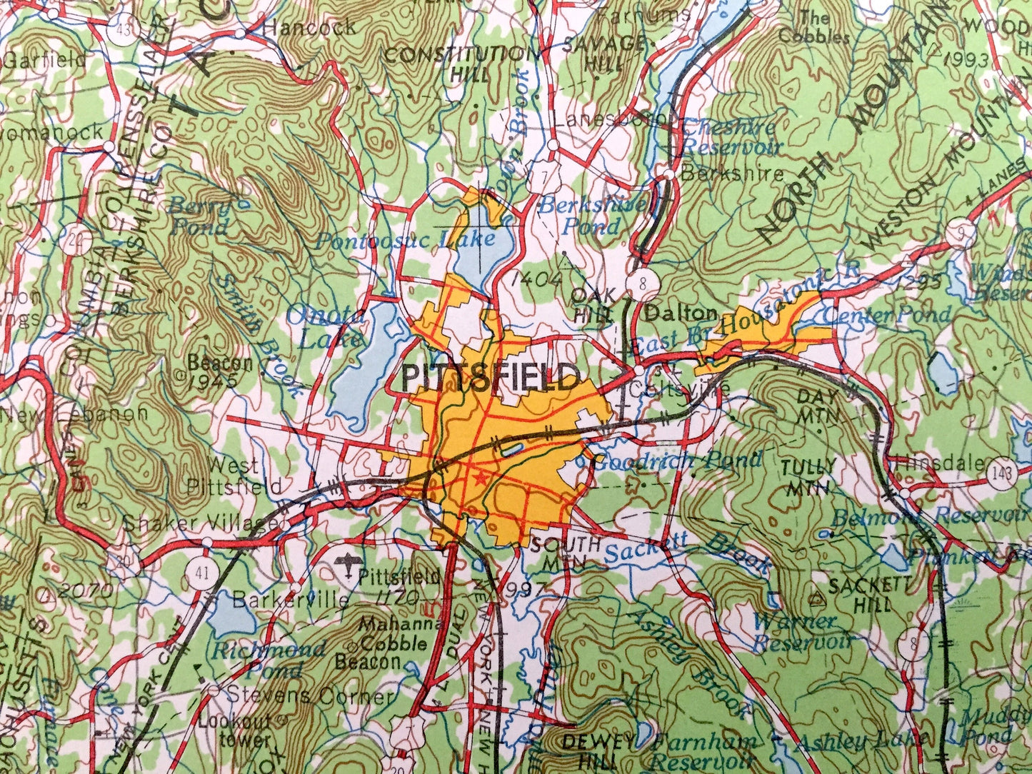
Beautiful, antique map of Albany, New York and surrounding Connecticut, Massachusetts, New Hampshire and Vermont areas. This is an authentic 1962 edition, 1962 print from the U.S. Geological Survey and NOT a computer reproduction.
See what New York, Connecticut, Massachusetts, New Hampshire and Vermont looked like over 60 years ago. Lots of intricate details and geological contours. Map is incredibly large and in the grand 1:250,000 scale. The USGS cartographers were very thorough back then!
Perfect for the historian, map-lover, the curious or just as a conversation starter. Wonderful and rare. Vintage maps such as these make great gifts.
Edition of 1962, printed 1962
Dimensions: 32" width x 22 1/2" height
----
Features
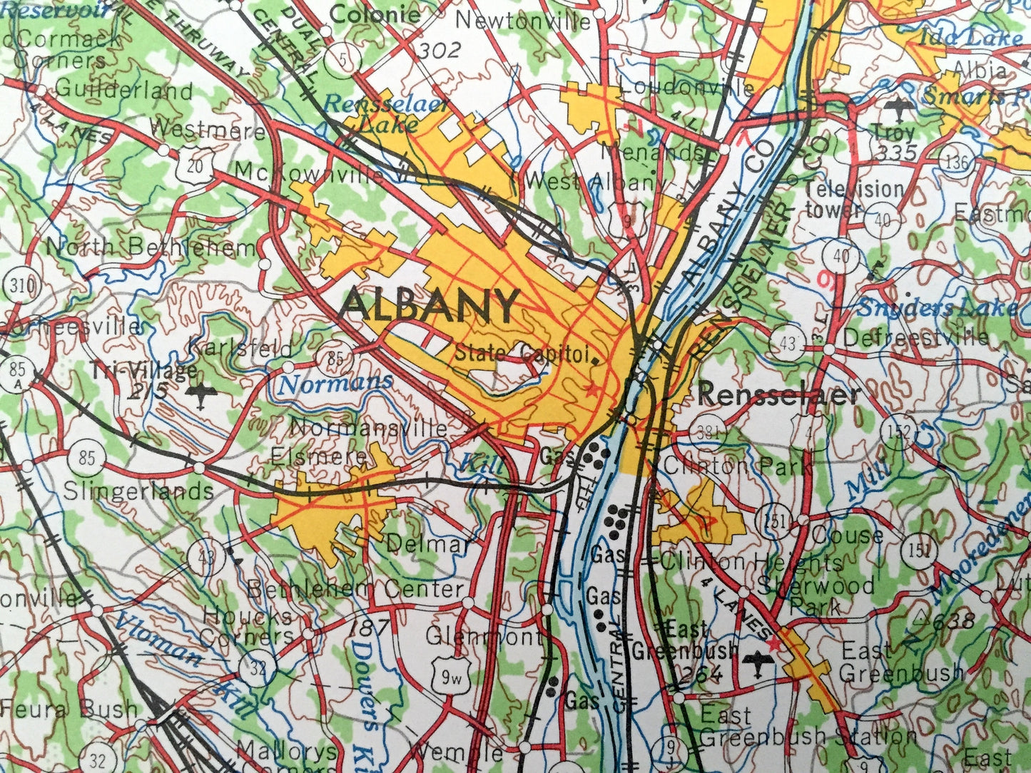
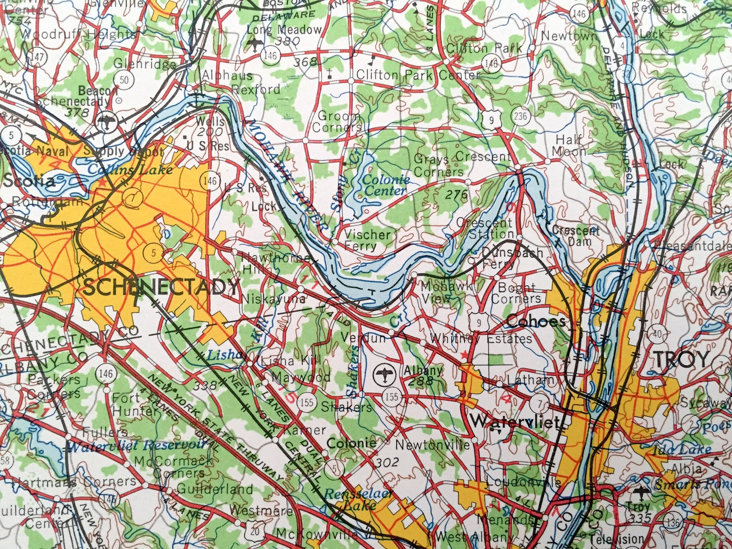
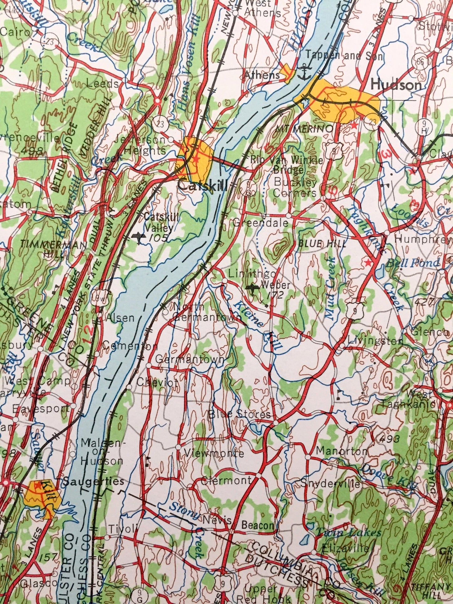
Cities & Towns: NEW YORK - Albany, Rensselaer, Chatham, Philmont, Saugerties, Red Hook, Athens, Coxsackie, Ravena, Colonie, Scotia, Hoosick Falls, Ballston Spa, Jonesville, Castleton-on-Hudson, Troy, Schenectady, Hudson, Catskill, Mechanicville, Watervliet, Cohoes.
CONNECTICUT - Thompsonville, Canaan, East Canaan, West Norfolk, West Hartland.
MASSACHUSETTS - Pittsfield, Williamstown, North Adams, Adams, Dalton, Lenox, Lee, Housatonic, Great Barrington, Sheffield, Shelburn Falls, Greenfield, Turners Falls, Amherst, Northampton, Easthampton, Holyoke, Westfield, Springfield, West Springfield, Longmeadow, Ludlow, Chicopee, Monsort, Southbridge, Ware, Warren, Brookfield, Spencer, Athol, Gardner.
NEW HAMPSHIRE - Keene, West Swanzy, Westport, Hinsdale, Jaffrey, Harrisville.
VERMONT - Brattleboro, West Brattleboro, Bennington, North Bennington, Somerset.
Points of Interest: NEW YORK - Hudson River, Mohawk River, Saratoga Lake, Saratoga National Historical Park, Taconic State Park, Taconic Range, Kijk-Uit Mountains, Misery Mountain, Tomhannock Reservoir, Copake Lake, Snyders Lake, Tomhannock Creek and lots more hills, mountains, rivers, lakes, creeks, roads, highways and railroads.
CONNECTICUT - Nipmuck State Forest, West Suffield Mountain, College Hill, Rattlesnake Hill, Blackberry River, Twin Lakes, Pinehurst Lake, Congamond Lake, State Line Pond and lots more hills, mountains, rivers, lakes, creeks, roads, highways and railroads.
MASSACHUSETTS - Taconic Range, Hoosac Range, Ragged Mountain, North Mountain, Brodie Mountain, Connecticut River, Hoosic River, Deerfield River, Westfield River, Prescott Peninsula, Webb Hill, Pottapoag Hill, Quabbin Reservoir, Hardwick Pond and lots more hills, mountains, rivers, lakes, creeks, roads, highways and railroads.
NEW HAMPSHIRE - Connecticut River, Pisgah Mountain Range, Monadnock Mountain, Bigelow Hill, Spaulding Hill, Laurel Lake, Wheeler Pond and lots more hills, mountains, rivers, lakes, creeks, roads, highways and railroads.
VERMONT - Connecticut River, West River, Green Mountains, Hoosac Range, Green Mountain National Forest, Mount Pisgah, The Dome, Beaver Brook, Harriman Reservoir, Somerset Reservoir, Lilly Pond, Shippee Pond and lots more hills, mountains, rivers, lakes, creeks, roads, highways and railroads.
Condition: Very Good Vintage condition, commensurate with age. This map is in great shape for being over 60 years old. Has light edge-wear, all of which will read as vintage character when framed.
----
We will happily adjust shipping price for multiple purchases. Maps are rolled up and shipped in sturdy mailing tubes, never folded.
Couldn't load pickup availability
Share