My Store
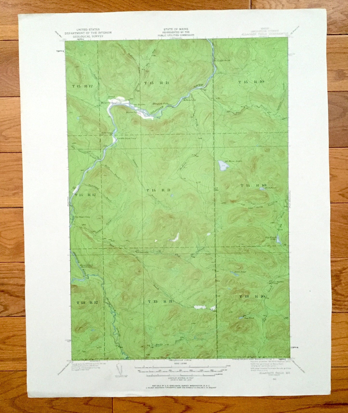
Antique Allagash Falls, Maine 1932 US Geological Survey Topographic Map – Aroostook County, Michaud Farm, WELS, Musquacook, McGargle Rocks
Antique Allagash Falls, Maine 1932 US Geological Survey Topographic Map – Aroostook County, Michaud Farm, WELS, Musquacook, McGargle Rocks
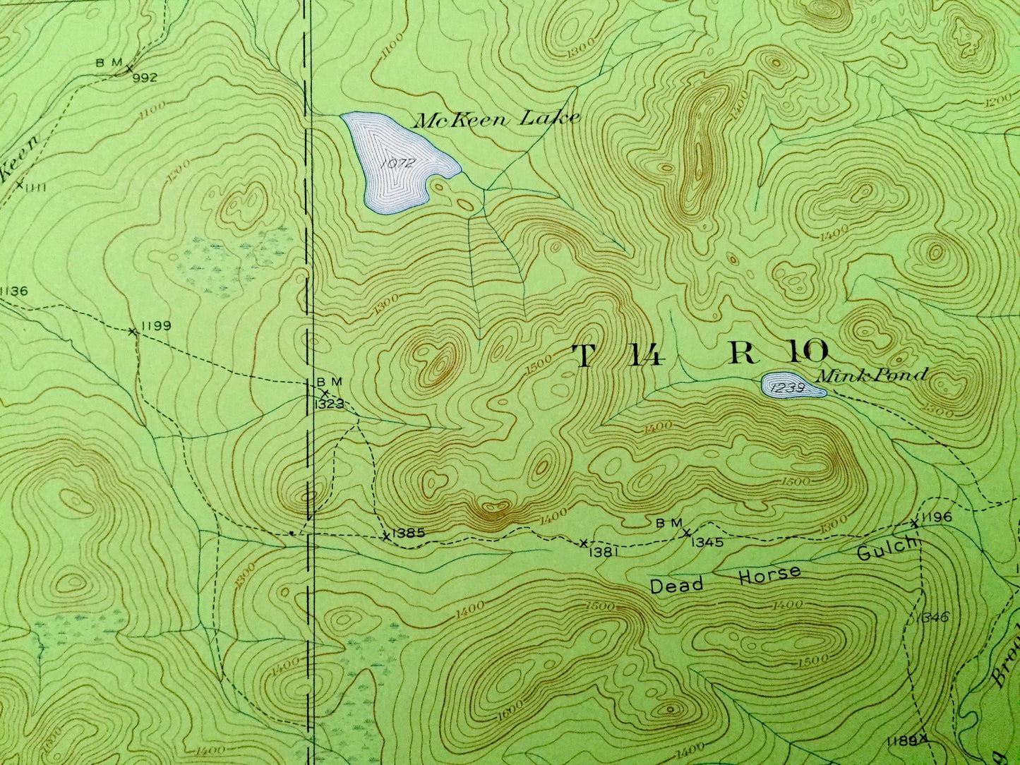
Beautiful, antique map of Allagash Falls, including surrounding Aroostook County area, West of the Easterly Line of the State (WELS). This is an authentic 1932 edition, 1961 print from the U.S. Geological Survey and NOT a computer reproduction.
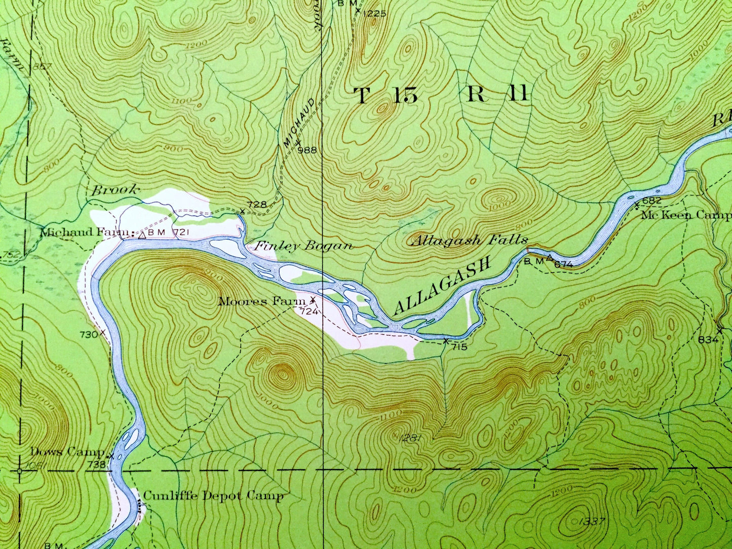
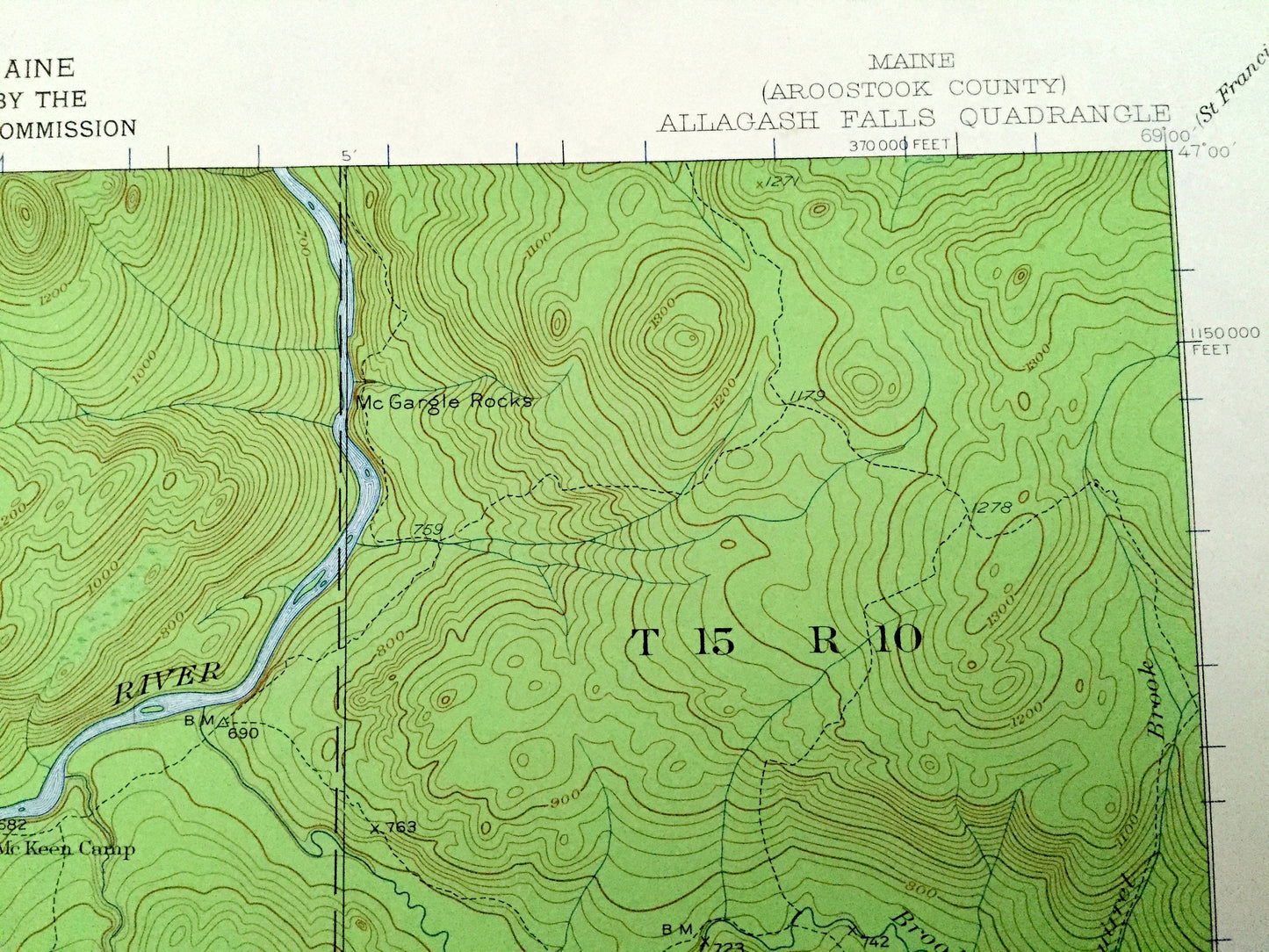
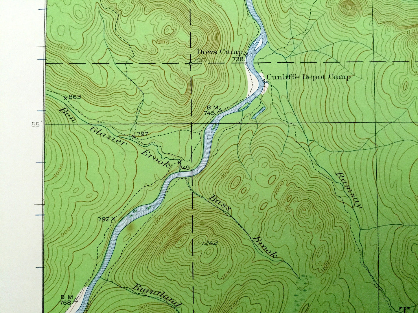
See what the Aroostook County of Maine looked like over 85 years ago. Lots of intricate details and geological contours. Map even has little squares for every house that existed at the time. The USGS cartographers were very thorough back then!
Perfect for the historian, map-lover, the curious or just as a conversation starter. Wonderful and rare. Vintage maps such as these make great gifts.
Edition of 1932, printed 1961
Dimensions: 17" width x 21" height
----
Features
Cities & Towns: T15 R12, T15 R11, T15 R10, T14 R12, T14 R11, T14 R10, T13 R12, T13 R 11, T13, R10 all within the unorganized territory township code, West of the Easterly Line of the State (WELS).
Points of Interest: Michaud Farm, Moores Farm, Cunliffe Depot Camp, Dows Camp, Allagash River, Allagash Falls, McKeen Camp, McGargle Rocks, Dead Horse Gulch, Big Brook Lake, McKeen Lake, Rideout Cabin, Musquacook Deadwater, Sag Pond, Joe Martins Camp, Petes Pond, and lots more hills, mountains, streams, ponds, houses, and roads.
Condition: Very Good condition, commensurate with age. This map is in great shape for being over 50 years old.
----
We will happily adjust shipping price for multiple purchases. Maps are rolled up and shipped in sturdy mailing tubes, never folded.
Couldn't load pickup availability
Share