My Store
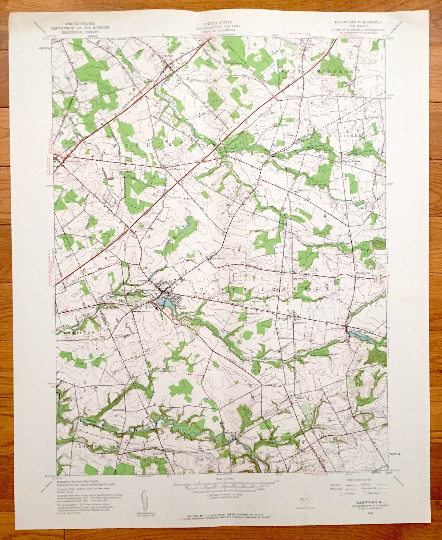
Antique Allentown, New Jersey 1957 US Geological Survey Topographic Map – Washington, East Windsor, Millstone, Upper Freehold, Hamilton, NJ
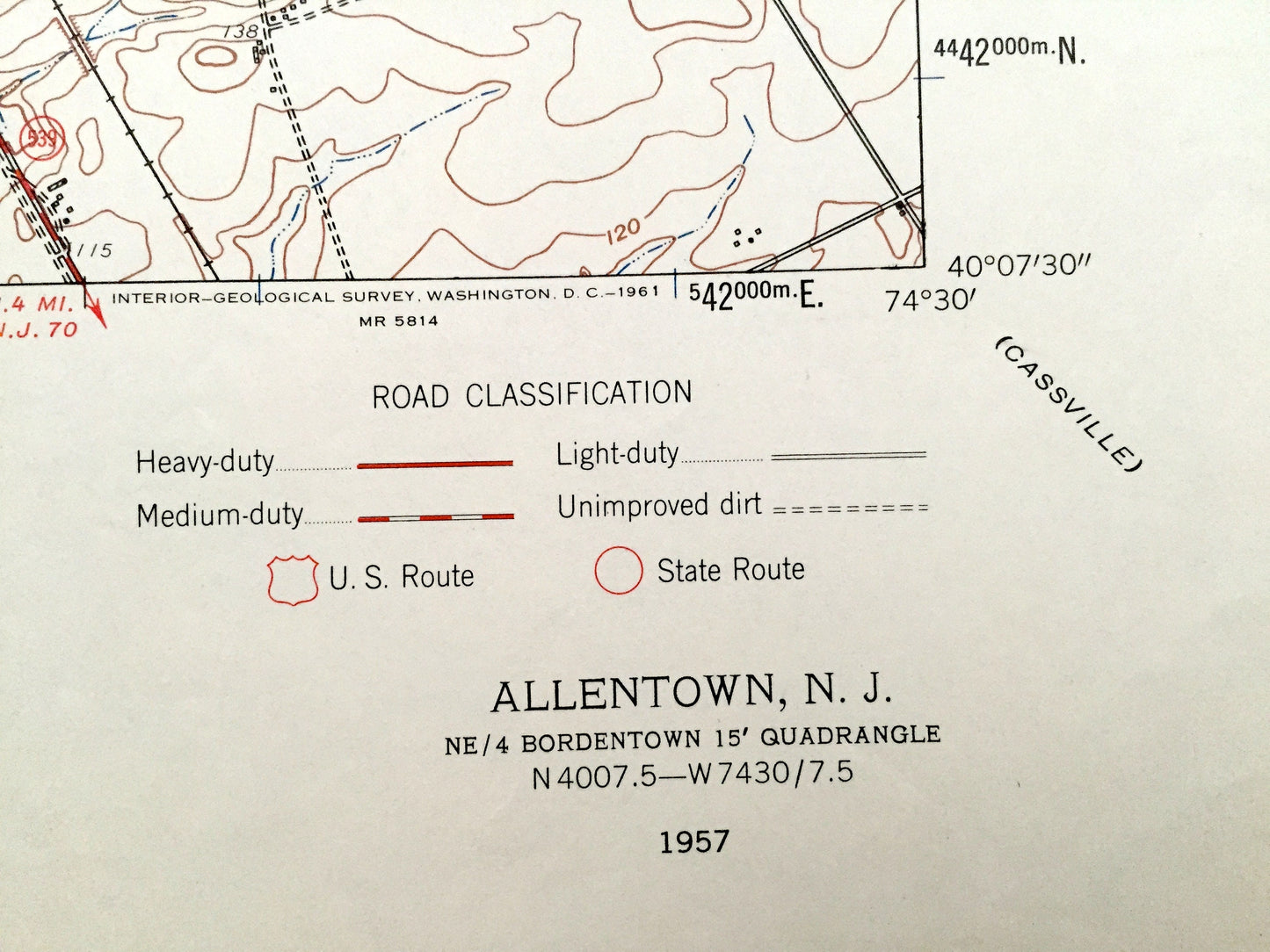
Antique Allentown, New Jersey 1957 US Geological Survey Topographic Map – Washington, East Windsor, Millstone, Upper Freehold, Hamilton, NJ
Beautiful, antique map of Washington, Wast Windsor, Millstone, Allentown, Upper Freehold and Hamilton, New Jersey. This is an authentic 1957 print from the U.S. Geological Survey and NOT a computer reproduction.
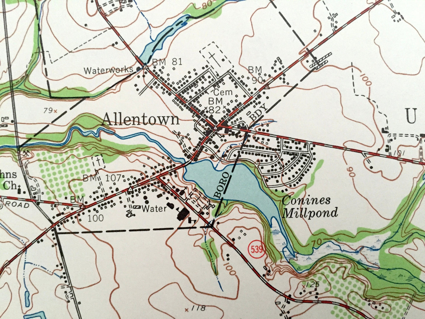
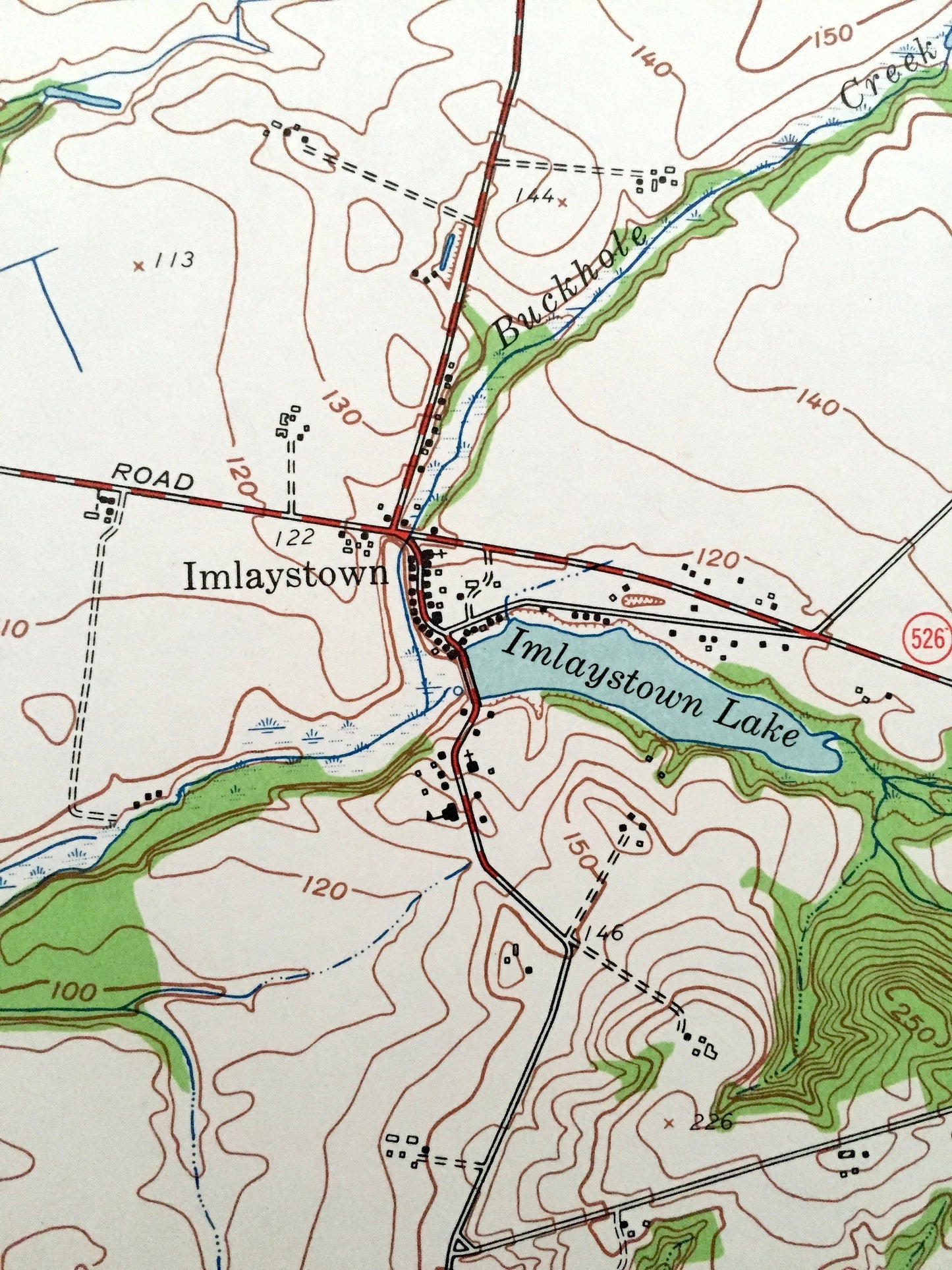
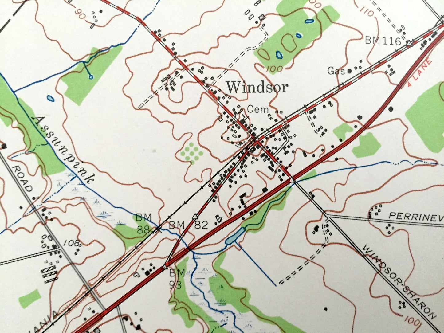
See what Mercer and Monmouth Counties of New Jersey looked like 60 years ago. Lots of intricate details and geological contours. Map even has little squares for every house that existed at the time. The USGS cartographers were very thorough back then!
Perfect for the historian, map-lover, the curious or just as a conversation starter. Wonderful and rare. Vintage maps such as these make great gifts.
Edition of 1957, printed 1957
Dimensions: 22" width x 27" height
----
Features
Cities & Towns: Windsor, Allentown, Washington, Robbinsville, Pages Corner, New Sharon, East Windsor, Millstone, Sharon, New Sharon, Shrewsbury, Upper Freehold, Nelsonville, Hamilton, Extonville, Chesterfield, North Hanover, Kirbys Mills, Homes Mills, Cream Ridge, Wrightsville, Cooleys Corner, Wilers Corner.
Points of Interest: Assunpink Wildlife Managment Area, Trento-Robbinsville Airport, Robbinsiville Golf Course, St Johns Church, Conines Millpond, Crosswicks Creek, Assunpink Lake, and lots more streams, houses, schools, towns, and roads
Condition: Very Good condition, commensurate with age. This map is in incredible shape for being over 60 years old.
----
We will happily adjust shipping price for multiple purchases. Maps are rolled up and shipped in sturdy mailing tubes, never folded.
Couldn't load pickup availability
Share