My Store
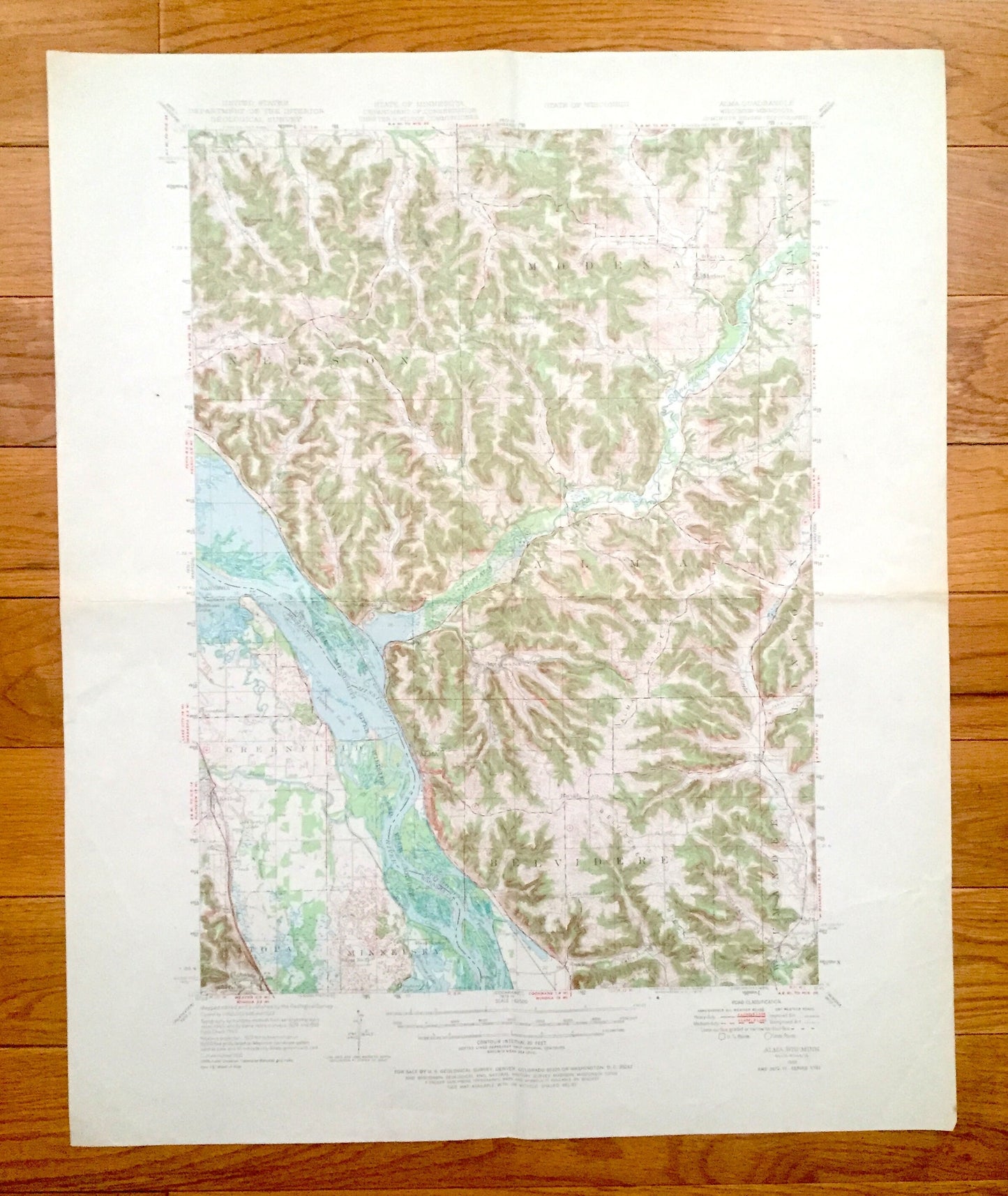
Antique Alma, Wisconsin 1950 US Geological Survey Topographic Map – Buffalo County, Modena, Nelson, Belvidere, WI, Wabasha County, Watopa MN
Antique Alma, Wisconsin 1950 US Geological Survey Topographic Map – Buffalo County, Modena, Nelson, Belvidere, WI, Wabasha County, Watopa MN
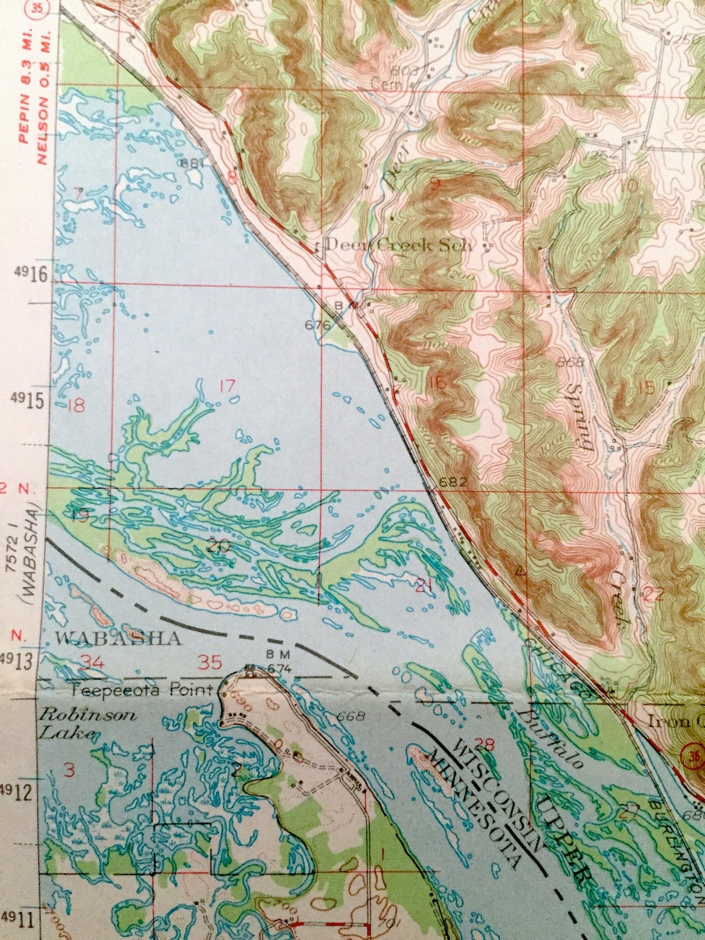
Beautiful, antique map of Alma, Wisconsin and surrounding Buffalo County areas, including Minnesota’s Wabasha County. This is an authentic 1950 edition, 1973 print from the U.S. Geological Survey and NOT a computer reproduction.
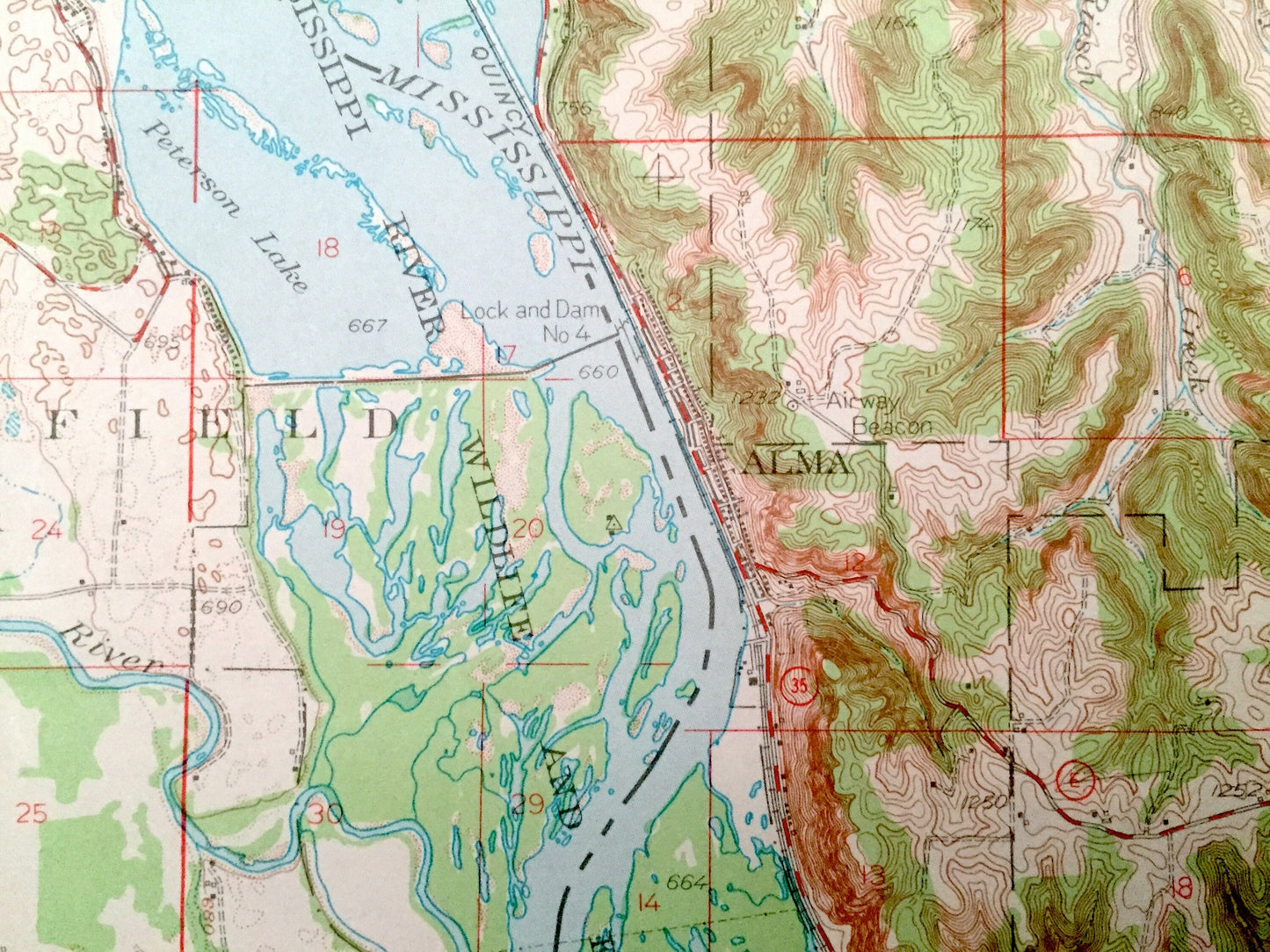
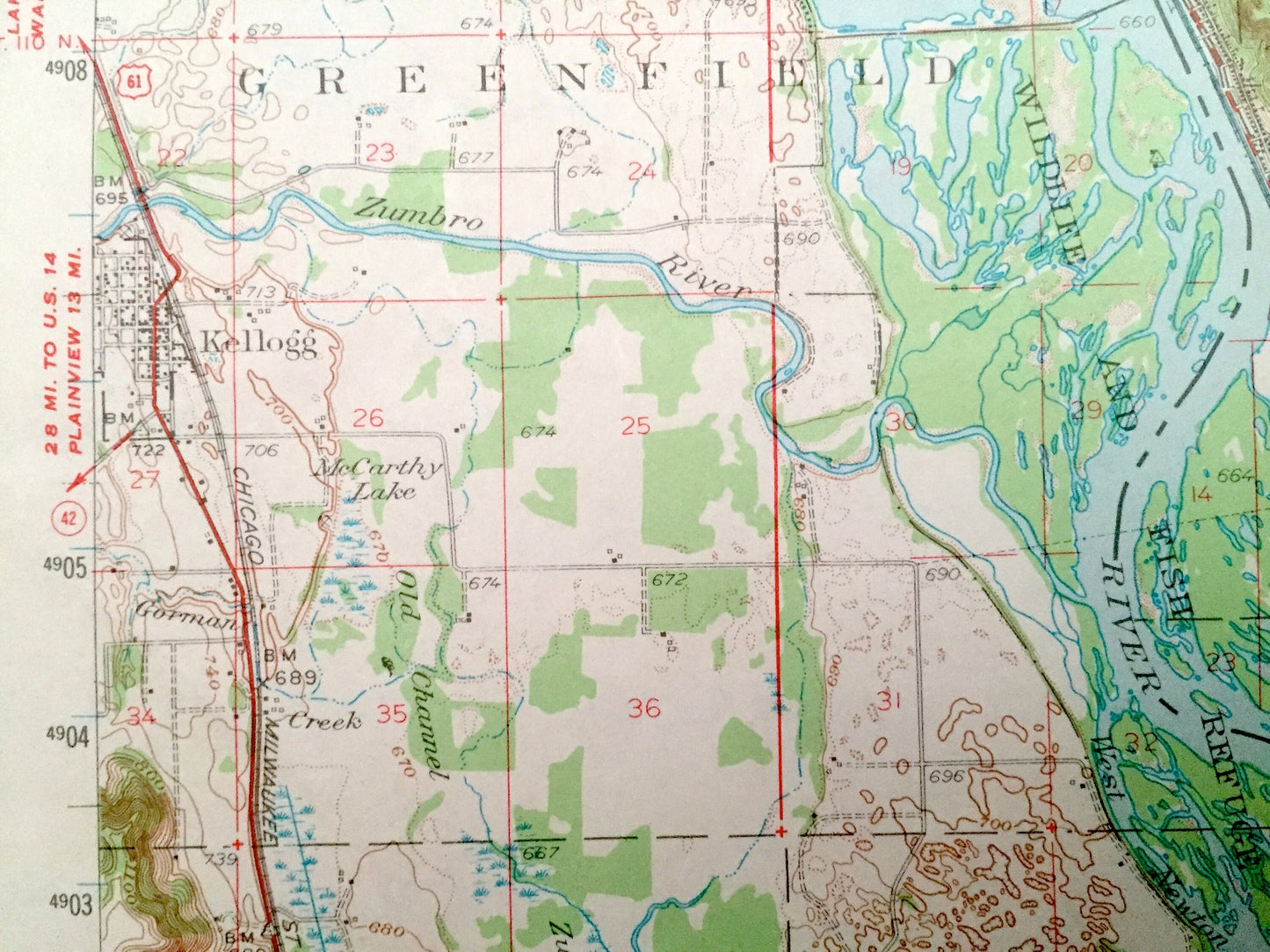
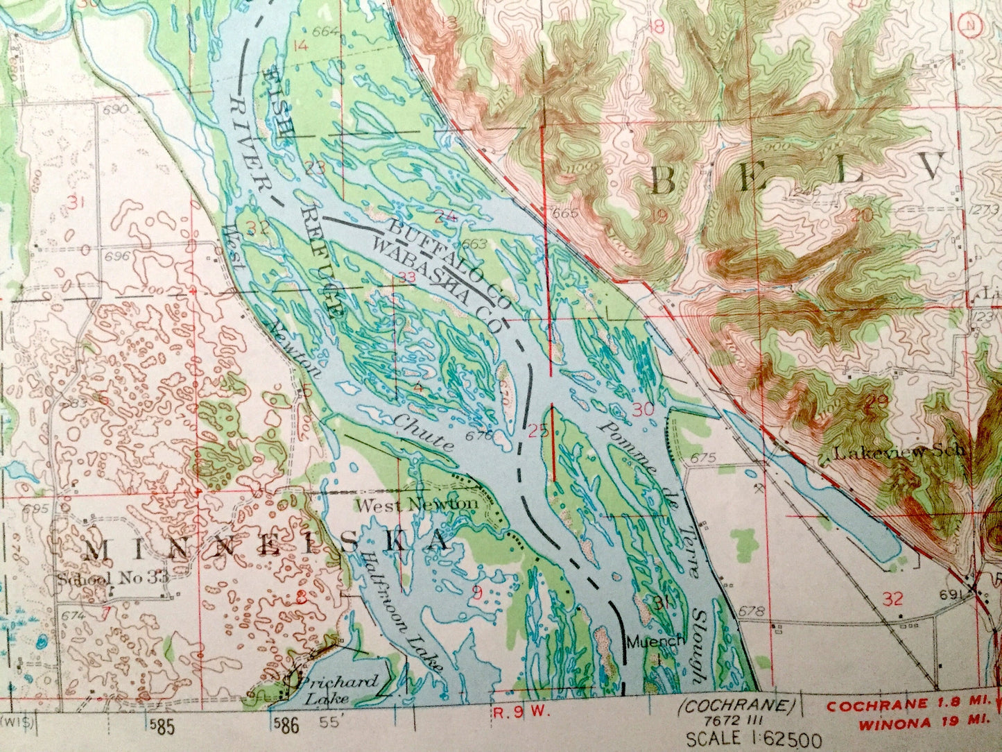
See what Wisconsin and Minnesota looked like over 70 years ago. Lots of intricate details and geological contours. Map even has little squares for every house that existed at the time. The USGS cartographers were very thorough back then!
Perfect for the historian, map-lover, the curious or just as a conversation starter. Wonderful and rare. Maps such as these make great gifts.
Edition of 1950, printed 1973
Dimensions: 18" width x 22" height
----
Features
Cities & Towns: WISCONSIN: Alma, Nelson, Modean, Gilmanton, Belvidere, Waumandee, Lincoln, Herold, Cream, Praag, Urne, Tell.
MINNESOTA: Greenfield, Watopa, Minneiska, Kellogg, Wabasha.
Points of Interest: Mississippi River, Upper Mississippi River Wildlife and Fish Refuge, Buffalo River, Pomme de Terre Slough, Zumbro River, Robinson Lake, Peterson Lake, McCarthy Lake, and many more hills, streams, ponds, houses, schools, railroads, churches and roads.
Condition: Good Vintage condition, commensurate with age. This map is in great shape for being over 50 years old. Has some wear and folds as-issued, but these will flatten easily, and all of which will read as character when framed.
----
We will happily adjust shipping price for multiple purchases. Maps are rolled up and shipped in sturdy mailing tubes, never folded.
Couldn't load pickup availability
Share