My Store
Antique Amador City, California 1962 US Geological Survey Topographic Map – County, Sutter Creek, Hill, Plymouth, Drytown, Whitney Museum CA
Antique Amador City, California 1962 US Geological Survey Topographic Map – County, Sutter Creek, Hill, Plymouth, Drytown, Whitney Museum CA
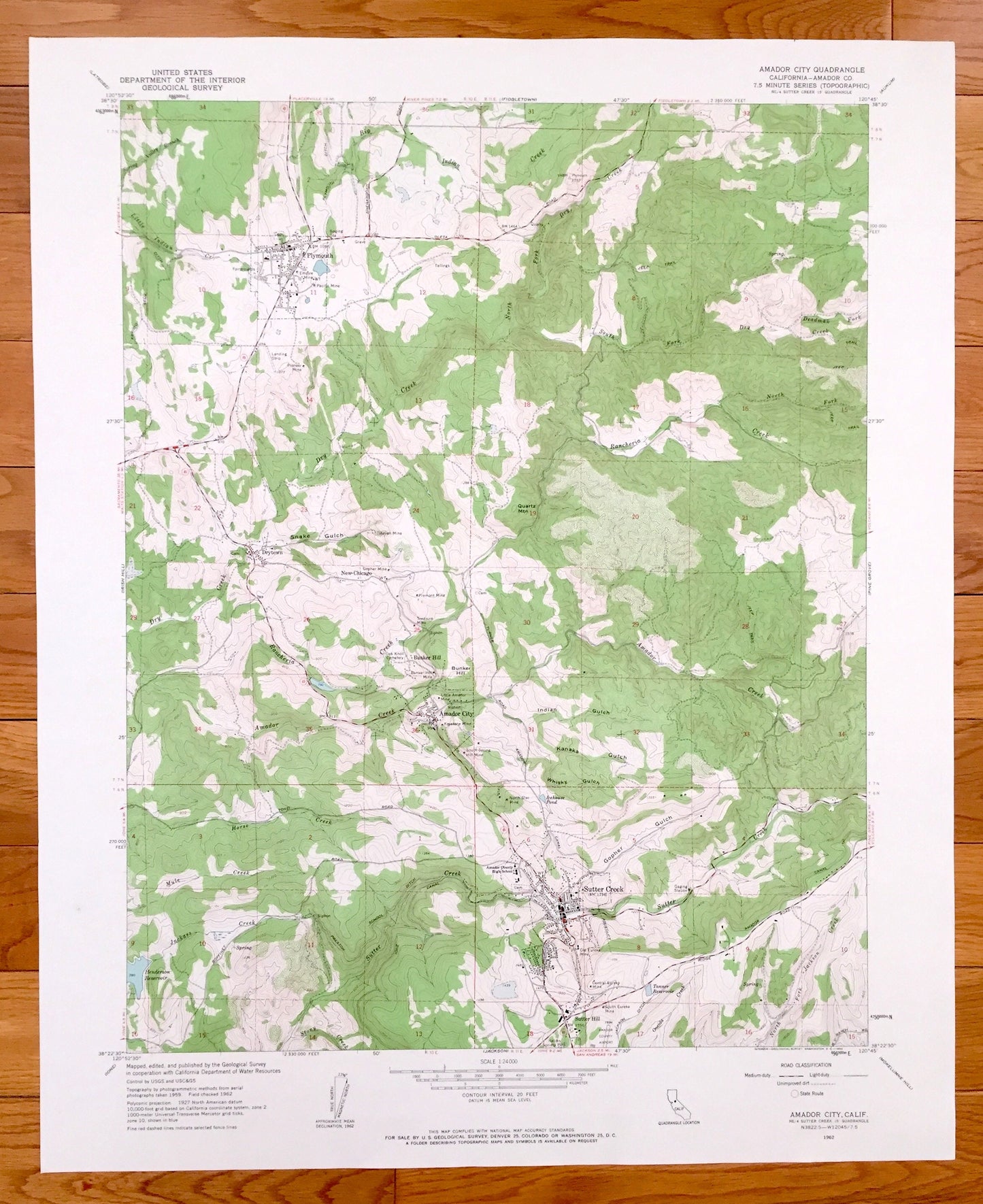
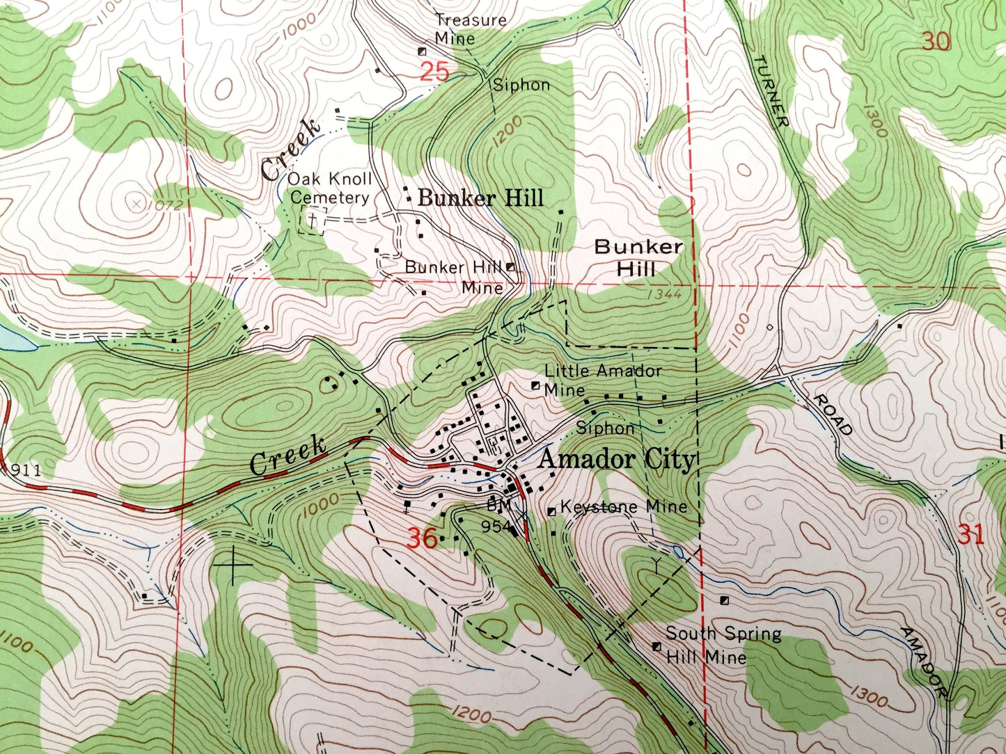
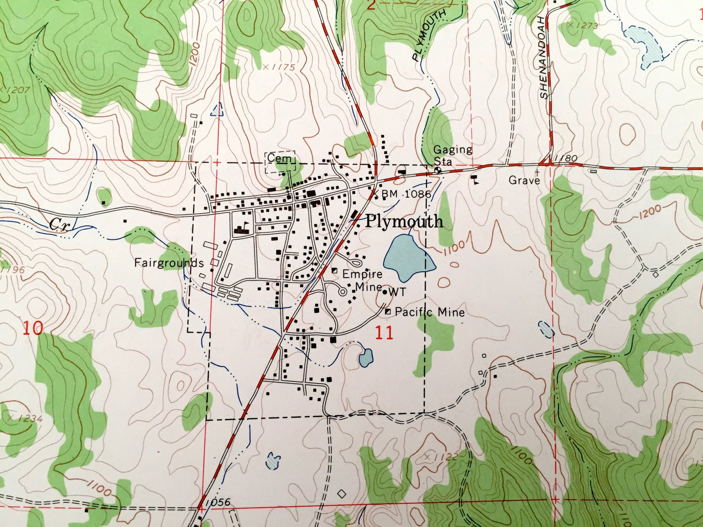
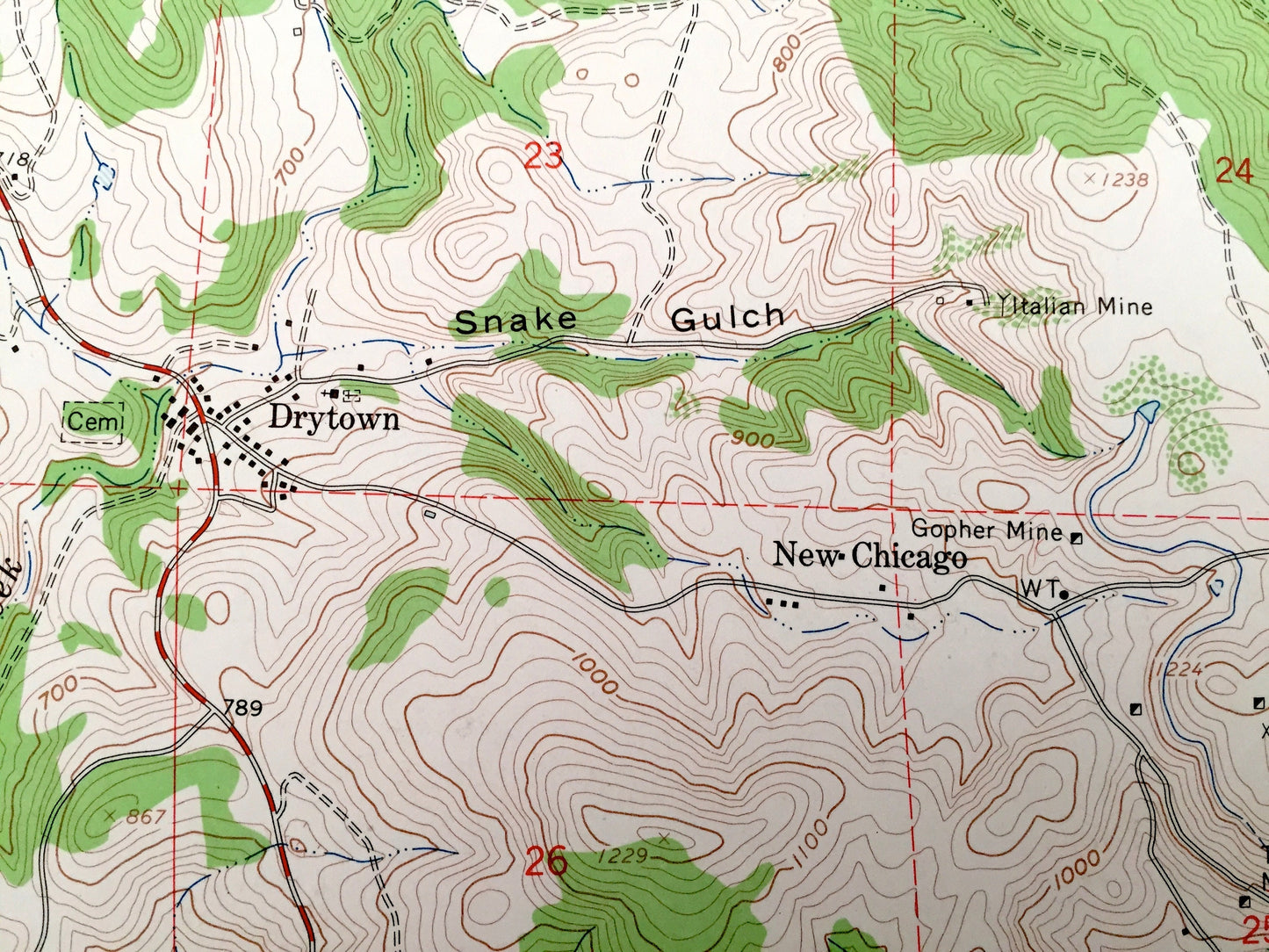
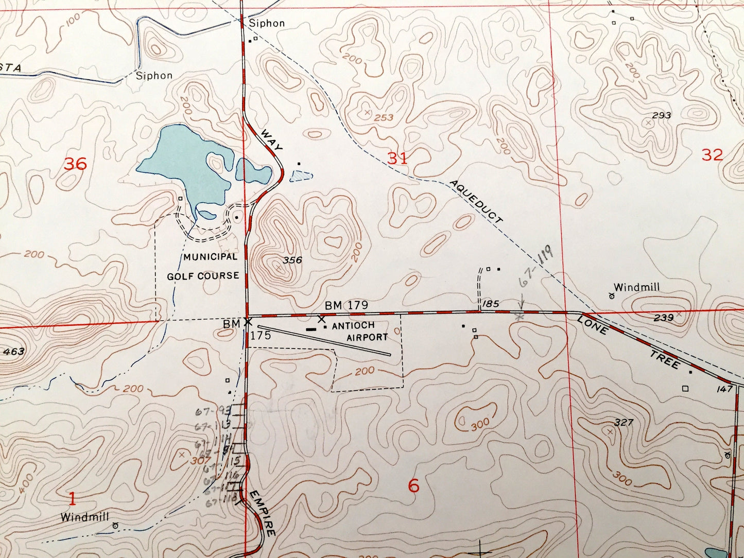
Beautiful, antique map of Amador City, California and surrounding Amador County area. This is an authentic 1953 print from the U.S. Geological Survey and NOT a computer reproduction.
See what California looked like 70 years ago. Lots of intricate details and geological contours. Map even has little squares for every house that existed at the time. The USGS cartographers were very thorough back then!
Perfect for the historian, map-lover, the curious or just as a conversation starter. Wonderful and rare. Vintage maps such as these make great gifts.
Edition of 1962, printed 1962
Dimensions: 22" width x 27" height
----
Features
Cities & Towns: Amador City, Sutter Creek, Sutter Hill, Bunker Hill, Drytown, Plymouth, New Chicago.
Points of Interest: Amador County, Jackass Creek, Horse Creek, Mule Creek, Sutter Creek, North Fork Jackson Creek, Dry Creek, Big Indian Creek, Rancheria Creek, Quartz Mountain, Indian Gulch, Kanaka Gulch, Whisky Gulch, Amador Creek and many more canyons, springs, gulches, creeks, and roads.
Condition: Very Good Vintage condition, commensurate with age. This map is in great shape for being about 70 years old.
----
We will happily adjust shipping price for multiple purchases. Maps are rolled up and shipped in sturdy mailing tubes, never folded.
Couldn't load pickup availability
Share