My Store
Antique Anson, Maine 1904 US Geological Survey Topographic Map – Somerset County, Madison, Bingham, Embden, Adison, Stark, Hayden Lake, ME
Antique Anson, Maine 1904 US Geological Survey Topographic Map – Somerset County, Madison, Bingham, Embden, Adison, Stark, Hayden Lake, ME
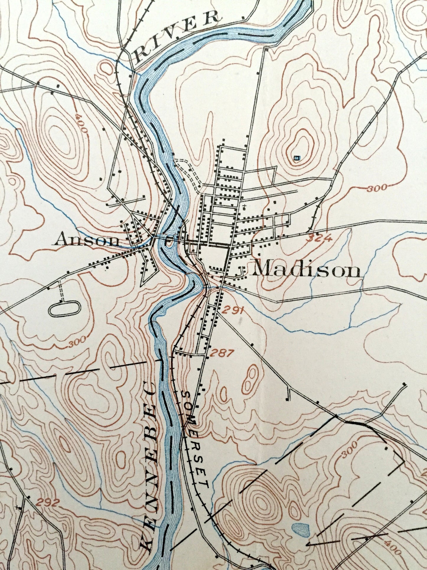
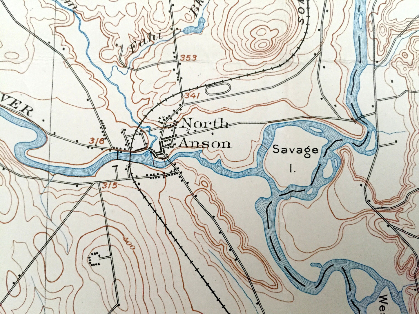
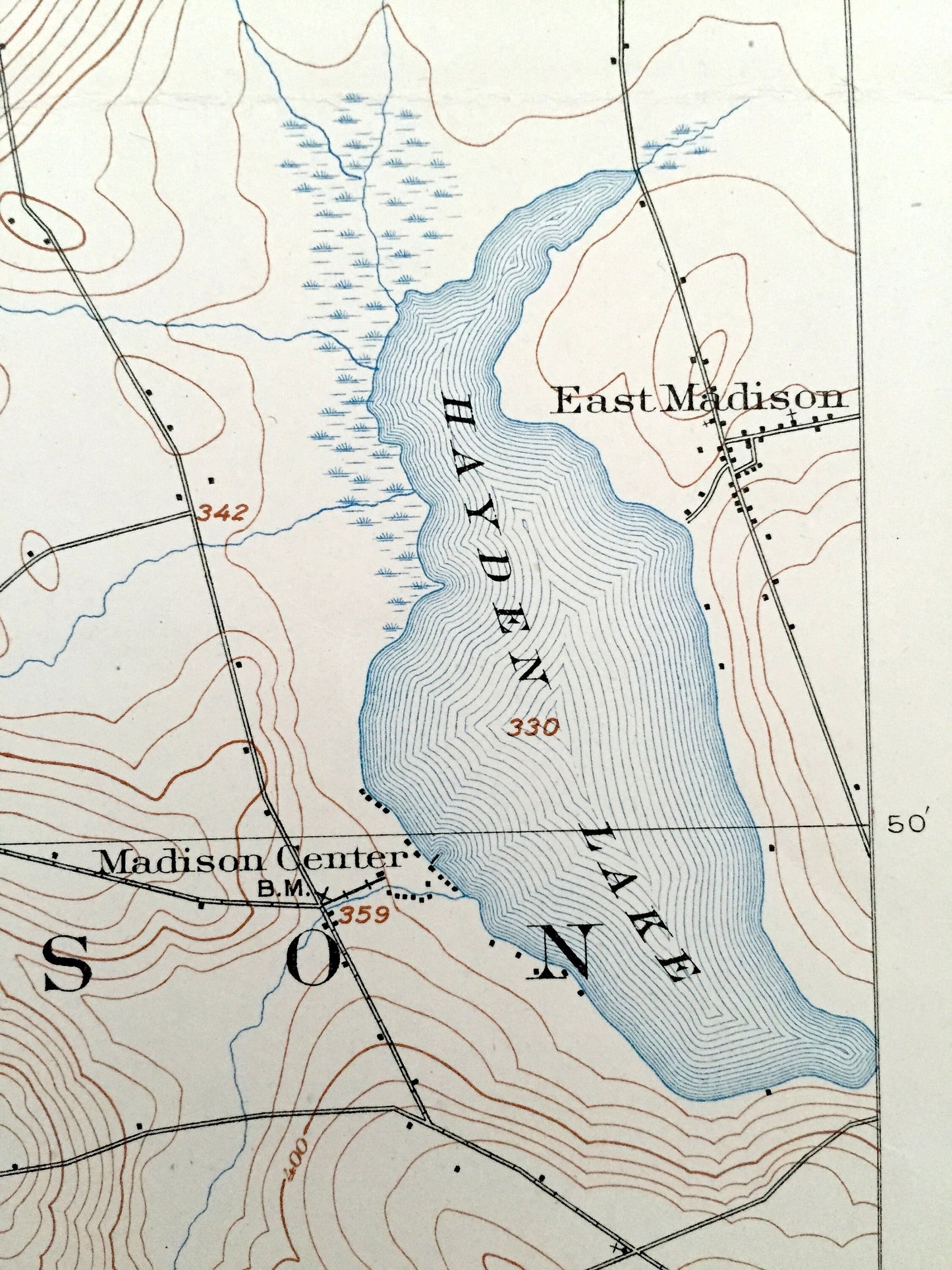
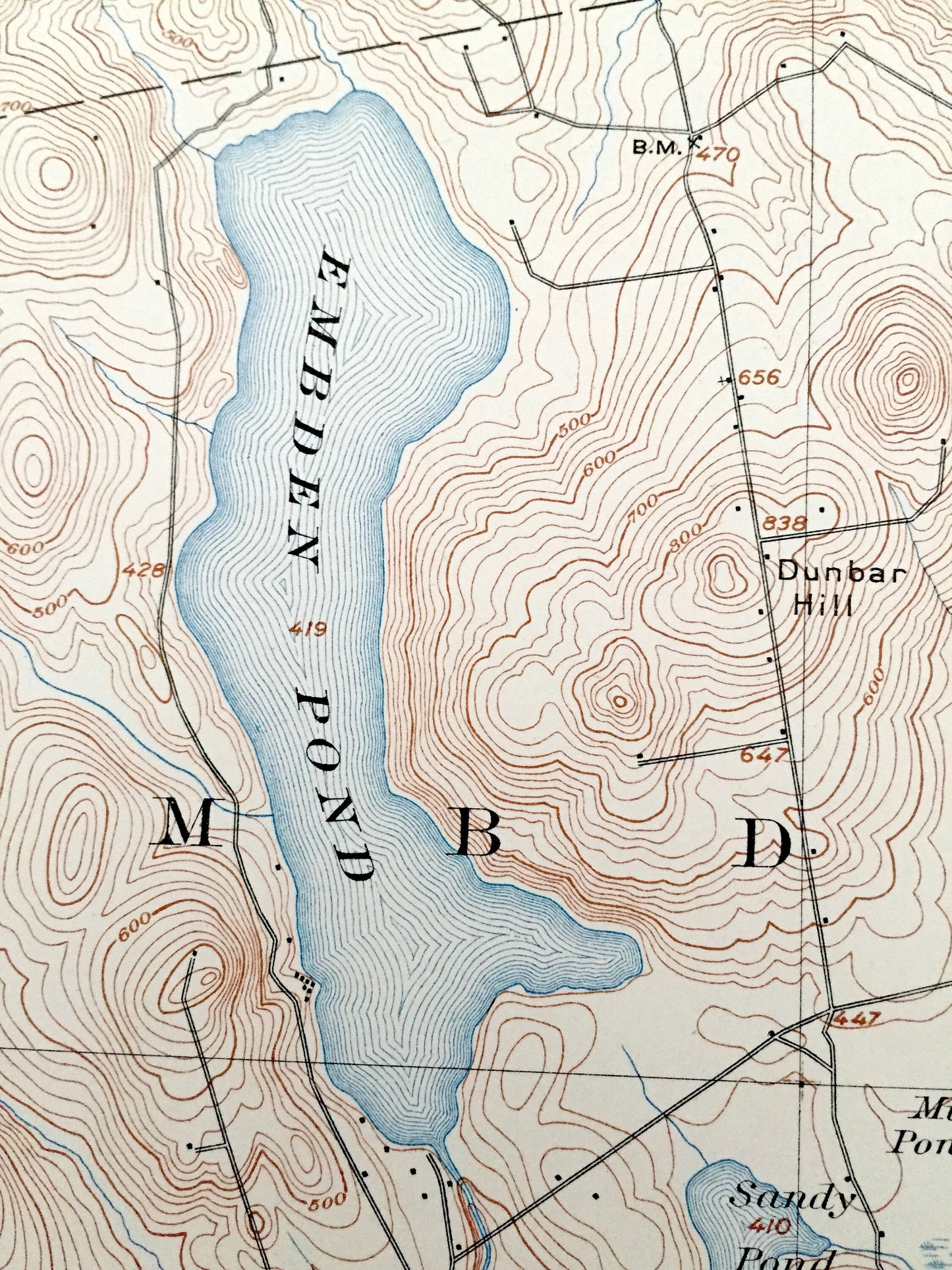
Beautiful, antique map of Anson, Concord, Solon, Embden, Madison, Norridgewock & Stark, Maine. This is an authentic 1904 print of the U.S. Geological Survey and NOT a computer reproduction.
See what Somerset County of Maine looked like over a century ago. Lots of intricate details and geological contours. Map even has little squares for every house that existed at the time. The USGS cartographers were very thorough back then! On the back is a description of topographic symbols and map guide.
Perfect for the historian, map-lover, the curious or just as a conversation starter. Wonderful and rare. Vintage maps such as these make great gifts.
Edition of 1904, printed 1904
Dimensions: 16 1/2" width x 20" height
----
Features
Cities & Towns: Lexington, Concord, Bingaham, Solon, Embden, Anson, Madison, Norridgewock, Stark, North Anson, East Madison, Twelve Corners.
Points of Interest: Savage Hill, Carratunk Falls Maine, Kennebec River, Embden Pond, Sandy Pond, Hayden Lake, Lane Hill, Somerset Railroaad, Carrabassett River and lots more hills, mountains, streams, ponds, houses, and roads.
Condition: Very Good Vintage condition, commensurate with age. This map is in great shape for being over 100 years old. Has some light fold marks and wear, but these will read as character when framed.
----
We will happily adjust shipping price for multiple purchases. Maps are rolled up and shipped in sturdy mailing tubes, never folded.
Couldn't load pickup availability
Share