My Store
Antique Antique Ayer, Massachusetts 1950 US Geological Survey Topographic Map – Harvard, Littleton, Fort Devens, Boxborough, Shirley, MA
Antique Antique Ayer, Massachusetts 1950 US Geological Survey Topographic Map – Harvard, Littleton, Fort Devens, Boxborough, Shirley, MA
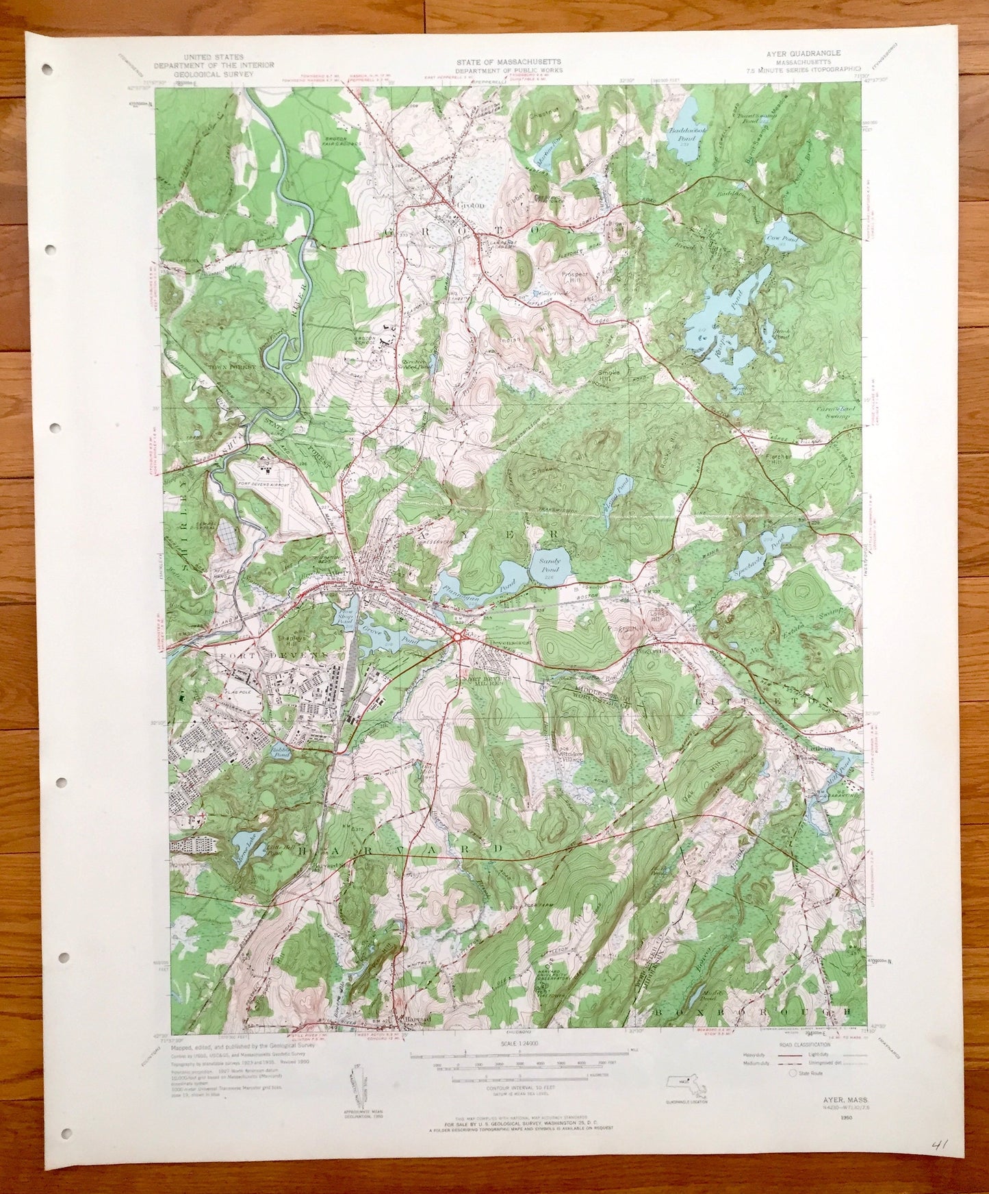
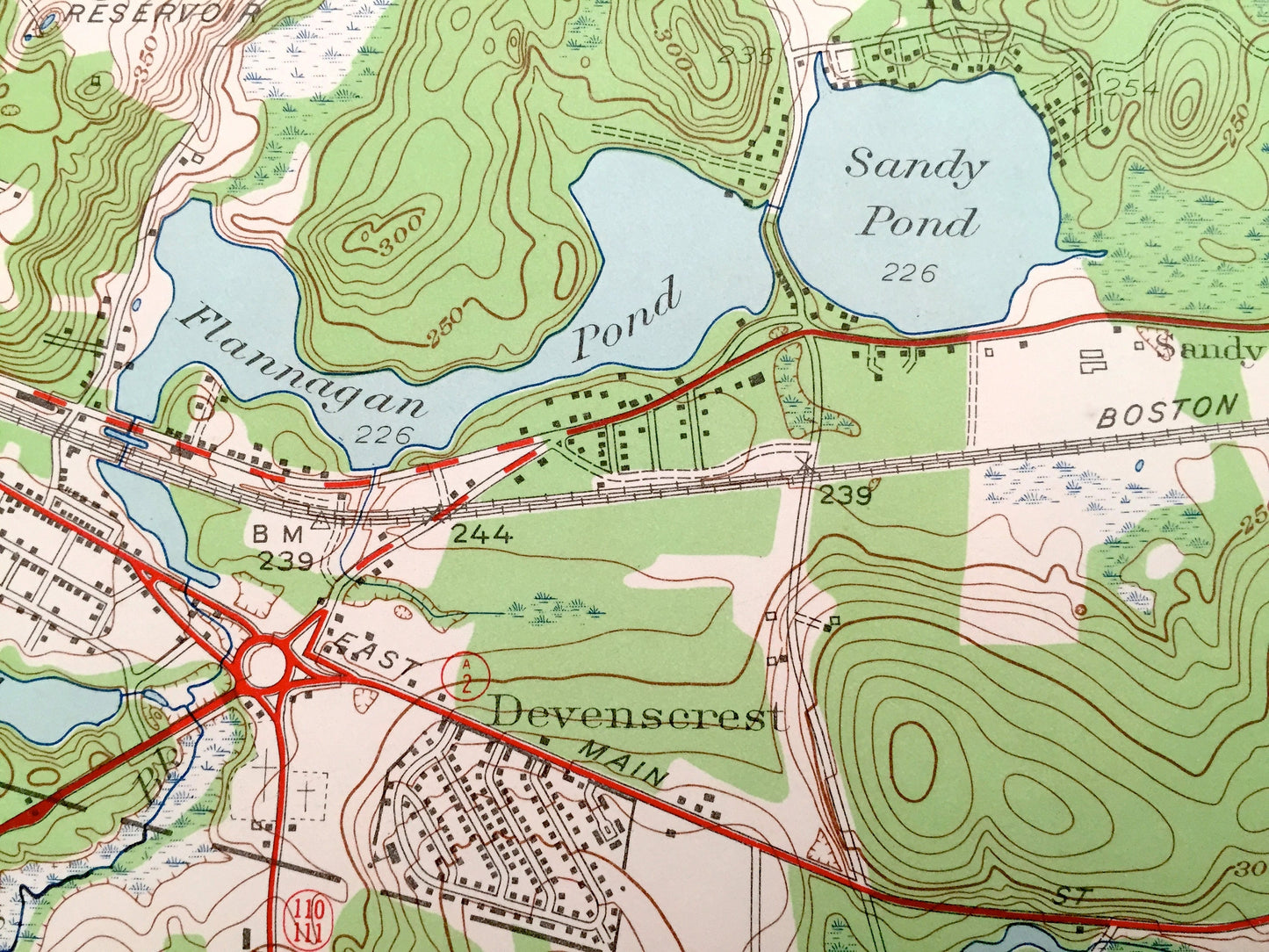
Beautiful, antique map of Ayer, Harvard and Fort Devens, Massachusetts and surrounding Middlesex County. This is an authentic 1950 print from the U.S. Geological Survey and NOT a computer reproduction.
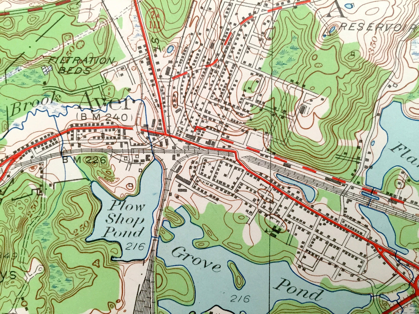
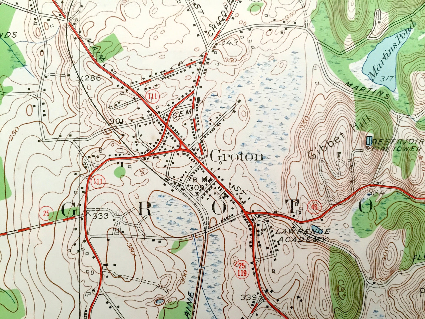
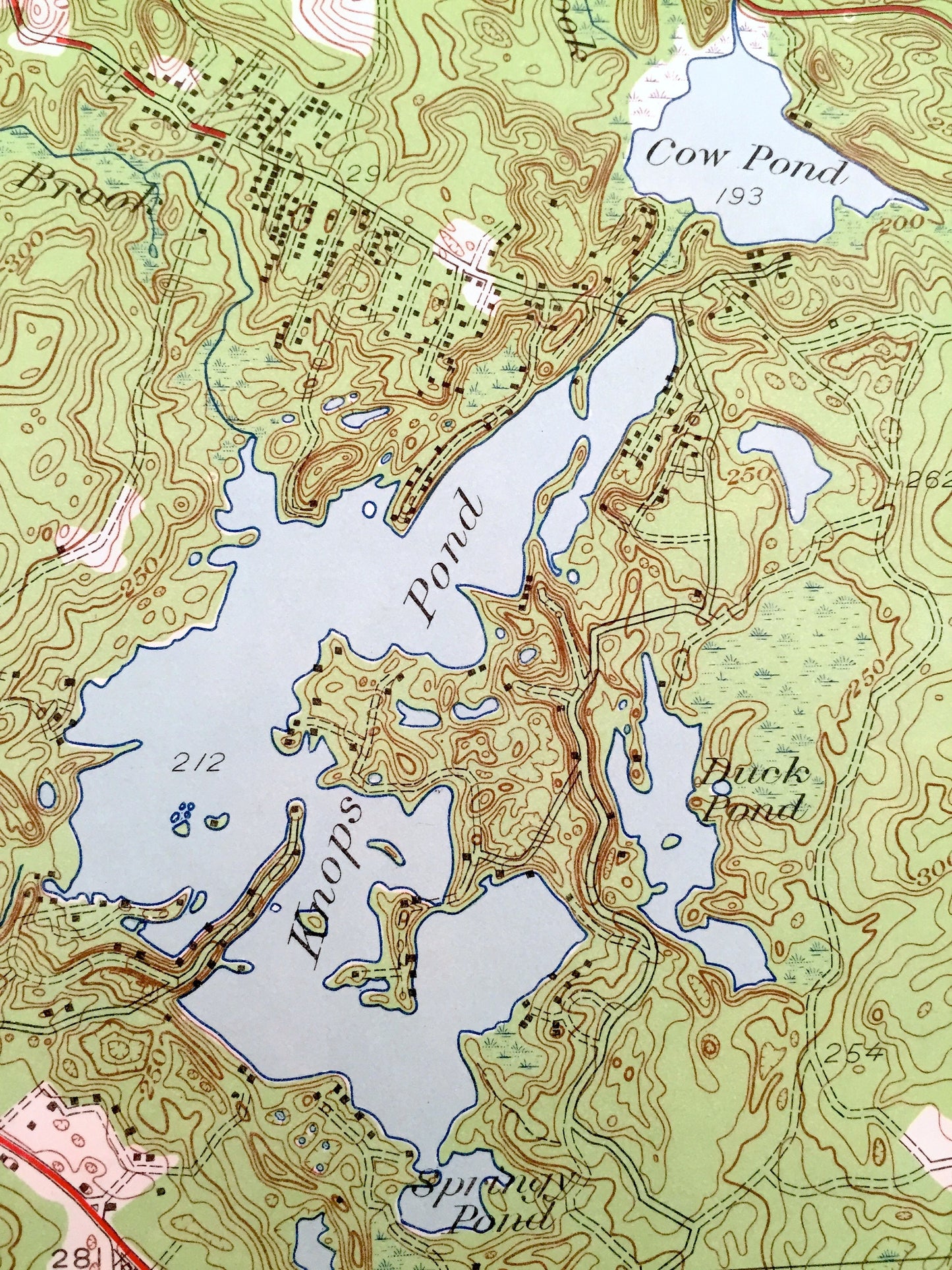
See what eastern Massachusetts looked like over 70 years ago. Lots of intricate details and geological contours. Map even has little squares for every house that existed at the time. The USGS cartographers were very thorough back then!
Perfect for the historian, map-lover, the curious or just as a conversation starter. Wonderful and rare. Vintage maps such as these make great gifts.
Edition of 1950, printed 1950
Dimensions: 22" width x 27" height
----
Features
Cities & Towns: Ayer, Groton, Harvard, Littleton, Fort Devens, Boxborough, West Groton, Shaker Village, Shirley, Pingryville, Devencrest.
Points of Interest: Groton Fairgrounds, Groton Reservoir Fire Tower, Baddacook Pond, Town Forest, Knops Pond (when it was still three separate ponds including Cow Pond and Duck Pond), Burntswamp Pond, Fort Devens Airport, Fort Devens Military Camp, Groton School, Fort Devens Riffle Range, Spectacle Pond, New Estate Swamp, Boston and Maine Railroad, Harvard Station, Harvard University Observatory, Beaver Brook Grove Pond, Mirror Lake and more roads, houses, ponds, hills, streams and lakes.
Condition: Good Vintage condition, commensurate with age. This map is in great shape for being over 70 years old. Map has punch holes but these are easily concealed with framing or placing a similar-colored paper behind the map, as can be seen in the photos.
----
We will happily adjust shipping price for multiple purchases. Maps are rolled up and shipped in sturdy mailing tubes, never folded.
Couldn't load pickup availability
Share