My Store
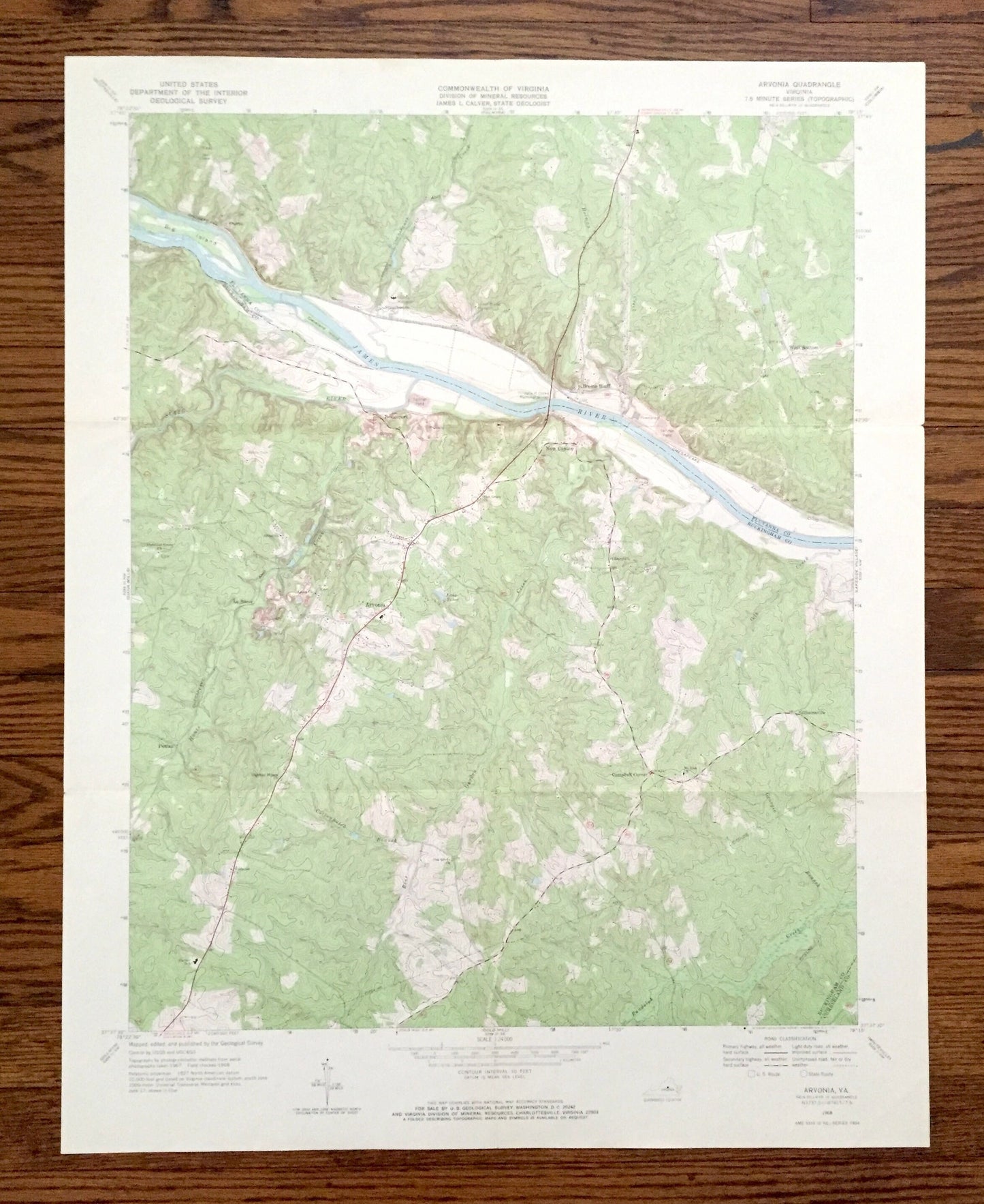
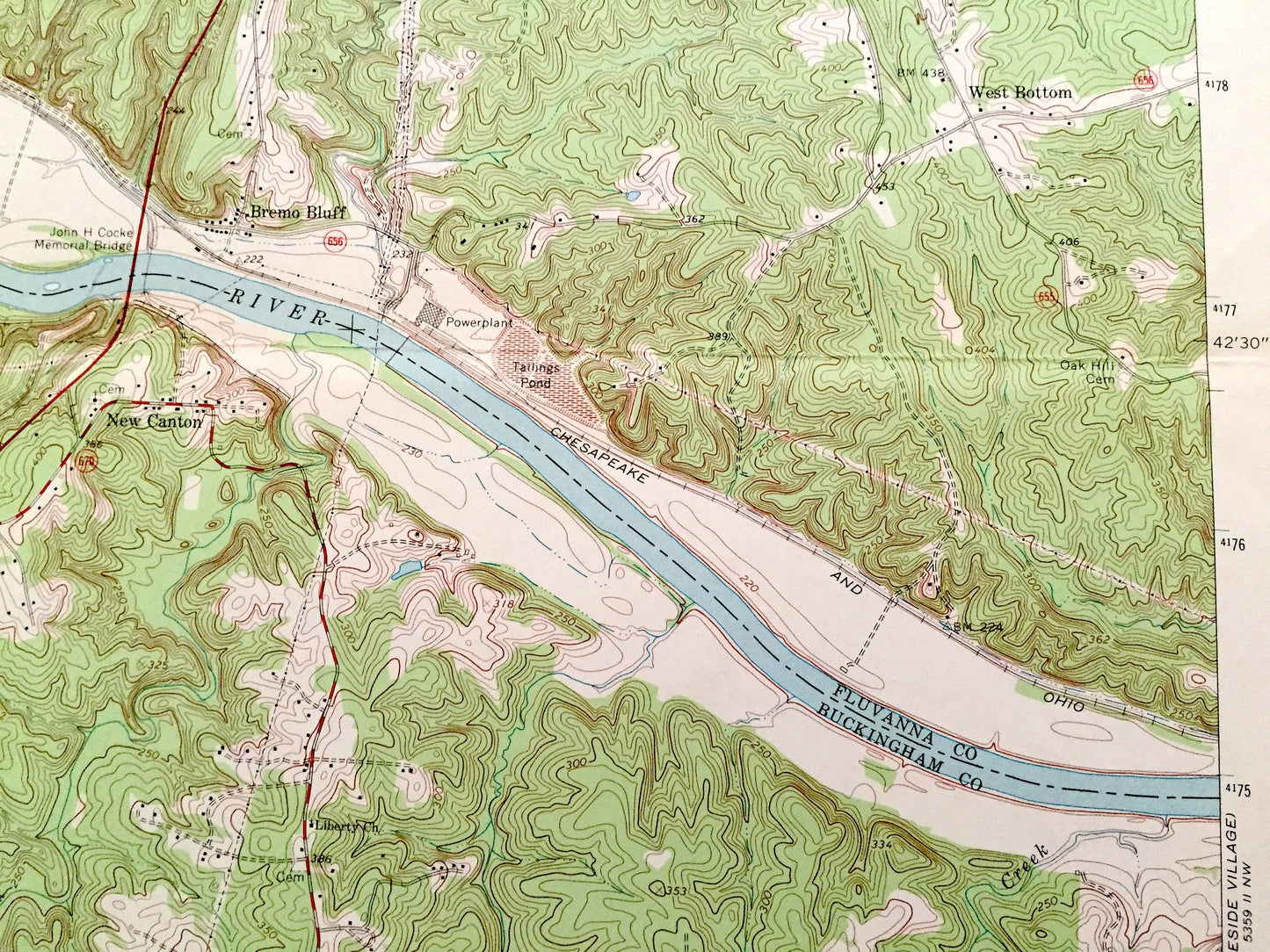
Antique Arvonia, Virginia 1968 US Geological Survey Topographic Map – Fluvanna, Buckingham County, James River, Bremo Bluff, New Canton, VA
Antique Arvonia, Virginia 1968 US Geological Survey Topographic Map – Fluvanna, Buckingham County, James River, Bremo Bluff, New Canton, VA
Beautiful, antique map of Arvonia, Virginia and surrounding Fluvanna & Buckingham County area on the James River. This is an authentic 1968 edition, 1971 print from the U.S. Geological Survey and NOT a computer reproduction.
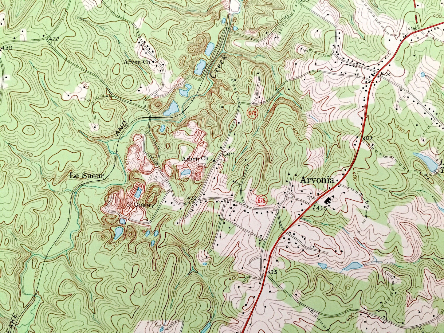
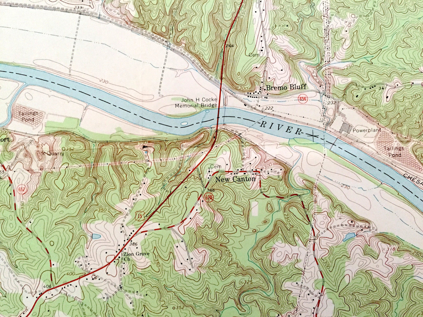
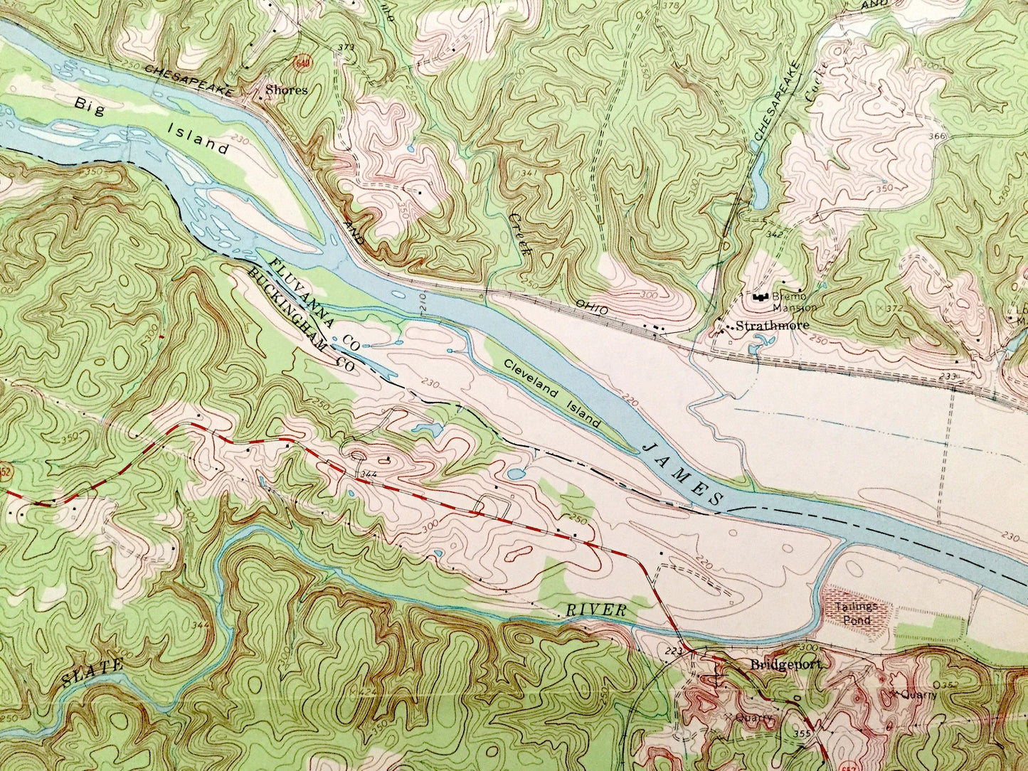
See what Virginia looked like over 50 years ago. Lots of intricate details and geological contours. Map even has little squares for every house that existed at the time. The USGS cartographers were very thorough back then!
Perfect for the historian, map-lover, the curious or just as a conversation starter. Wonderful and rare. Vintage maps such as these make great gifts.
Edition of 1968, printed 1971
Dimensions: 21 1/2" width x 27" height
----
Features
Cities & Towns: Arvonia, Strathmore, Bremo Bluff, West Bottom, Shores, Bridgeport, New Canton, Campbell Corner, Gilliamsville, Le Sueur, Penlan.
Points of Interest: Fluvanna County, Buckingham County, Cumberland County, James River, Slate River, Cocke Creek, Lake Tahoe, Randolph Creek, Chesapeake and Ohio Railroad, Big Island, and many more hills, streams, ponds, houses, schools, churches and roads.
Condition: Good Vintage condition, commensurate with age. This map is in great shape for being over 50 years old. Has light edge-wear and old folds as-issued, but these will flatten easily and all will add to vintage character when framed.
----
We will happily adjust shipping price for multiple purchases. Maps are rolled up and shipped in sturdy mailing tubes, never folded.
Couldn't load pickup availability
Share